[MUSIC]
A lot of us who are drone enthusiasts and who work in the drone industry are really excited about the idea of Drones for Good.
[MUSIC]
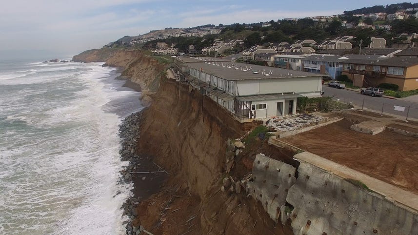
Wanna know what are the impacts of sea level rise on our coastline
[INAUDIBLE] So we're asking people to go out, take pictures, and then send it to us so we can use it to help predict and prepare for impacts of climate change.
[MUSIC]
We do capture metadata specifically GPS location.
So even a picture that's GPS tagged that shows a coastline somewhere is useful data.
But I think what's really powerful is mapping from the air.
[MUSIC]
If you have a DGI drone, the simplest thing to do is to download our apps.
And you can just draw a square around an area in first line and just press there and really make the drone take off, fly, capture data
[MUSIC]
In the past you could go up in a helicopter or a plane and look at the whole coastline but you couldn't hover above something you know like an exposed rock or tide pool and the waves coming over it.
[MUSIC]
It's important to know how and where the impacts are gonna be most severe, so we can prepare for it.
We can build coastal defenses, using dues and wetlands, to help protect communities.
[MUSIC]