Drones and sensors could help us escape volcanoes' destructive power
Science
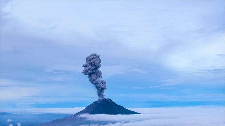
More than a half a billion people in the world live in a shadow of an active volcano, like Hawaii's Kilauea.
In May it began oozing rivers of lava, a slow motion disaster compared to the eruption of Mount Saint Helens in Washington State in 1980.
It blew debris and ash 15 miles high Darken skies were hundred of miles in set up avalanches and mud flows that killed 57 people.
Well, eruptions can't be stopped, they can be predicted and with the use of tech, scientists are getting a lot better at it.
[MUSIC]
Mount Rainier is just 50 miles away from Mount St.
Helen's.
It's even closer to my hometown of Tacoma and it's capable of a cataclysmic event.
That's why I went to see the tech that can detect signs of an imminent volcanic eruption.
And that's the route we take.
We just follow that ridgeline up all the way.
I did a seven mile hike with a team from the Pacific Northwest Seismic Network.
To look at a seismology station at Mt.
Ranier.
It's due for a big tech upgrade.
To get to the station, we had to walk down a steep Alpine meadow and deal with three kinds of biting insects.
I'm at the seismology station.
I am being eaten alive by bugs, it is beautiful though.
Everything here is analog right now.
A seismometer sends data about ground movement as an electrical current.
That's picked up and transmitted by an old school FM radio.
This month, the team will hike back out here and install a new seismometer.
14 solar panels and digital equipment that will set higher quality data back to the lab in Seattle.
The objective is to make the analog signal digital as early as possible, so in this case, what we're doing is taking the analog
Analog signal that comes out of the seismometer and digitizing it immediately at the sight.
From that point on no noise is introduced.
The data can tell scientists when small cluster quakes happen on the mountain.
Those can be a sign of imminent eruption.
Seismologist want to put the same kind of equipment at Glacier Peak.
A volcano 90 miles to the north.
To find the best places to put seismology stations, scientists relied on lidar images that strip away ground cover from the mountain and reveal the topography underneath.
If Mount Rainier erupted, the worst danger to the millions of people who live nearby are lahars.
So what is a lahar?
It's essentially a landslide, slurry mix that travels down river paths.
They can be hot.
They're fast, and they're thick and goopy and wreak havoc on any structures [NOISE]
An eruption could also shoot volcanic ash, rock, and lava into the sky.
And blow off the face of Mount Ranier.
That's what happened at Mount Saint Helens.
[UNKNOWN] monitors measure ground movement.
Mass spectrometers can measure what kinds of gas are coming out of a volcano.
If there's a high level of sulphur dioxide, eruption is imminent.
[MUSIC]
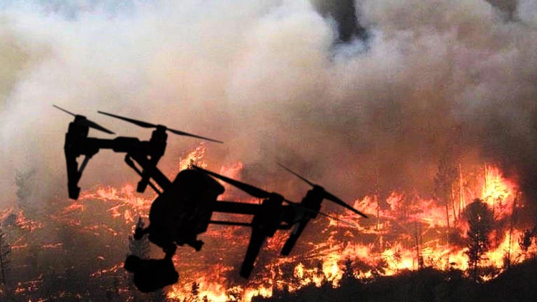
Scientists at NASA's jet propulsion lab are building small mass spectrometers to mount on drones that look like these.
Those drones will protect the lives of scientists working near active volcanoes and keeping them safe will help keep everyone else living near an active volcano a little safer too.
[BLANK_AUDIO]