Top third-party public transit apps for iOS
A big missing feature in Apple's Maps app is directions for public transit. Check out this collection for good third-party options.


By now most everyone knows about Apple's deficient Maps app in iOS 6 -- particularly those who counted on the former Google-powered app for public transit directions. Apple CEO Tim Cook publically apologized for the Maps app and said the company is working to make the app better. But in the meantime, if you need public transit directions, you're going to have to rely on third-party apps from the App Store.
Before you start sifting through hundreds of transit apps, I put together this collection so you can get the help you need right away. It's important to note that there are several apps that are made for specific cities and you can try searching for your city in the App Store if you want a more localized experience. I chose apps that cover most of the big cities in the U.S. along with several other countries.
TransitMap (99 cents) gives you public transit directions for the quickest route to your destination and offers global transit information. The app has support for more than 400 cities across 40 countries. Unlike other localized apps I found that require you to start in the Apple Maps app, you can use the search tools in TransitMap to find your destination, then get step-by-step directions for when and where to jump on public transit to get there.
You start by simply searching for a place or address, use a button to determine your current location, then hit Start. Once you've confirmed your starting and end points, you can touch Route to see an overview of your trip. When you touch the Start button, TransitMap gives you turn-by-turn walking directions to get to the nearest bus or train stop and shows you when the next one arrives. From there, you'll be able to see what time and where you need to get off and how long the trip will take.
TransitMap is the only paid app in this collection, but it does seem to give accurate and fast results. The drawback is that it doesn't let you select your mode of transportation, so if you had a bike, for example, and would prefer to catch the local ferry, you won't get those type of directions here. Still, if you're simply trying to find the fastest way to your destination, this app will do the job.
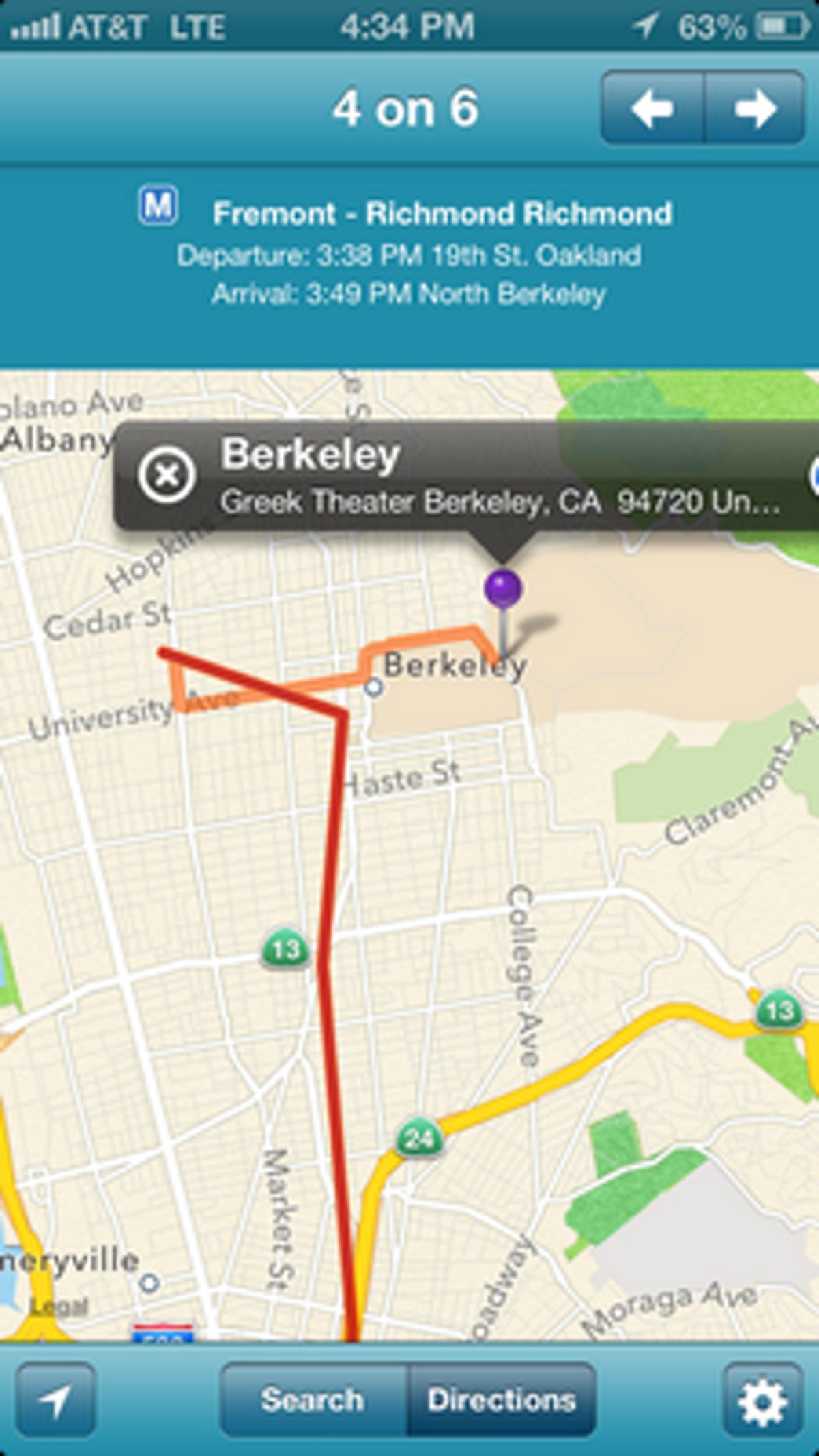
Transit (free) gives you a few more route options for public transit than TransitMap. Instead of just one quick route, the app gives you several routes so you can select the mode of transportation you want to use.
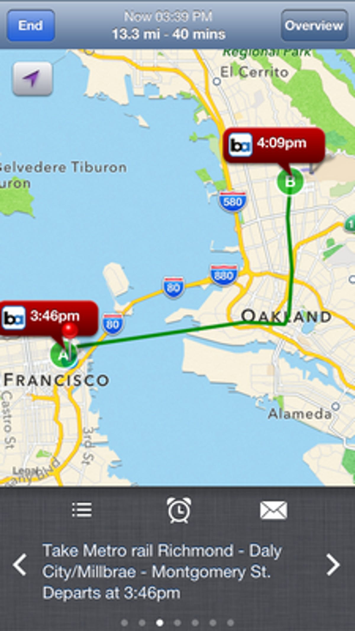
You start by using the search box at the top to enter an address or commonly known location (I tested it with the Greek Theater in Berkeley, Calif.). The app finds the destination on the map, and you can touch a green bus icon to get directions by public transit. For my trip to the Greek Theater, the app gave me four options that included both bus and train routes. When you select a route, the app lists out each step of your journey and the times you'll need to catch each mode of transportation with estimated times of arrival. When you touch start, the app gives you a map to get to the nearest bus or train (you'll get no turn-by-turn walking directions like you do in TransitMap). From there, you can touch arrows at the bottom of the interface to advance your trip to each step of the journey.
The app has a couple of other handy tools to make your trip easier. You can set alarms within the app to remind you to start heading for the bus stop. You also can send your trip details via e-mail to a friend who may have better advice for your trip than the app can give you.
If you can do without the turn-by-turn walking directions, Transit is an excellent choice, giving you more than one option for public transit trips and offers useful extras to make trip planning easier.
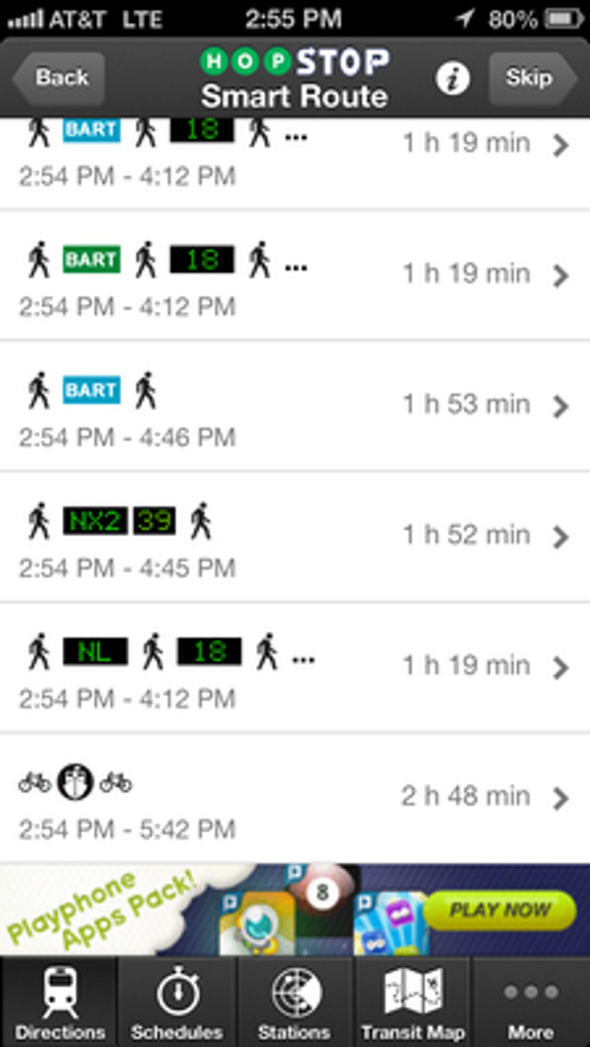
HopStop Transit Directions (free) seems like the most feature-rich of the bunch, giving you multiple options for your trip, public transit schedules, transit maps for certain cities, and more, but it's not perfect. It was only able to give results on some of the common location names I entered. On the other hand, I was able to set my preferred mode of transportation before I entered a search.
With this app, you can enter your current location and an address for your destination and HopStop will give you multiple options for getting where you want to go. It also gives the most options for travel compared with the other two apps in this collection, with combinations of both buses and trains. I was particularly impressed that HopStop offered the San Francisco Ferry as an option, with biking directions on both ends of the trip.
While HopStop has more features than the other two apps, I found a few issues. Once you've selected a route, the directions can be a bit hit or miss with turn-by-turn walking directions or when you're riding a bike. Most directions are clear like "Turn right on Main Street," only to be followed by "left" with no street name. This is clearly a big issue, but the public transit directions were always spot on in my testing.
HopStop seems to be the best of the collection for its number of routes and options, but it falls short in some cases once your feet hit the pavement. But if you're more interested in the schedules and routes, this is the app to have.