How Whereis maps Australia
We take an in-depth look at Whereis' latest generation of mapping vehicle, which will update the map data that's powering many in-car and portable navigation systems.


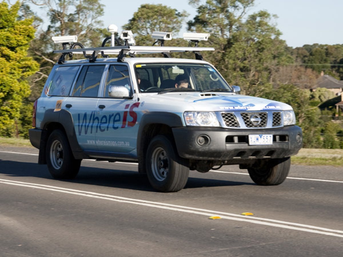
Dingo
We take an in-depth look at Whereis' latest generation of mapping vehicle, which will update the map data that's powering many in-car and portable navigation systems.
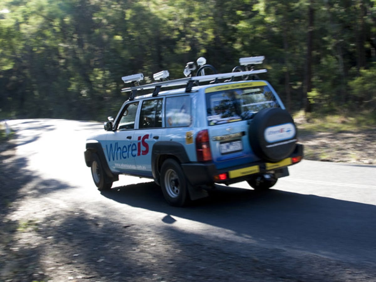
A few weeks back, we spotted a vehicle bedecked in Whereis' livery near our office. Turns out the car we spotted was one of two next-generation mapping vehicles that the company is using to update and refine its Australian maps.
All up, the permanent Whereis fleet consists of eight to nine vehicles. The car we spotted (also pictured above) is dubbed Dingo, while the car featured in the rest of this gallery had yet to be christened.
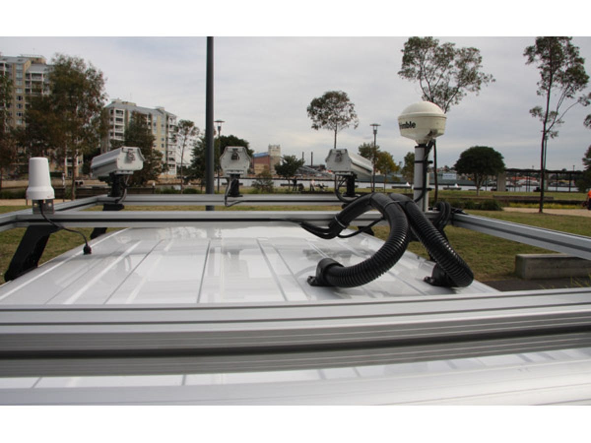
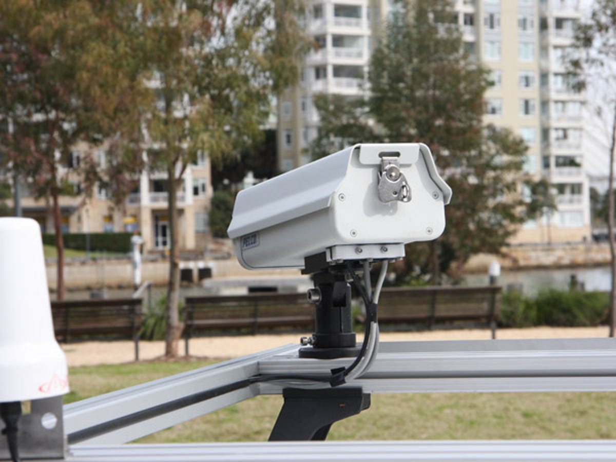
Up high
Atop the Nissan Patrol are five security-style cameras (three facing forward and two looking aft, out of the photo), a GPS receiver (dome on the right) and a satellite phone antenna (left).
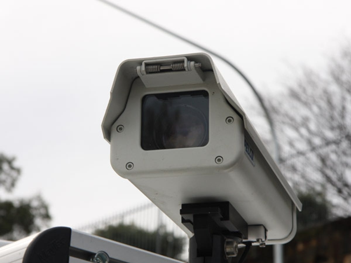
Smile!
A panoramic view in the direction of travel is provided by the three forward facing (left, right and centre) cameras. They're used to capture lane data (centre lines, guidance info, type and so forth), as well as signposts, point-of-interest data and, in some circumstances, data for 3D landmarks and city modelling.
The two rearward facing cameras (left and right only) are used to capture signage in the opposite direction, allowing the relevant data for single carriageways to be captured in one pass.
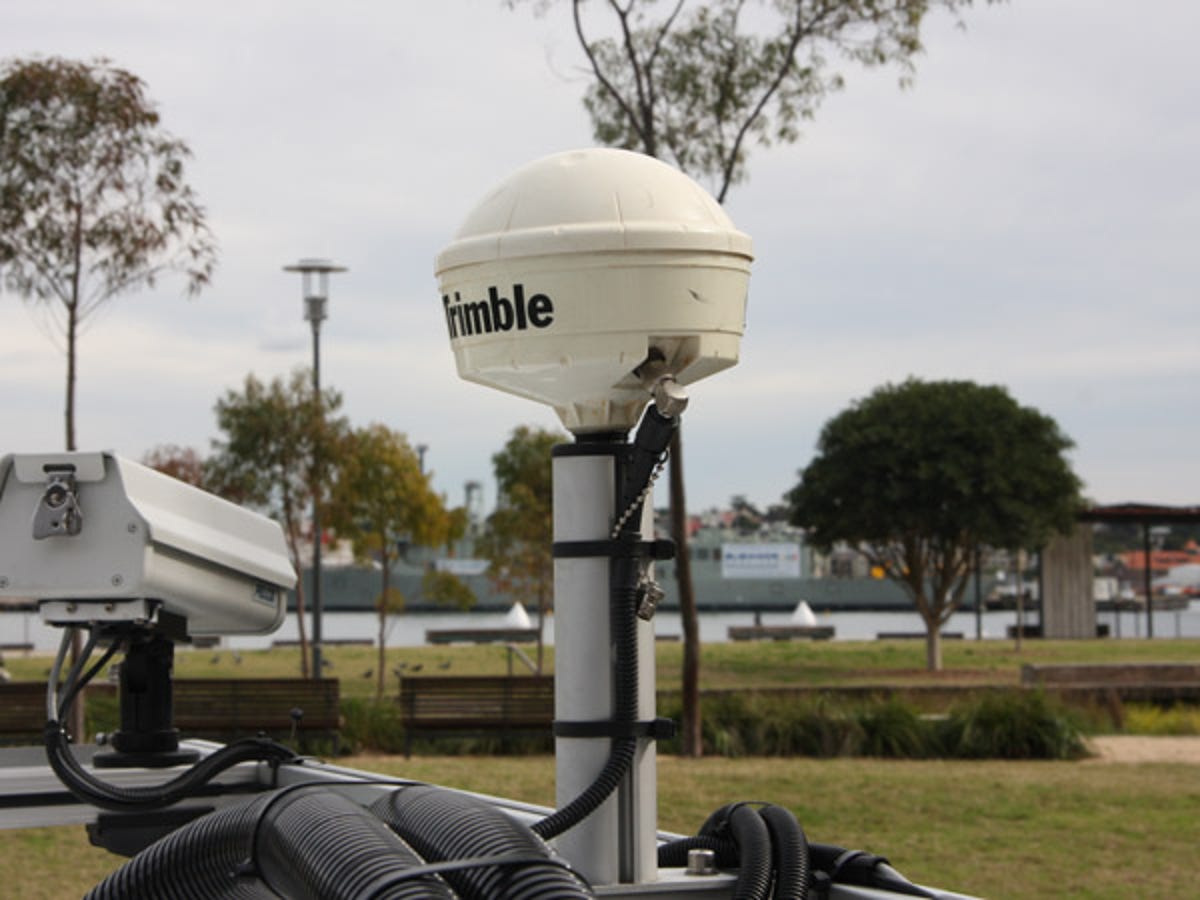
Plenty of Zs
The differential GPS antenna (above) combined with inertia sensors, distance measuring equipment and gyroscopes allows the car to record its position in all three axes, as well as road inclination — even in areas with obscured GPS tracking, such as the CBD, or where there's no satellite line of sight, like inside a tunnel. Differential GPS alone can yield fairly accurate X and Y coordinates, and a coarse Z reading.
Eye in the sky
The car's cameras aren't the only source of visual information used by Whereis. The company also uses aerial and satellite photography that's accurate down to 7.5cm.
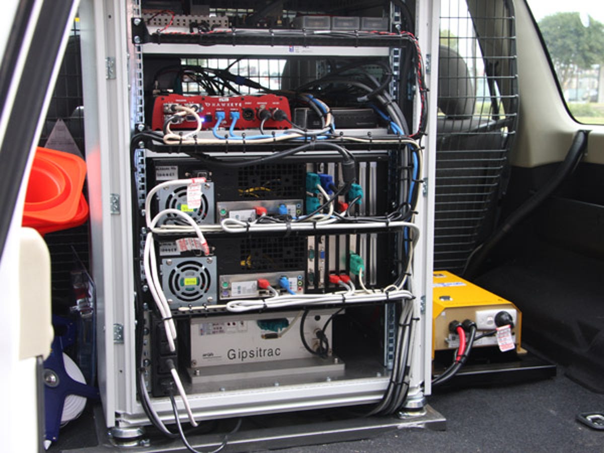
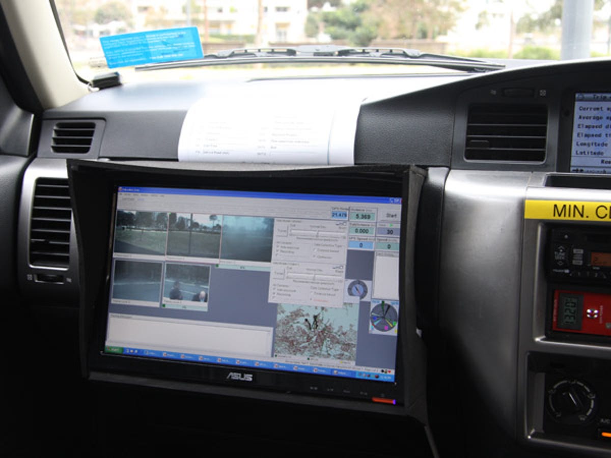
Rack 'em up
All of the car's cameras and positioning equipment feeds into this rack in the Patrol's boot. There's four terrabytes of storage on-board and when the field crew return from a mapping mission, the data is given over to Whereis' production group which, the company claims, has in excess of 100 staff.
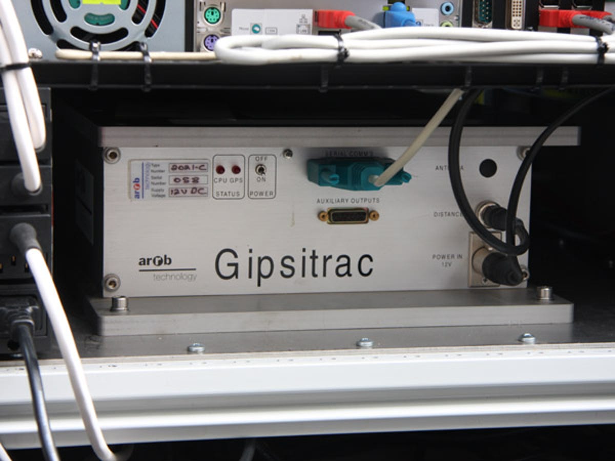
Of guns and gyros
The car's GIPSITRAC gyro system is of military grade precision, so the Australian Road Research Board (ARRB) required federal government permission to sell the system to Whereis. GIPSITRAC, incidentally, stands for Global-Inertial Positioning Systems Integration for Tracking Road Alignment and Crossfall.
Underneath the car are distance measuring instruments that measure the rotation of the rear wheels.
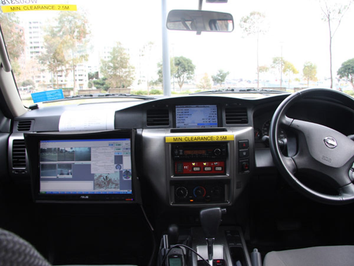
Two up
Typically there are two crew members aboard a mapping vehicle: one driver and one capturing data. To stabilise the gyroscope, the car is required to make a stop every half an hour, with a longer stop required once a day.
Travel all over the countryside
Whereis chose to use diesel Nissan Patrols four-wheel drives for its next-gen fleet as they allow the company to traverse all of Australia, including unpaved roads and four-wheel drive tracks.
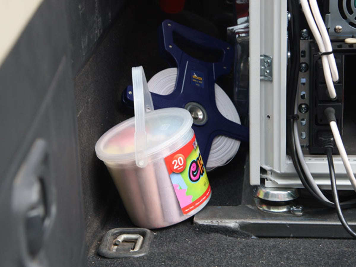
Hop, skip and jump
No, it's not a game the Whereis drivers have come up with to keep themselves entertained on their frequent stops or when they're stuck in Nowheresville, Australia. The chalk and tape help with equipment calibration.
Aussie made
The system of equipment used in Whereis' new generation vehicle is an Australian design. So far, the technology has been licensed to Australian road authorities, as well as clients in Asia, the Middle East and New Zealand.
More Galleries

My Favorite Shots From the Galaxy S24 Ultra's Camera
20 Photos
Honor's Magic V2 Foldable Is Lighter Than Samsung's Galaxy S24 Ultra
10 Photos
The Samsung Galaxy S24 and S24 Plus Looks Sweet in Aluminum
23 Photos
Samsung's Galaxy S24 Ultra Now Has a Titanium Design
23 Photos
I Took 600+ Photos With the iPhone 15 Pro and Pro Max. Look at My Favorites
34 Photos
