Welcome to Mount Washington, home of the 'world's worst weather'
The New Hampshire peak regularly gets hit with hurricane-force winds and socked in by fog, snow and ice. Some people actually work there.


Mount Washington
Serene, no? This is New Hampshire's Mount Washington, at 6,288 feet, the tallest peak in the Northeastern US. It doesn't look like it from this picture taken on the balmy July day I drove there, but this mountain has a reputation for some absolutely terrifying weather. I went up for a closer look and to talk with the staff of the Mount Washington Observatory.

The summit
Things look a little more bleak when you get near the summit, toward the end of the 7.6-mile Auto Road. That building looks like a Bond villain's lair, but it's actually a visitor center (the Sherman Adams building) for Mount Washington State Park. The Observatory's facilities are at the very far right end, including that tower.
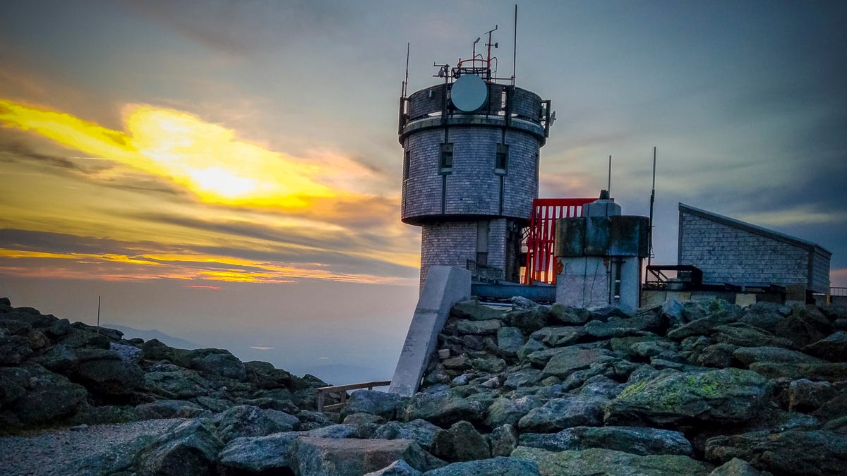
Observatory tower at sunset
Here's a closer look at the Observatory tower, with a lovely July sunset going on. Mounted on top and around the tower are instruments for tracking the weather and for communicating with civilization below. It takes on a very different appearance in winter....
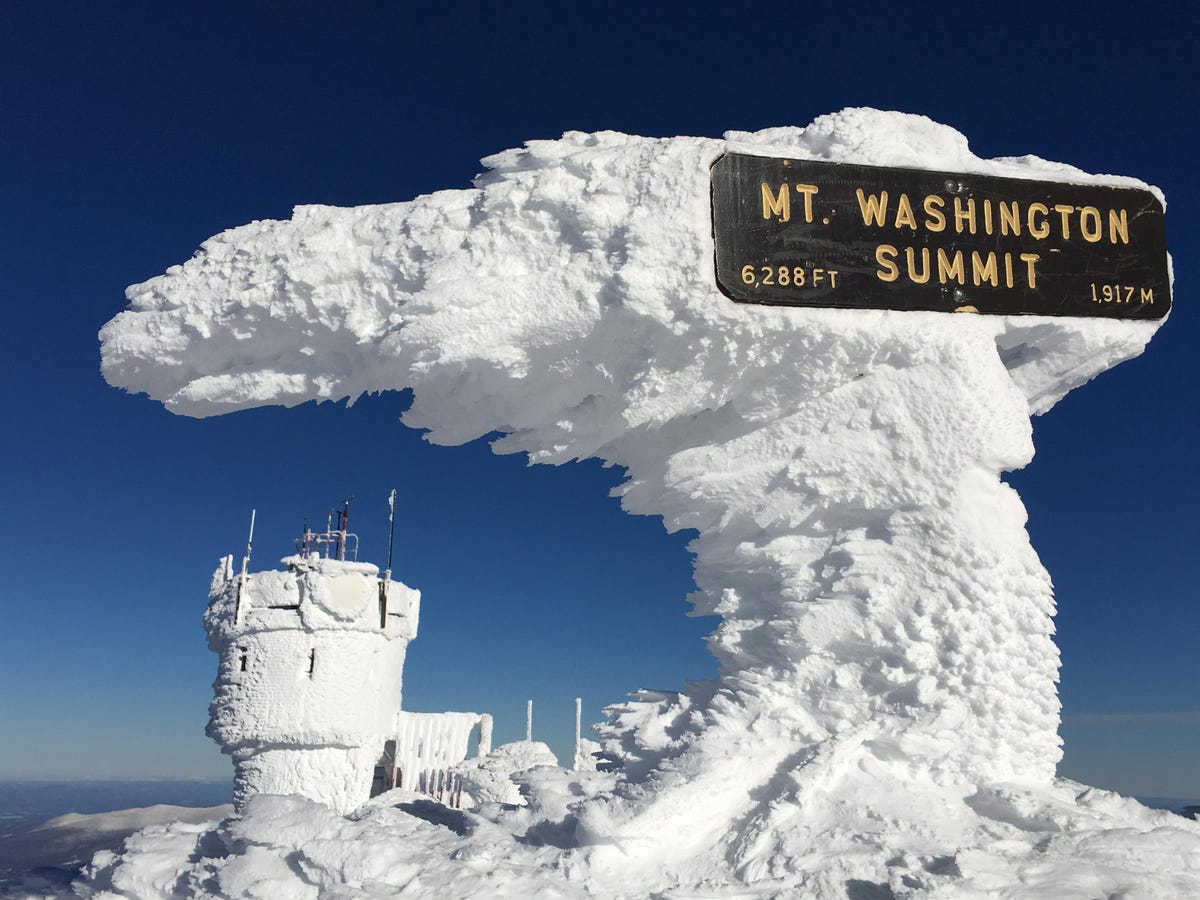
Rime ice
The January sky is clear, but that rime ice didn't come from nowhere. The summit of Mount Washington spends an awful lot of time in the clouds and averages 281 inches of snow a year. January and February temperatures hover around 14 degrees Fahrenheit, with record lows at minus 46 -- all before factoring in the wind chill.
That rime ice you see builds up quickly: 2 inches an hour as an average, but up to a sobering 6 inches an hour.
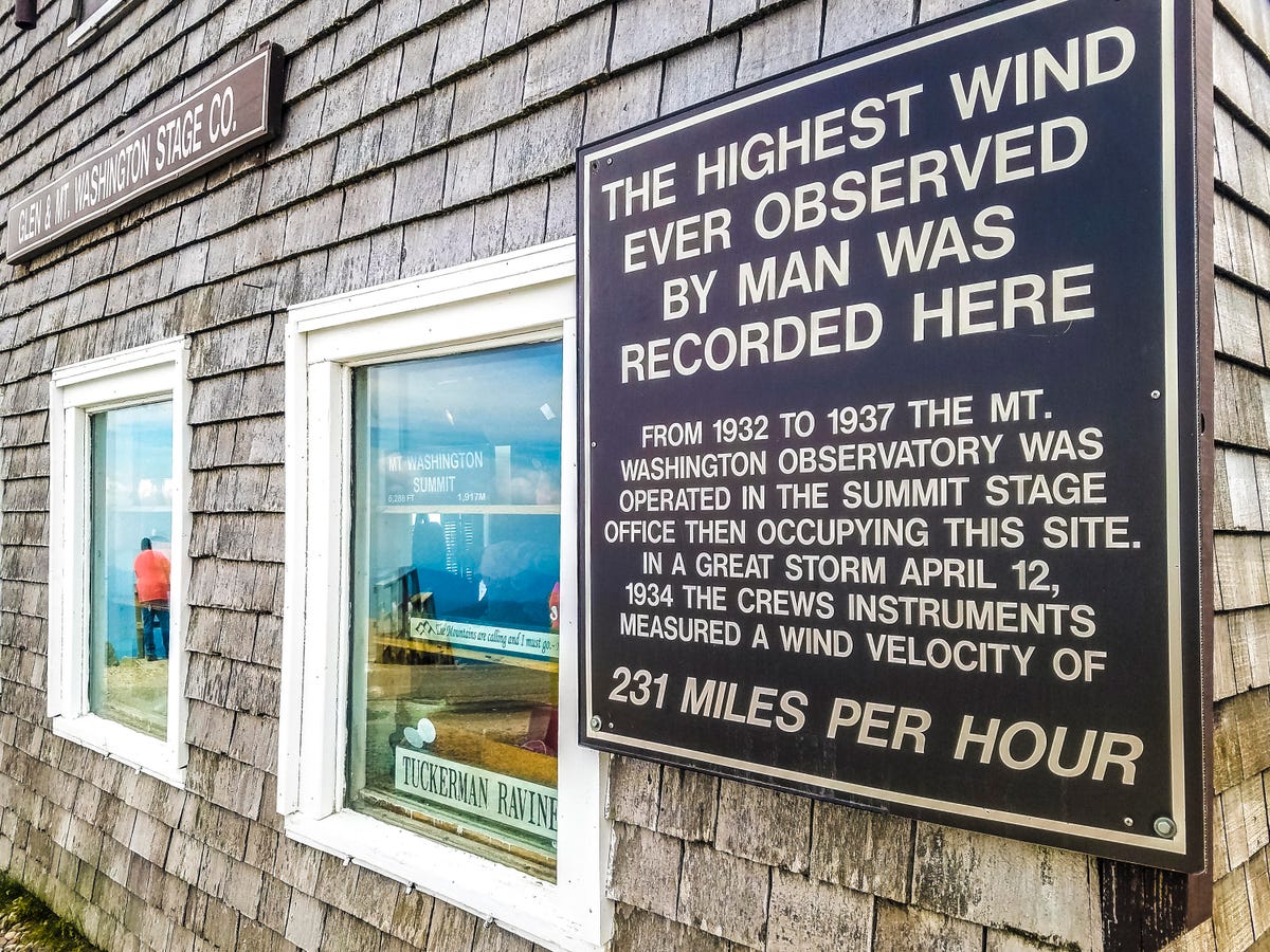
'Highest Wind Ever Observed'
For six decades, the summit of Mount Washington held the world record for the fastest gust of wind: 231 miles per hour. That happened in April 1934. Only once has that speed has been topped, in 1996, when a tropical cyclone off the coast of Australia reached 253 mph.
It's not as much of an outlier as you may think. "We see 100-mph winds basically once a week during the winter season," says Tom Padham, a meteorologist at the Observatory.

A winter landscape
The summit of New Hampshire's Mount Washington under a blanket of snow, as seen from the Observatory tower. In the foreground is the Tip-Top House, which in the 19th century served as a hotel and now is a museum. The small building to its left is the Auto Road carriage house, a replica of the original Mount Washington Observatory building.
Mount Washington snowcat
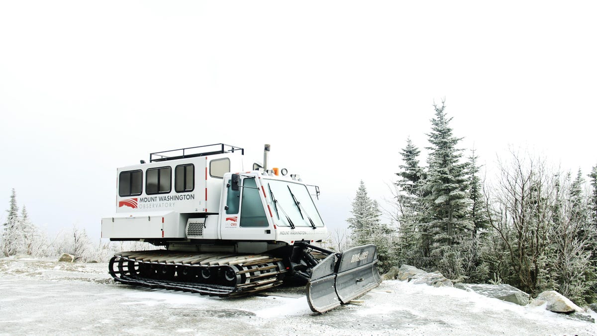
To get up and down Mount Washington in wintertime, when the Auto Road is buried in snow and closed to cars, the Observatory staff rides in a tracked snowcat.

Observatory tower and observer
On my second day there, the weather had deteriorated from the classic summer weather of my drive up. As he was heading back inside from an hourly observation, Padham said to me, "You should come in in the next five minutes, in case there's any lightning."
Thunderstorms rolled in later in the day.
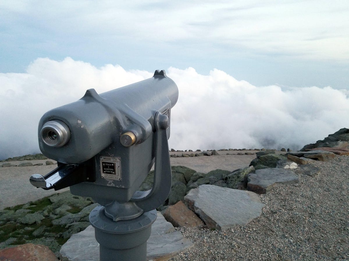
Not much of a view
On a clear day atop Mount Washington, you might see out as far as 130 miles. Most days, though, the clouds get in the way. At some points on this particular morning, the summit was completed socked in by fog.

Pitot tube and anemometer
Atop the Observatory tower are two key instruments, both of which record wind speed. In the foreground is a traditional anemometer, looking a little like an airplane -- with propeller, but without wings. The silver item behind it is a Pitot tube, which measures air pressure as the wind blows over and into it, which then gets translated into speed. You know where else you'll find Pitot tubes? Mounted on aircraft.

Work to be done
All the outdoor instruments and equipment have to be kept free of ice, which can mess up readings and communication. The Pitot tube stays heated to between 70 and 80 degrees Fahrenheit, but still needs to be cleared -- gently, of course. For unheated surfaces, the ice-breaking tool of choice is often a crowbar.
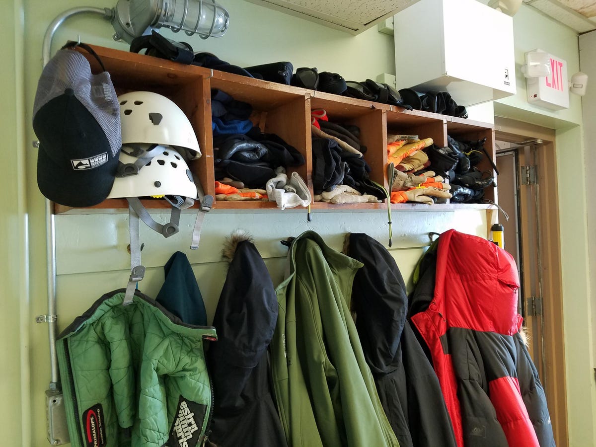
Helmets and gloves
The weather observers head outside at least once an hour, around the clock. Coats, gloves and helmets are always at the ready.
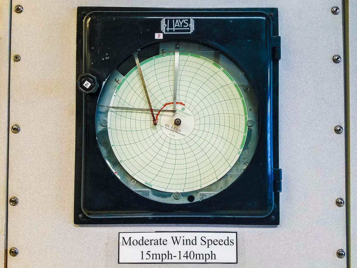
Hays chart apparatus
Inside the Observatory office you'll find a "weather wall" of instruments, including this Hays device, which compiles a record of wind speeds over the course of a 24-hour period. Think of it as an EKG for the wind. Things were downright balmy when I took this picture, with just a light breeze outside, but...

Hurricane-force winds
Twenty-two years earlier, on July 20, 1996, the Observatory recorded sustained above-hurricane-force winds throughout the entire day, with a peak gust of 154 miles per hour. There were also snow showers that day.

AT&T cellular antenna
The summit has long been home to broadcast towers for various TV and radio stations. The tall cylinder in the center of this photo looks a little like a rocket fuselage, but it's the housing for a trio of cellular antennas belonging to AT&T.

Mesonet station
Spread out around Mount Washington and nearby mountains are 19 mesonet stations, solar-powered remote sites that keep tabs on the weather and relay the data to the Observatory by radio signal. This one is on the side of the Auto Road, at around the 4,000-foot elevation mark.
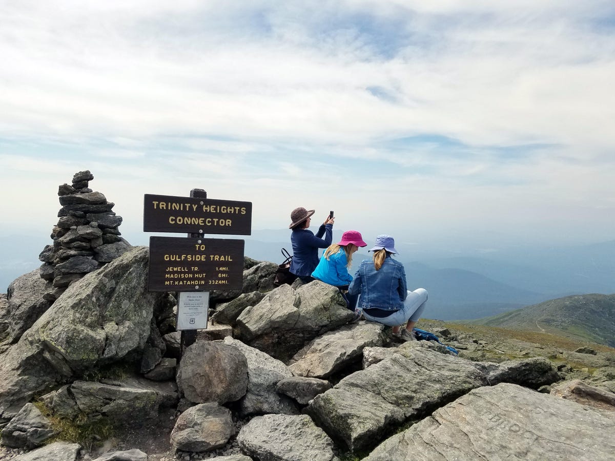
Trinity Heights Connector
In fair weather, the summit is a lovely spot to hang out. Here, some tourists take a lunch break, looking out to the west.
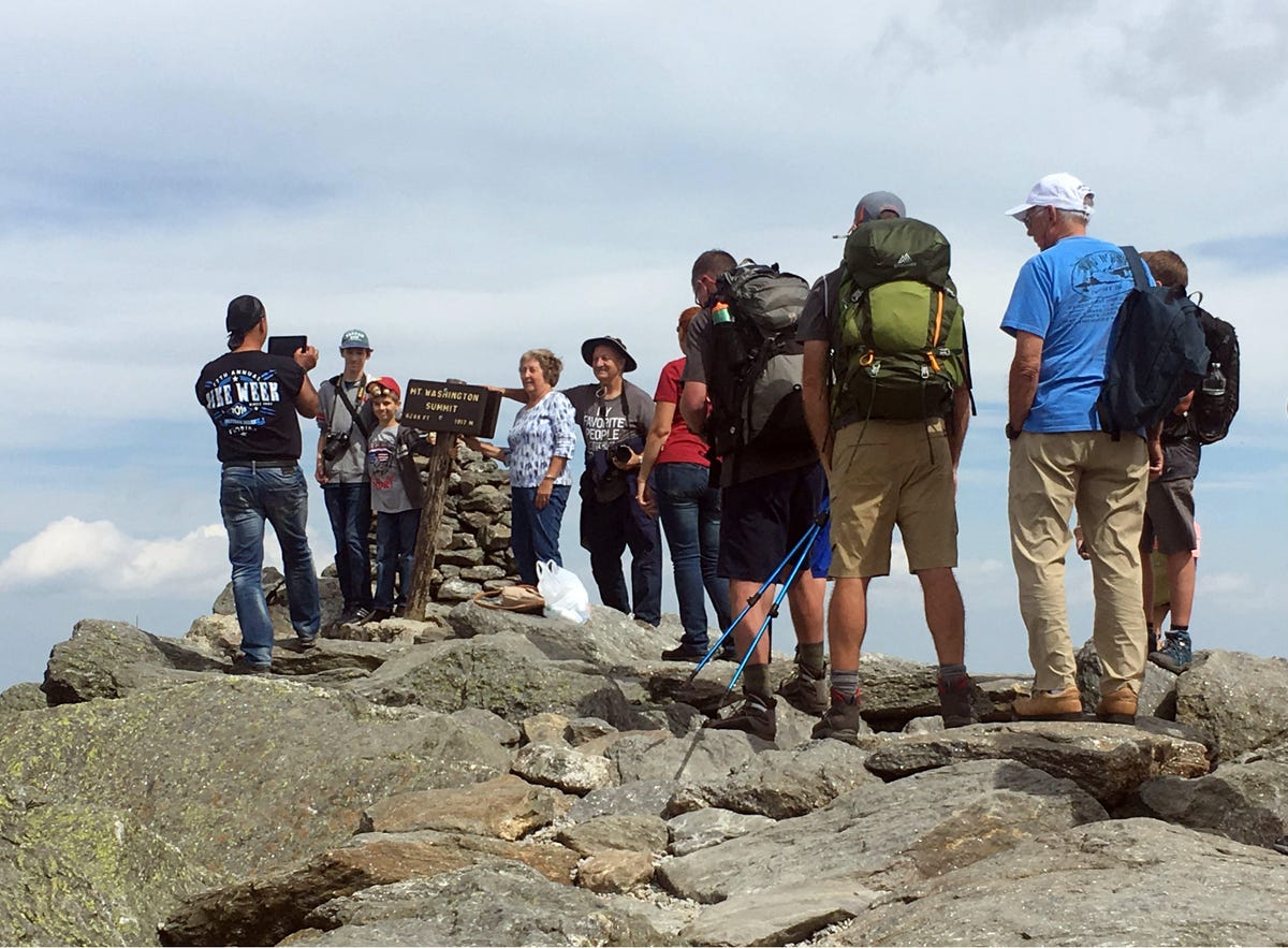
Snapshots at the summit
And visitors of course flock to take pictures at the sign marking the summit of Mount Washington. Some pack for a hike, while others look like they're out for a stroll in the suburbs.
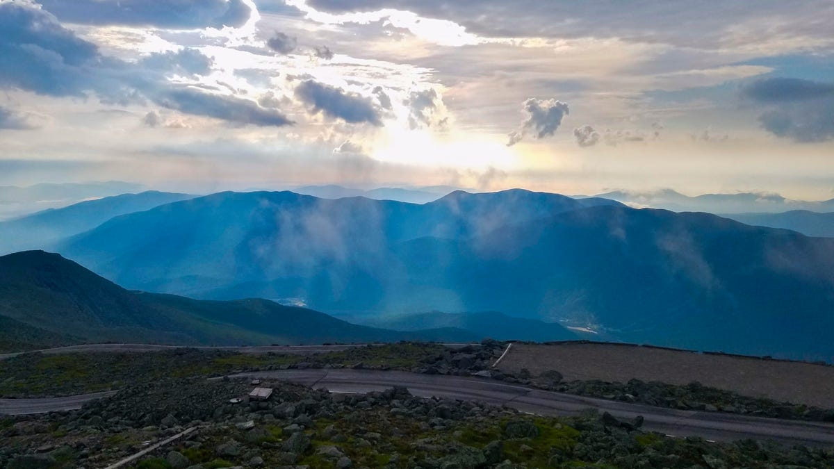
Sunrise from Mount Washington
The views from the summit can be stunning. This was sunrise, before the fog rolled in.

Tip-Top House
Here's another view of the Tip-Top House, built in 1853. Today it's a museum. Look at how thick those stone walls are.

Carriage house
This structure on the summit of Mount Washington now marks the top end of the 7.6-mile auto road. It's a replica of the original Observatory building, and today holds a gift shop. Notice the chains over the building and anchored into the rocks. It's that windy up there.

'Use lowest gear'
As you start the descent down the Mount Washington Auto Road from the summit, a sign offers a safety warning.
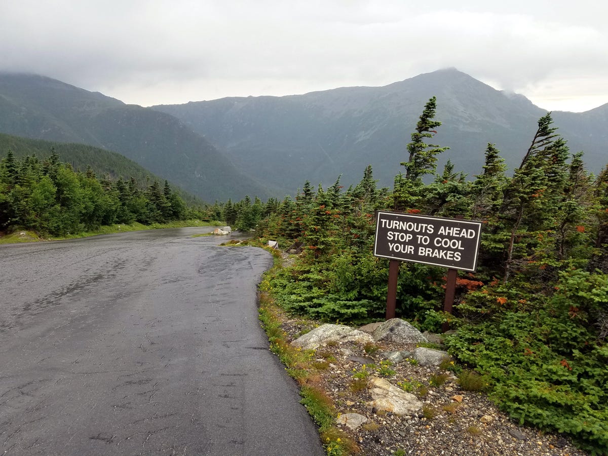
'Turnouts ahead'
Midway down the Mount Washington Auto Road, a sign recommends taking a break, for your brakes' sake.

Auto Road vans
The Mount Washington Auto Road is narrow and often steep. The views are stunning, but do drive carefully.
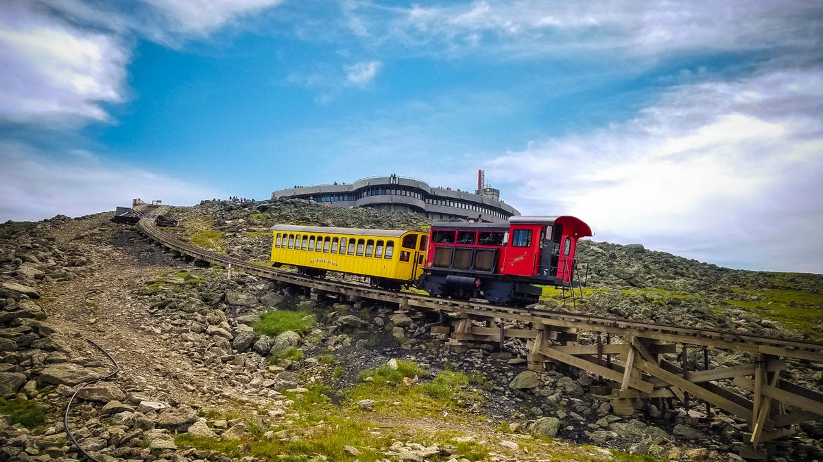
Cog Railway
A private company, the Mount Washington Cog Railway offers an old-fashioned form of travel to and from the summit. Electrical power to the facilities at the top runs up underground cables along the railway route.

Gary Reuter
Every year, approximately 350,000 people head up Mount Washington. Not all of them ride up in cars or the Cog Railway. Lots of people hike up, and in fact the Appalachian Trail crosses the summit. This gent is Gary Reuter, a 79-year-old retired fuel engineer, taking a break in the visitor center after hiking up the Bootspur Trail. It was his 16th time up one trail or another this year alone.
"We try to stay under 50-mph winds. It's just not worth the trouble. You lose a glove in that kind of weather, that's it," he said. "Temperature isn't that concerning, it's the wind chill."
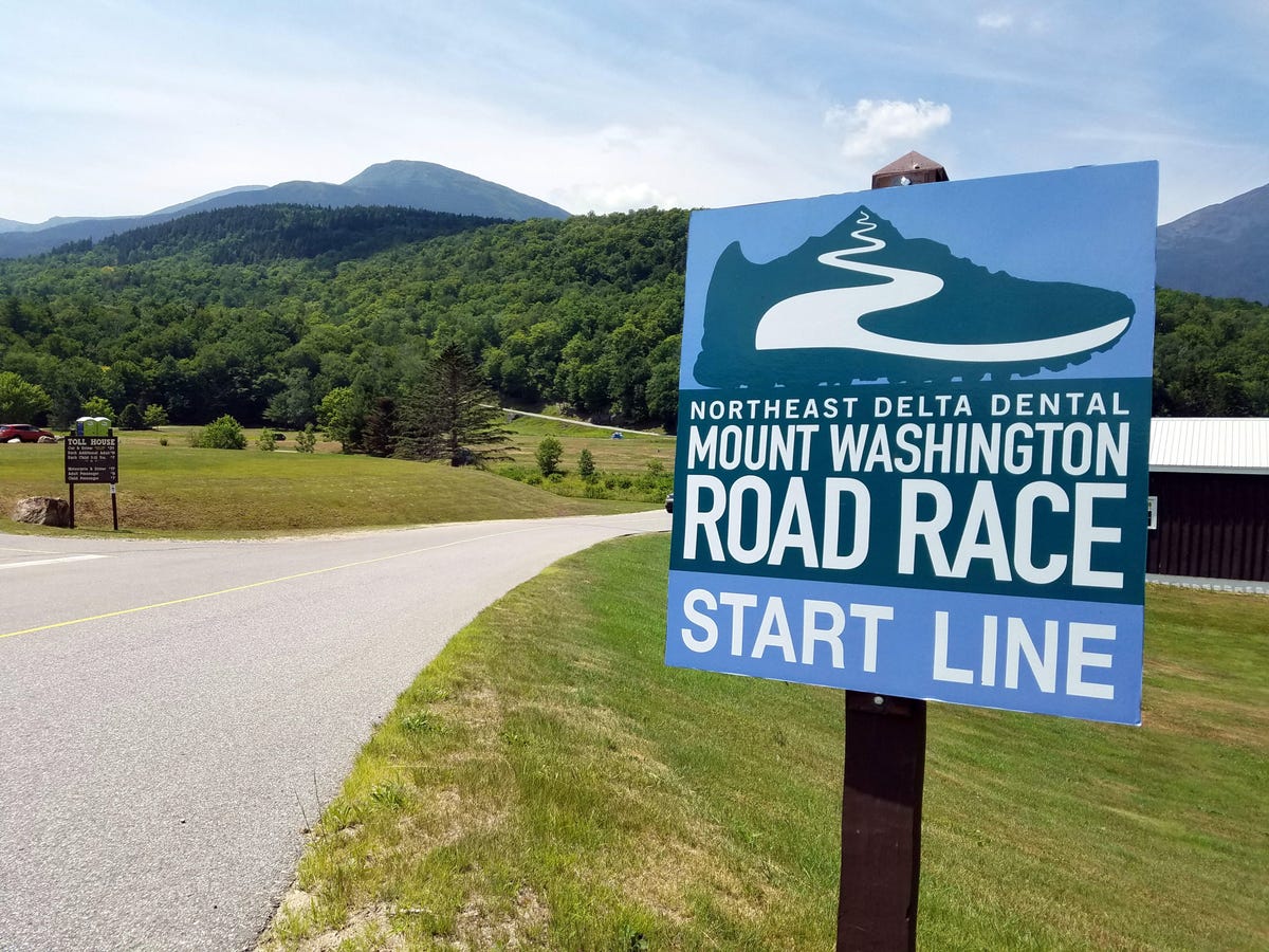
Road race
Up for a challenge, runners? The Mount Washington Road Race is uphill all the way, a 7.6-mile route with a vertical gain of 4,650 feet and an average grade of 12 degrees. Just to rub it in, the last 50 yards of the course are at a 22 percent grade.
More Galleries

My Favorite Shots From the Galaxy S24 Ultra's Camera
20 Photos
Honor's Magic V2 Foldable Is Lighter Than Samsung's Galaxy S24 Ultra
10 Photos
The Samsung Galaxy S24 and S24 Plus Looks Sweet in Aluminum
23 Photos
Samsung's Galaxy S24 Ultra Now Has a Titanium Design
23 Photos
I Took 600+ Photos With the iPhone 15 Pro and Pro Max. Look at My Favorites
34 Photos
