Watching a massive winter storm from space (pictures)
As the Northeast braces for one of the biggest snowstorms in decades, scientists are poring over the latest images of the storm transmitted by satellites.
Satellite images captured by the U.S. National Oceanic and Atmospheric Administration's (NOAA) Geostationary Operational Environmental Satellite system (GOES) reveal a clear picture of the staggering winter storm bearing down on the East Coast of the United States.
The potentially record-breaking storm is believed to be capable of dumping more than 2-3 feet of snow across wide parts of New England, including the heavily populated New York and Boston areas.
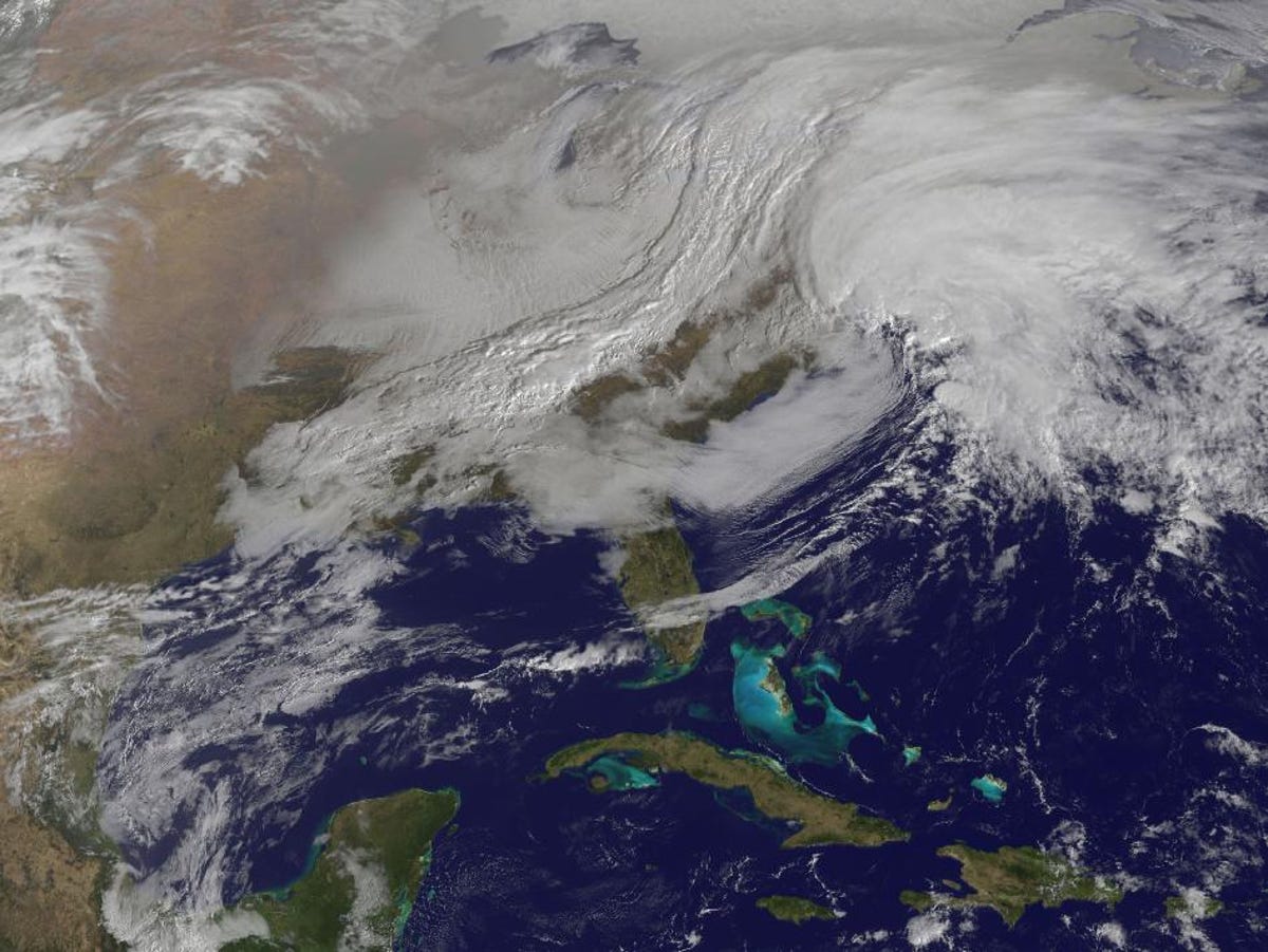
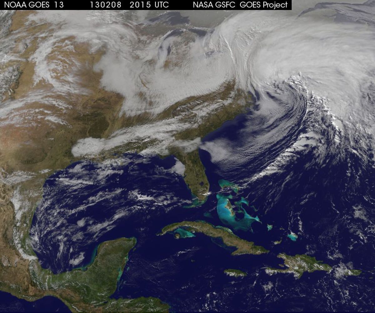
A view of the winter storm, being nicknamed "Nemo" by the Weather Channel, is seen here closing in on New England earlier today at 2:15 p.m. ET.
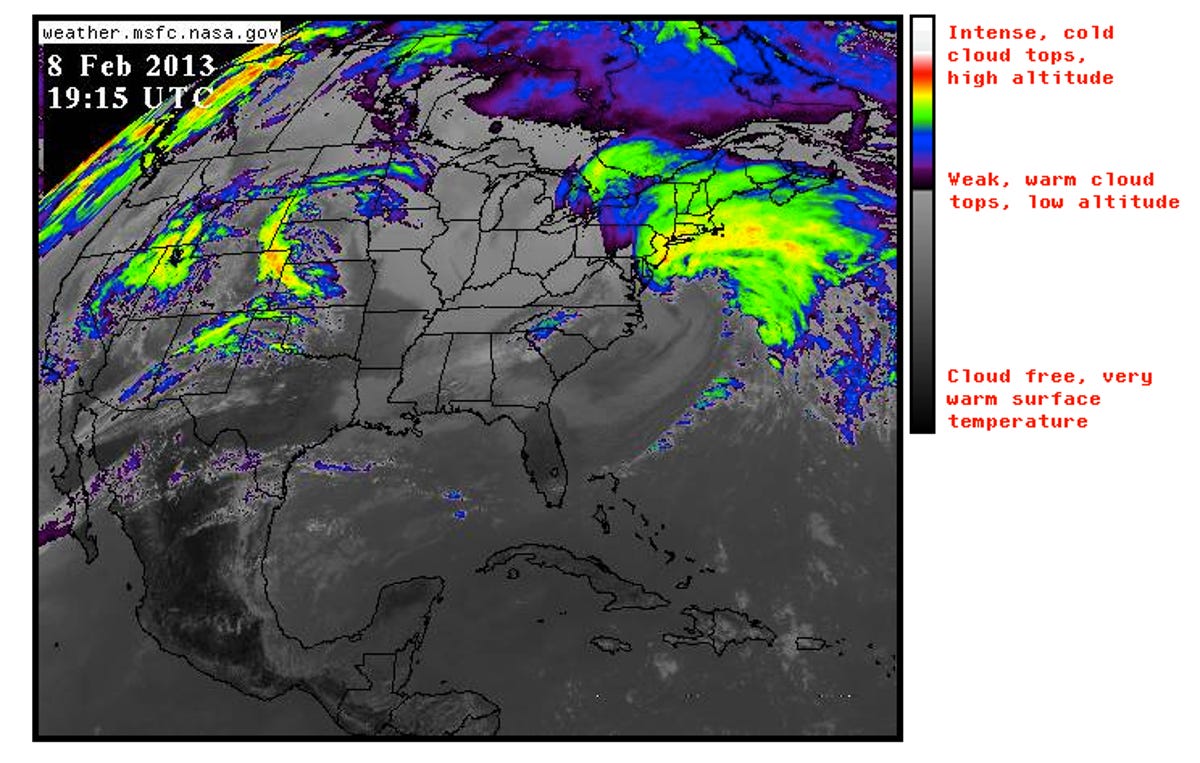
This satellite image from NOAA's GOES-13 satellite shows the infrared view of the winter storm closing in on New England.
In preparation for the potential turmoil the snowstorm could cause, subways have been closed, train services suspended, and more than 3,000 airlines flights in and out of the region have been canceled.
When looking at these satellite images, it's easy to draw comparisons to superstorm Sandy which devastated the Northeast region in late October.
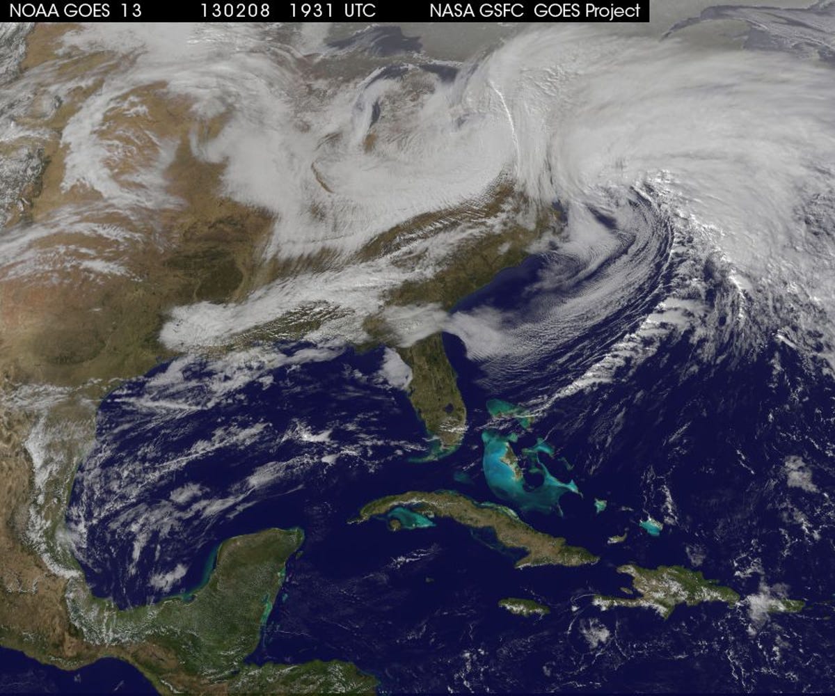
3 of 7 NOAA GOES-13
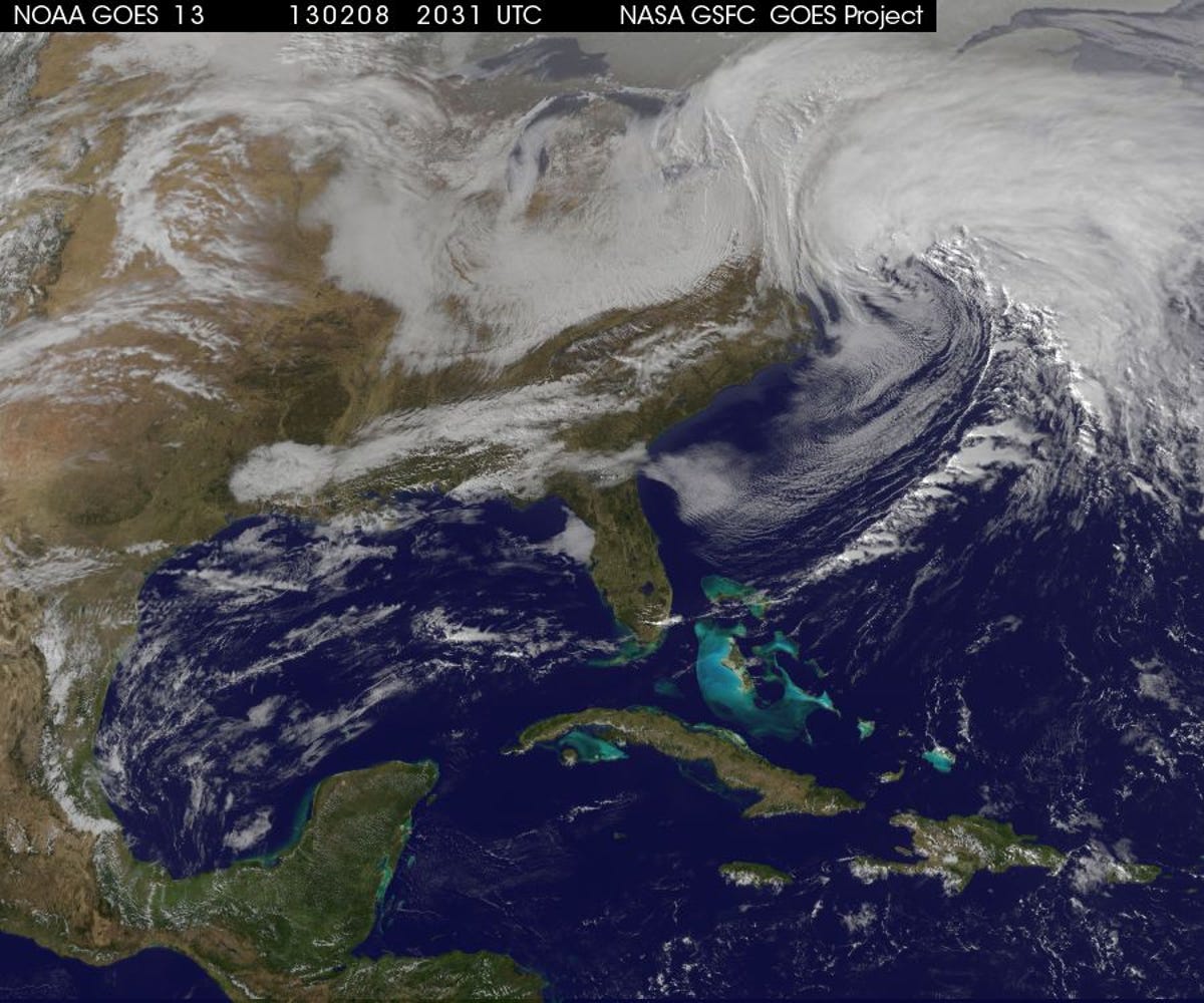
Closing in on the Northeast
The winter storm closing in on New England is expected to hit the Northeast tonight and through Saturday morning. It's seen here in an image captured by the GOES-13 satellite today at 2:31 p.m. ET.
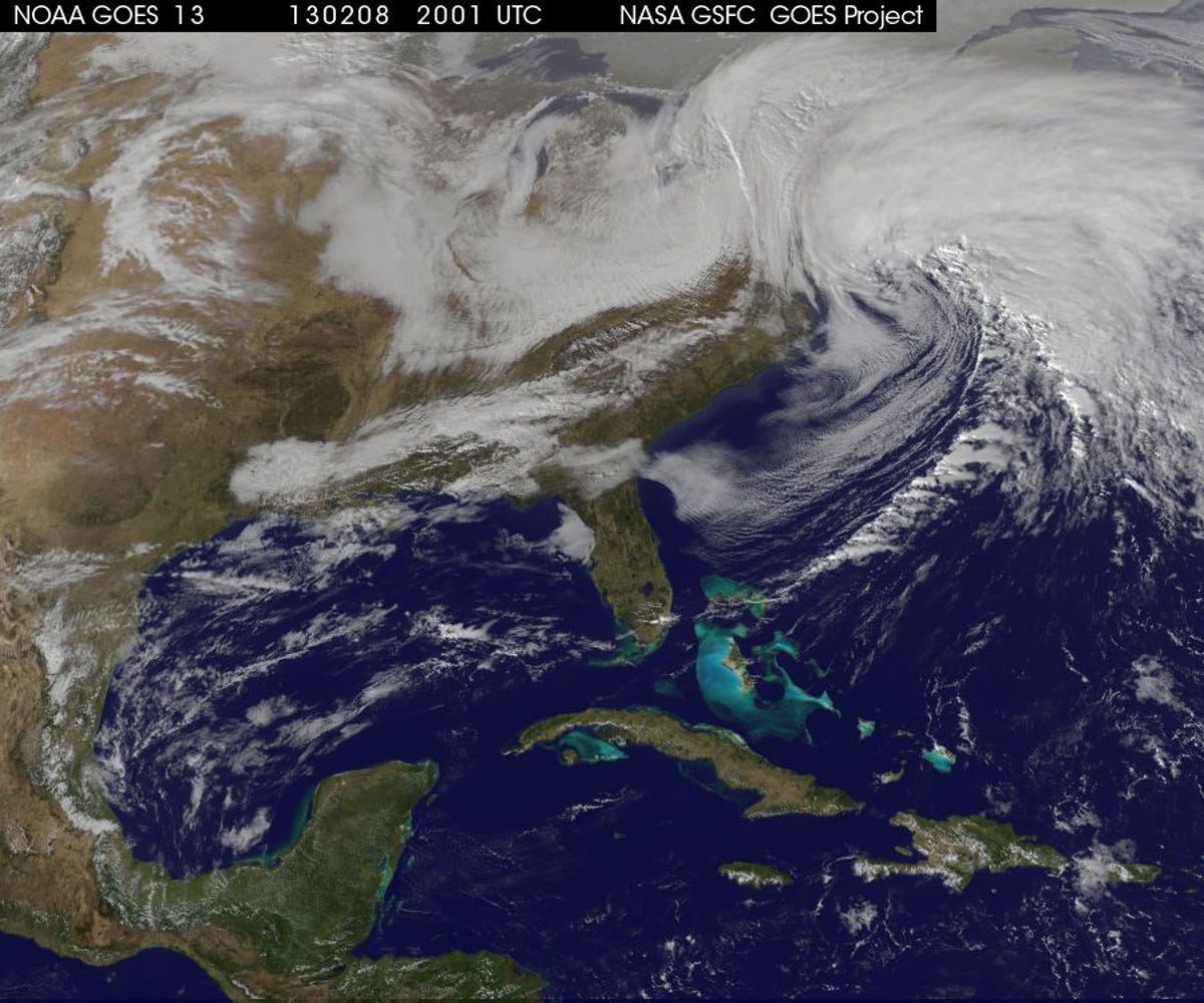
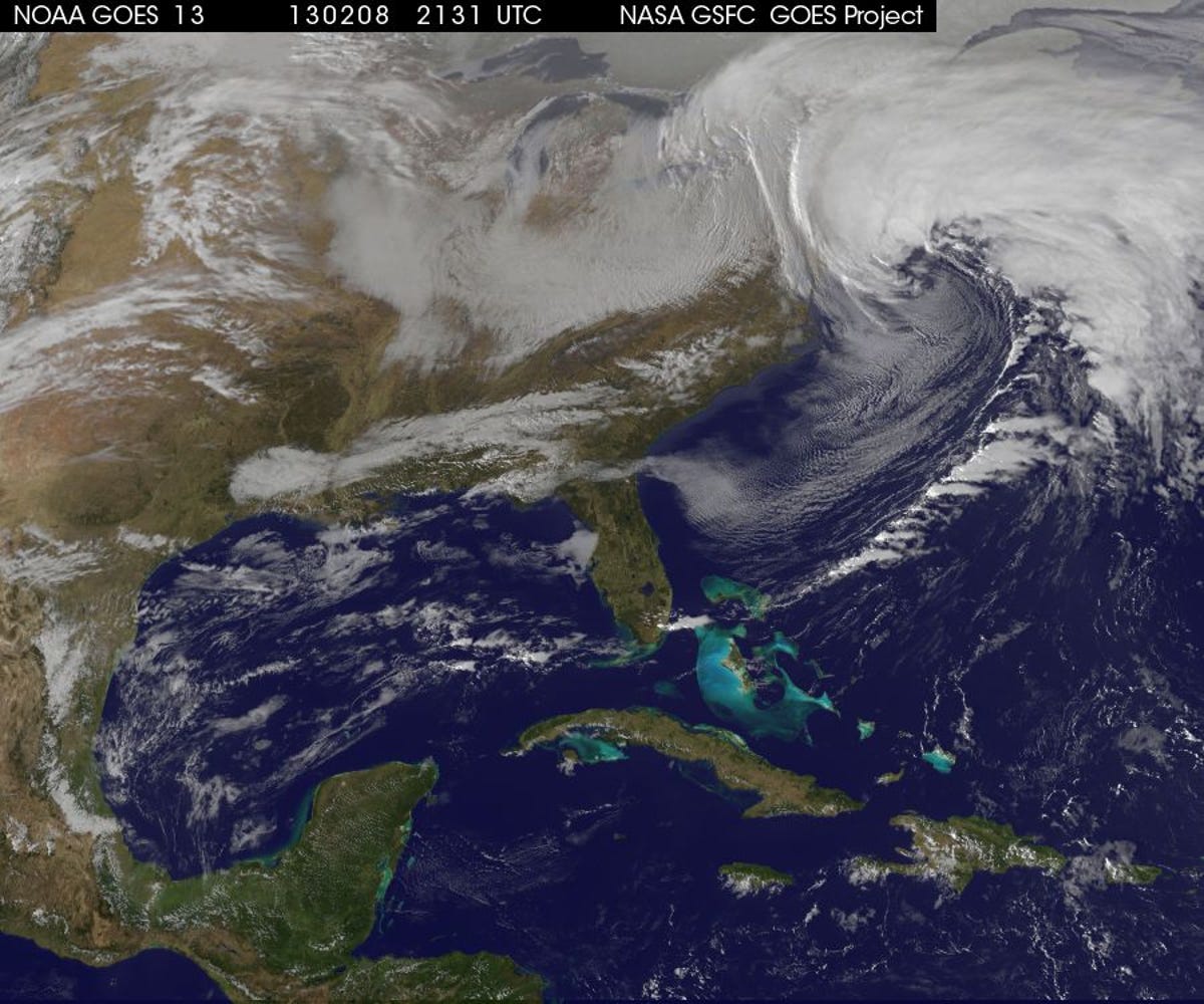
4 of 7 NOAA GOES-13
The massive winter storm closing in on New England is seen here at 2:45 p.m. ET. The storm is expected to dump 2-3 feet of snow across much of the region, from New York to Maine.
5 of 7 NOAA GOES-13
A satellite image of the winter storm closing in on New England at 3:15 p.m. ET.
6 of 7 NOAA GOES-13
This image was taken at 3:15 p.m. ET on February 8, hours before the storm is expected to hit the region hardest.
7 of 7 NOAA GOES-13
This image was taken at 3:31 p.m. ET on February 8, hours before the storm is expected to hit the region hardest.