A new Web application from Microsoft features striking, high-resolution aerial photos from around the United States.
Jay Greene
Jay Greene, a CNET senior writer, works from Seattle and focuses on investigations and analysis. He's a former Seattle bureau chief for BusinessWeek and author of the book "Design Is How It Works: How the Smartest Companies Turn Products into Icons" (Penguin/Portfolio).
Microsoft launched the GeoArt application to showcase the high-resolutions aerial mapping photography, shot for its Bing Maps Global Ortho project. The vivid pictures are stitched seamlessly together to create a mosaic that users can pan through for a bird's eye view. The company plans to complete mapping the continental United States and Western Europe by June 2012.
2 of 10 Microsoft; screenshot by Jay Greene/CNET
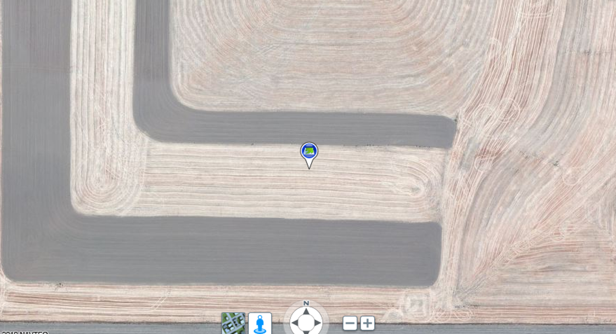
Pataha, Wash., farmland
Pataha, Wash., farmland as viewed by Bing Maps Global Ortho.
3 of 10 Microsoft; screenshot by Jay Greene/CNET
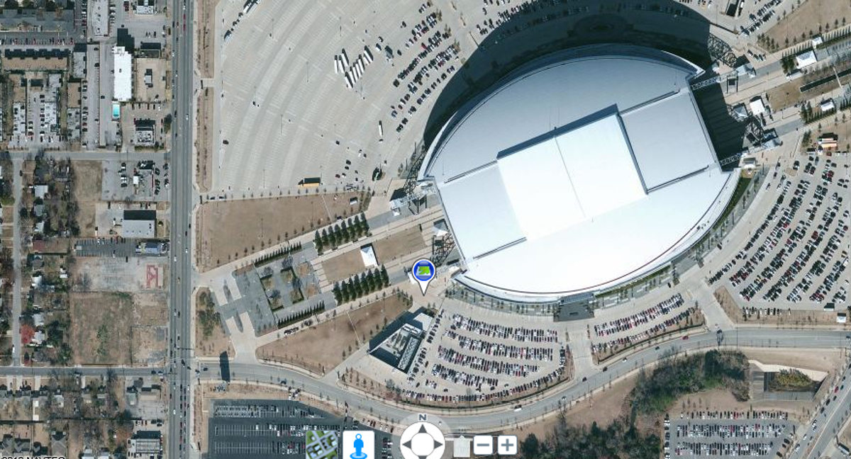
Cowboys Stadium, Arlington, Texas
Cowboys Stadium, Arlington, Texas, as viewed by Bing Maps Global Ortho.
4 of 10 Microsoft; screenshot by Jay Greene/CNET
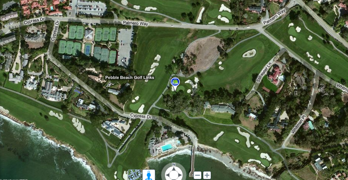
Pebble Beach Golf Links
Pebble Beach Golf Links as viewed by Bing Maps Global Ortho.
5 of 10 Microsoft; screenshot by Jay Greene/CNET
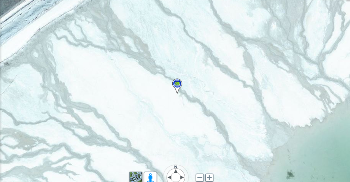
Tailings Pond, west of Central Heights, Ariz.
Tailings Pond, west of Central Heights, Ariz., as viewed by Bing Maps Global Ortho.
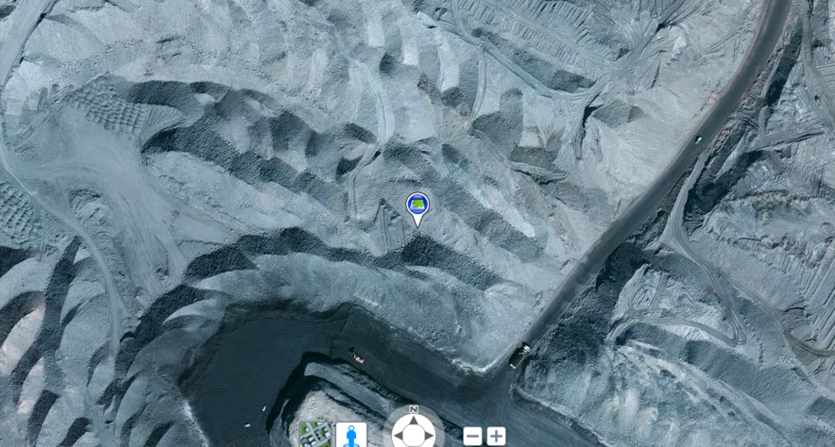
6 of 10 Microsoft; screenshot by Jay Greene/CNET
Black Mesa Coal Mine
Black Mesa Coal Mine, Navajo Indian Reservation, Arizona, as viewed by Bing Maps Global Ortho.
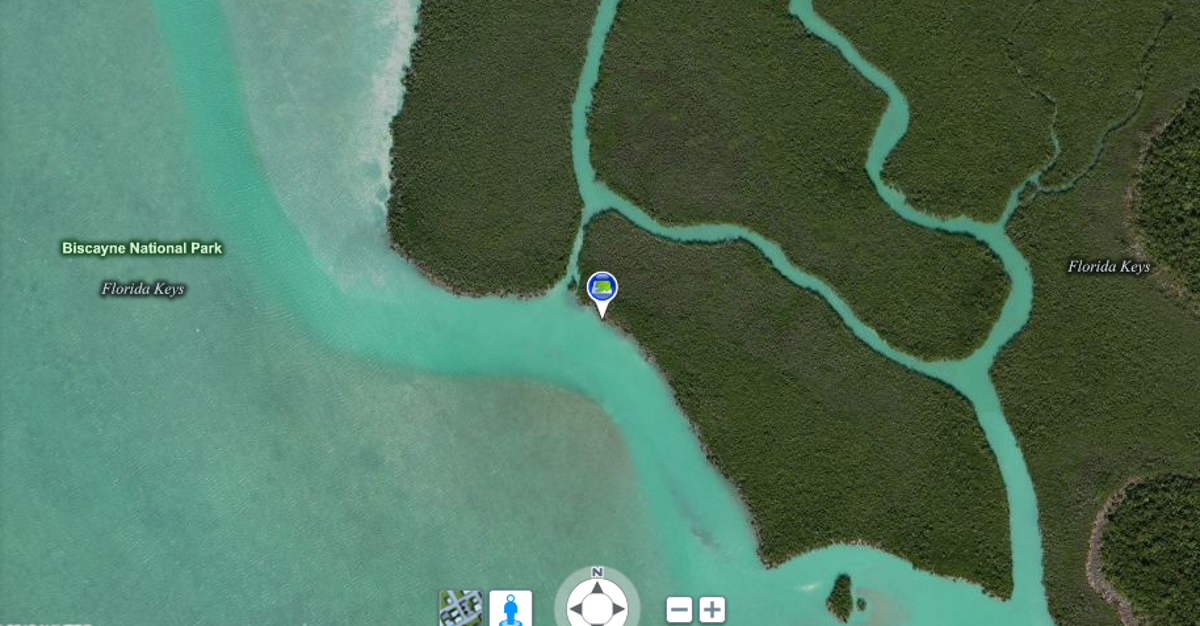
7 of 10 Microsoft; screenshot by Jay Greene/CNET
Biscayne National Park, Florida
Biscayne National Park, Florida, as viewed by Bing Maps Global Ortho.
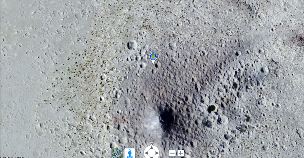
8 of 10 Microsoft; screenshot by Jay Greene
Navy bombing target area
Navy bombing target area, east of Humbolt Lake, Nev., as viewed by Bing Maps Global Ortho.
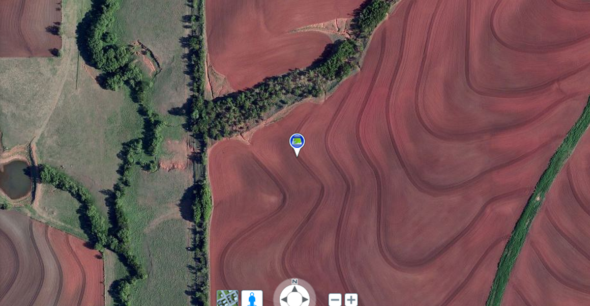
9 of 10 Microsoft; screenshot by Jay Greene/CNET
Clinton, Okla., farmland
Clinton, Okla., farmland as viewed by Bing Maps Global Ortho.
10 of 10 Microsoft; screenshot by Jay Greene/CNET
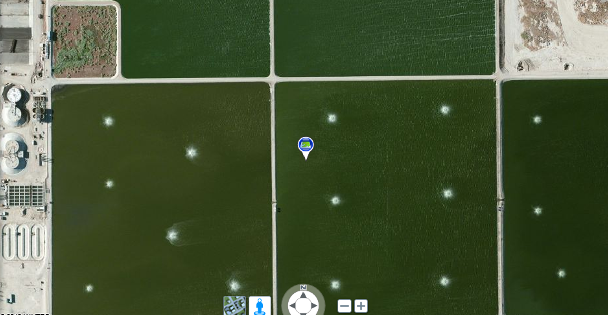
Water reclamation plant
Water reclamation plant, north of Lancaster, Calif., as viewed by Bing Maps Global Ortho.