Typhoon Haiyan pounds the Pacific (pictures)
On November 8, Typhoon Haiyan made landfall in the central Philippines, bringing strong winds and heavy rains that have resulted in flooding, landslides, and widespread damage.


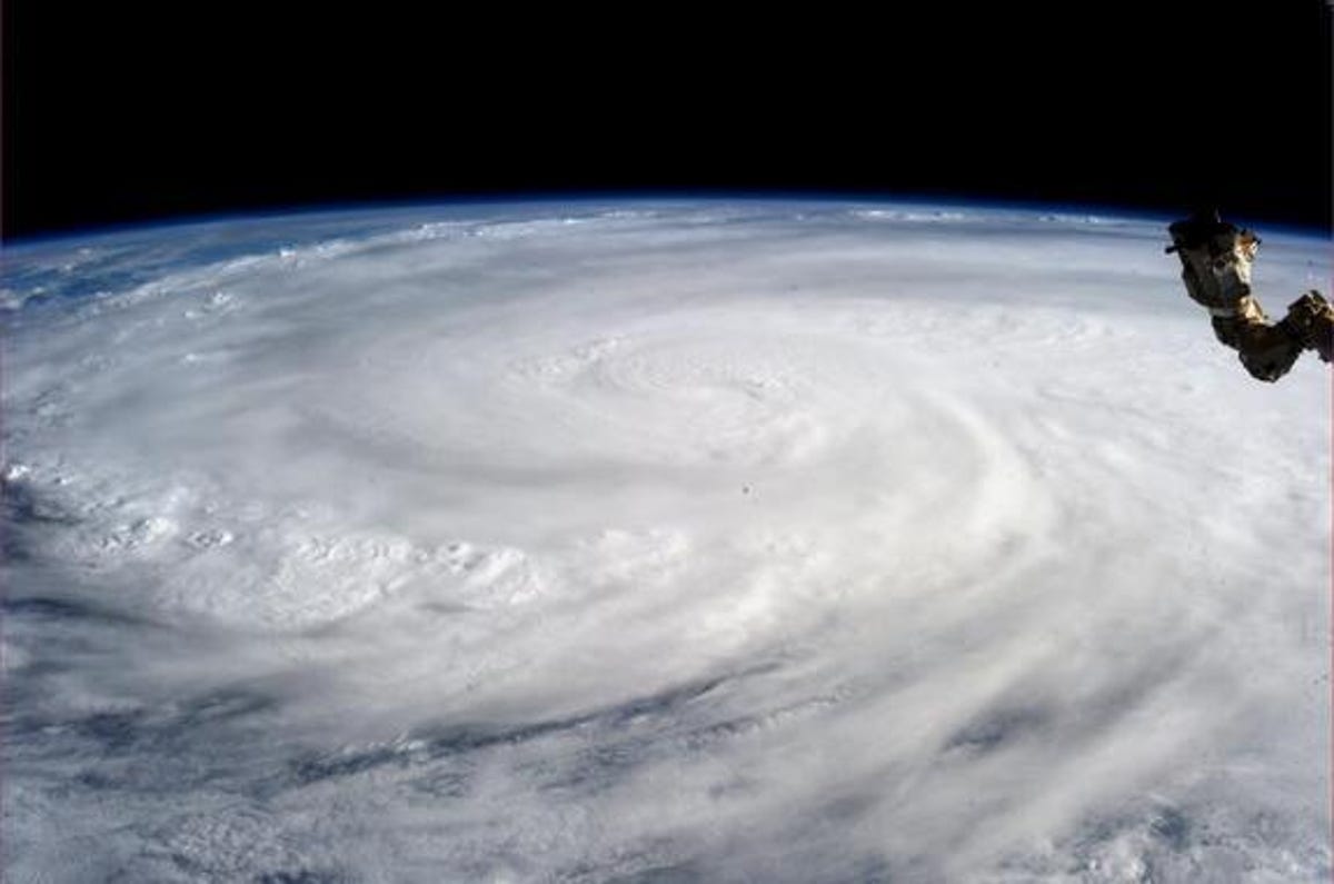
Typhoon Haiyan from the ISS
While orbiting Earth on board the International Space Station, NASA astronaut Karen Nyberg took in a wide view of Typhoon Haiyan on Saturday, November 9, 2013, the day after the storm made impact in the Philippines.
"Typhoon Haiyan. November 9," Nyberg tweeted.
On November 8, Typhoon Haiyan -- known as Yolanda in the Philippines -- made landfall in the central Philippines, bringing strong winds and heavy rains that have resulted in flooding, landslides, and widespread damage. According to the Philippines' National Disaster Risk Reduction and Management Center (NDRRMC), an estimated 9.7 million people across 41 provinces have been affected by Typhoon Yolanda/Haiyan. Access to many areas is still difficult or impossible, and the full scale of the damage is yet unknown.
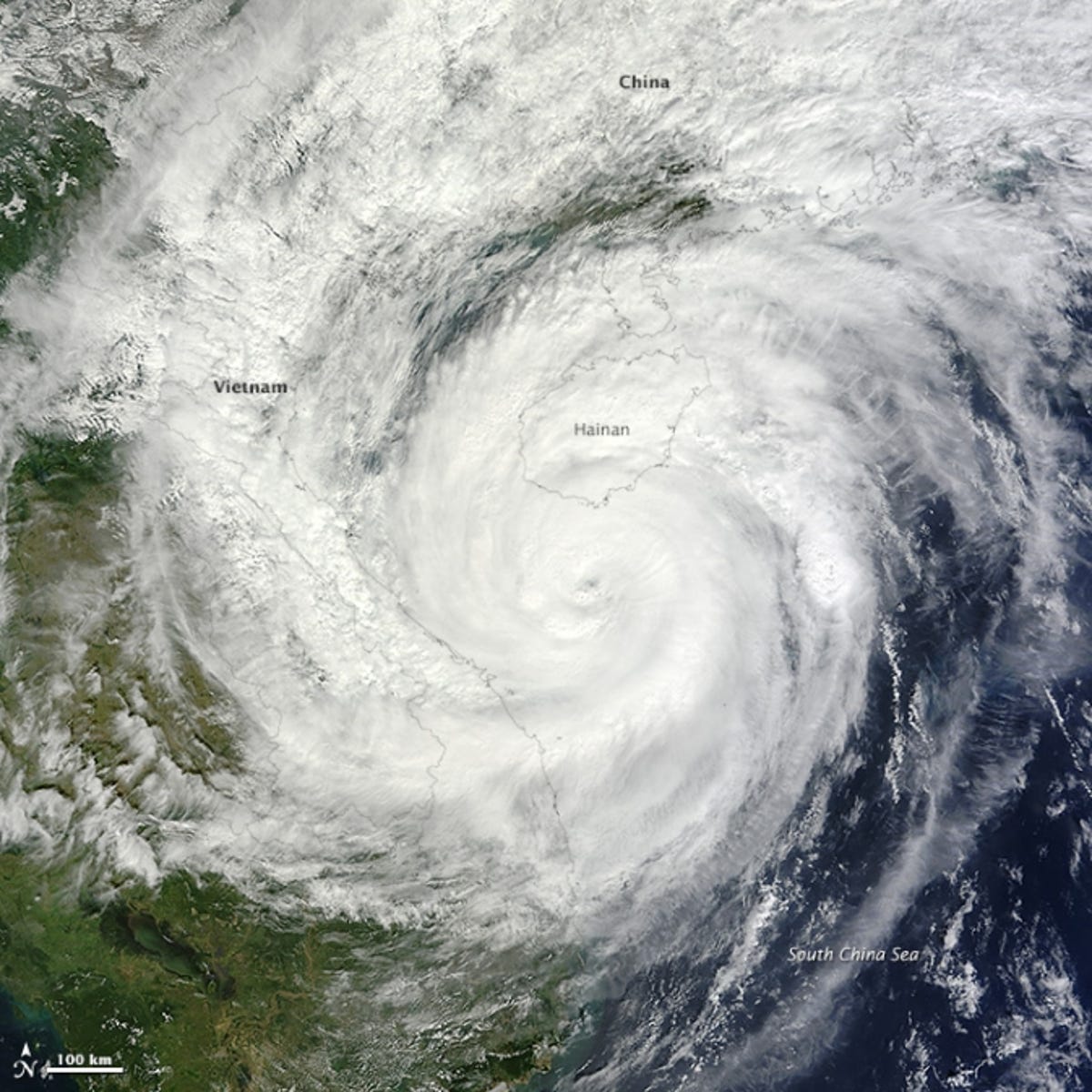
Haiyan crosses the Philippines as a Super-Typhoon
The Moderate Resolution Imaging Spectroradiometer (MODIS) on NASA's Terra satellite captured this image of Typhoon Haiyan just south of Hainan Island, China and approaching Vietnam on November 10, 2013.
The storm was tracking northwest and slowly weakening prior to landfall in northern Vietnam on Sunday evening. As of early Sunday morning, the storm had maximum sustained winds of about 90 miles per hour, the equivalent of a category 1 storm.
Haiyan crossed the Philippines as a Super-Typhoon, defined as reaching maximum sustained 1-minute surface winds of at least 150 mph. This is the equivalent of a strong Saffir-Simpson category 4 or category 5 hurricane in the Atlantic basin or a category 5 severe tropical cyclone in the Australian basin.
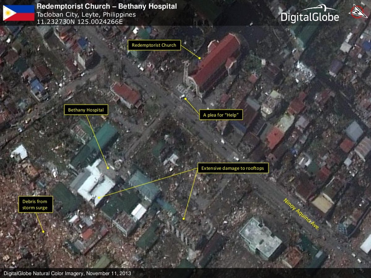
West side of Cancabato Bay
This area, on the west side of Cancabato Bay, bore some of the heaviest brunt of Typhoon Haiyan. Debris from the storm surge is seen in the lower left area of the image, as well as debris scattered across the area. Damage to the Bethany Hospital looks extensive, and cars and trucks are attempting to navigate the streets.
The scale of the storm’s destruction has been absolutely massive. In an effort to help map the destruction and provide help and assistance to those most in need, DigitalGlobe has activated a crowdsourcing campaign, open to anyone willing to help.
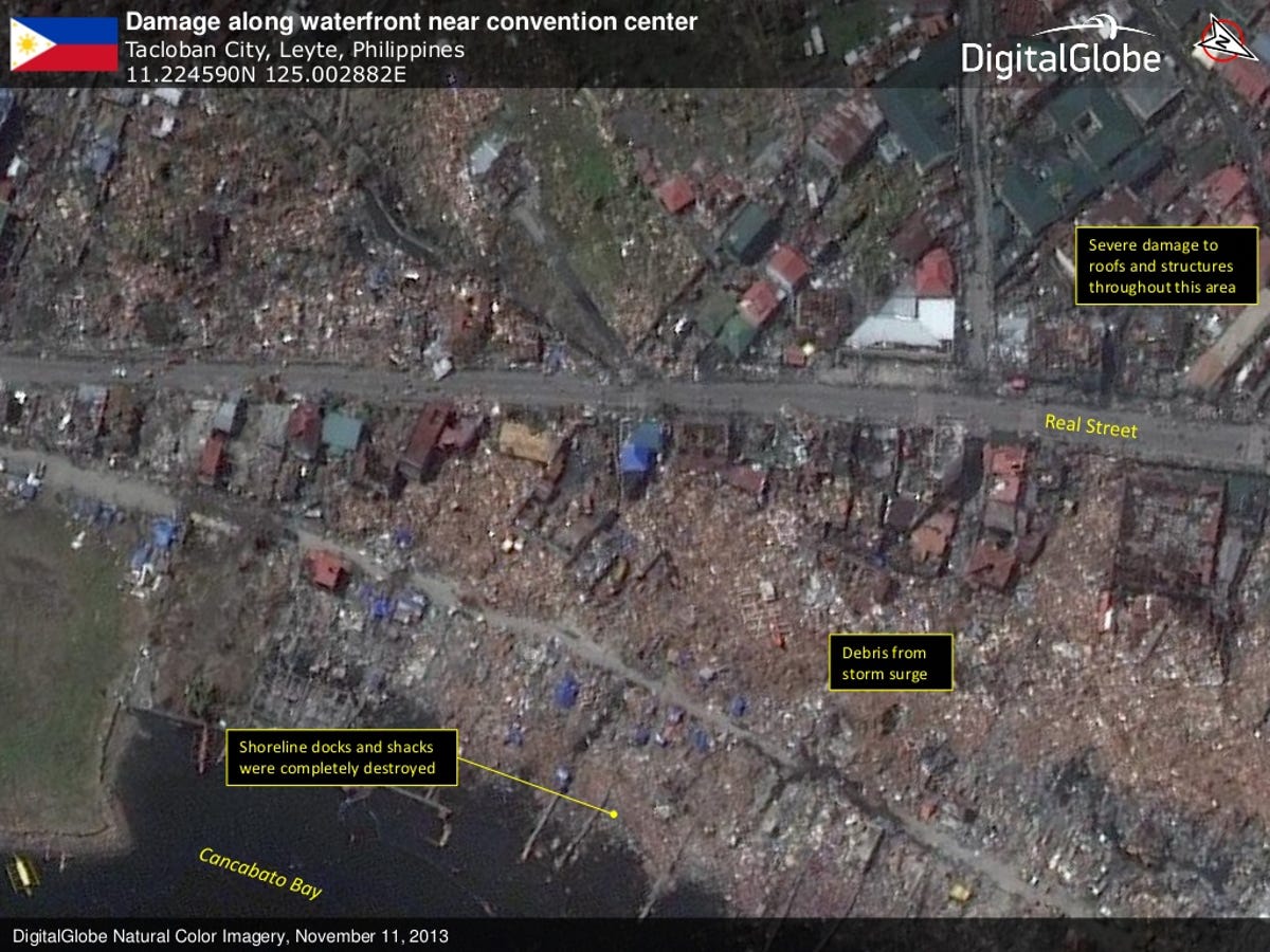
Waterfront damage
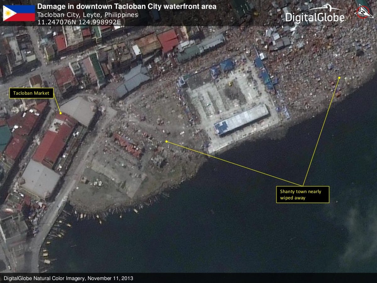
Tacloban City
The downtown waterfront area of Tacloban City was not spared by the storm. The roof of the market was extensively damaged, and the nearby shanty town (marked by the arrows) was almost completely wiped off the map.
The US Government is providing $20 million in immediate humanitarian assistance to benefit typhoon-affected populations, including emergency shelter, food, water, sanitation, and hygiene support.
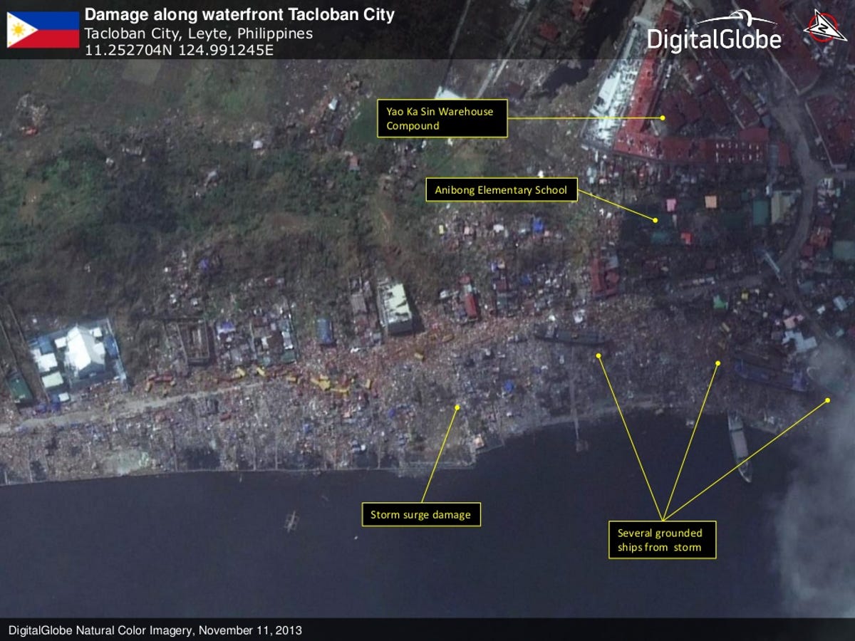
Grounded ships
More coastal damage around Tacloban City and three ships grounded from the storm can be seen at the arrows in the lower right of this satellite image from DigitalGlobe.
Authorities said that more than 23,200 houses have been damaged or destroyed by Typhoon Yolanda/Haiyan in the Philippines.
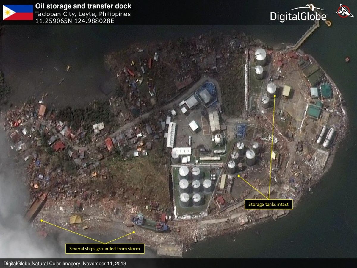
Oil storage and transfer dock
This image from DigitalGlobe shows more ships grounded from the storm. An oil storage and transfer dock appears to be intact, a small bit of good news among more widespread environmental concerns.
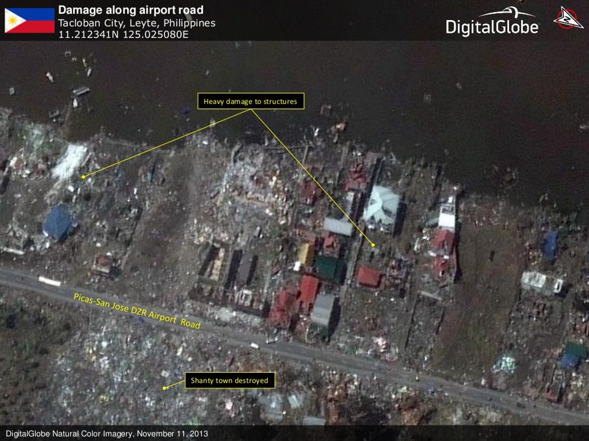
The road to the Tacloban City airport
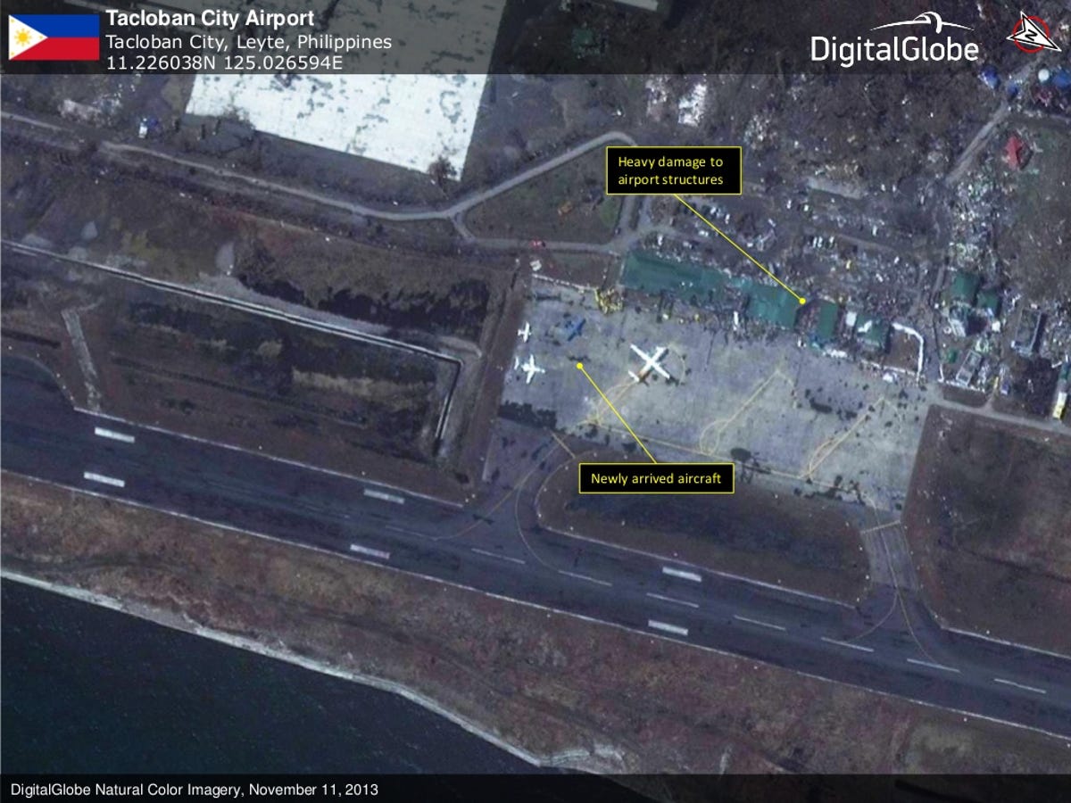
Airport damage
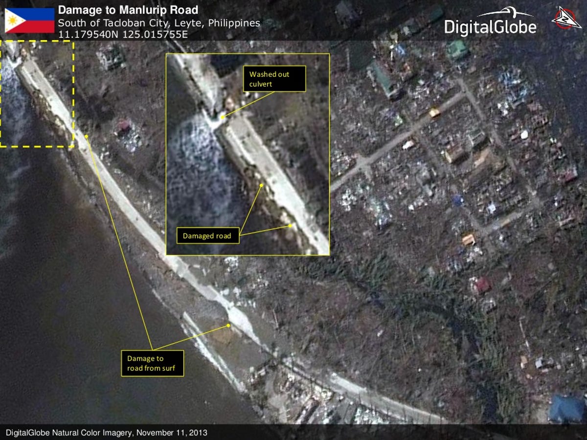
Coastal roads damaged
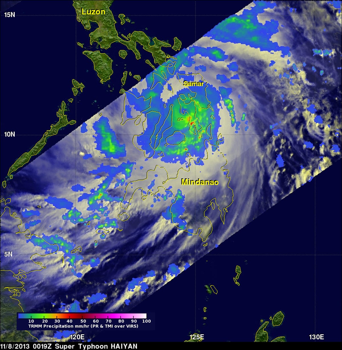
NASA's TRMM satellite
Leyte, Philippines
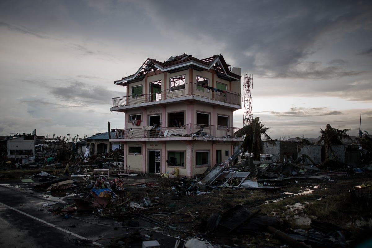
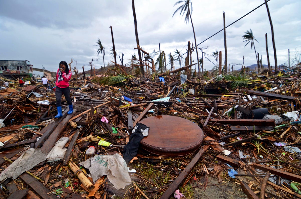
Believed to have killed more than 10,000 people
A the sun sets over a house damaged by Typhoon Haiyan outside the airport in Tacloban, on the eastern island of Leyte on November 12, 2013 after Super Typhoon Haiyan swept over the Philippines. The typhoon that destroyed entire towns across the Philippines is believed to have killed more than 10,000 people, which would make it the country's deadliest recorded natural disaster.
The scale of the storm’s destruction has been absolutely massive. In an effort to help map the destruction and provide help and assistance to those most in need, DigitalGlobe has activated a crowdsourcing campaign, open to anyone willing to help.
Resources:
InterAction
ReliefWeb
GlobalGiving
More Galleries

My Favorite Shots From the Galaxy S24 Ultra's Camera
20 Photos
Honor's Magic V2 Foldable Is Lighter Than Samsung's Galaxy S24 Ultra
10 Photos
The Samsung Galaxy S24 and S24 Plus Looks Sweet in Aluminum
23 Photos
Samsung's Galaxy S24 Ultra Now Has a Titanium Design
23 Photos
I Took 600+ Photos With the iPhone 15 Pro and Pro Max. Look at My Favorites
34 Photos
