Satellite views of California as wildfires rage
More than 1 million acres of California have already burned as fire season only just begins


As wildfires continue to burn across California, there appears to be no end in sight to the destruction. The hot dry winds that typically denote California's "fire season" between August and November have only just begun.
In all of 2019, an estimated 259,823 acres of California burned, and already this year, California has seen more than 1 million acres burned.
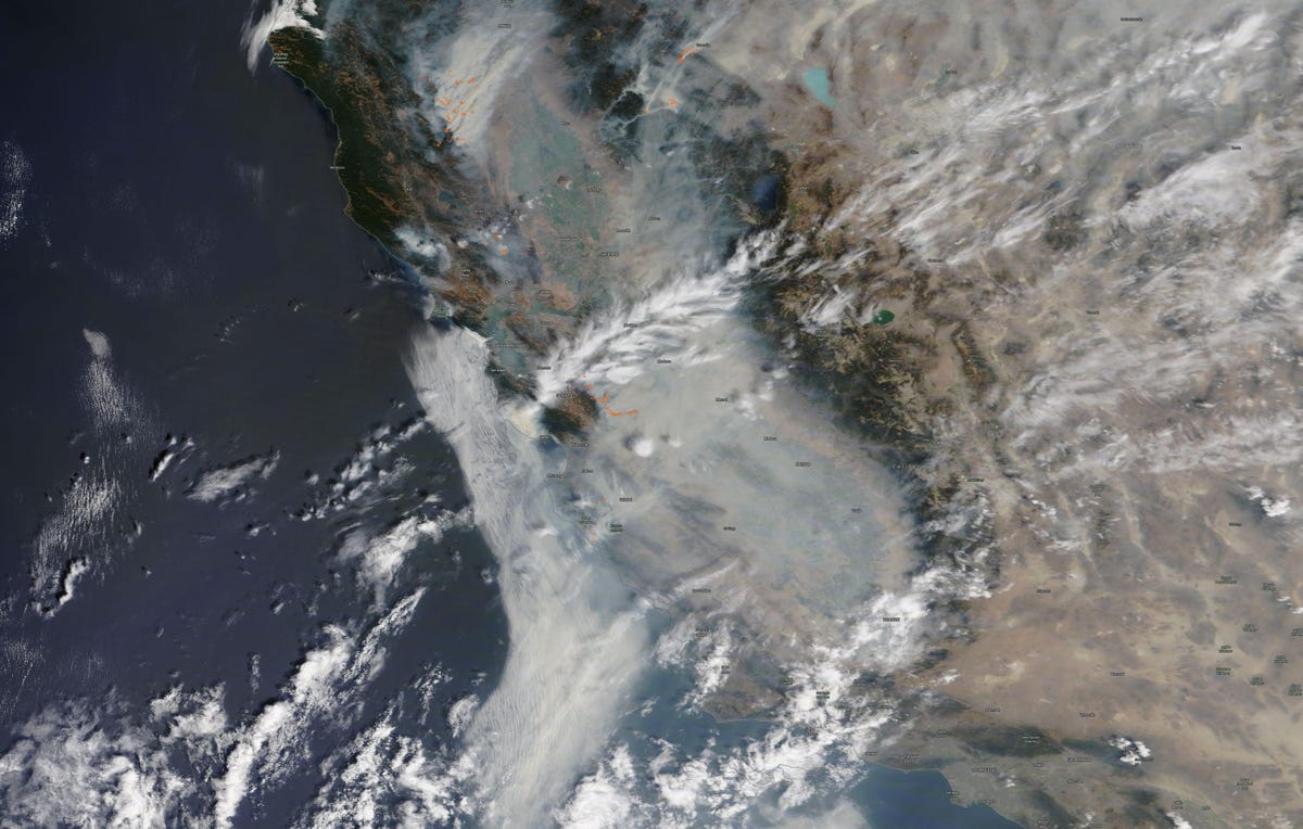
This image from NASA's Terra Modis (Moderate Resolution Imaging Spectroradiometer) satellite shows a view of California from Redding in the north to Los Angeles in the south, with thick smoke covering nearly the entire state.
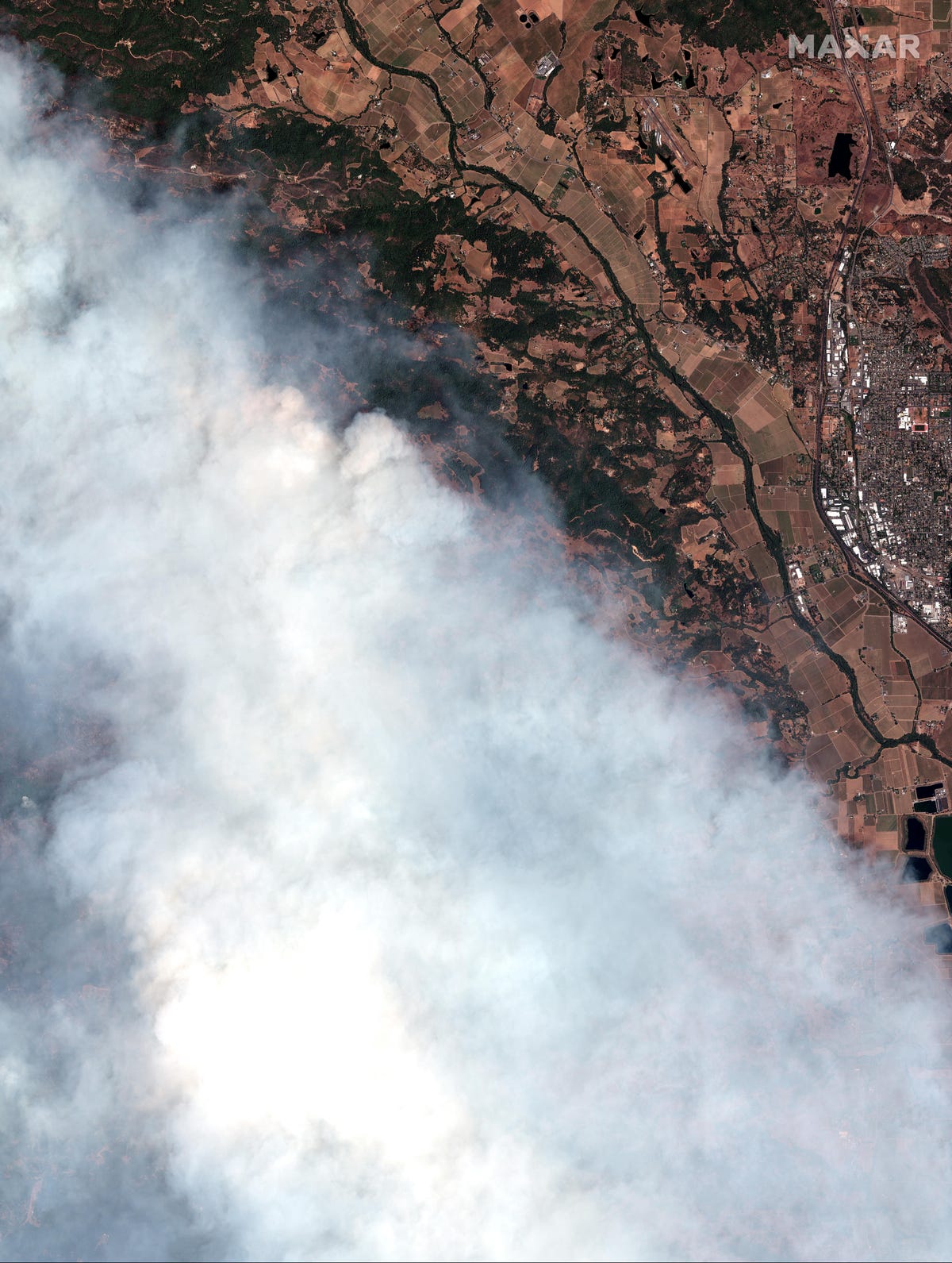
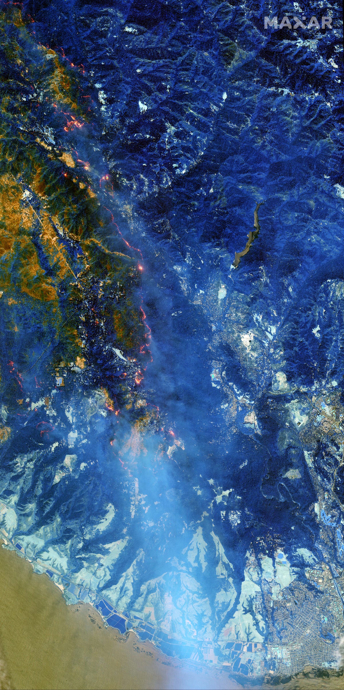
This natural color image of the LNU Lightening Complex fire burning through Lake and Sonoma counties near the famed wine country along Dry Creek Road and the town of Healdsburg, California, taken on Aug. 20, 2020.
Maxar's WorldView-3 satellite is equipped with a shortwave infrared sensor that penetrates the smoke and lets users detect active fires, hot spots and accurately map and measure burn areas including the LNU Lightning Complex wildfires, the CZU Lightning Complex wildfires, the SCU Lightning Complex wildfires and the Carmel and River wildfires.
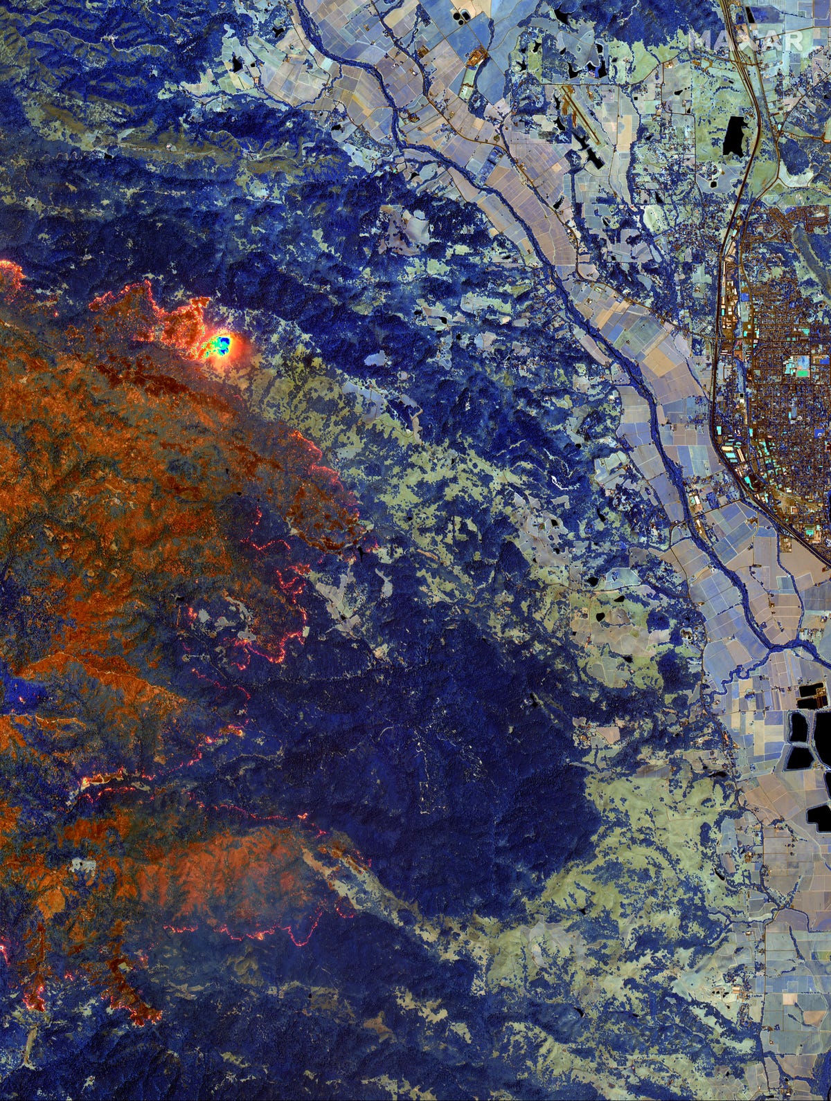
A shortwave infrared sensor image of the LNU Lightening Complex fire burning through Lake and Sonoma counties near the famed wine country and the town of Healdsburg, California, taken on Aug. 20, 2020.
A natural color image of the CZU Lightening Complex fires near Santa Cruz, California taken on Aug. 21, 2020, shows the dense smoke now covering much of California.
A wide overview shortwave infrared sensor image of the CZU Lightening Complex fires near Santa Cruz, California taken on Aug. 21, 2020.

A natural color image of the CZU Lightening Complex wildfires burning through Boulder Creek and Loch Lomond, California, taken on Aug. 21, 2020.
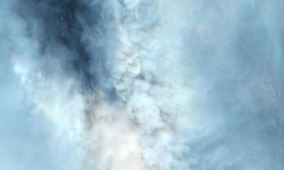
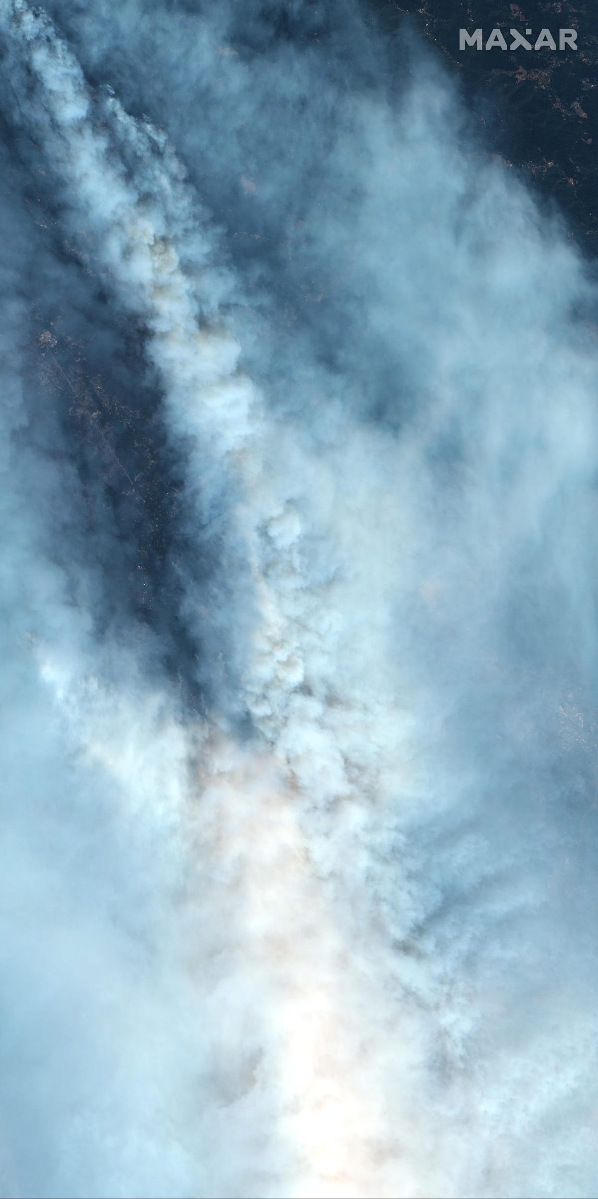
This visible and near-infrared image of the CZU Lightening Complex wildfires near Bonny Doon and Felton, California, taken on Aug. 21, 2020 shows the incredible cloud of smoke being emitted.
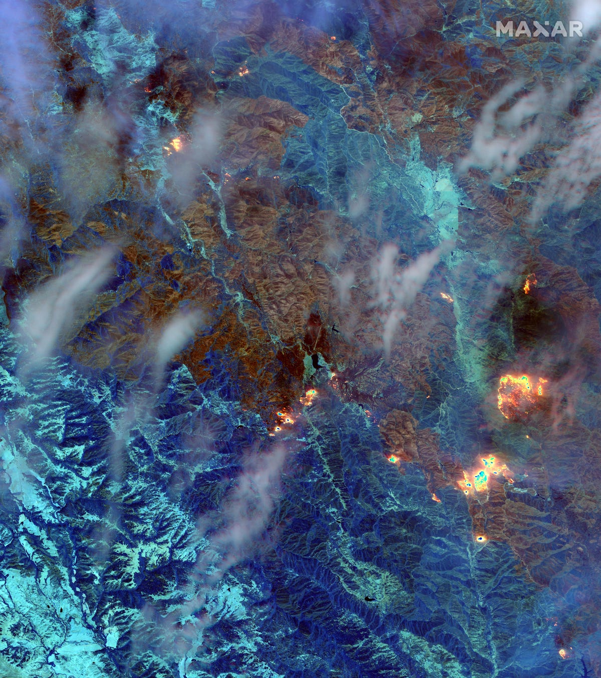
A wide overview shortwave infrared sensor image of the SCU Lightening Complex fires taken on Aug. 22, 2020, having already burned 339,968 acres across several counties.
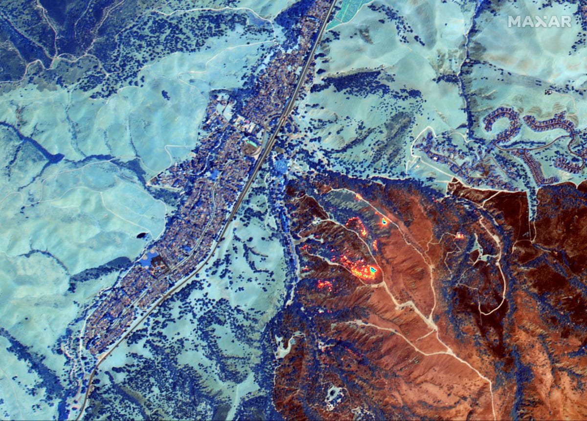
A close-up view of the River Fire, burning south of Salinas, which had grown to 39,464 acres by Friday morning when this image was taken on Aug. 21, 2020, and was 9% contained.
More Galleries

My Favorite Shots From the Galaxy S24 Ultra's Camera
20 Photos
Honor's Magic V2 Foldable Is Lighter Than Samsung's Galaxy S24 Ultra
10 Photos
The Samsung Galaxy S24 and S24 Plus Looks Sweet in Aluminum
23 Photos
Samsung's Galaxy S24 Ultra Now Has a Titanium Design
23 Photos
I Took 600+ Photos With the iPhone 15 Pro and Pro Max. Look at My Favorites
34 Photos
