Photos: The Moon lands on Google Earth
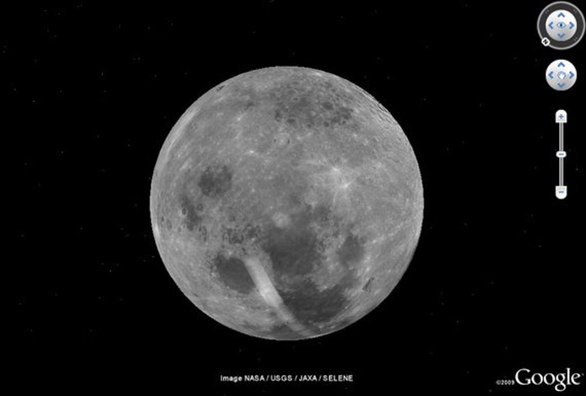
To celebrate the 40th anniversary of the Apollo 11 Moon landing, Google Earth 5.0 now incorporates a complete 3D landscape of our closest and dearest celestial relative, the Moon
To celebrate the 40th anniversary of the Apollo 11 Moon landing, Google Earth 5.0 now incorporates the landscape and terrain of our closest and dearest celestial relative, the Moon.
Earth's moon, often known as the Moon, or simply just 'Moon' for short, is the rocky, cooler companion to the star of our local cosmic show, the Sun. And if you're familiar with Google Earth 5.0, you'll know what to expect of its appearance within this update.
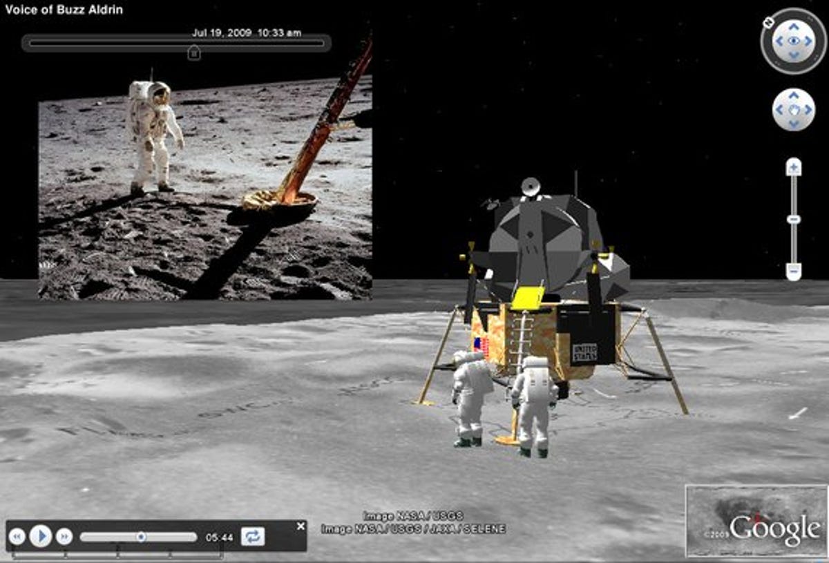
It's a fully navigable 3D model of the satellite and its surface, built from detailed, stitched images, panoramic photography, video footage and audible guided tours from Apollo astronauts, including Apollo 11 'naut Buzz Aldrin.
It seems the whole moon can be explored, though low-resolution imagery inhibits the close-up investigation of many zones. But for all the important areas and craters we examined, it's just a matter of clicking on whichever rock, lump, crater or grey thing piques your curiosity.
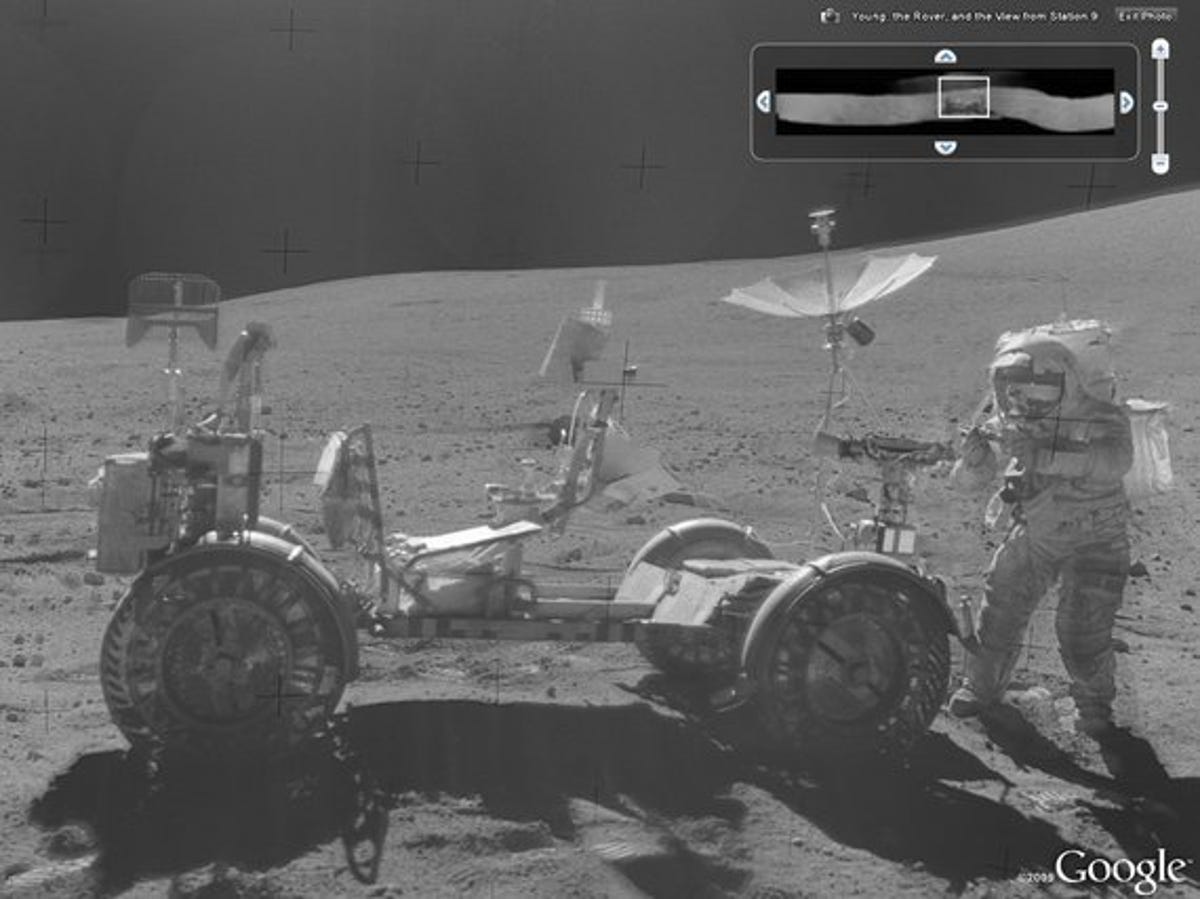
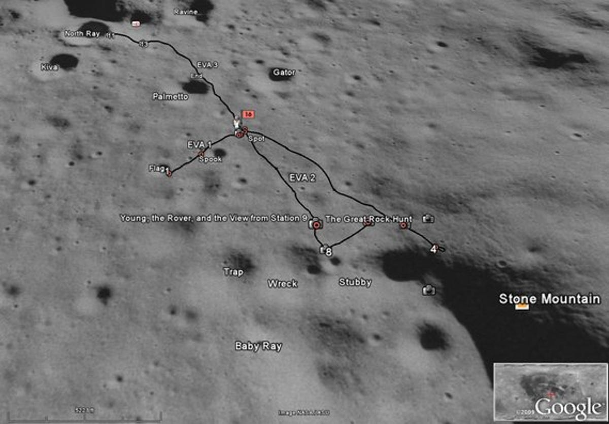
Take Apollo 16's landing site, for example. If we zoom in close enough we're given a pile of pinpoints to highlight areas of particular interest, one of which shows a panoramic image taken of Apollo 16's commander John Young, and his lunar Rover. Google Earth will let you fly, a la Street View, into this panorama and explore it from the perspective of the camera and lens which took the photo way back in 1972.
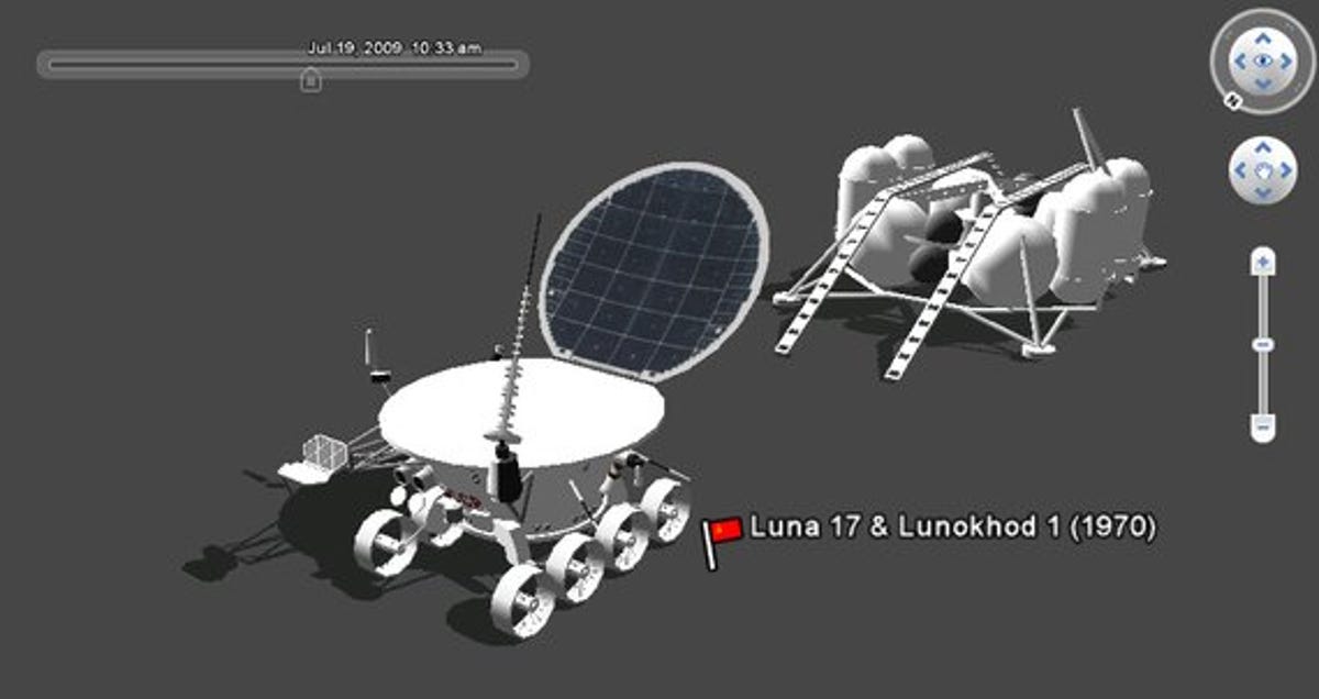
Really, the best way to see what's new in this update is to download the software for free, and get exploring. But over the next few pages we've captured a few examples of what to expect from Moon in Google Earth, including 3D models of some of the junk we've left stranded up there, almost 240,000 miles away from our home planet.
More Galleries

My Favorite Shots From the Galaxy S24 Ultra's Camera
20 Photos
Honor's Magic V2 Foldable Is Lighter Than Samsung's Galaxy S24 Ultra
10 Photos
The Samsung Galaxy S24 and S24 Plus Looks Sweet in Aluminum
23 Photos
Samsung's Galaxy S24 Ultra Now Has a Titanium Design
23 Photos
I Took 600+ Photos With the iPhone 15 Pro and Pro Max. Look at My Favorites
34 Photos
