SAN JOSE, Calif.--As more and more information becomes available to more and more people, we have a greater need to access and organize the vast amounts of data surrounding us. Increasingly, this means defining the spaces and places around us and finding the relevant information connected to those spaces. At the Where 2.0 conference here this week, programmers, mappers, and designers are taking a look at the newest ideas in location-based information.
2 of 10 James Martin/CNET
Tyler Bell
Yahoo's Tyler Bell discusses innovation in open location at Where 2.0 Wednesday. Yahoo's idea is to make all online content geo-relevant with tools like GeoPlanet, which is designed group content related to a specific place. Yahoo's Placemaker, an XML API for developers, identifies places, extracts data, and enables developers to organize Web content, e-mails, and documents based on relevant location information. Yahoo is focusing less on displaying information and more on creating location-accessible infrastructure, which developers can use and build on top of.
3 of 10 James Martin/CNET
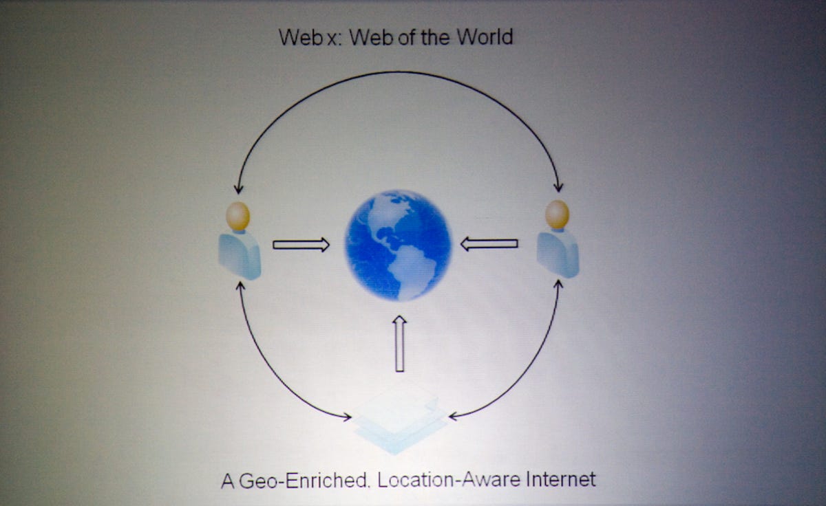
WebX
As localized information is made available to more people, the sharing and exchange of information between people, rather than from a centralized source will be the next iteration of the Web.
4 of 10 James Martin/CNET
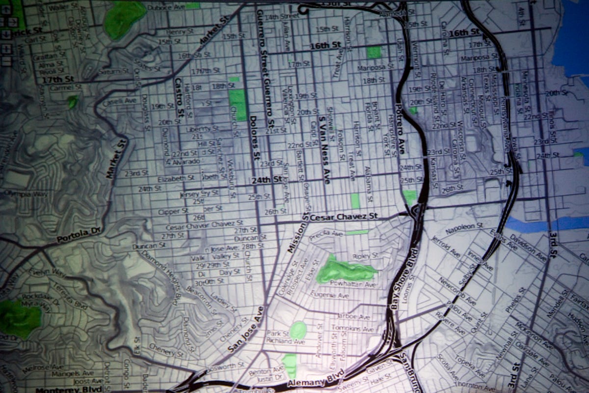
Maps
In recent years, maps have come from a few centralized sources like Google Maps, Yahoo Maps, and MapQuest, but as the information and tools to depict localized information becomes more readily available, maps are going to be created and shared by more and more people. Essentially, at their core, maps are information that is organized, stylized, and designed into functional visualizations. At Where 2.0, designers are discussing the many options available in the design of maps, and how their forms can better help us understand places.
5 of 10 James Martin/CNET
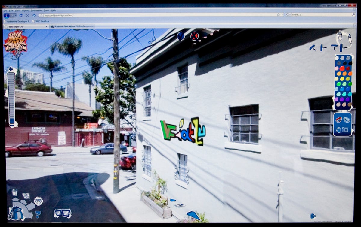
WildStyleCity
Earthmine's WildStyleCity is a fun virtual graffiti application that demonstrates the layering of data over 3D environments, creating a more detailed and information-rich geo-spatial environment at street level.
6 of 10 James Martin/CNET
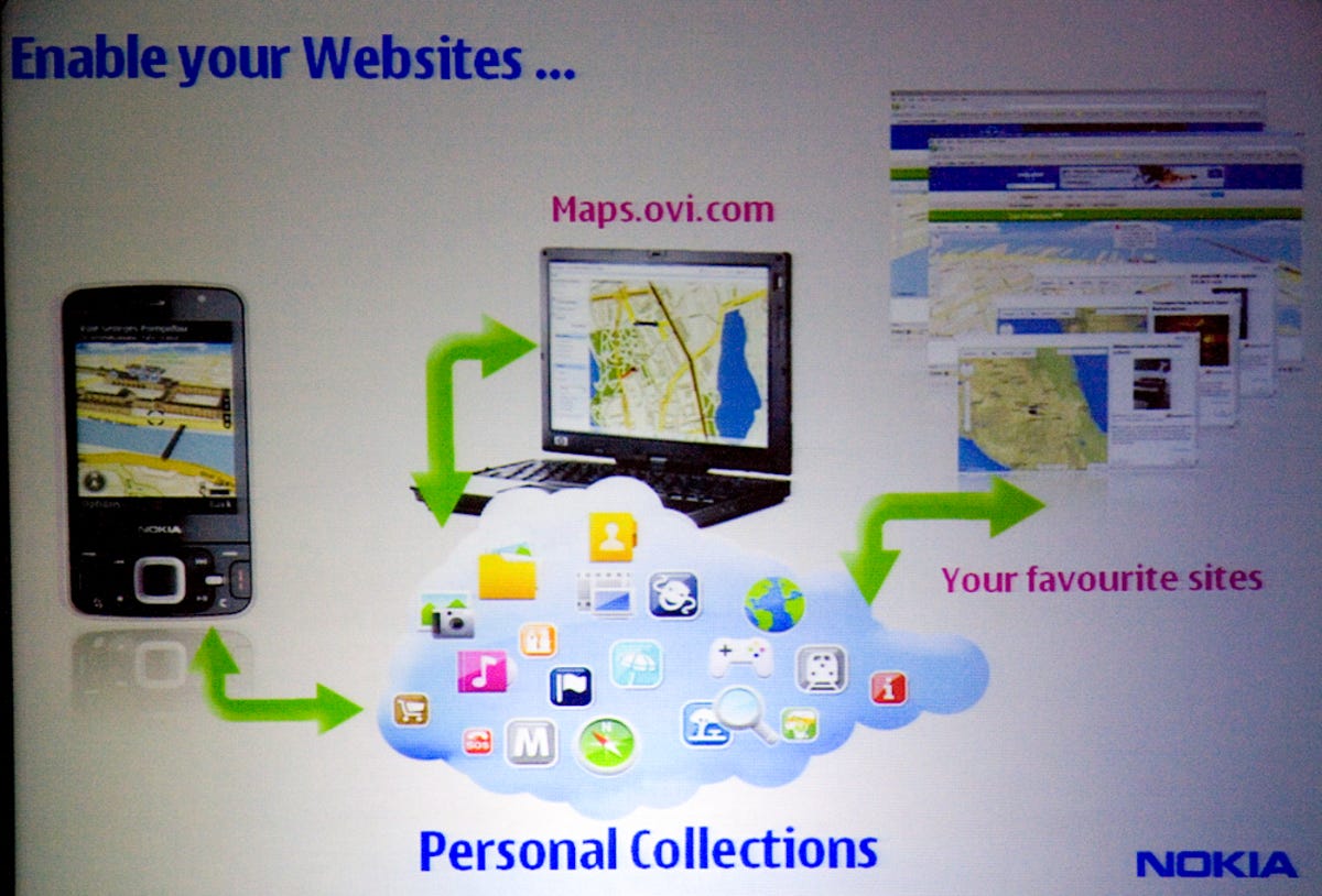
Ovi Maps
User created Ovi Maps, uploaded to the cloud and shared between map builders, Web sites, and mobile devices, are giving Nokia users broad access to design rich, real-time information on places and spaces.
7 of 10 James Martin/CNET
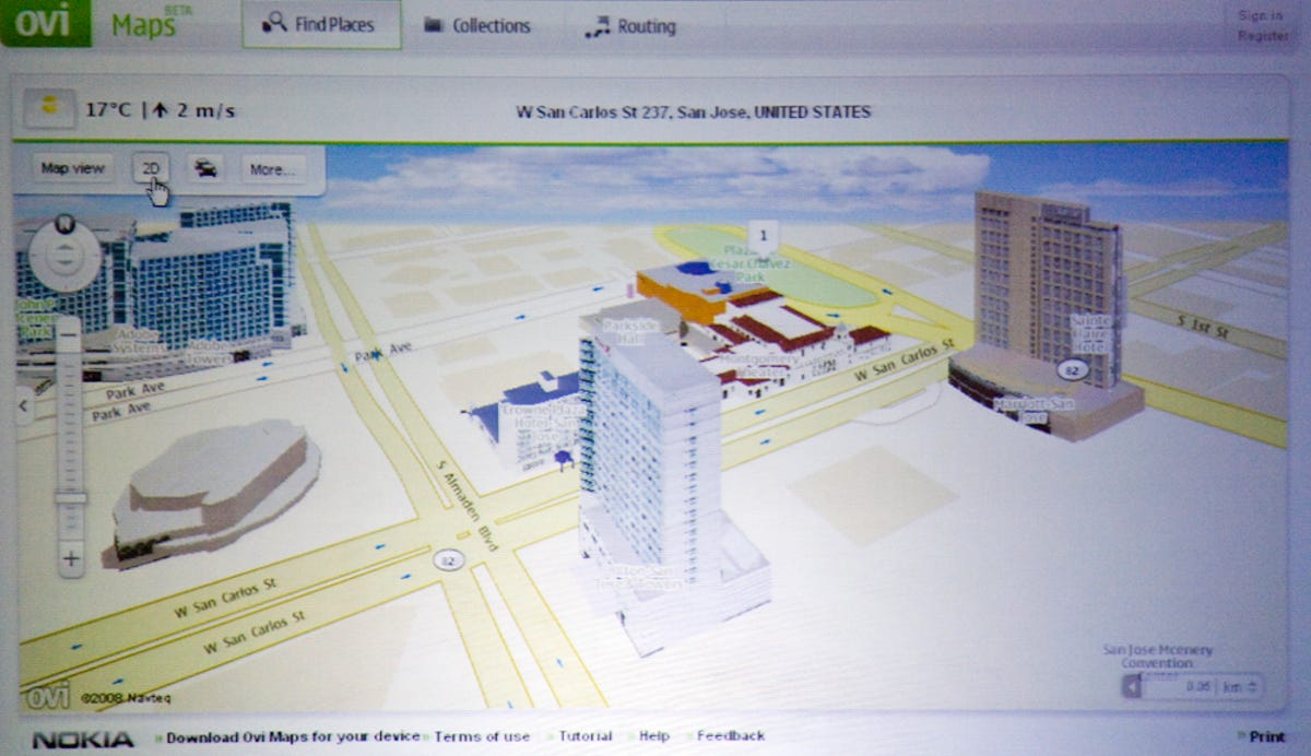
Ovi
Ovi Maps' map player API has a rich interactive interface with animated 3D movement through the maps.
8 of 10 James Martin/CNET
Christof Hellmis
Christof Hellmis, director of Navigation & Context Services Platform in Nokia's Services & Software Business Group, and Michael Halbherr, vice president of Social Location in Nokia's Services business unit, discuss Nokia Maps and the geo-aware mobile Web apps the company has been building on Ovi.
9 of 10 James Martin/CNET
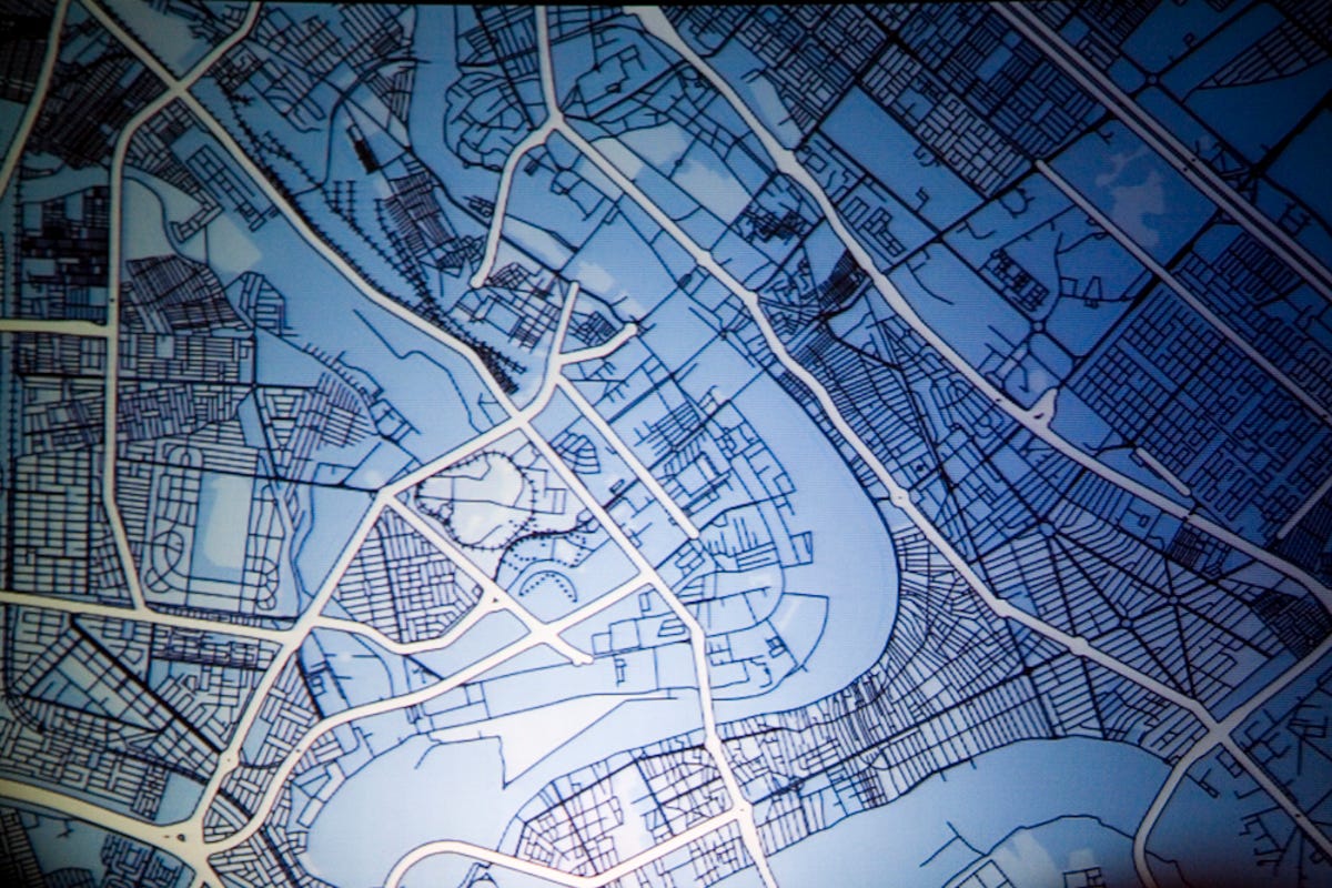
Open Source Maps
With open-source mapping, accurate maps are being created by locals with intimate knowledge of places. This is a map of Baghdad, Iraq, on OpenStreetMaps.org.
10 of 10 James Martin/CNET
Joker Racer
With the Joker Racer application, a user can drive a camera-equipped remote control car over a local area network.