New images reveal planet in a state of flux (photos)
NASA satellite imagery offers eye-opening view, with before-and-after photos chronicling impact of fires, floods, glacier melt, and deforestation on the Earth.
James Martin
James Martin is the Managing Editor of Photography at CNET.
His photos capture technology's impact on society - from the widening wealth gap in San Francisco, to the European refugee crisis and Rwanda's efforts to improve health care.
From the technology pioneers of Google and Facebook, photographing Apple's Steve Jobs and Tim Cook, Facebook's Mark Zuckerberg and Google's Sundar Pichai, to the most groundbreaking launches at Apple and NASA, his is a dream job for any documentary photography and journalist with a love for technology.
Exhibited widely, syndicated and reprinted thousands of times over the years, James follows the people and places behind the technology changing our world, bringing their stories and ideas to life.
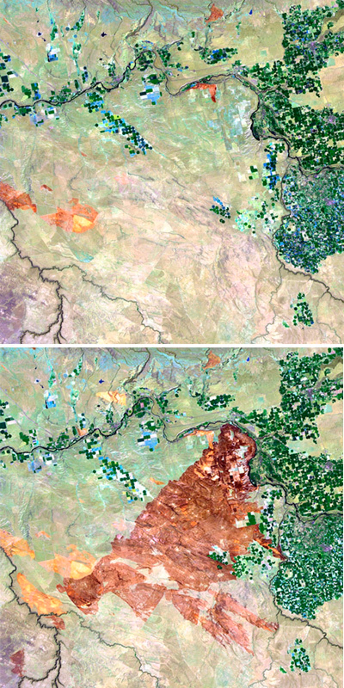
1 of 13 U.S. Department of the Interior / U.S. Geological Survey
Fire burns Idaho
A series of wildfires triggered by lightning strikes in August 2010 burned more than 300,000 acres across Idaho.
The top image, taken July 24, shows burn marks from earlier, smaller fires, while the bottom image, from August, shows the dark brown area burned by the more-recent fires.
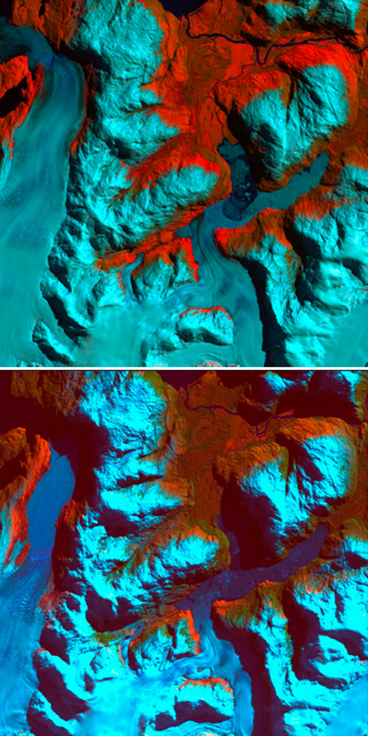
2 of 13 U.S. Department of the Interior / U.S. Geological Survey
Ice melts in Chile
The 1986 image on top shows the region of Patagonia, Chile, prior to a major retreat of the glaciers. The 2002 image below shows an incredible 6.2 mile pullback of the glacier on the left side.
In front of the smaller glacier, two ribbon lakes have formed behind the debris left by the glacier's advance. Scientists are using satellite imagery like these images from the U.S. Department of the Interior to monitor glaciers and the impact on water bodies caused by the changes in the glacier's size and direction.
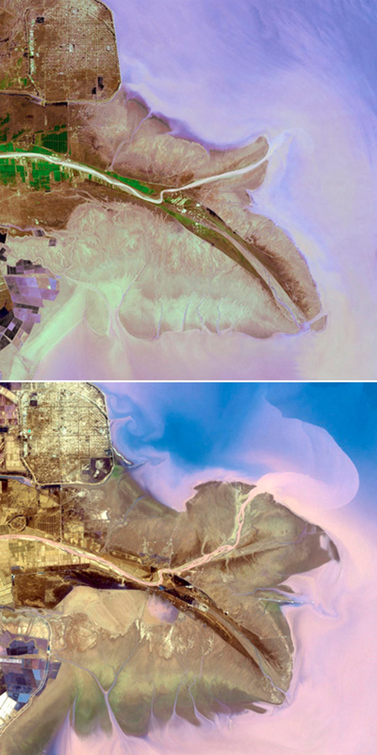
3 of 13 NASA/GSFC/METI/ERSDAC/JAROS and the U.S./Japan ASTER Science Team.
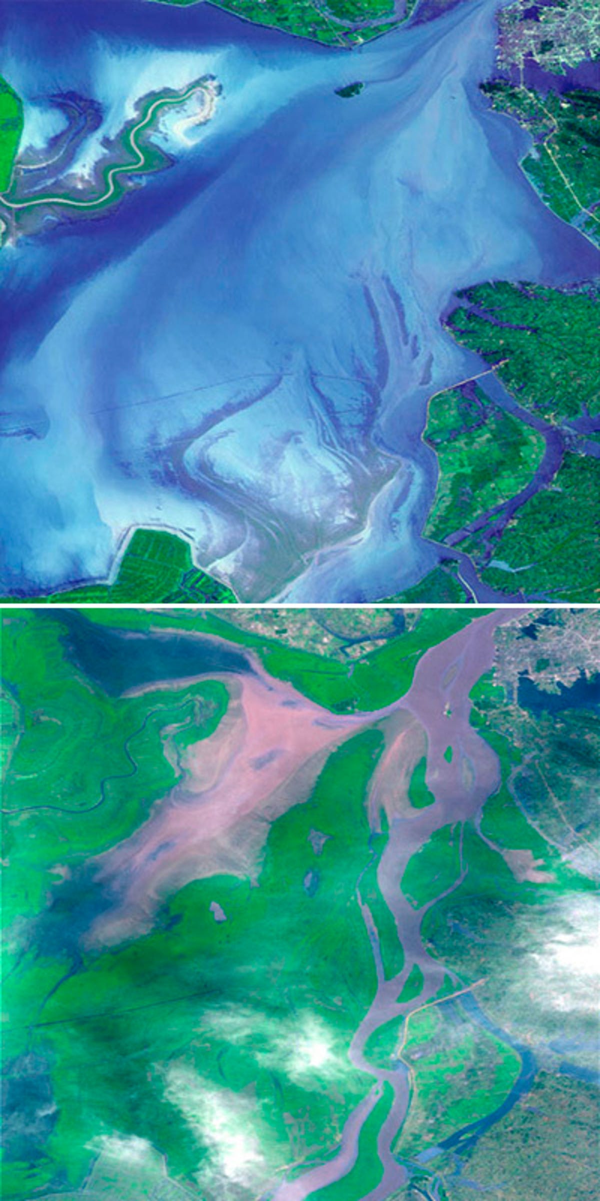
River changes flow in China
The Yellow River, seen here in the top image in 2001, and on the bottom in 2009, is the second-longest river in China, and the sixth-longest in the world. It has been the cradle of Chinese civilization, but frequent devastating floods have also earned it the name of "China's Sorrow."
Currently, the Yellow River ends in the Bohai Sea, yet its eastern terminus continues to oscillate from points north and south of the Shandong Peninsula. These images show the changes.
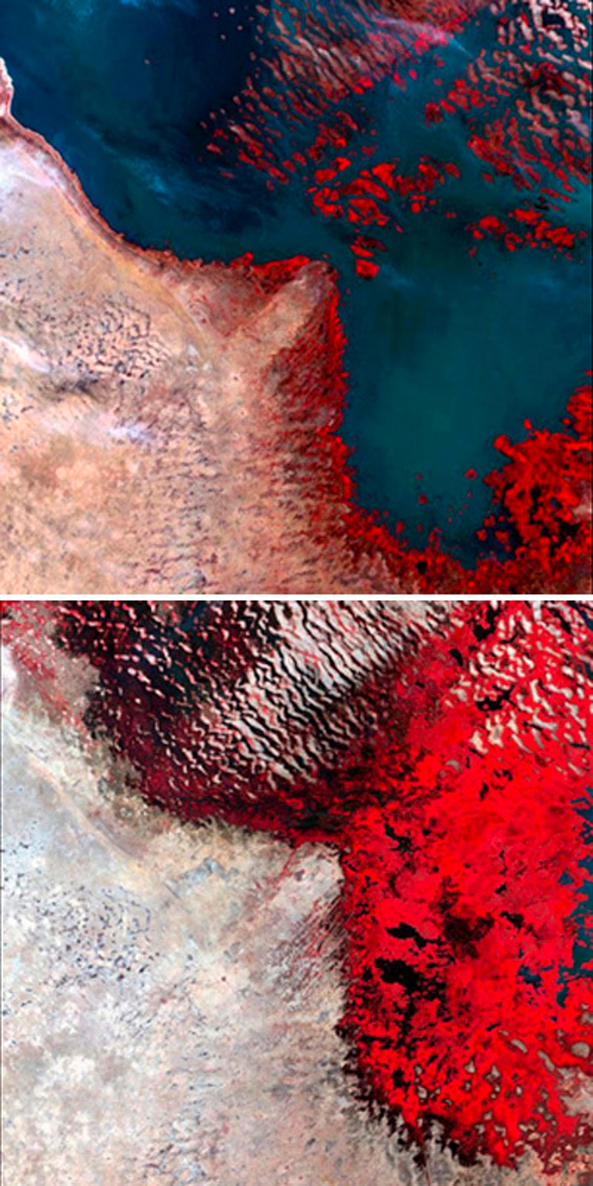
4 of 13 U.S. Department of the Interior / U.S. Geological Survey
Lakes shrink in Africa
Persistent drought has shrunk Lake Chad (seen in this image on top from 1982) from the world's sixth-largest lake to about one-twentieth of the size it was in the 1960s.
As the lake has receded, large wetland areas, shown in red, have replaced open water.
5 of 13 One Planet Many People Atlas of our Changing Environment; Division of Early Warning and Assessment (DEWA) UNEP
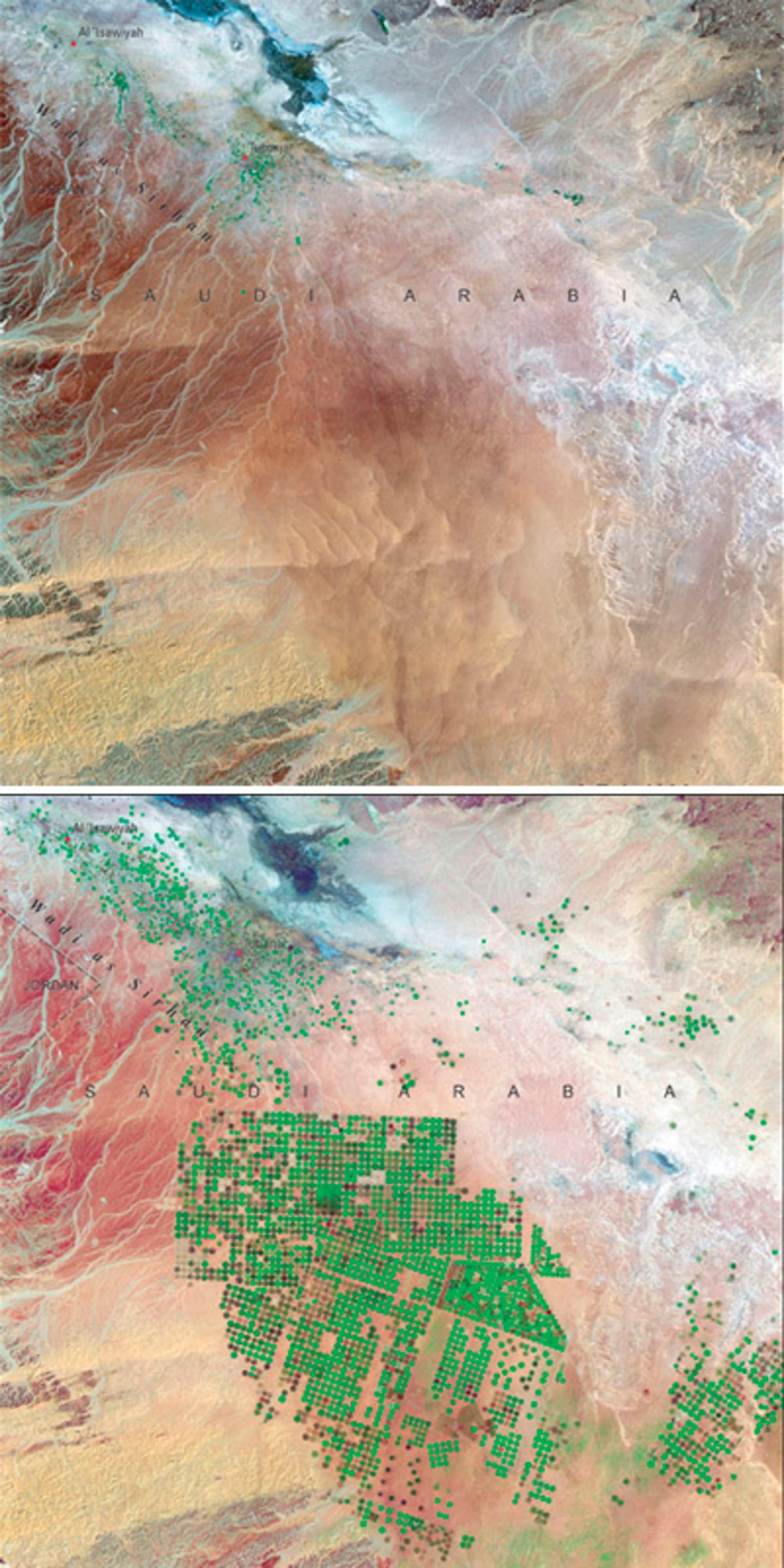
Agriculture in Saudi Arabia
Once so barren it could barely support the towns of Al'Isawiyah and Tubarjal, Saudi Arabia has slowly developed crop-producing fields.
Irrigation that taps an ancient aquifer containing water as much as 20,000 years old has allowed the population to sprout green fields, depicted here as green dots. Judicious use of water resources and climate-appropriate technology has improved food production without harming the environment. The top image was taken in 1986.
6 of 13 U.S. Department of the Interior / U.S. Geological Survey
Land recovery at Chernobyl
Twenty-five years after the Chernobyl Nuclear Power Plant meltdown, the land is beginning to recover.
The image on top, taken April 29, 1986, shows bright light tones where cultivated fields were being prepared for planting, and dense dark green forest cover.
In the 2011 image at the bottom, limited resettlement has begun. Most of the fields are now seen in light green grasslands, and the dense forests have been destroyed and replanted and can be seen in lighter, more uniform greens.
7 of 13 U.S. Department of the Interior / U.S. Geological Survey
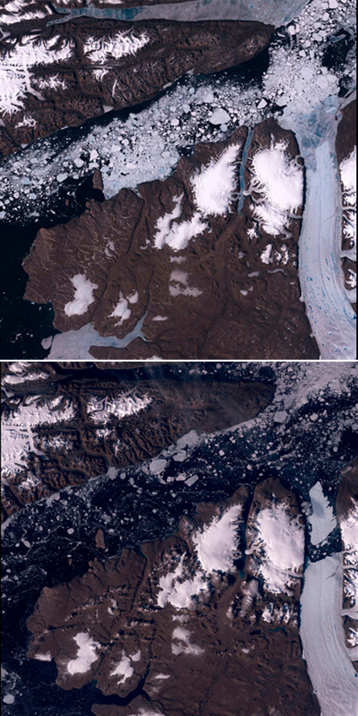
Ice melts in Greenland
In 2010, an iceberg more than four times the size of Manhattan broke off the Petermann Glacier, probably because of warmer waters owing to changes in global temperatures. You can see it on the right side of the bottom image.
8 of 13 U.S. Department of the Interior / U.S. Geological Survey
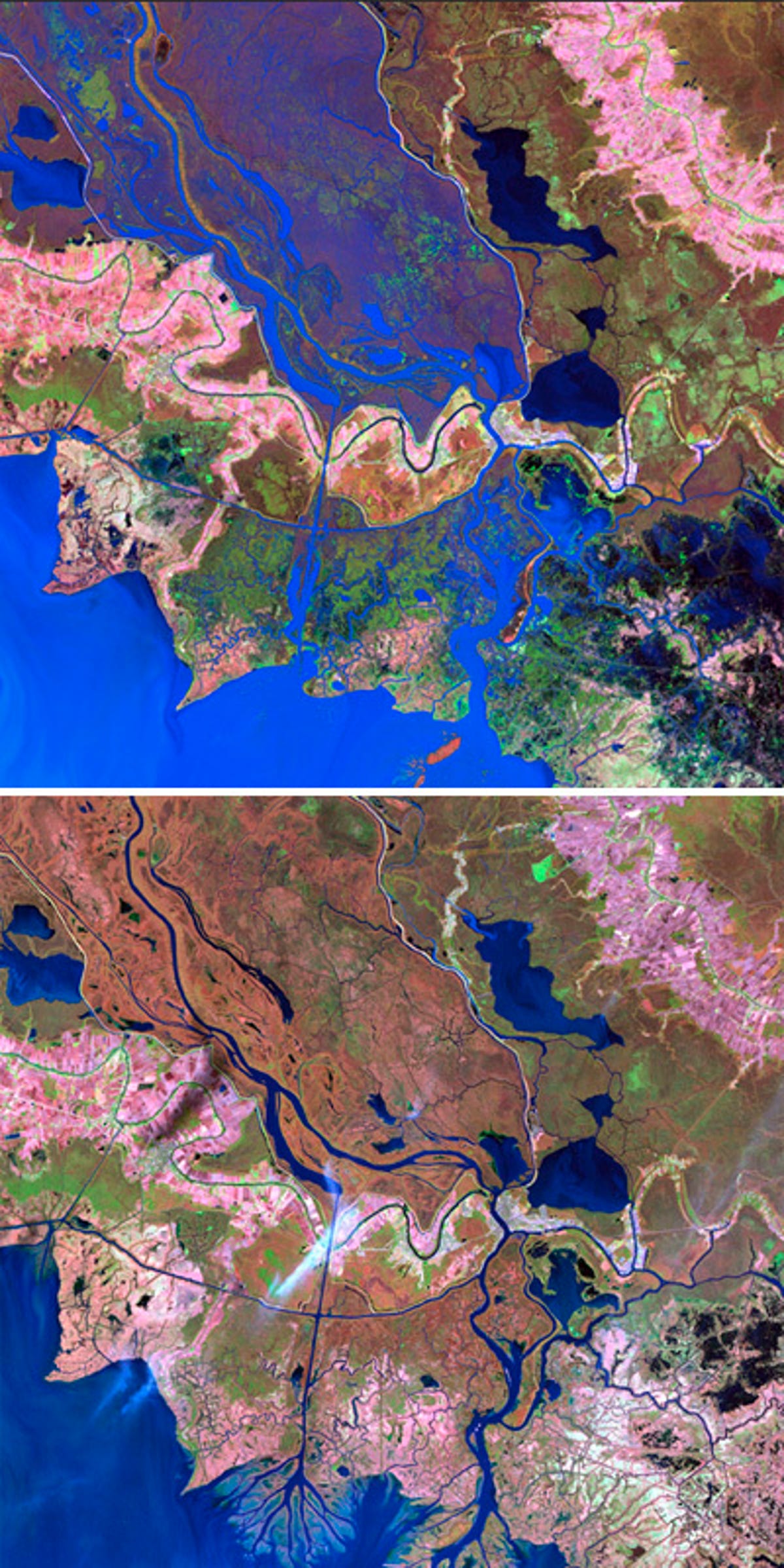
Delta restored in Louisiana
The Wax Lake Delta in Louisiana, with the Atchafalaya River seen flowing into the Gulf of Mexico, was formed by sediment following the construction of a canal through Wax Lake in 1941. Since Hurricane Katrina in 2005, the delta has served as a model for restoring wildlife habitat and for protection against storm surge in the Mississippi River delta region.
9 of 13 NASA/GSFC/METI/ERSDAC/JAROS and the U.S./Japan ASTER Science Team
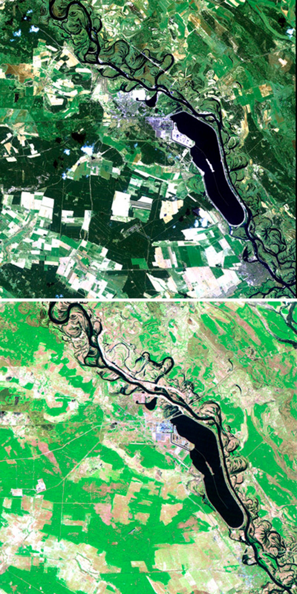
Flooding in China
Flooding has caused dramatic change in the water at Dongting Lake in Hunan province, China. The image at the top was captured September 2, 2002, after devastating flooding.
10 of 13 Data from NASA Goddard Institute for Space Studies. Courtesy of the NASA Earth Observatory and Mike Carlowicz
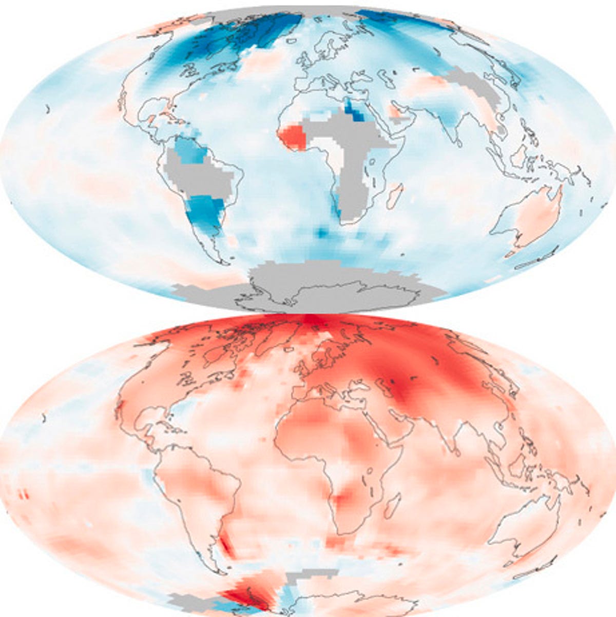
Earth warms
Data maps from 1880-1889 on top and 2000-2009 on the bottom illustrate global temperature changes.
These maps compare temperatures in each region of the world to what they were from 1951 to 1980. NASA's Goddard Institute for Space Studies conducted the analysis using ship-based and satellite observations of ocean temperatures, and data from Antarctic research stations and 6,300 meteorological stations around the world. Earth's average surface temperature has increased by about 0.7 degress Celsius since 1880. Two-thirds of the warming has occurred since 1975, at a rate of roughly 0.15 to 0.20 degrees Celcius per decade.
11 of 13 NASA/GSFC/LaRC/JPL, MISR Team.
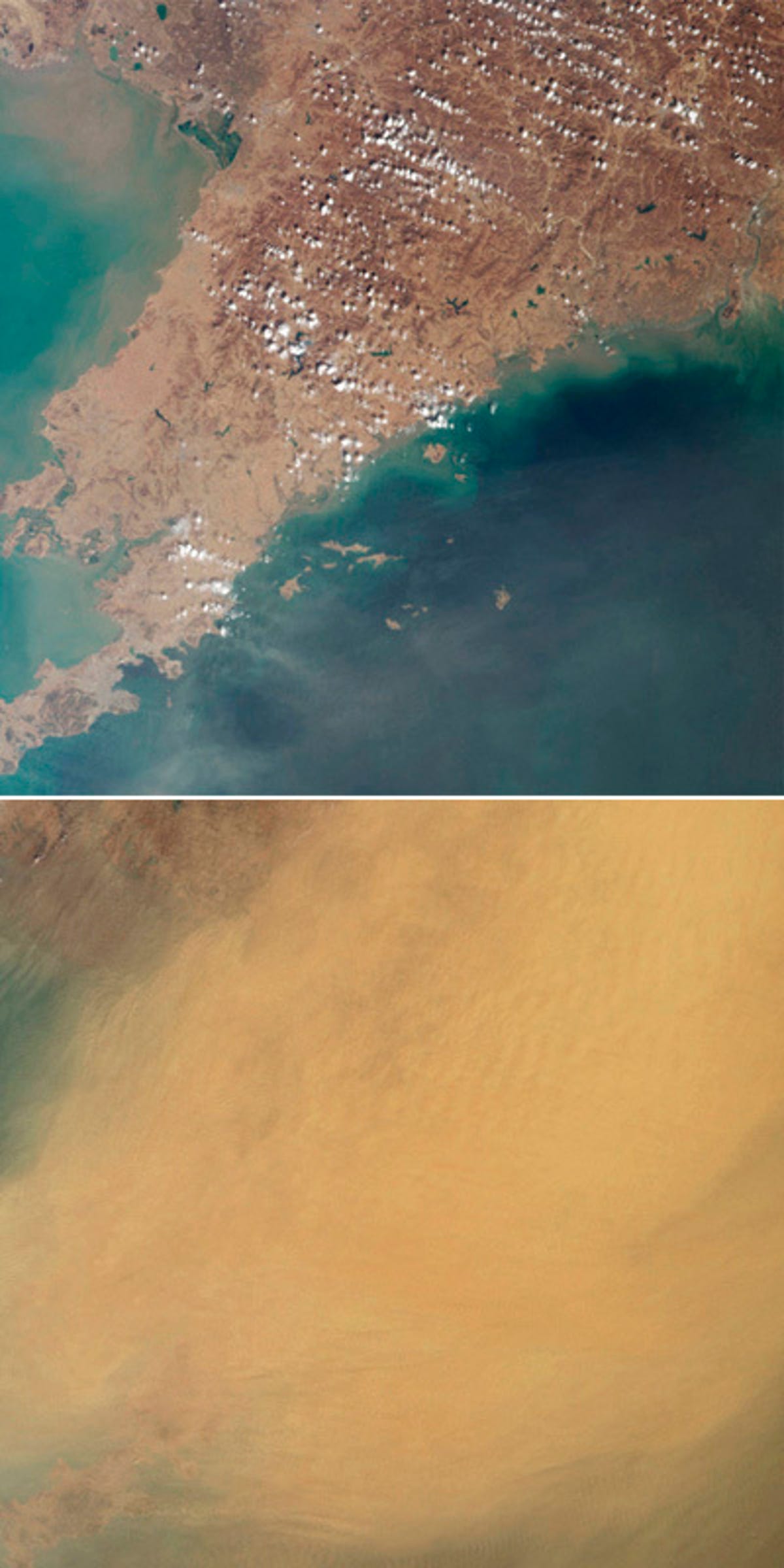
Dust storms obscure China
Dust storms like this one seen in 2003 in the Liaoning region of China and parts of northern and western Korea transport mineral dust from the deserts of China and Mongolia -- as well as pollution from agriculture, industry, and power generation -- over great distances.
12 of 13 NASA's Earth Observatory.
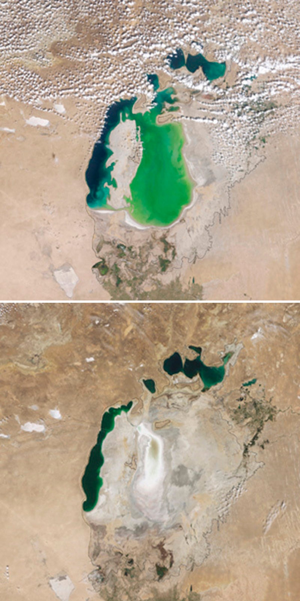
Aral Sea shrinks in Central Asia
Central Asia's Aral Sea, once one of the largest inland bodies of salty water in the world, is shrinking.
The image on top, taken in 2000, shows the effects of water being drawn off from rivers for crop irrigation.The sea has shrunk, causing changes in the climate, dust storms, and insufficient drinking water. By 2009, shown in the bottom image, the Aral Sea had lost four fifths of its water volume.
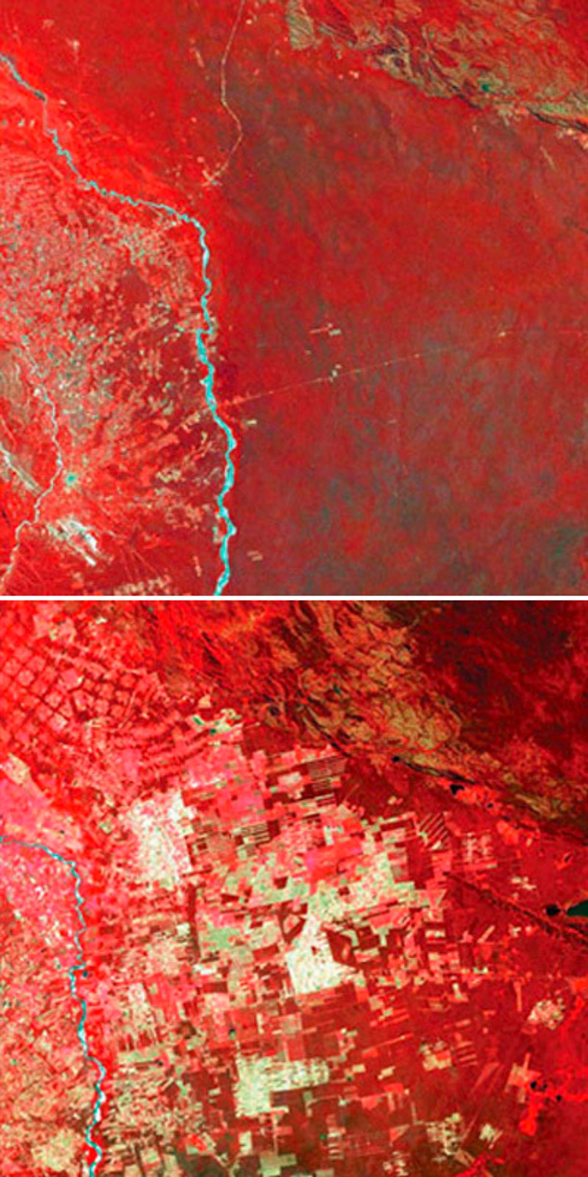
13 of 13 NASA/USGS
Deforested Bolivia
The top image was taken June 17, 1975, and shows an area of Bolivia east of Santa Cruz de la Sierra, an area of tropical dry forest. Resettlement of people from the Andean high plains has led to deforestation in this area, as seen in the lower image, taken 25 years later on August 1, 2000.