Navteq has begun capturing 3D data of the world using laser technology. Here's what the system sees.
Stephen Shankland
Stephen Shankland worked at CNET from 1998 to 2024 and wrote about processors, digital photography, AI, quantum computing, computer science, materials science, supercomputers, drones, browsers, 3D printing, USB, and new computing technology in general. He has a soft spot in his heart for standards groups and I/O interfaces. His first big scoop was about radioactive cat poop.
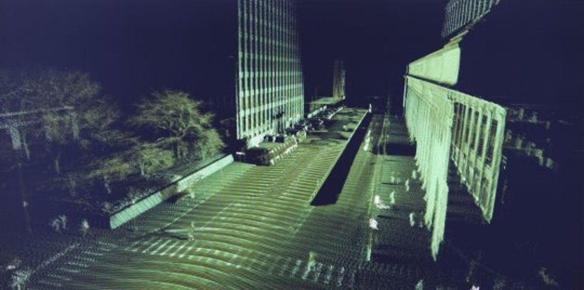
Navteq has begun capturing 3D data with the vehicles used to gather digital map information. This ghostly view of a street is reconstructed from a sea of 3D data points.
2 of 6 Navteq
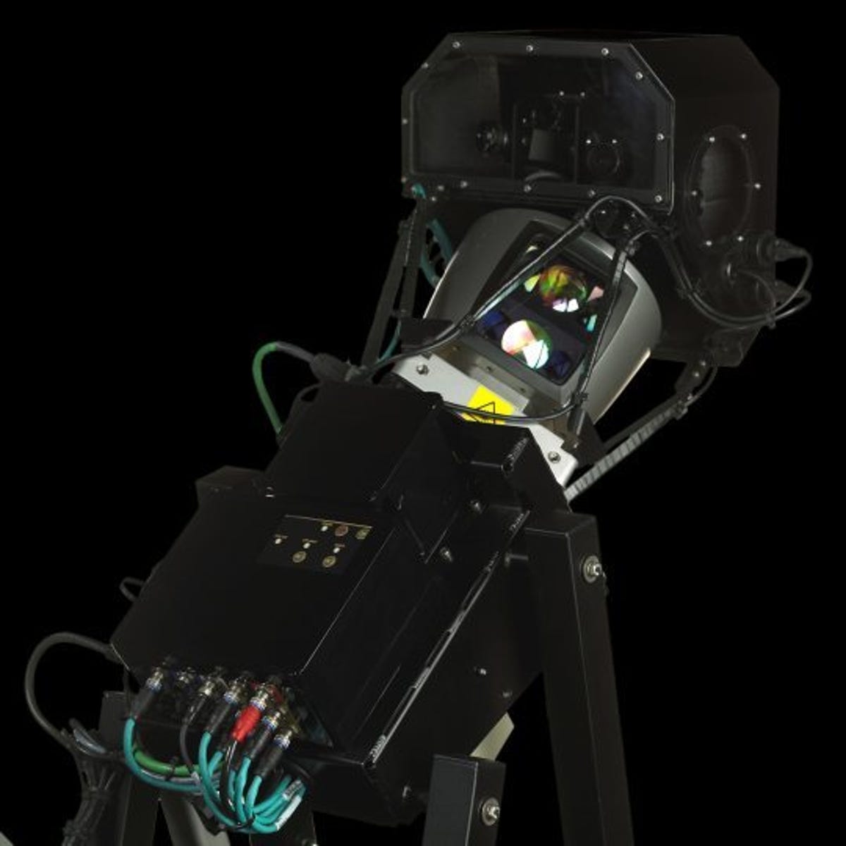
Navteq 3D laser system
Navteq's laser technology--lidar, short for light detection and ranging--uses 64 lasers mounted on a stalk atop a vehicle. It can work even when the vehicle is traveling at highway speeds.
3 of 6 Navteq
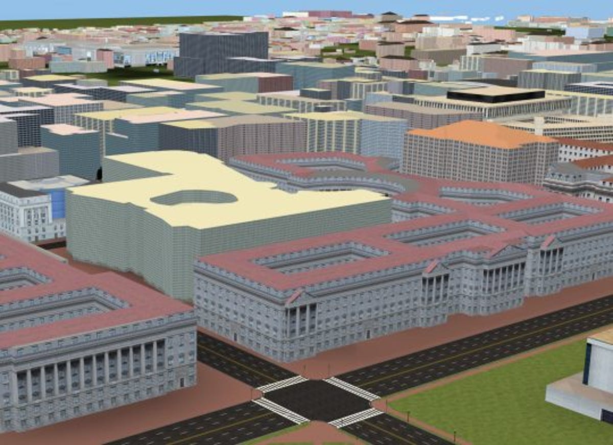
Navteq's 3D city model
Navteq has begun offering these 3D digital models of cities in the United States. European, South American, and Asian cities will follow.
4 of 6 Navteq
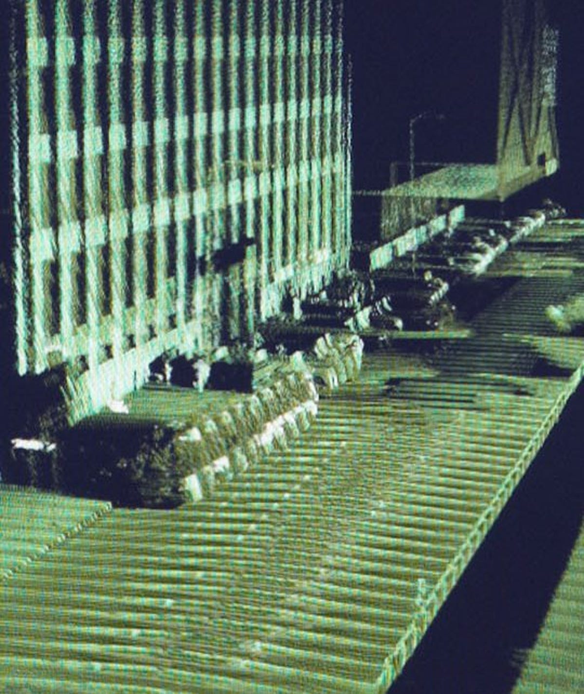
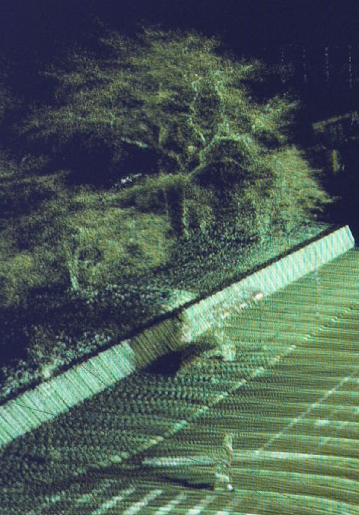
3D laser view close-up
This close-up shows a more detailed view of what the Navteq 3D laser system can capture.
5 of 6 Navteq
Pedestrian viewed with 3D lasers
This view from Navteq's 3D mapping technology shows both trees and a pedestrian crossing the road.
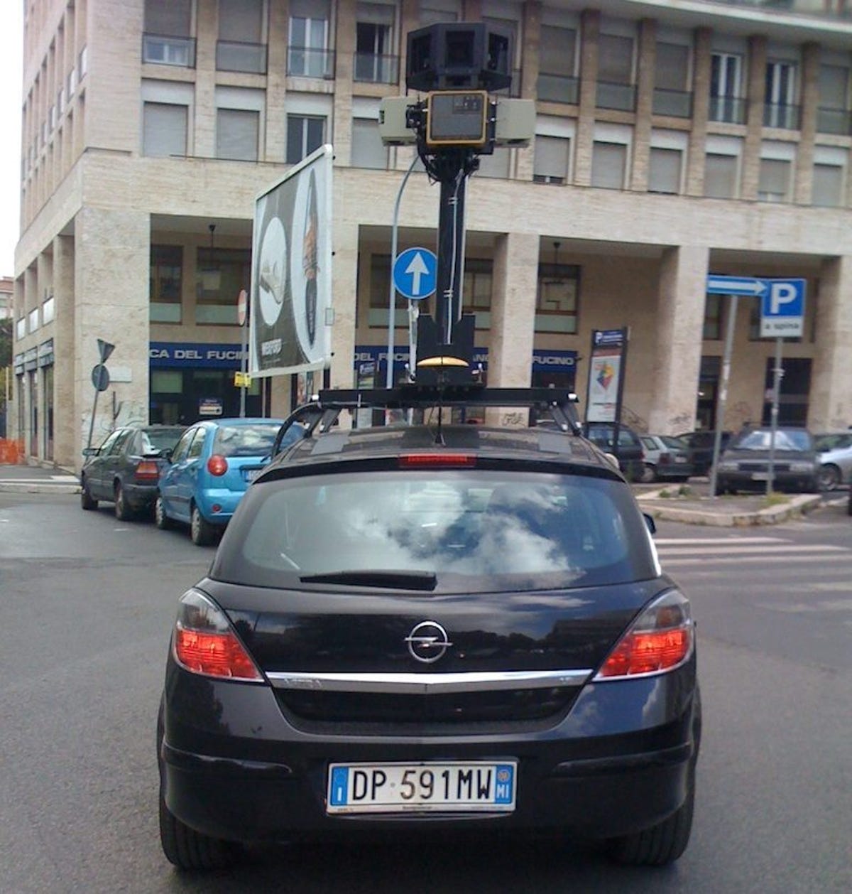
6 of 6 Gabriele Peloso/dnakiller
Google Street View car
Navteq isn't the only mapper gathering 3D data. Google has been doing so since at least 2008. This view shows one of Google's Street View cars, photographed by Gabriele Peloso.