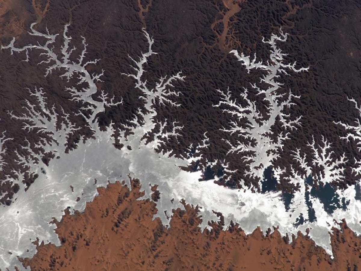
Although the entire collection features dozens of images and photographs of a wide variety of subjects--from hurricanes to volcano eruptions to data visualizations of things like average rainfalls and terrain height--CNET has chosen these 20 images to represent the best of Earth, as seen from high above.
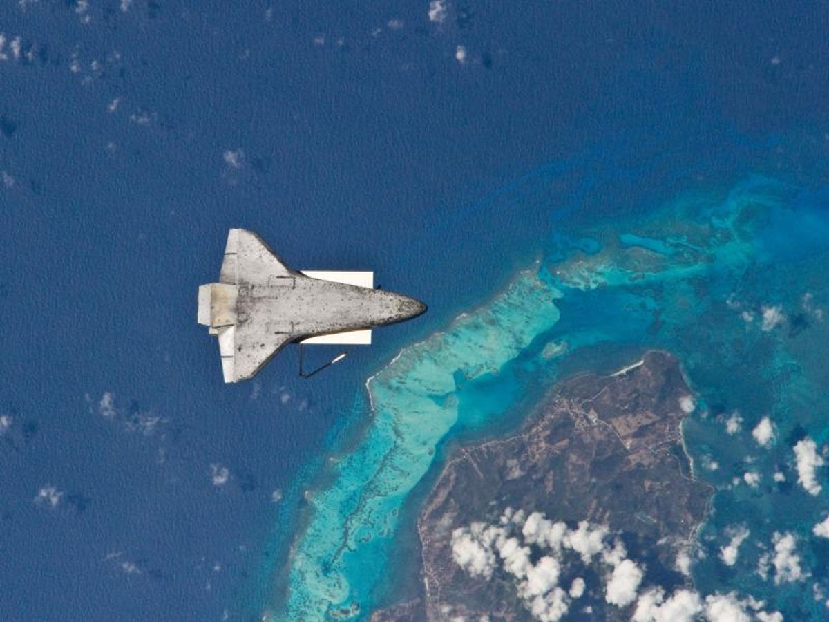
In this incredible image taken from the International Space Station, we see the underside of the Space Shuttle just after the spacecraft completed its post-undocking relative separation on April 17, 2010.
2 of 20 NASA
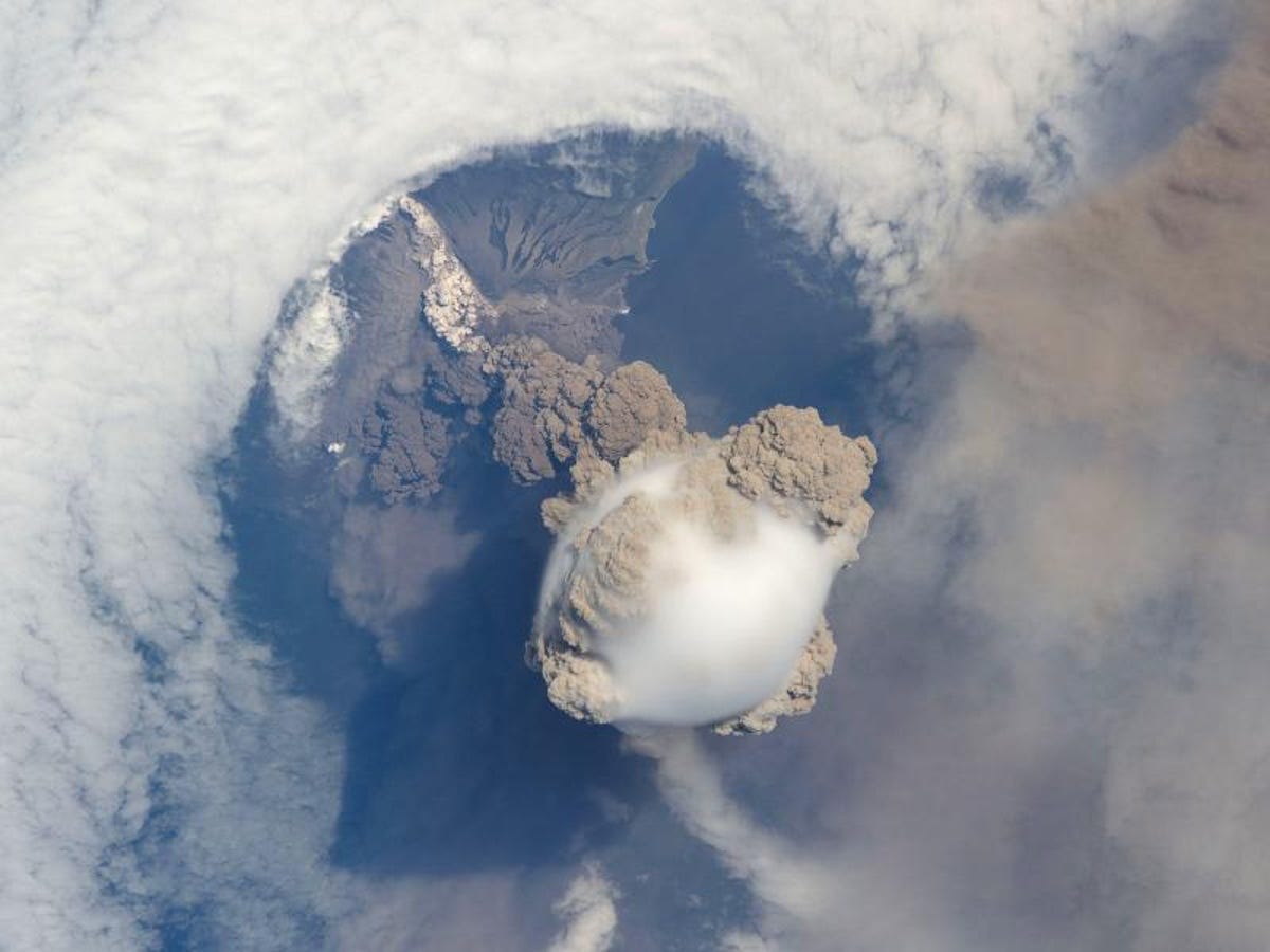
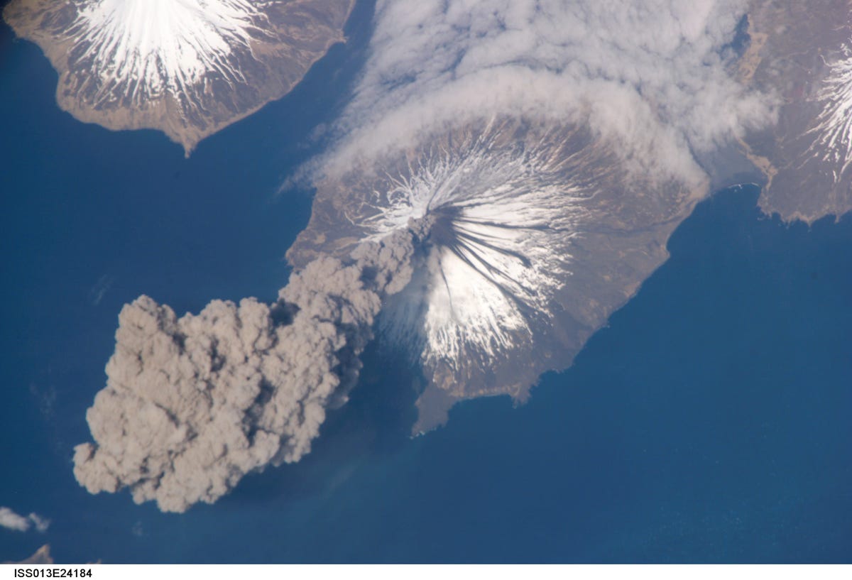
Sarychev Volcano
On June 12, 2009, the International Space Station happened to be flying over Sarychev volcano on Russia's Kuril Islands just as it began to erupt.
3 of 20 NASA
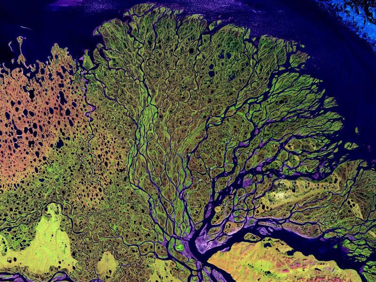
Lena Delta
This stunning image shows the Lena Delta in Siberia. The Lena river, which is about 2,800 miles long, flows into the Arctic Ocean. Many species of Siberian wildlife thrive in the Lena Delta Wildlife Preserve.
4 of 20 NASA
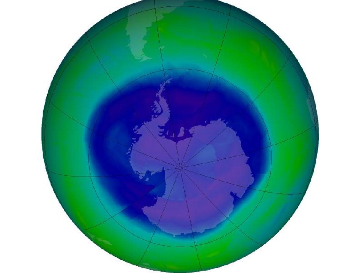
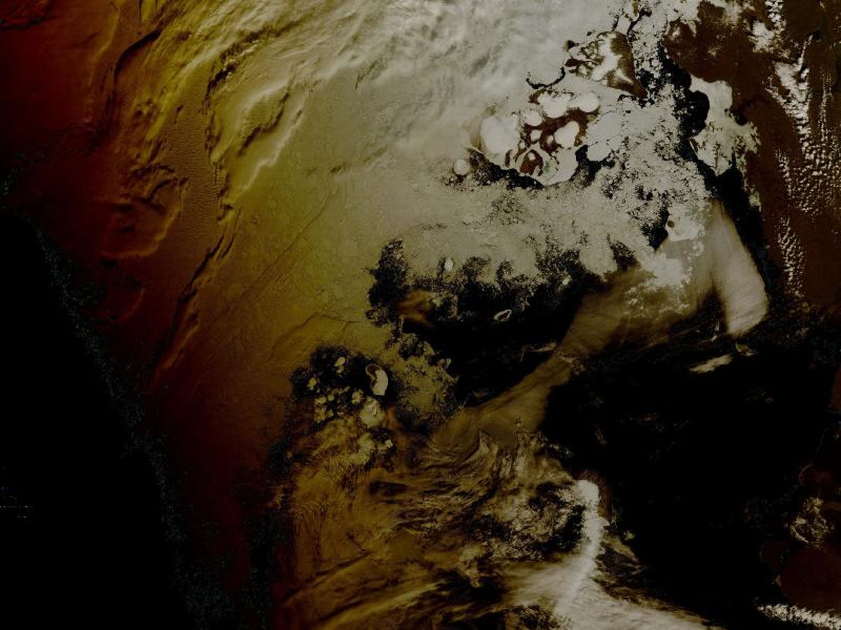
Ozone hole
On September 12, 2008, according to NASA, the Antarctic ozone hole hit its yearly maximum. The hole spanned more than 10.5 million square miles, as calculated with data from the Ozone Monitoring Instrument aboard NASA's Aura satellite.
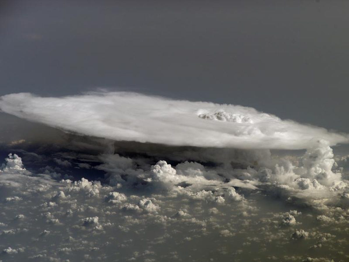
5 of 20 NASA
African cumulonimbus
In this photograph, an incredible cumulonimbus cloud soars above Africa.
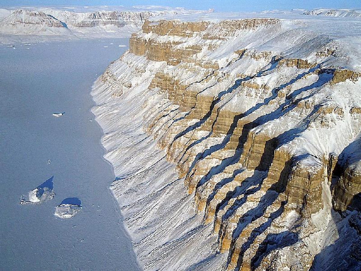
6 of 20 NASA/Michael Studinger
Northwest Greenland canyons
This photograph was taken on March 29, 2011, as Operation IceBridge flew near the canyons and glaciers of northwest Greenland.
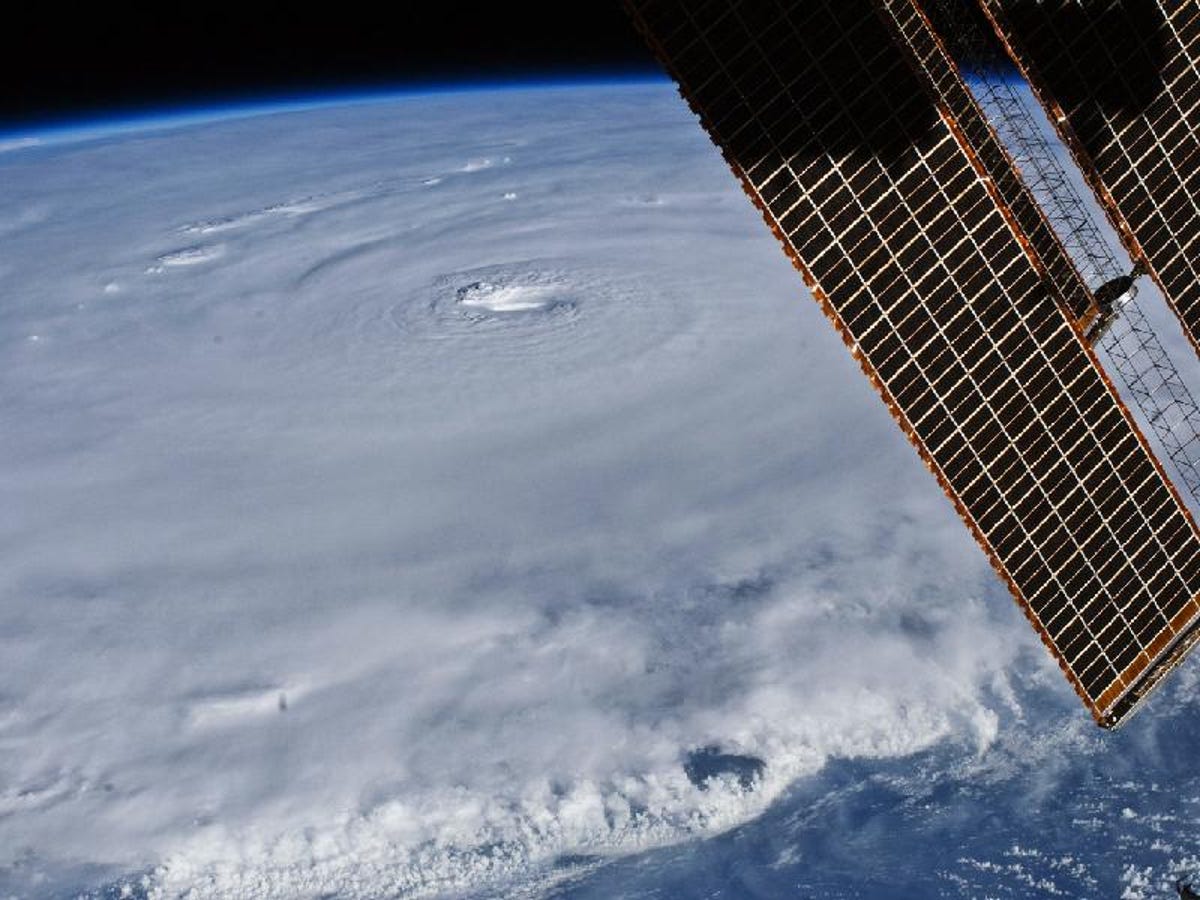
7 of 20 NASA
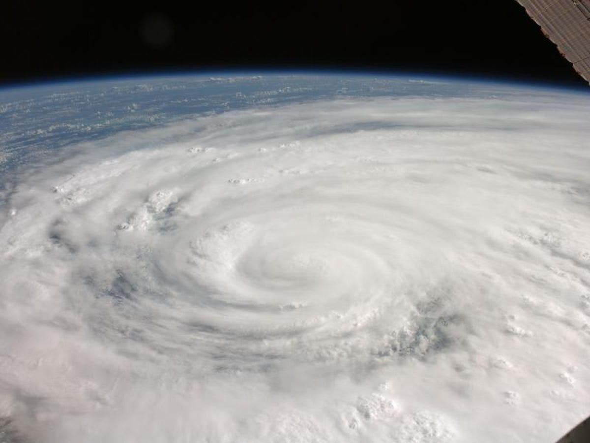
Hurricane Earl, from space
On August 30, 2010, those aboard the International Space Station were able to see this amazing view of Hurricane Earl northeast of Puerto Rico. The hurricane had maximum sustained winds of 135 miles an hour, and was a category 4 storm (out of 5) on the Saffir-Simpson scale.
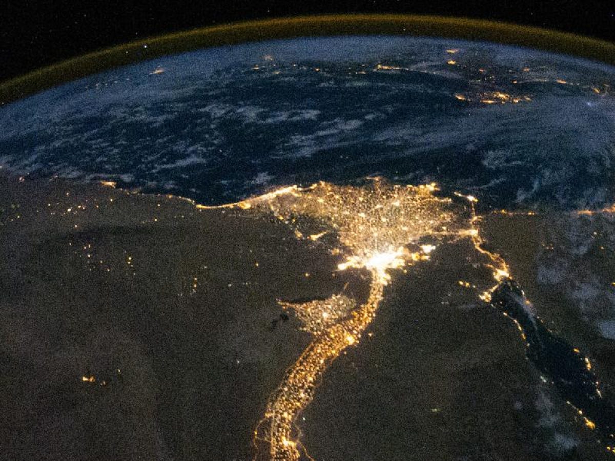
8 of 20 NASA
Nighttime on the Nile River Delta
In this image, taken at night, we see that the population of Egypt is concentrated almost entirely in the Nile River Delta. The image was taken from the International Space Station.
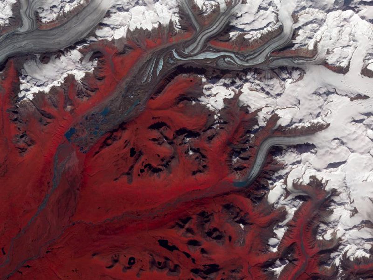
9 of 20 NASA/GSFC/METI/ERSDAC/JAROS, and U.S./Japan ASTER Science
Sustina Glacier
This is Alaska's Susitna Glacier, featuring ice formations that flow downhill. This image was taken with the Advanced Spaceborne Thermal Emission and Reflection Radiometer (ASTER) aboard NASA's Tera satellite on August 27, 2009. In the image, we see red, green, and infrared wavelengths, which form a false-color image. Here, vegetation is red, and the surface of the glacier is marked with blue ice that is dirt-free and brown, dirty ice.
10 of 20 NASA
Lake Nasser
This beautiful image shows Lake Nasser in Egypt. The photo was taken from the International Space Station in January 2005.
11 of 20 NASA
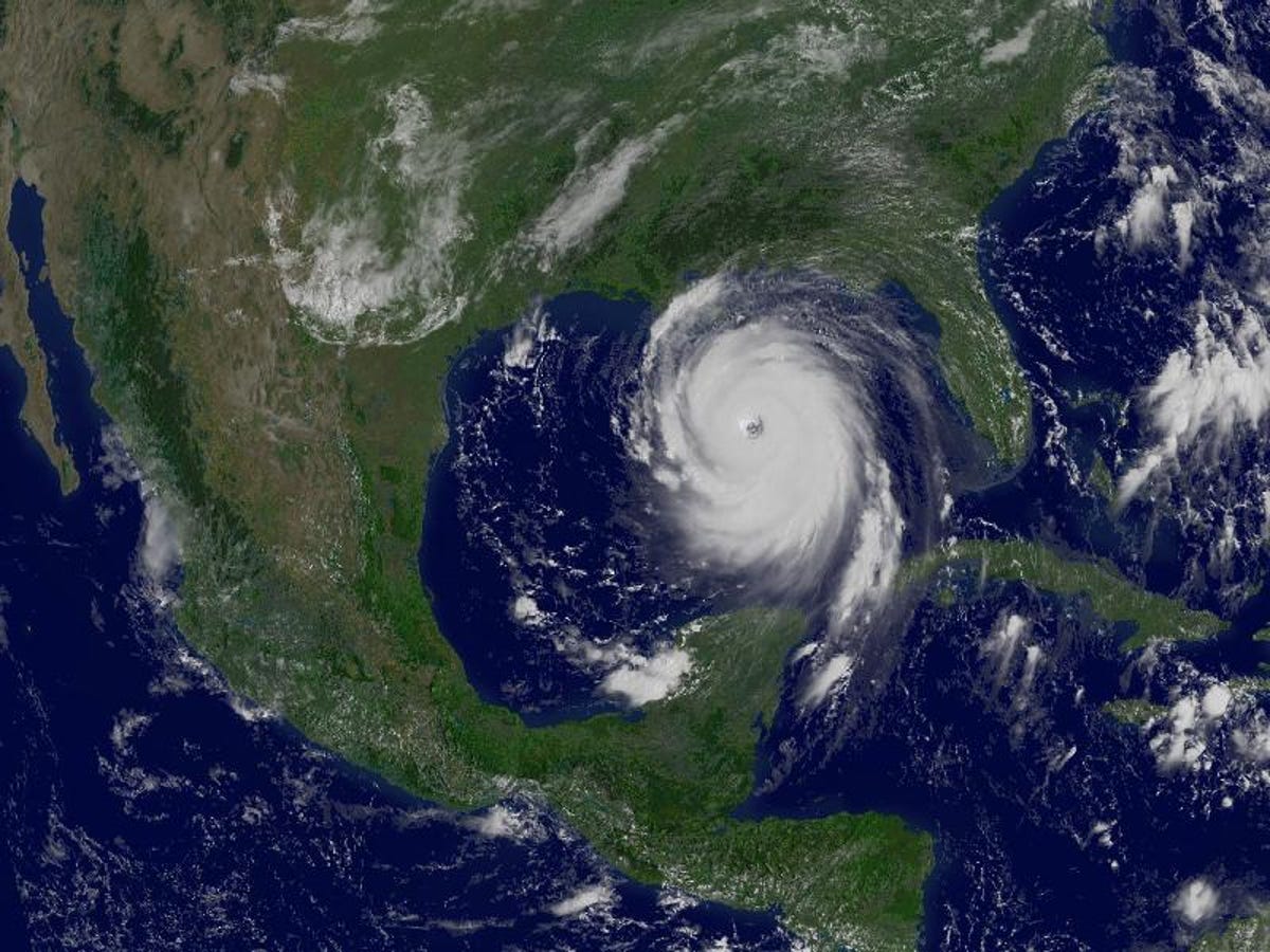
Katrina
This is Hurricane Katrina on August 29, 2005, just as it is about to slam into the U.S. Gulf Coast.
12 of 20 NASA/GSFC/METI/ERSDAC/JAROS, and U.S./Japan ASTER Science Team
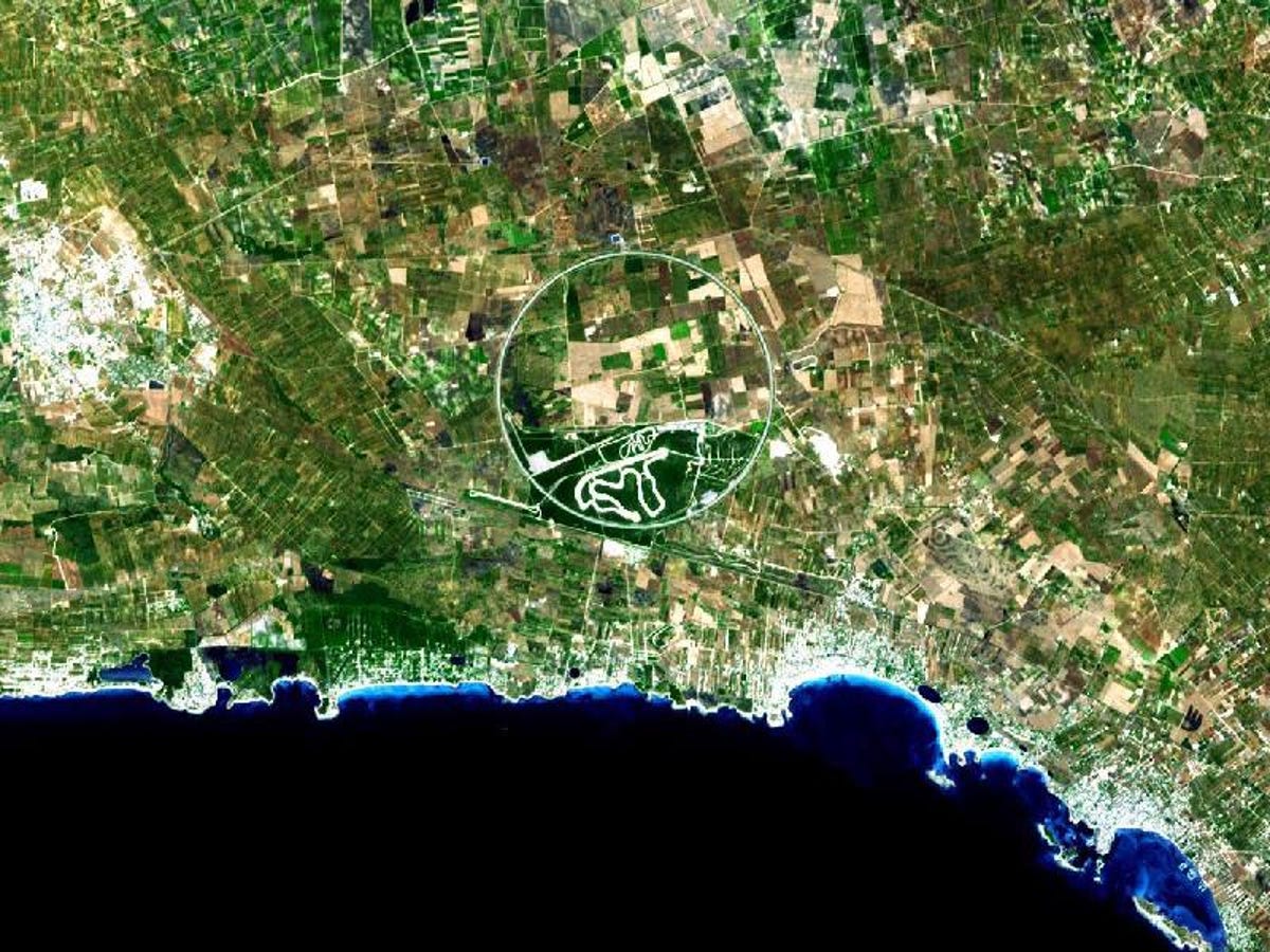
Nardo Ring
This unusual circle is the Nardo Ring in Italy. It's actually a huge race car test track in Italy that, according to NASA, is "steeply banked to reduce the amount of active steering needed by drivers."
13 of 20 NASA
Solar Eclipse over the Arctic
Here we see the effects of a total solar eclipse on August 1, 2008. The image, which was taken from NASA's Terra satellite, shows the eclipse obscuring parts of the Arctic.
14 of 20 NASA
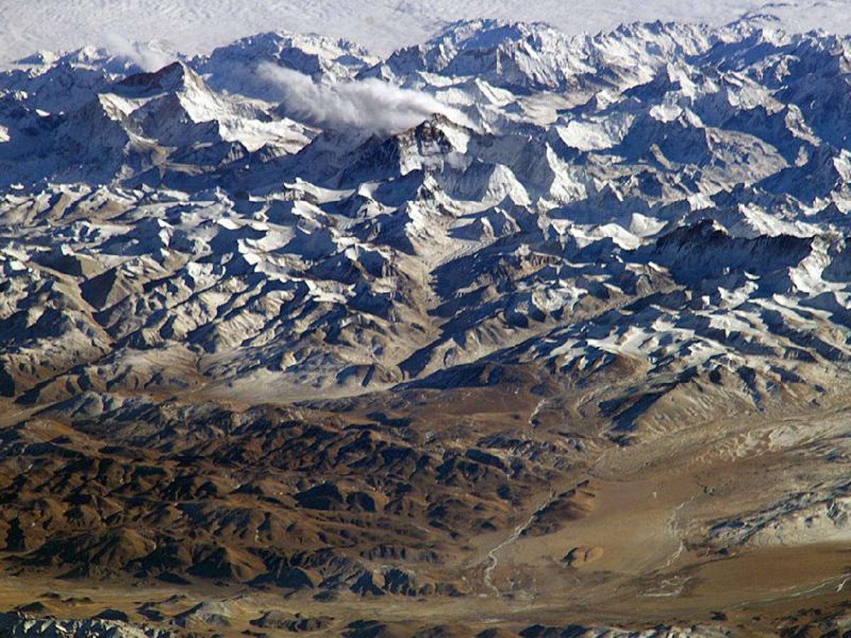
Everest
Because Mount Everest, seen here, is nearly as high as many commercial planes fly, it should come as no surprise that its peak appears to be on the horizon. However, the photo, taken in 2004, was shot from the International Space Station.
15 of 20 NASA
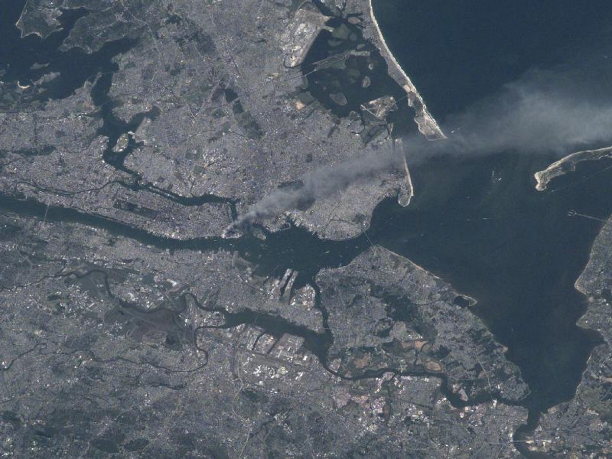
September 11
This image of Manhattan on September 11, 2001, shows the effects of the terrorist attacks on New York. The image was taken from the International Space Station.
16 of 20 NASA
Hurricane Ike
This is a photograph of Hurricane Ike, taken from the International Space Station. The massive storm hit Texas on September 13, 2008, and was one of the most destructive to ever strike the United States.
17 of 20 NASA
Eruption from orbit
The Cleveland Volcano in Alaska erupts on May 23, 2006. The photo was taken by astronaut Jeff Williams from the International Space Station.
18 of 20 NASA
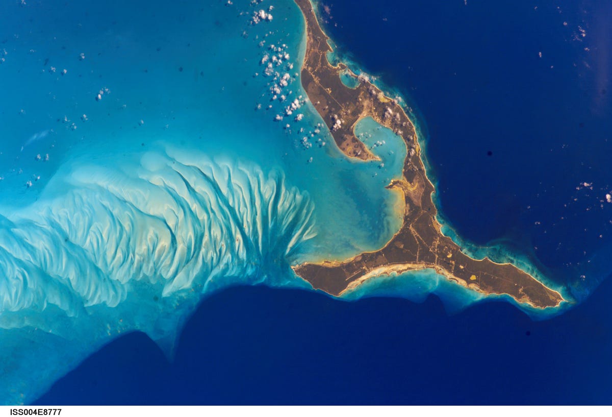
Bahamas
This stunning image shows Eleuthera Island in the Bahamas. The photo was taken in 2002 from the International Space Station.
19 of 20 NASA
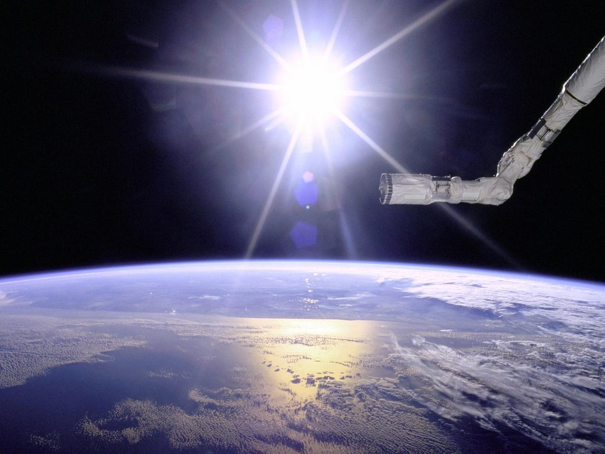
Robot arm
The robotic arm from Space Shuttle Endeavour is seen with the Earth's horizon and a starburst from the sun in the background. The photo was taken aboard Endeavour's STS-77 mission in 1996.
20 of 20 NASA/GSFC/METI/ERSDAC/JAROS, and U.S./Japan ASTER Science Team
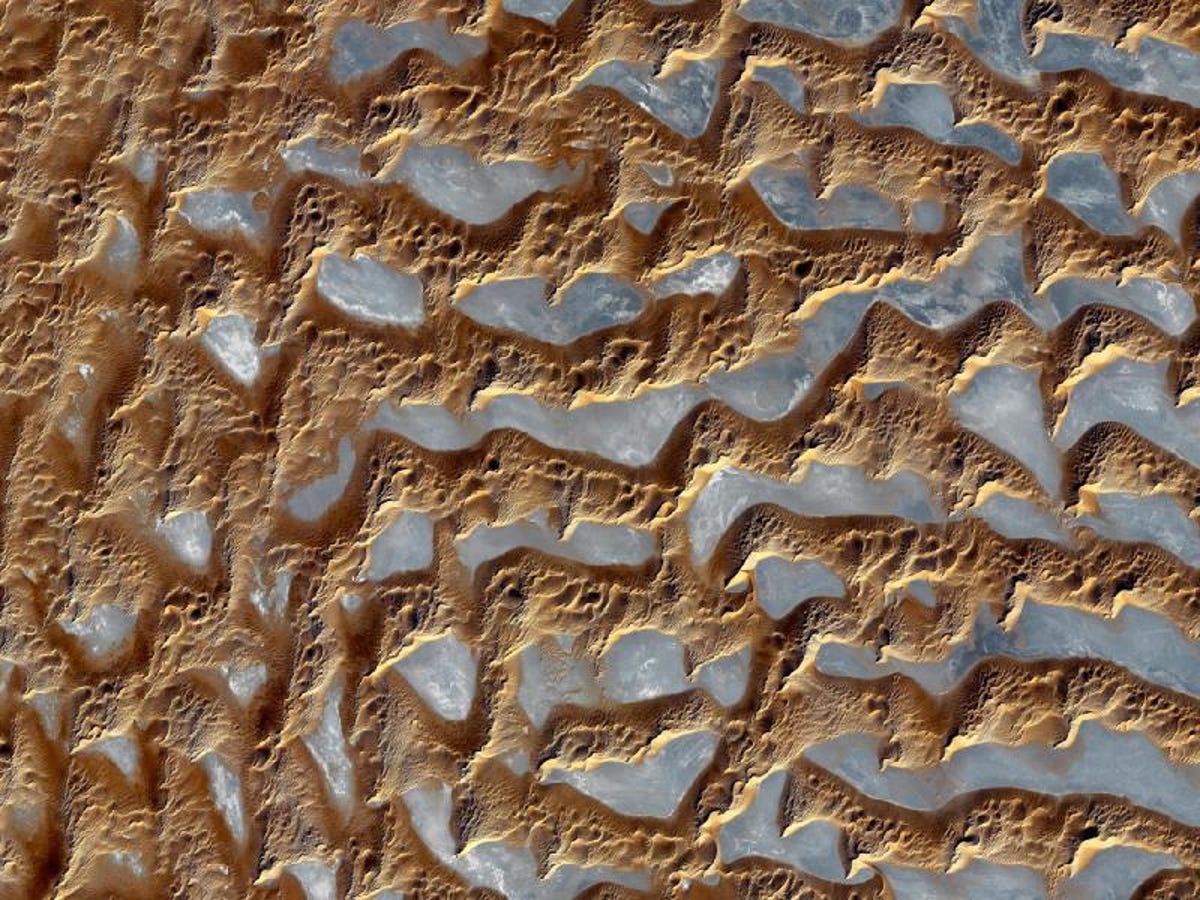
Rub' al Khali desert
This is the Rub' Al Khali desert, one of the largest sand deserts on the planet. It spans most of the lower third of the Arabian Peninsula, including parts of Yemen, Oman, and the United Arab Emirates.