Images: No-go for NASA on CO2 satellite
About half of the carbon absorbed out of the atmosphere can't be located precisely. The Orbiting Carbon Observatory was supposed to help provide answers, but it failed at launch.


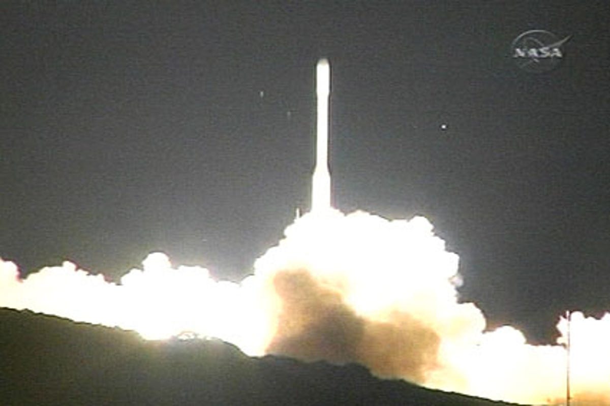
OCO rocket liftoff
NASA reported early Tuesday that the spacecraft carrying the Orbiting Carbon Observatory satellite failed to reach orbit during its overnight launch. It likely landed in the Pacific Ocean after takeoff from Vandenberg Air Force Base in California, putting an end to the mission.
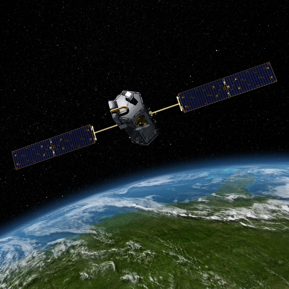
Orbiting Carbon Observatory
Scientists know that there's a lot more carbon dioxide in the atmosphere than there used to be in decades past. What they don't know as precisely as they'd like is where it all comes from and where it all ends up. To help put an end to that uncertainty, NASA had been looking forward to Tuesday's launch of a satellite called the Orbiting Carbon Observatory.
Over the next two years or more, the satellite (seen here in an artist's rendering) was expected to take about 8 million measurements every 16 days to provide a much more detailed picture of how carbon dioxide is distributed around the globe.
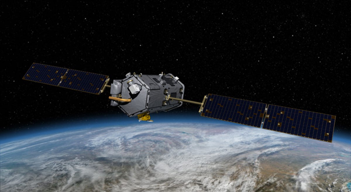
Orbiting Carbon Observatory, another view
That "somewhere" is the big question mark; it's what NASA refers to as the "missing" carbon sink--a sink in this case being someplace where carbon dioxide has been removed from the atmosphere and stored. Measurements from the OCO satellite will be combined with data from other satellites, from aircraft, and from ground stations to help determine where exactly, and how efficiently, the carbon dioxide is being absorbed in land sinks.
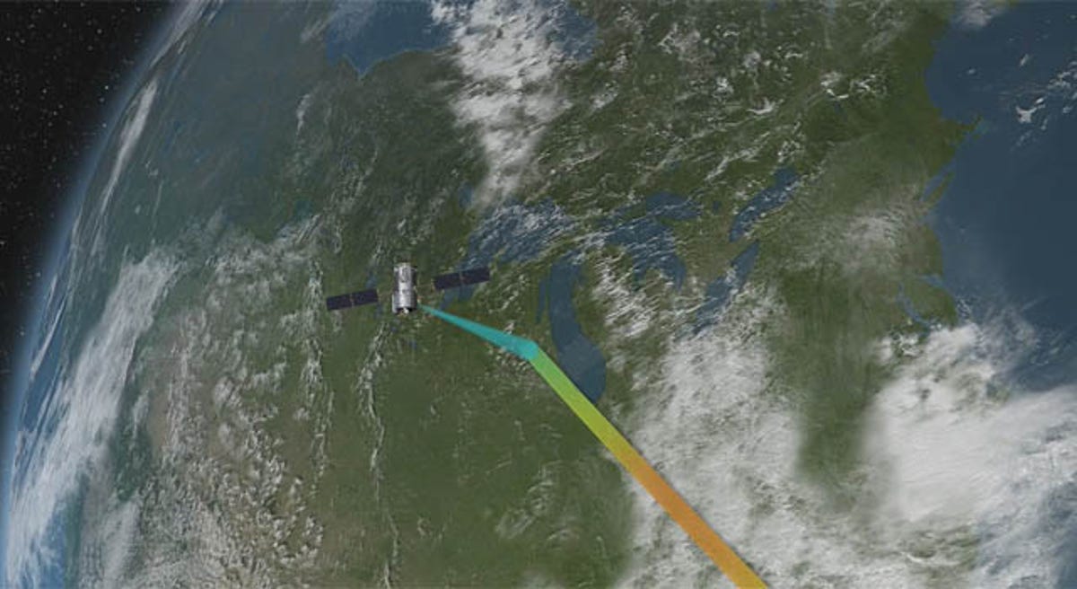
Orbiting Carbon Observatory, with spectrum
"Essentially, if you visualize a column of air that stretches from Earth's surface to the top of the atmosphere, the Orbiting Carbon Observatory will identify how much of that vertical column is carbon dioxide, with an understanding that most is emitted at the surface," Gregg Marland of Oak Ridge National Laboratory in Oak Ridge, Tenn., said in a NASA statement in January. "Simply, it will act like a plane observing the smoke from forest fires down below, with the task of assessing where the fires are and how big they are. Compare that aerial capability with sending a lot of people into the forest looking for fires. In this vein, the observatory will use its vantage point from space to peer down and capture a picture of where the sources and sinks of carbon dioxide are, rather than our cobbling data together from multiple sources with less frequency, reliability, and detail."
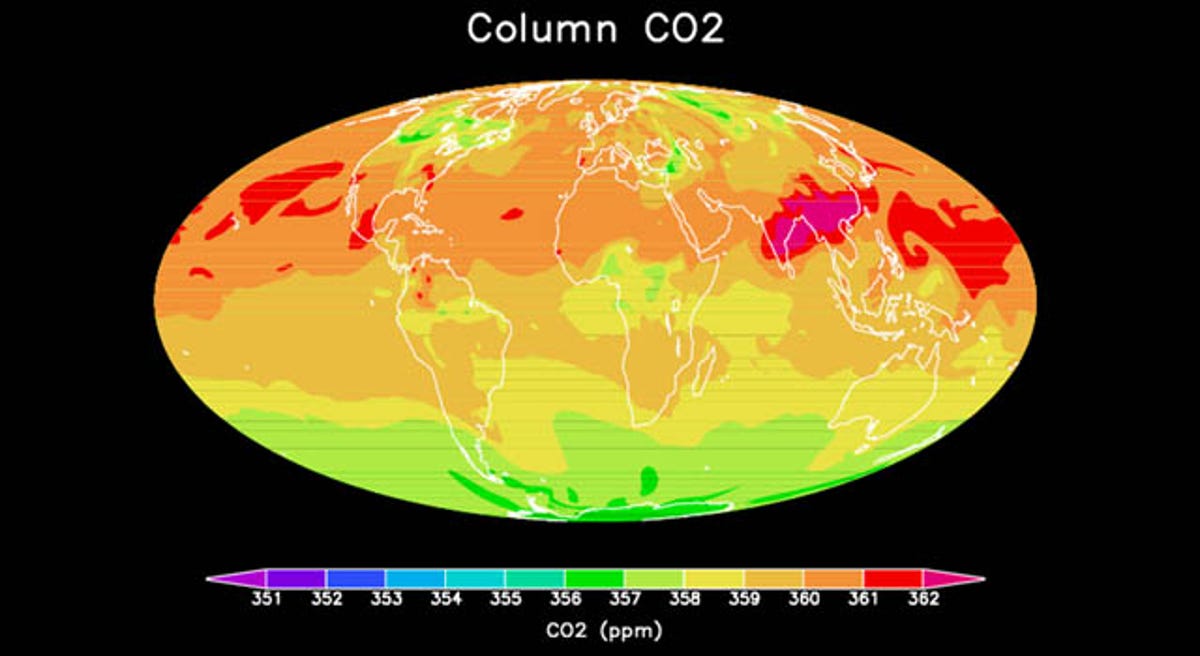
CO2 map
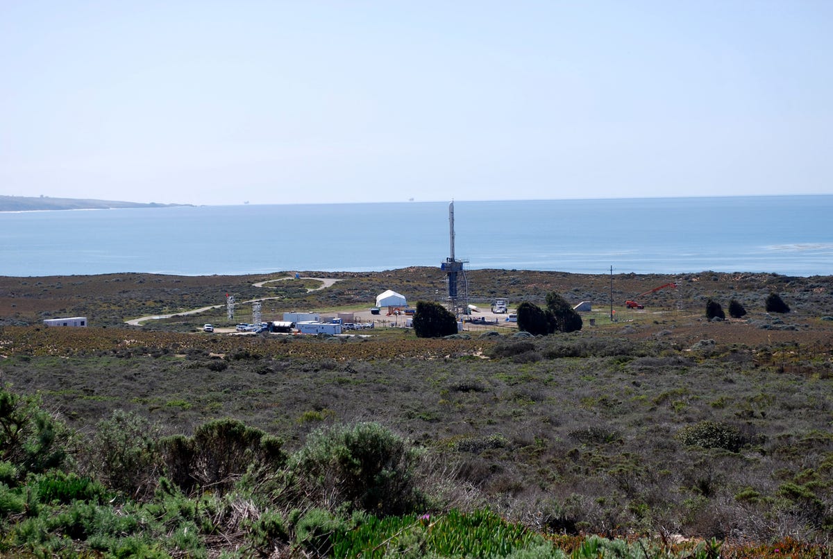
OCO launch site
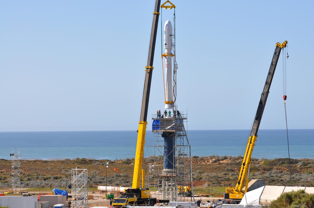
Working on the OCO launchpad

ARM Climate Research Facility site
More Galleries

My Favorite Shots From the Galaxy S24 Ultra's Camera
20 Photos
Honor's Magic V2 Foldable Is Lighter Than Samsung's Galaxy S24 Ultra
10 Photos
The Samsung Galaxy S24 and S24 Plus Looks Sweet in Aluminum
23 Photos
Samsung's Galaxy S24 Ultra Now Has a Titanium Design
23 Photos
I Took 600+ Photos With the iPhone 15 Pro and Pro Max. Look at My Favorites
34 Photos
