Google Earth as censored by the ever-artsy Dutch (images)
Most countries blur, pixelate, or whitewash sensitive areas in the name of national security, but the design-conscious Dutch dress things up a bit.
Edward Moyer
Edward Moyer is a senior editor at CNET and a many-year veteran of the writing and editing world. He enjoys taking sentences apart and putting them back together. He also likes making them from scratch. ¶ For nearly a quarter of a century, he's edited and written stories about various aspects of the technology world, from the US National Security Agency's controversial spying techniques to historic NASA space missions to 3D-printed works of fine art. Before that, he wrote about movies, musicians, artists and subcultures.
As noted in Granta, Dutch artist Mishka Henner has unearthed the remarkable way in which Holland's government has censored Google Earth's satellite views to obscure sensitive sites such as military installations and government buildings.
Unlike other countries, which tend to blur, pixelate, or whitewash such areas, the Netherlands covers them with colorful abstractions that call to mind camouflage or contemporary graphic design.
Henner's book "Dutch Landscapes" juxtaposes images of these stylish obstructions with Google Earth photos of the similarly arresting interventions the Dutch have made into the landscape itself to keep their country above water (dikes, dunes, drainage networks, and the like).
Flipping through the book is interesting. And as for the censored images (some of which you'll see in this gallery), we commend the land of Rembrandt and Mondrian for its unflagging attention to aesthetics. Who would've thought we'd be tempted to make a screensaver or desktop background out of a censored Google Earth image?
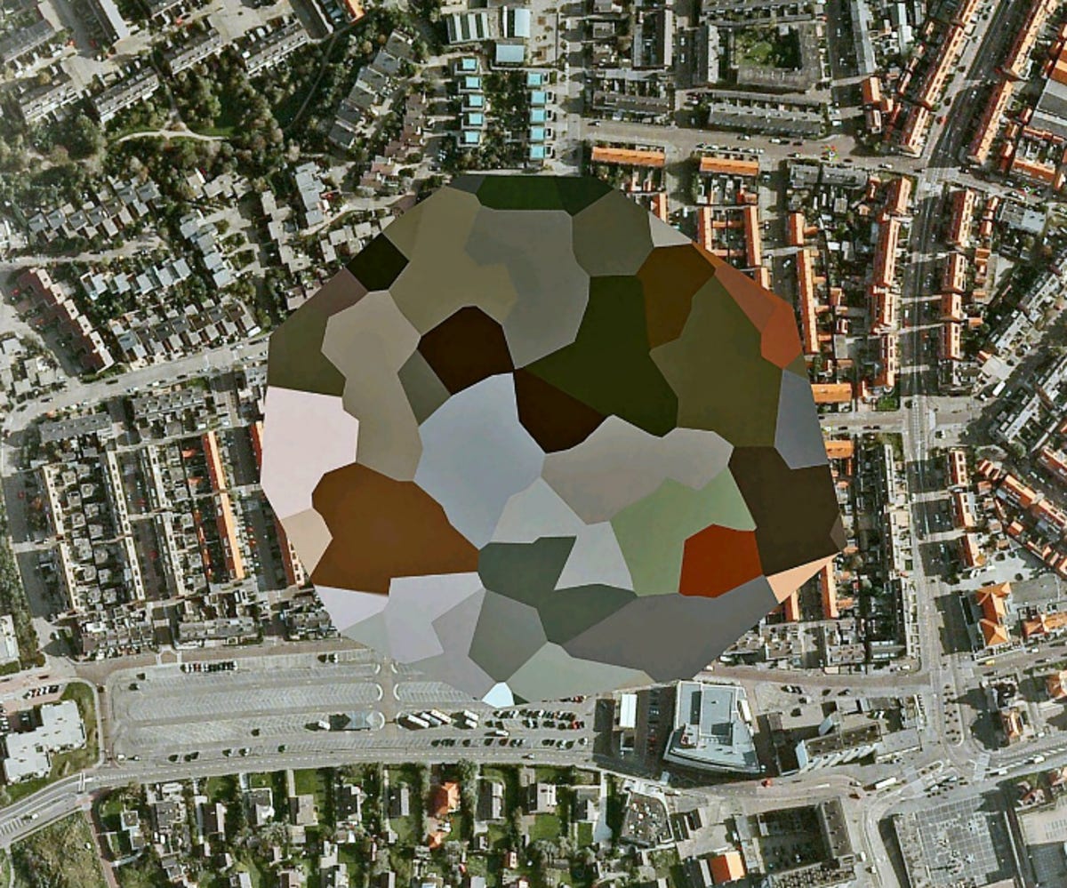
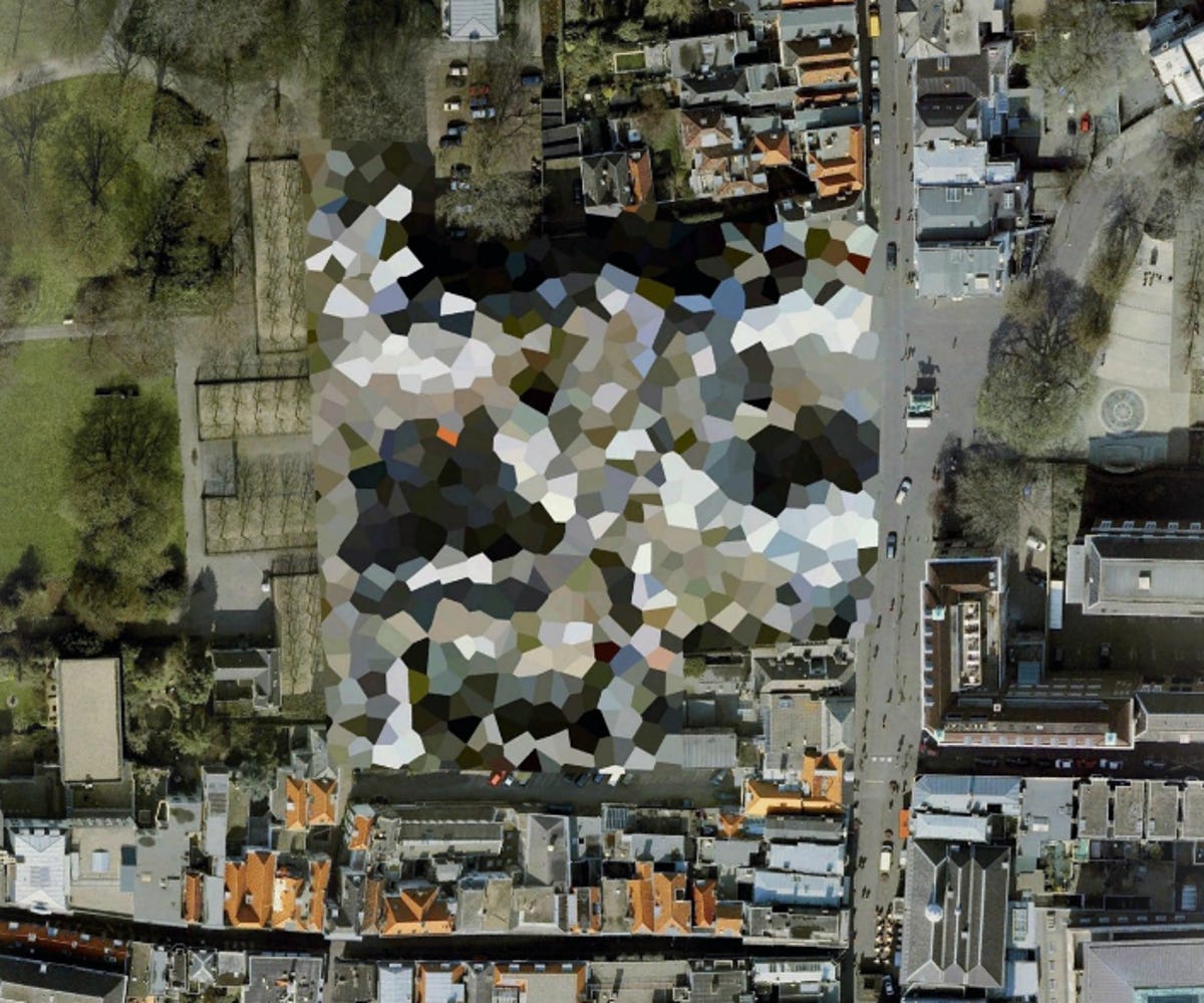
In this image: An unknown site -- Noordwijkaan Zee, South Holland.
2 of 8 Mishka Henner/Google Earth
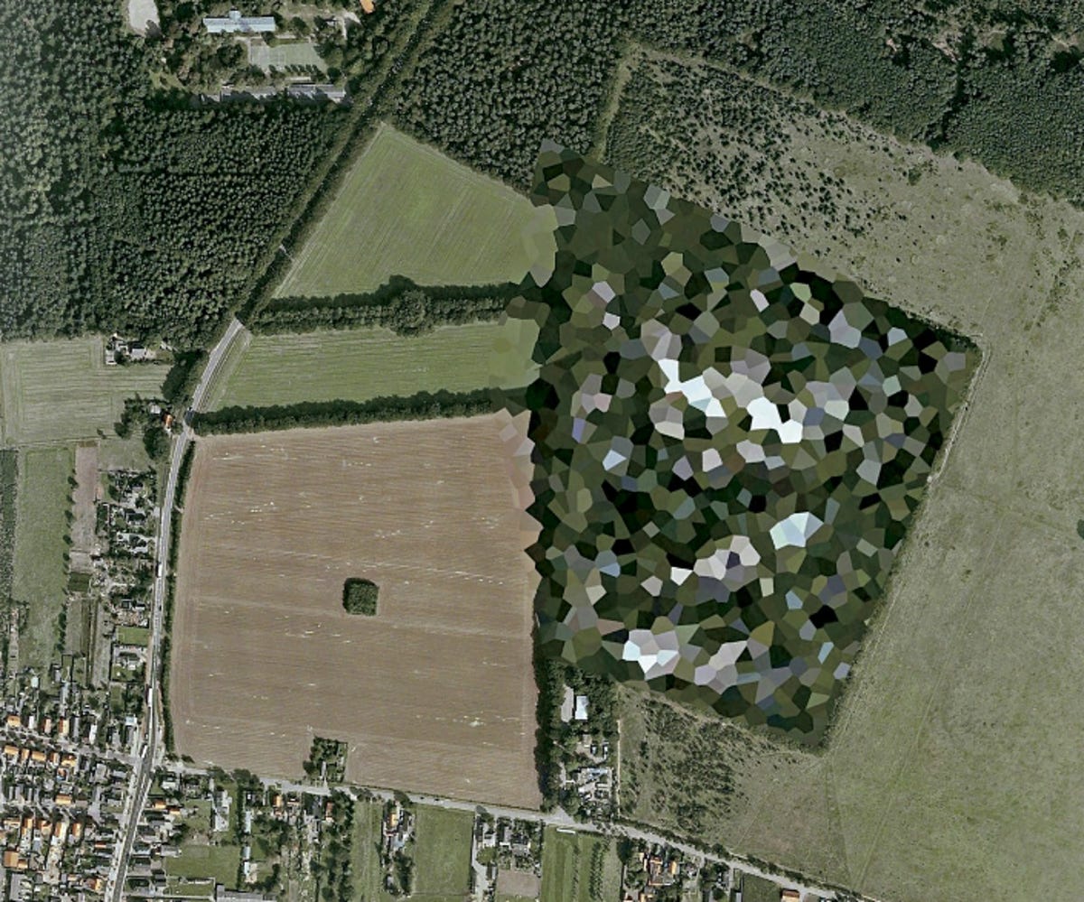
Logistic division
Logistic Division Rhenen -- Remmerden, Utrecht.
3 of 8 Mishka Henner/Google Earth
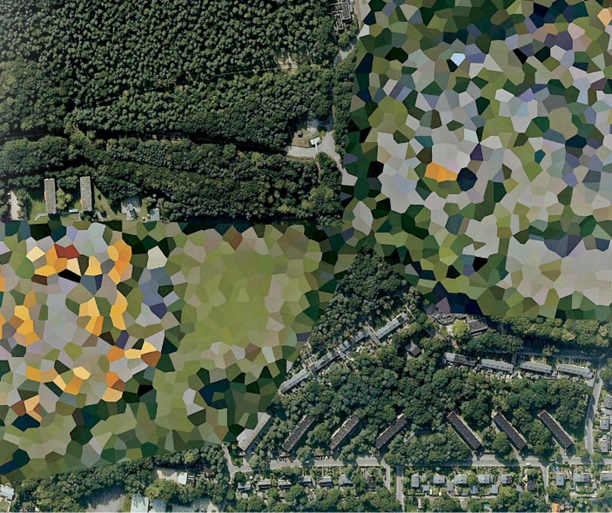
Army barracks
Prins Maurits Army Barracks -- Ede, Gelderland.
4 of 8 Mishka Henner/Google Earth
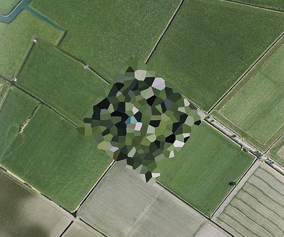
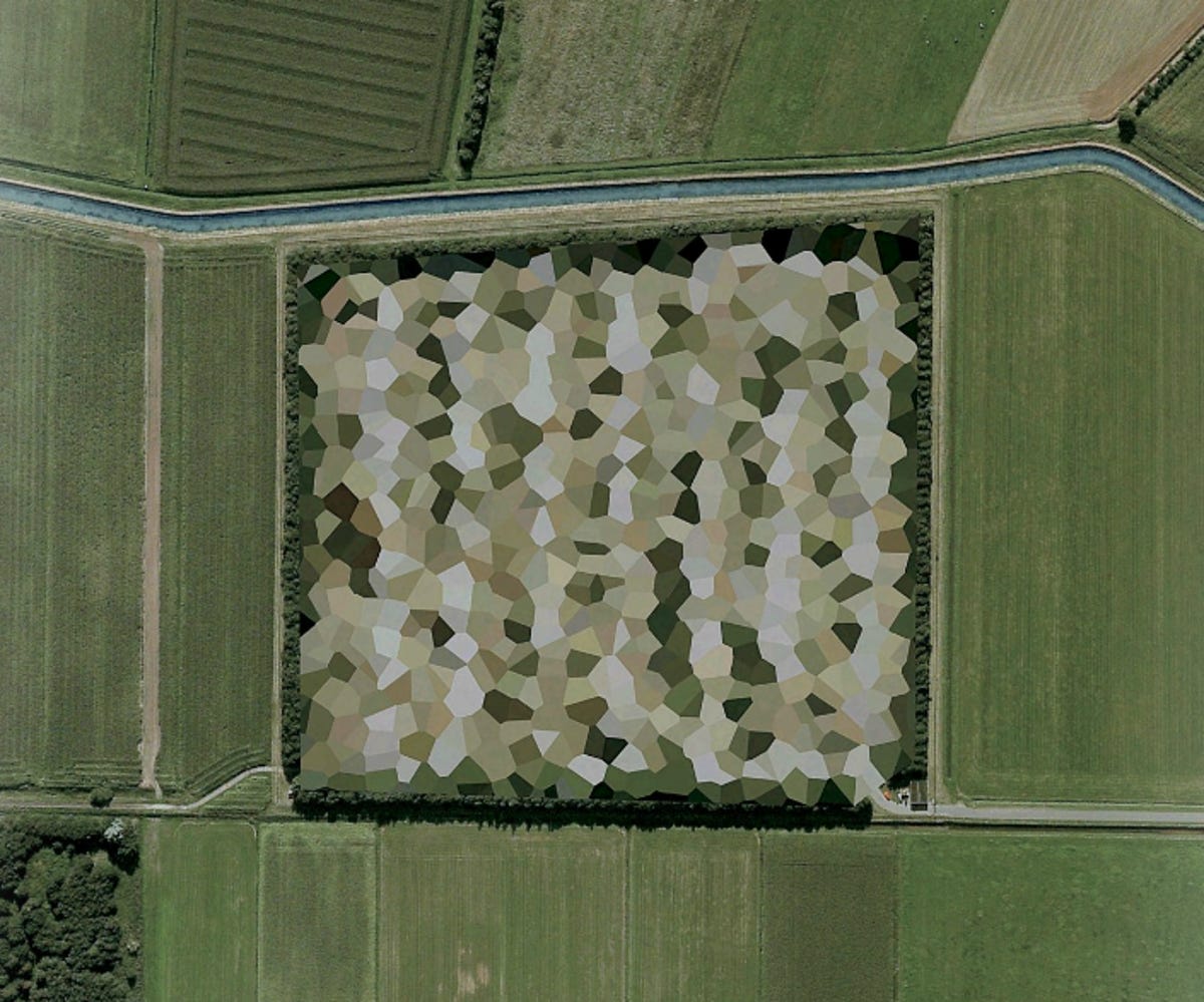
Radar installation
Air Force Radar Installation -- Wier, Friesland.
5 of 8 Mishka Henner/Google Earth
Palace in The Hague
A far-out building by starchitect Rem Koolhaas? Nope, it's the Noordeinde Palace in The Hague, South Holland.
6 of 8 Mishka Henner/Google Earth
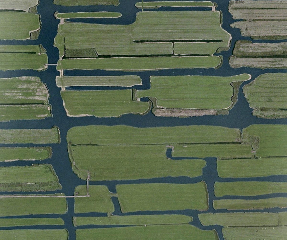
Waterways
Wormerland, North Holland.
In his book, artist Mishka Henner juxtaposes the censored images with shots of the centuries-old system Holland has built to keep the below-sea-level country from flooding. This is one of those images, showing a network of waterways.
7 of 8 Mishka Henner/Google Earth
Control station
Air Operations Control Station -- Nieuw-Milligen, Gelderland.