Here's a look at Google-supplied satellite imagery comparing sites before and after the tsunami wreaked havoc in Japan.
Stephen Shankland
Stephen Shankland worked at CNET from 1998 to 2024 and wrote about processors, digital photography, AI, quantum computing, computer science, materials science, supercomputers, drones, browsers, 3D printing, USB, and new computing technology in general. He has a soft spot in his heart for standards groups and I/O interfaces. His first big scoop was about radioactive cat poop.
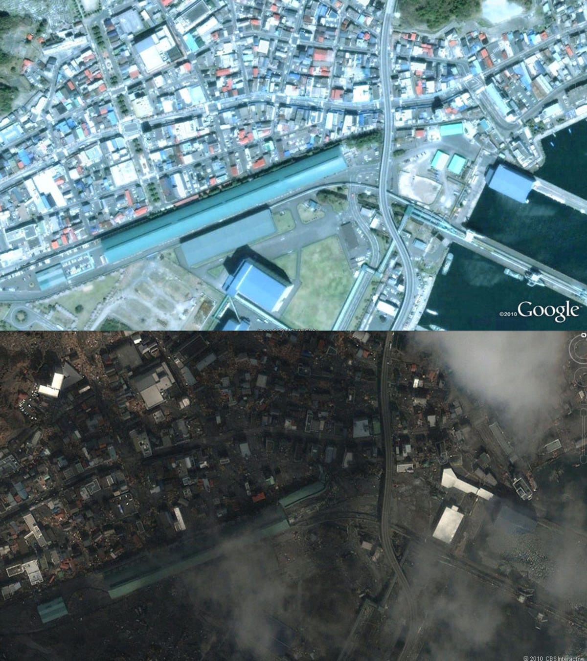
1 of 9 satellite images from GeoEye and Digital Globe via Google Earth; composite by Stephen Shankland/CNET
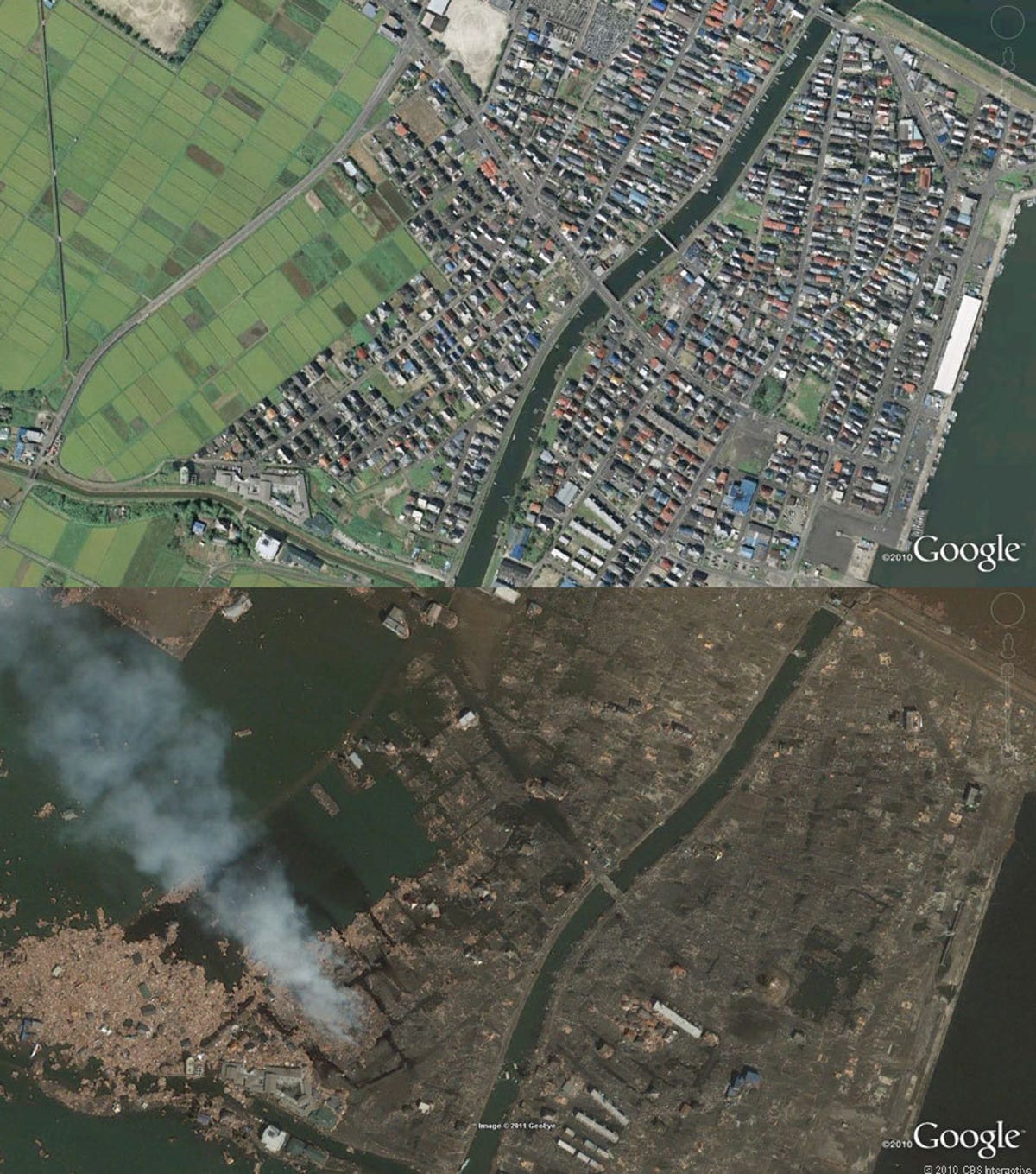
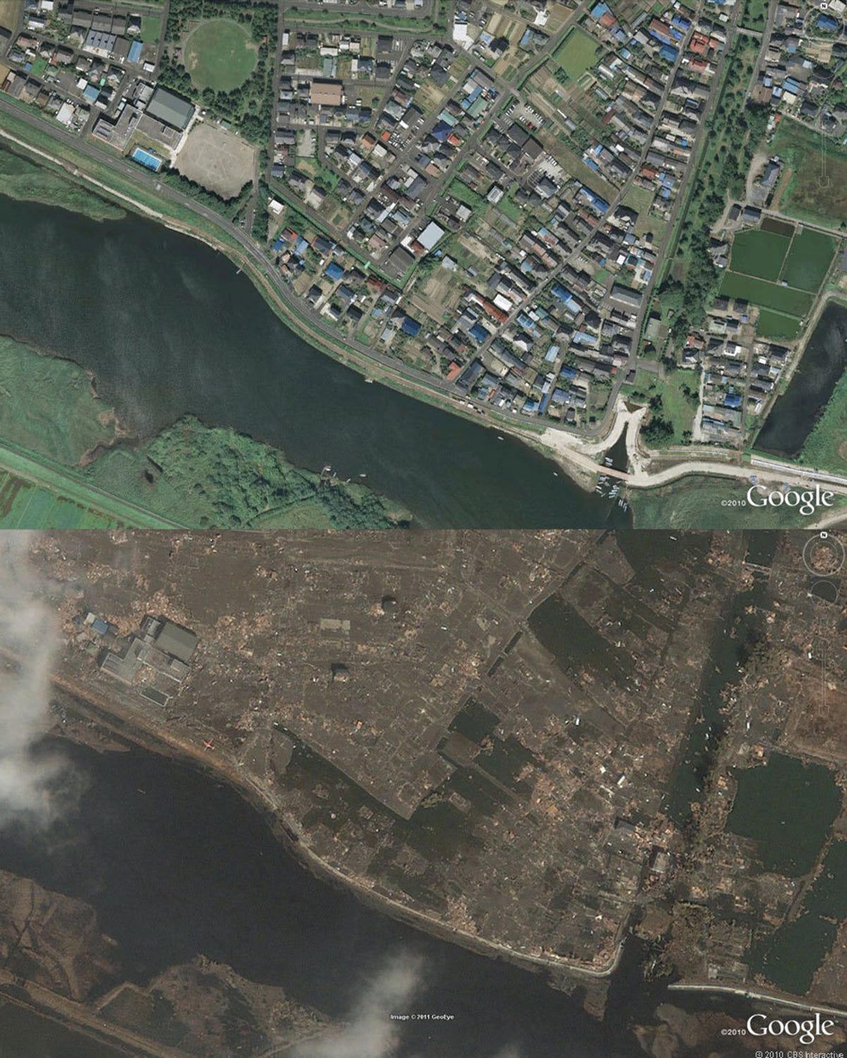
Yuriagi in Natori
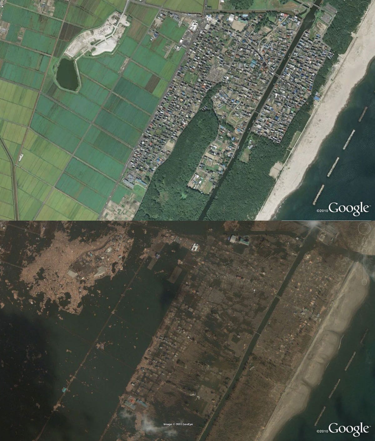
Google supplied new satellite imagery from GeoEye and Digital Globe shortly after Japan's devastating earthquake and tsunami. This comparison shows Yuriagi in Natori before (top) and after (bottom).
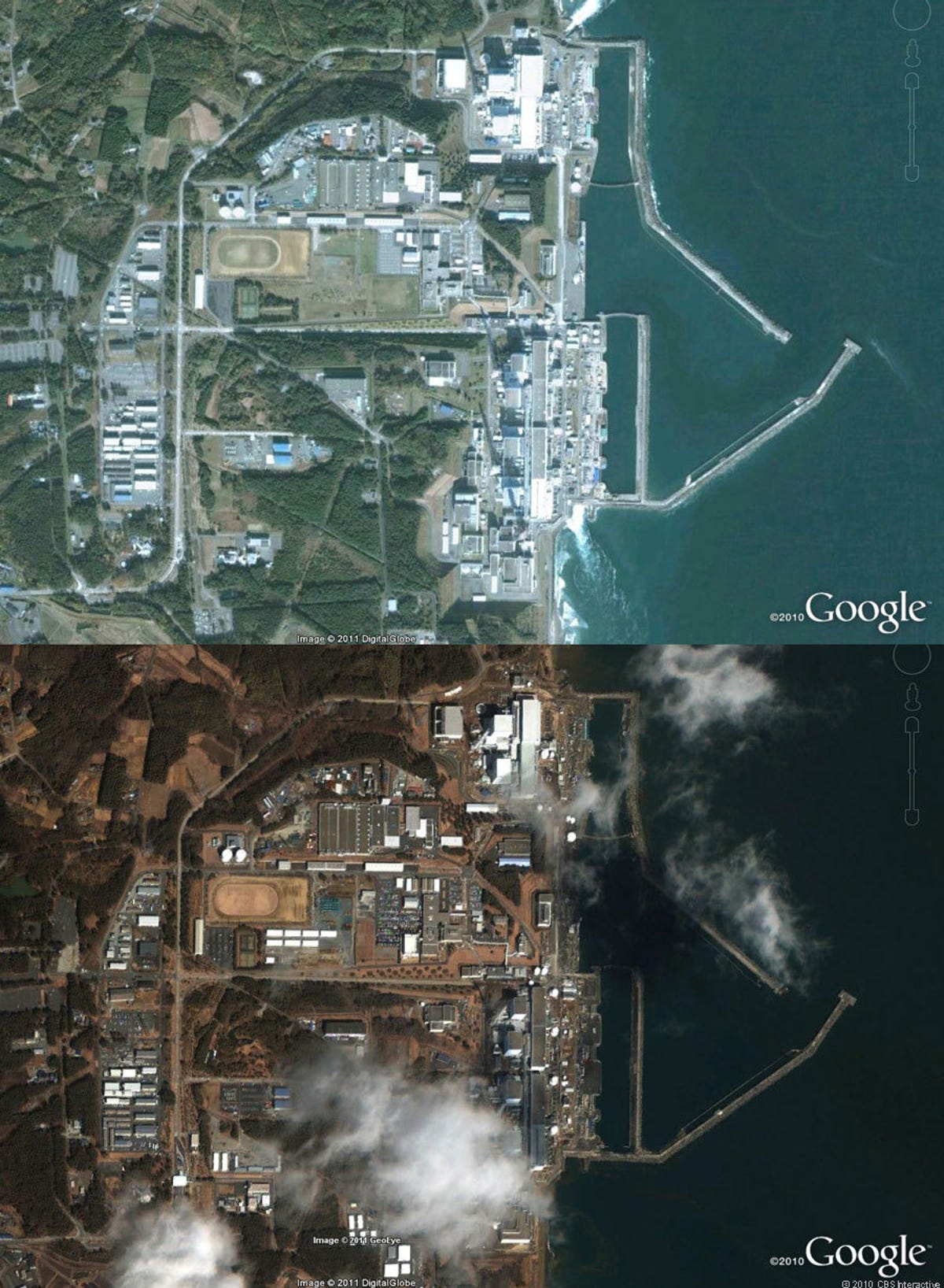
In this slideshow, the "before" and "after" images have been placed on top of one another for comparison.
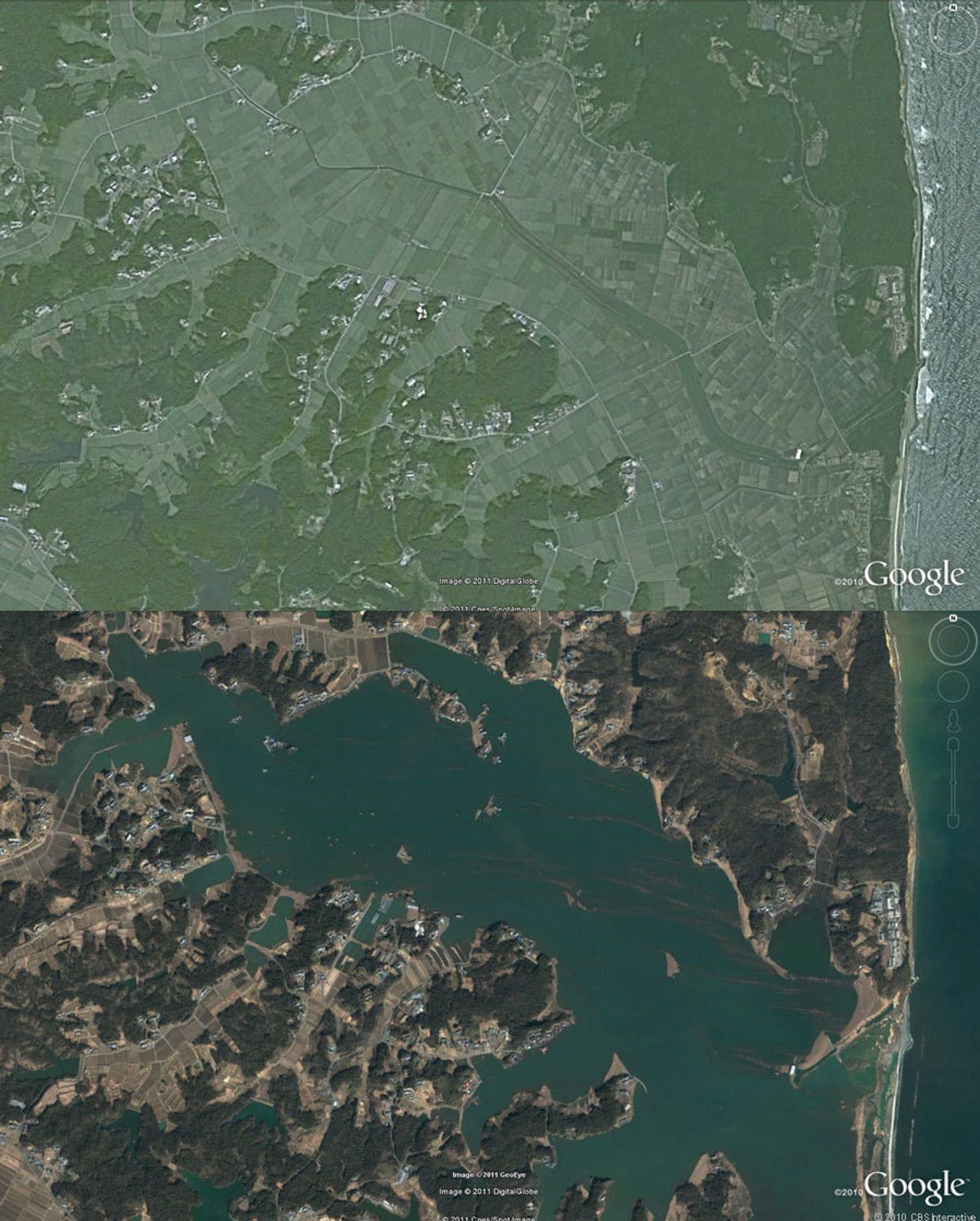
2 of 9 satellite images from GeoEye and Digital Globe via Google Earth; composite by Stephen Shankland/CNET
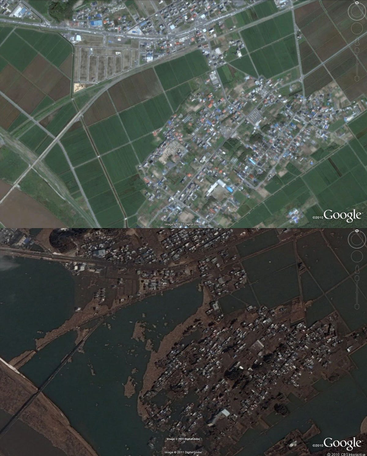
Sendai devastation
The Arahama area of Sendai, a flat area, was swamped by the tsunami. Farmland was inundated and houses demolished.
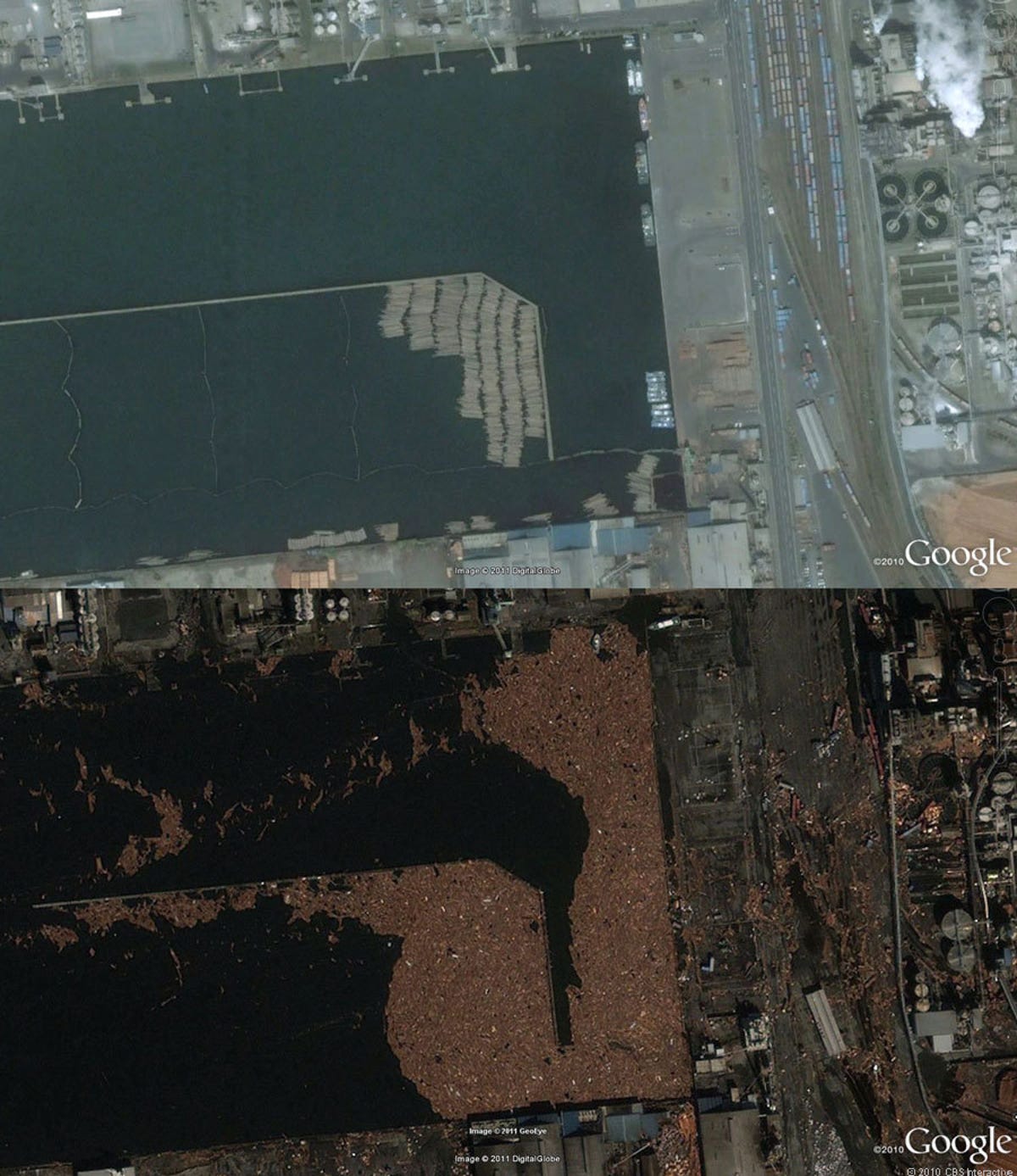
3 of 9 satellite images from GeoEye and Digital Globe via Google Earth; composite by Stephen Shankland/CNET