The magnitude 7.0 earthquake that struck Haiti on Tuesday occurred along the strike-slip fault line that separates the Caribbean and North American tectonic plates, just 10 miles southwest of the capital city, Port-Au-Prince.
The quake, the largest in the region in more than 200 years, has been devastating, and throughout Port-Au-Prince buildings have collapsed, leaving people trapped and streets blocked with the ruins of fallen buildings.
2 of 16 Google/DigitalGlobe
After
Here is the same area as seen after the earthquake.
3 of 16 Google/DigitalGlobe
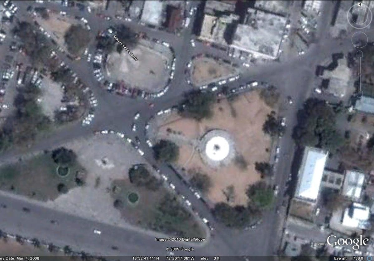
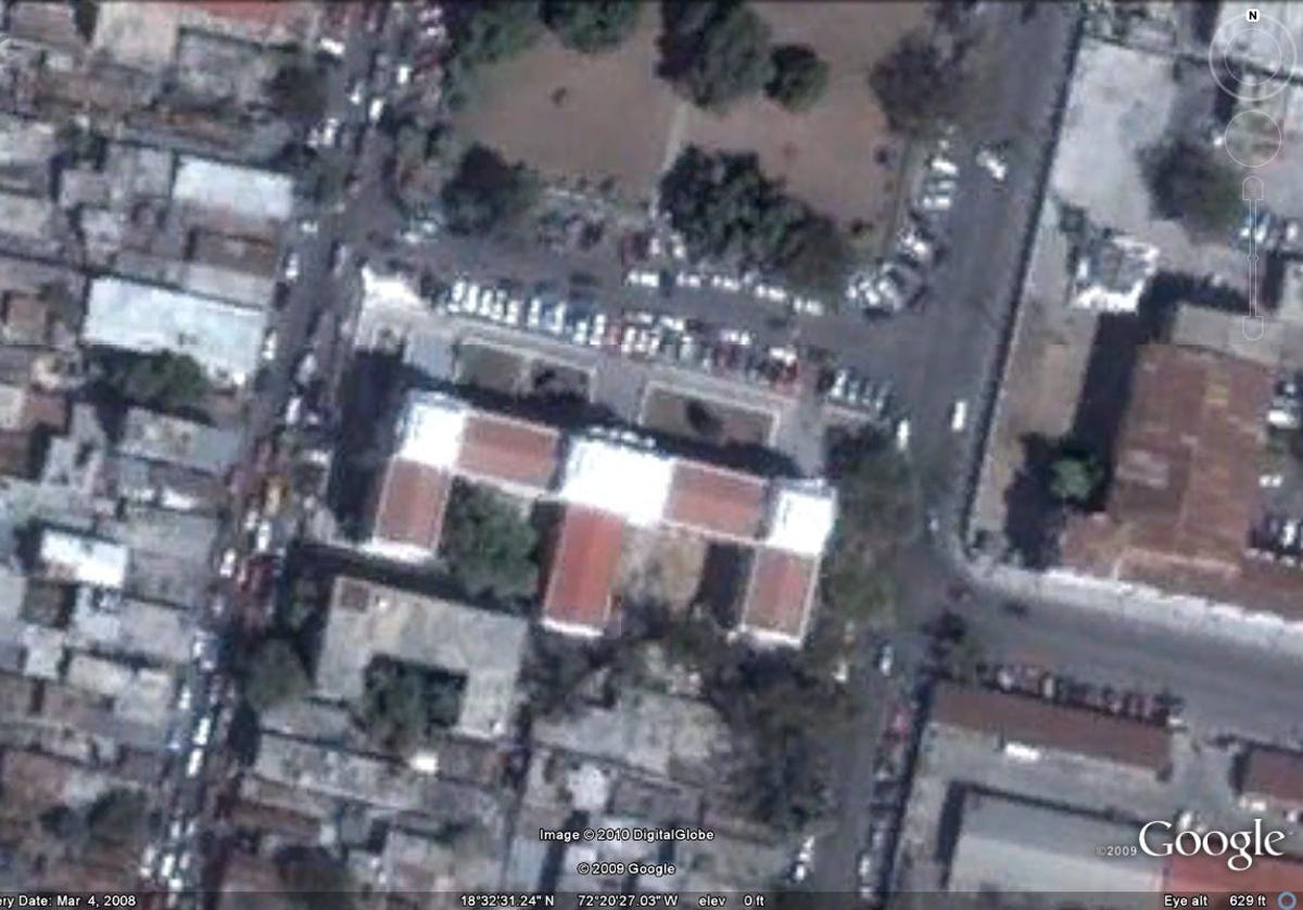
Before
This image from Google shows Champs de Mars plaza on an average day in 2008 before the devastating quake struck.
4 of 16 Google/DigitalGlobe
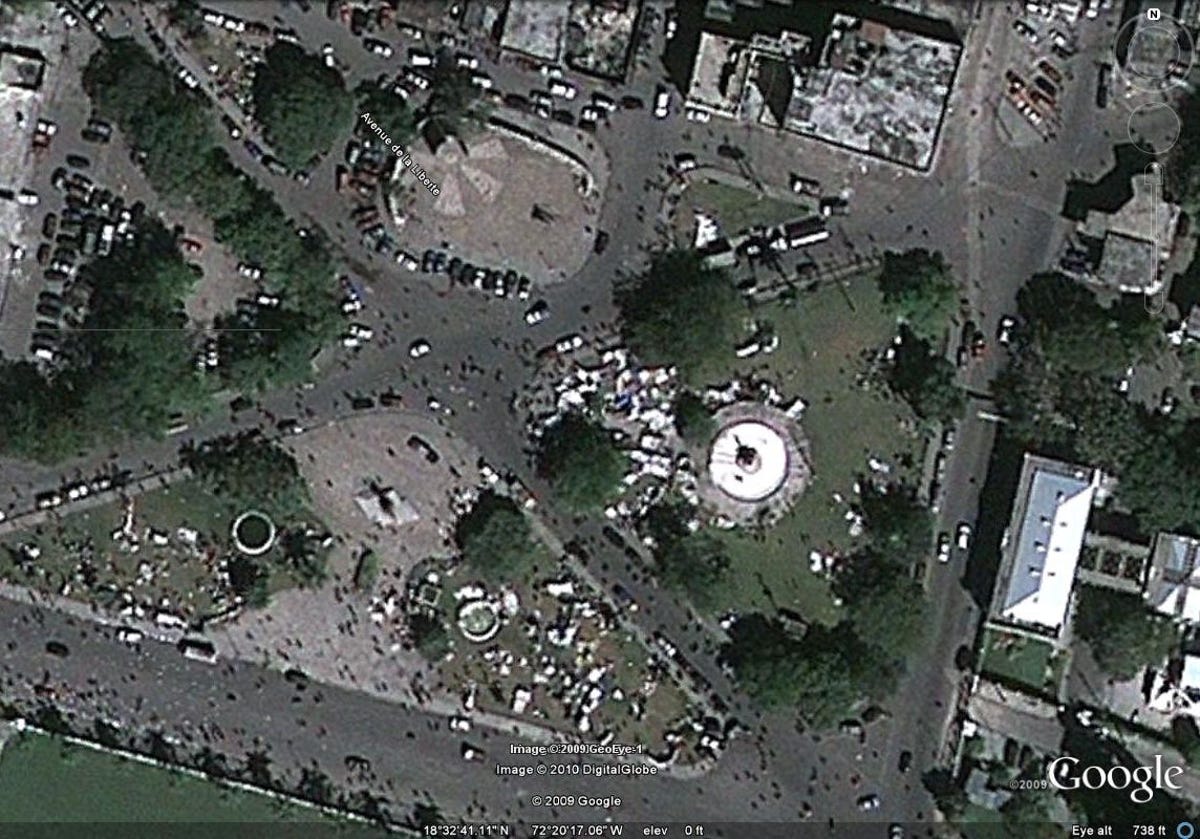
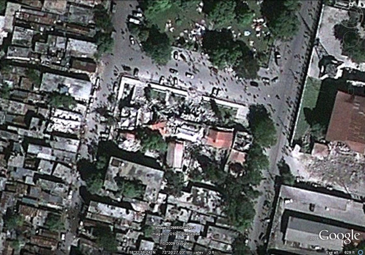
After
The normally calm Champs de Mars plaza in front of the the Presidential Palace has, like other public spaces throughout the city, become a place to gather and to seek refuge from the destruction caused by the earthquake.
5 of 16 Google/DigitalGlobe
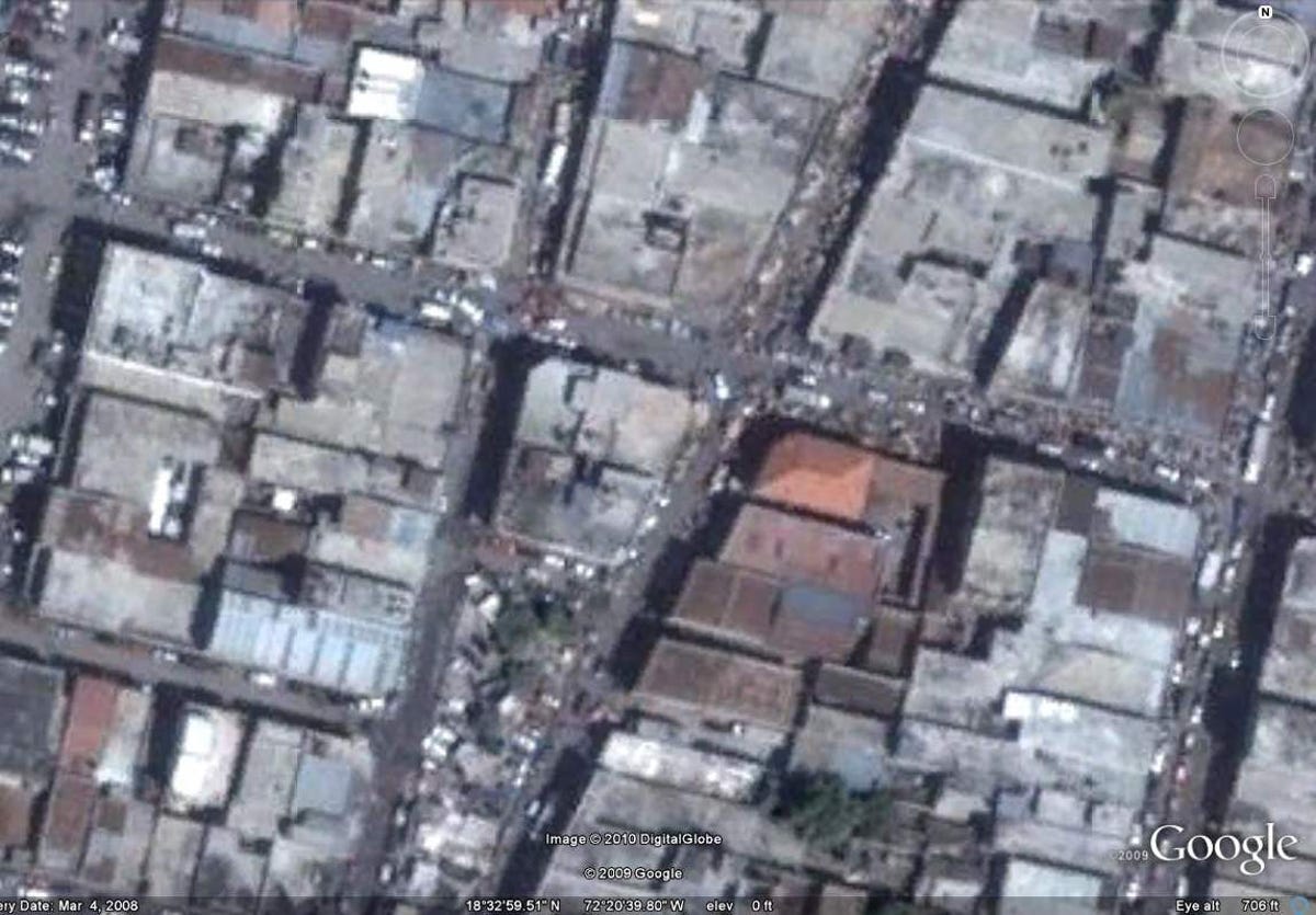
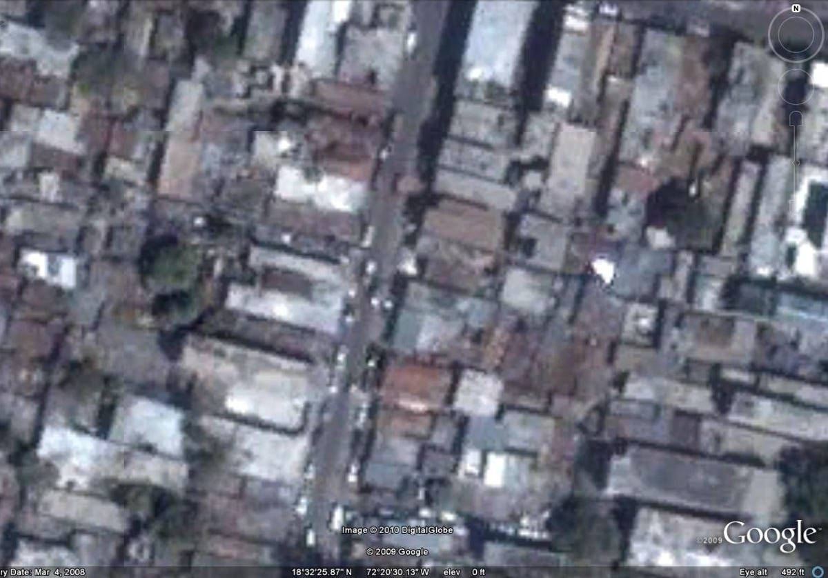
A neighborhood in Port-Au-Prince, before.
A neighborhood in Port-Au-Prince, before.
6 of 16 Google/DigitalGlobe
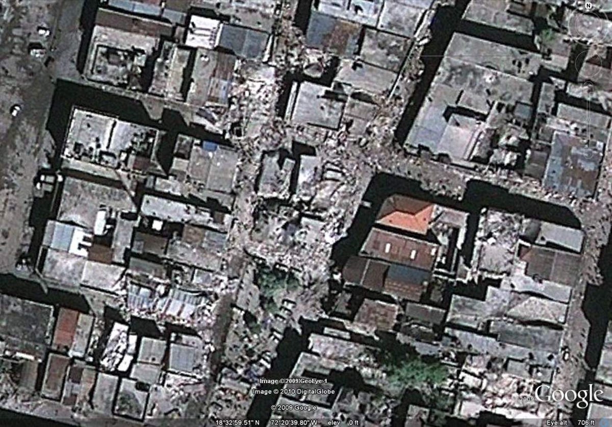
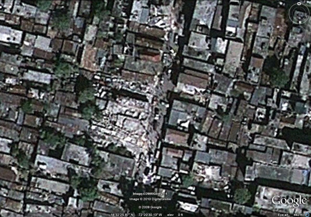
Poorly maintained
According to the Encyclopedia of Nations, "Haiti's infrastructure is primitive and poorly maintained, the result of decades of under-investment and environmental damage."
The poor infrastructure accelerated the damage caused by the quake, inflicting an unusually high toll for a quake with magnitude of 7.0.
Here, the same area is seen after the quake.
7 of 16 Google/DigitalGlobe
Before
A building near the city's center before the quake.
8 of 16 Google/DigitalGlobe
Destruction
The same building after Tuesday's earthquake.
9 of 16 Google/DigitalGlobe
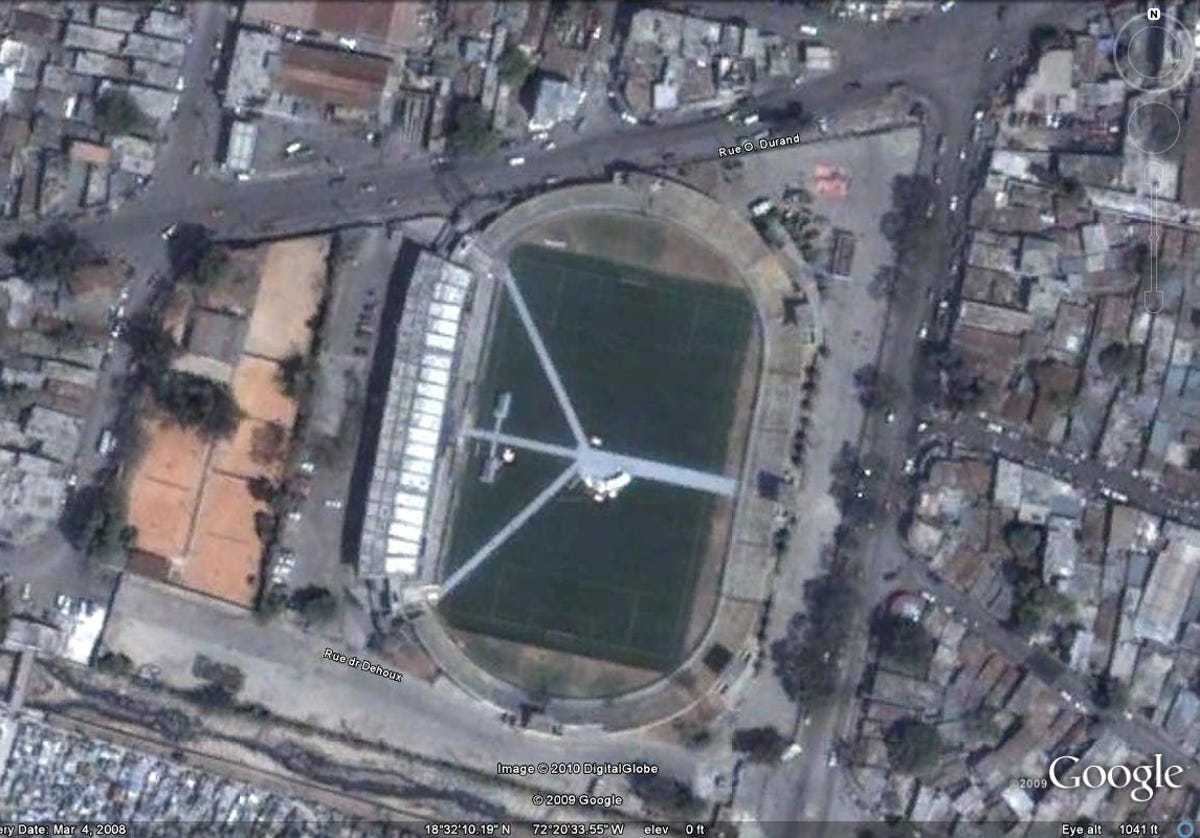
Stade Sylvio Cator, after
The 30,000-person multipurpose stadium Stade Sylvio Cator, named for Haitian Olympic medalist long jumper Sylvio Cator, as seen before the quake in 2008.
10 of 16 Google/DigitalGlobe
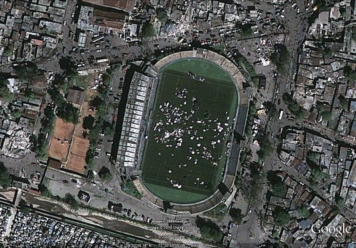
Stade Sylvio Cator, before
The Stade Sylvio Cator was damaged in the earthquake, and its grounds have now become a safe haven for earthquake refugees.
11 of 16 Google/DigitalGlobe
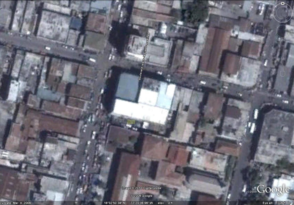
Boulevard JeanJaques Dessalines
A corner building along Boulevard Jean-Jaques Dessalines before Tuesday's quake.
12 of 16 Google/DigitalGlobe
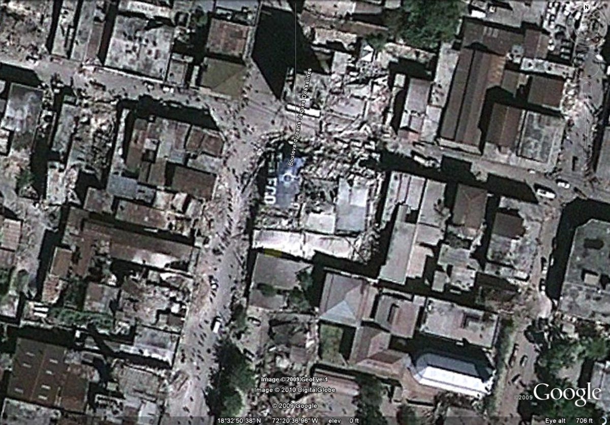
Boulevard JeanJaques Dessalines
The same corner building after it collapsed, partially blocking the surrounding streets.
13 of 16 Google/DigitalGlobe
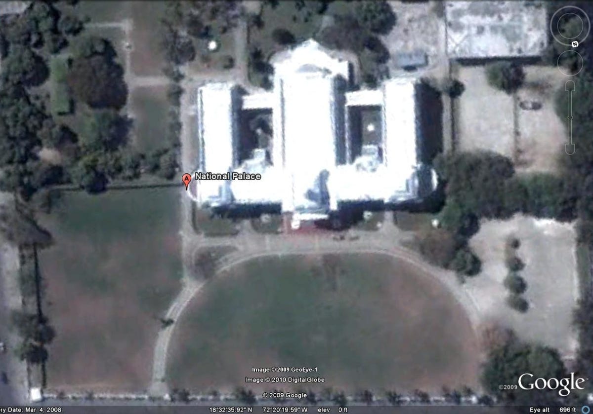
Presidential Palace
The Presidential Palace prior to its collapse in the earthquake on Tuesday.
14 of 16 Google/DigitalGlobe
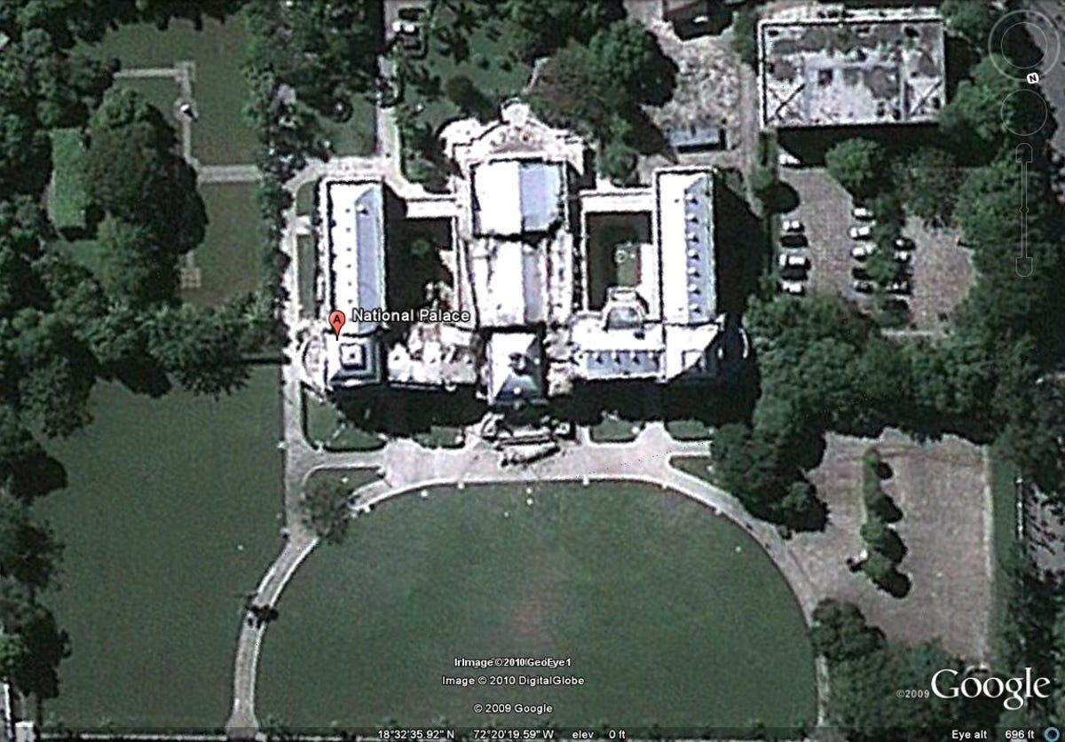
Presidential Palace collapse
The Presidential Palace in the Champs de Mars plaza was nearly destroyed following Tuesday's quake.
15 of 16 Google/DigitalGlobe
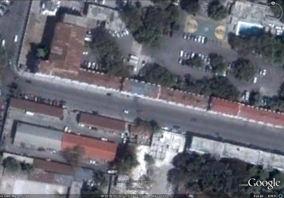
Before the collapse
A block of buildings near the Presidential Palace before the earthquake.
16 of 16 Google/DigitalGlobe
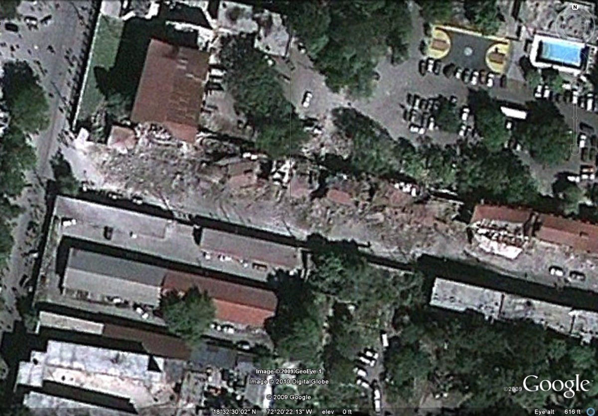
Near the Presidential Palace
The same block near the Presidential Palace collapsed into the street after the quake.