Google Maps for walkers, Microsoft Virtual Earth expand
Google opens up walking directions on Google Maps to more people, while Microsoft expands Virtual Earth imagery to cover more cities around the world.


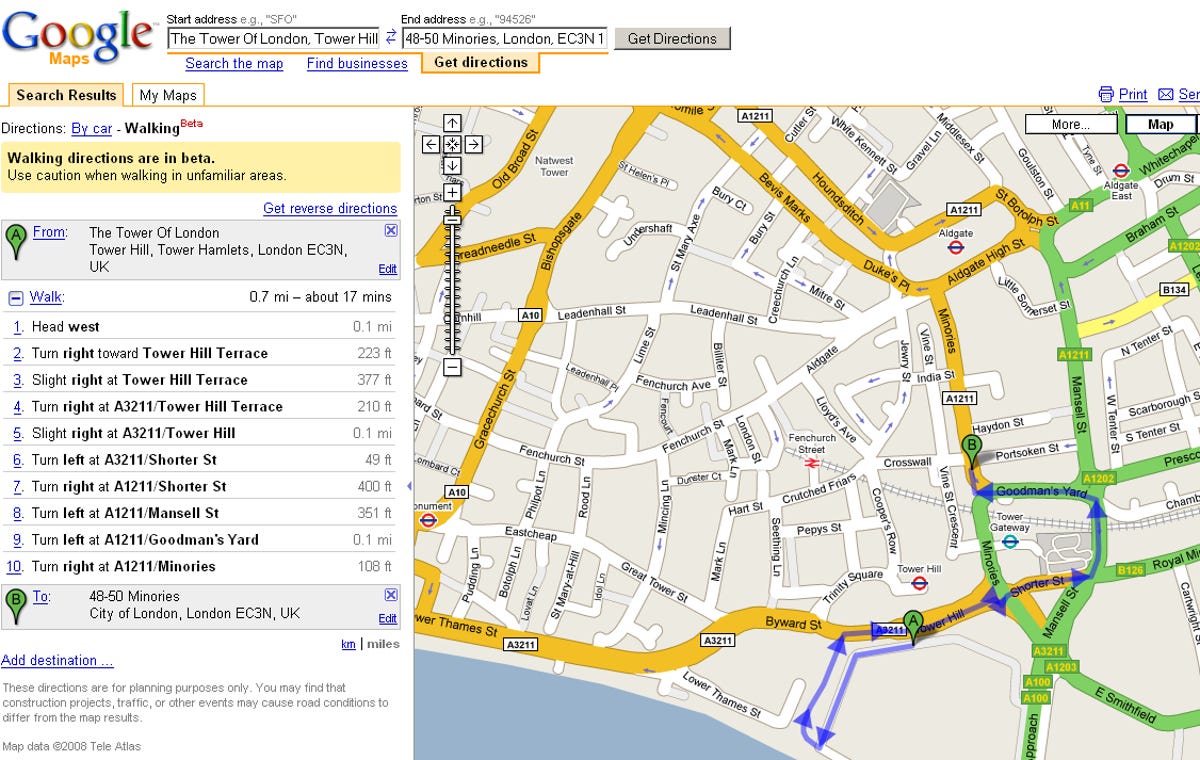
Updated July 24 to fix London walking map
There are some online mapping news tidbits on Tuesday.
First, Google has expanded its walking directions feature from a test for a limited number of users to a public beta covering everywhere that driving directions are available, according to the Google LatLong blog.
For directions that are 6.2 miles (10 kilometers) or less the walking directions option will appear. "We'll try to find you a route that's direct, flat, and uses pedestrian pathways when we know about them," the blog posting says.
You can use Google's walking directions to help earn money for charity. Google has a program running through October 25 where people who complete a 15-week "Walk for Good" program can vote for a charity
to share a $100,000 contribution from the company.
And over at Microsoft they've greatly expanded the coverage of Virtual Earth, according to a Virtual Earth evangelist's blog.
The site's Orthoimagery feature, which are images taken from directly overhead, and its 45-degree bird's-eye view, now include tons of additional cities in the U.S. and Europe. Meanwhile, a bunch of new countries around the world can now be seen in satellite images.
In a separate announcement, Urban Mapping, which provides location-rich content for interactive applications, said it had surpassed the 50,000 mark for United States neighborhood boundary collection. Its system lets someone search the Internet to find a coffee shop in New York's SoHo neighborhood, say, instead of having to know the zip code or address.
(Thanks to Search Engine Roundtable for the Google walking directions tip.)