Google Map Maker arrives in U.K.
The United Kingdom's denizens now can add detail such as paths and businesses to Google's online maps service. But remember: it's free labor for Google.


- Shankland covered the tech industry for more than 25 years and was a science writer for five years before that. He has deep expertise in microprocessors, digital photography, computer hardware and software, internet standards, web technology, and more.
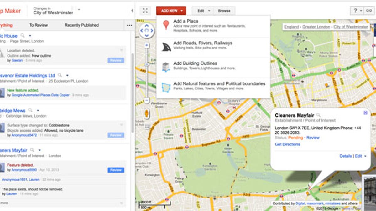
Google has brought its Map Maker tool to the United Kingdom, letting ordinary people contribute mapping data to the widely used Google Maps service.
The company announced the move today on its Lat-Long blog and at an event at the famed World War II code-breaking site of Bletchley Park.
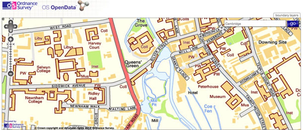
That means the public could help endow online maps with the same level of detail that's in the superb Ordnance Survey maps -- which seemingly document every footpath, Roman road, and hamlet in Old Blighty.
Google Maps has become a major force in modern computing as Google combines information on roads, trails, ski areas, addresses, business interiors, Wi-Fi networks, and public transit with real-world views from satellites, planes, panoramic cameras, and Street View cars. The company is seeking to capture the full "ground truth" in its database -- an up-to-date record of the real world reproduced in its servers.
Google has spent a lot of its own money gathering and licensing data for Google Maps. But company has benefited from the public's help, too, with do-it-yourself tools. Google Map Maker lets people add data on their own, a move that's helped map hard-to-reach areas such as North Korea.
Letting locals with expert knowledge flesh out map details has great appeal: their changes can improve the utility of Google Maps for themselves, their neighbors, visiting friends, and tourists. Google's power amplifies people's contributions with the largest, most relevant mapping project there is. Map Maker is available in dozens of countries.
But if you've considered contributing (I have), be aware of a big caveat: you're working for free for Google. And although you and others may get something out of it, your labor becomes Google's proprietary data.
In contrast, the OpenStreetMap project accepts data from various governments with contributions from the public and offers it back for free usage by anyone.
The Ordnance Survey maps previously had carried many restrictions for online use, but the mapping agency released much of its data for free starting in 2010. It's now incorporated into OpenStreetMap along with data from France, Austria, Australia, Chile, Canada, New Zealand, South Africa, the Netherlands, and other countries.
Updated 2:49 a.m. PT with details about liberalized terms for using Ordnance Survey maps.