Google Maps charts the frozen home of the polar bear
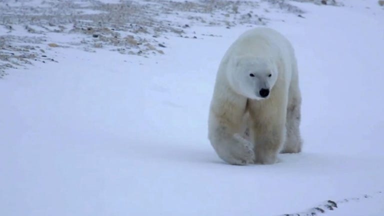
Thanks to a Street View camera bolted to a specially designed "tundra buggy," Google Maps shows a bear's-eye view of Churchill, Manitoba, nestled within one of the world's largest polar bear populations.


Polar bears may not have much use for pavement, but that didn't stop Google Maps' Street View from getting very up close and personal with the elusive Ursus maritimus.
In honor of International Polar Bear Day, Google released on Thursday its first Street View maps of a remote area of Canada's tundra. In capturing images of polar bears in and around the town of Churchill, Manitoba, Google has created a "baseline record for imagery associated with geospatial data," Krista Wright, executive director of the conservation group Polar Bears International, wrote in a guest blog for Google.
Working in collaboration with Churchill residents and the conservation group, Google has created a record of not just the town and its polar bear visitors, but the appearance of the tundra at precise coordinates during a specific time of year. Even if the company never visits Churchill again, Polar Bears International said that the comprehensive Street View imagery can be used to help understand the impact of climate change on the region in the future.
To map the region, Google outfitted a "tundra buggy," a popular, specially-designed all-terrain vehicle for the frozen north, with a Street View 360-degree camera. As you can see in the gallery below, the results depict the stark tundra as well as curious polar bears approaching the buggy.
Polar Bears International also uses the Google Maps API to track the bears, Wright explained. As Hudson Bay freezes, the bears venture further out in search of seals to eat and other bears to mate with.


In efforts to make the Churchill community feel like they were being included in the mapping process, she noted that Google held a community event called a MapUp so that town residents could contribute local landmarks to the map, such as the town skating rink, school, movie theater, and holding pen for bears that wander into town.
The town keeps the bears isolated until they can safely returned to the wild. Or, in terms that the rest of the Internet will understand, they keep the bears for a bit and then say, "Go home, polar bear. You're drunk."