The joys of geotagging
Adding geo data enables Flickr to put photos on a map, so that when I'm old and senile (okay, older and more senile), I'll be able to remember where they were taken


While I was on holiday I took about 1,800 photographs of ducks, windmills, Lincolnshire beaches and the Norfolk Broads. Many of them were rubbish, but that's the way it goes. I also recorded the latitudes and longitudes of all my shooting positions, not by the you've-got-to-be-bonkers method of looking up each place on a map and writing down the coordinates in a little book, but by turning on my Sony GPS-CS1 GPS logger and clipping it to my rucksack.
When I got home, it took me about half an hour to transfer all the photos to my computer, and maybe five minutes to add geo data to all the files. That's nothing compared to the eight hours I spent viewing all the files, picking out the best 90 shots, processing them in Photoshop and uploading them to Flickr.
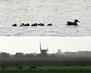
Adding the geo data enables Flickr to put the photos on a map, so that when I'm old and senile (okay, older and more senile), I'll be able to remember where they were taken. And while I'm waiting for my brain to turn to mush, anyone who's inspired to visit this amazing beach...
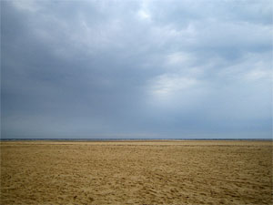
...can find out exactly where the photograph was taken. It's like drawing on the wall of a cave to tell the next generation where the mammoth herds hang out, except easier and much more accurate.
Taking good photographs, on the other hand, is almost as hard as drawing a mammoth.