Google begins testing AR walking navigation for Maps
The feature will use digital images to help you get where you're going.


Google Maps is testing an AR feature.
Augmented reality is coming to Google Maps.
The search giant said Monday it's testing an update to the app's walking navigation feature, so you could use your phone's camera and arrows on the screen to help you find your way. The company first announced the feature at its I/O developer conference in May, but said Monday it's rolling the update out to a small number of the app's Local Guides, a community of Google Maps users who voluntarily contribute local information about businesses and test out new features. Google said it doesn't have a timeline for a broader release.
The point of the new feature is to help you orient yourself when you're following a walking map. It also helps to solve a common annoyance in many big cities: You get out of a subway and you have no idea which way you're facing, so you wait for the little blue dot on the Maps app to point you in the right direction.
"You're trying to figure out where you are relative to the world," Joanna Kim, a product manager for Google Maps, said Monday. "But that blue dot doesn't always really tell you where you are."
The announcement comes as Google has been adding more capabilities to Maps, which has more than 1 billion users. Back in May, Google announced features to make the app more social, such as a "for you" tab that offers tailored recommendations and a "match score" to tell you how much you might like a restaurant or business. Google Maps has also been expanding its partnerships. In December, Google announced it was teaming up with electric scooter company Lime to show you where the nearest scooter is parked.
Google Maps shows you where you are in the real world.
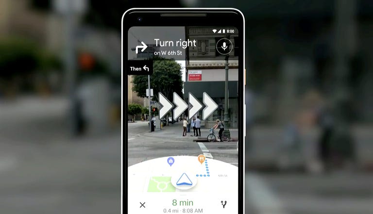
Here's how the new navigation feature works: Enter an address or business into Google maps, go to the walking directions mode, and tap on a button to start the AR functions. (Augmented reality, or AR, overlays digital images onto what you'd normally see through a smartphone camera. Think Pokemon Go or dog ear filters on Instagram.)
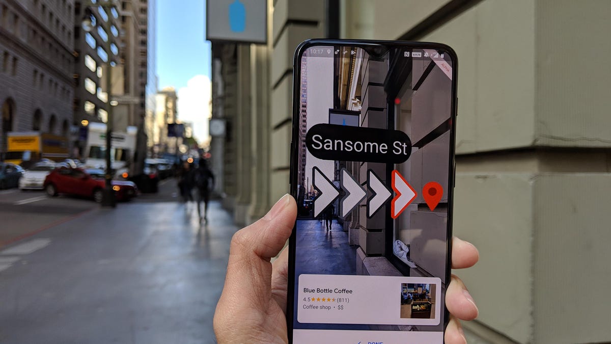
From there, if you hold your phone in front of you, you'll see a camera view at the top of the screen and a traditional map at the bottom. When you approach a turn, the phone will vibrate and there will be arrows on the screen to guide your way. The idea isn't to hold your phone in front of you the entire time -- that could be dangerous -- but at only select parts of your route: at the beginning of the trip to orient yourself, to confirm a turn, or to find the entrance of a building. In fact, if you're in AR mode for too long, a warning will pop up on your phone telling you to put it down. When you get to your destination, you'll see a big red pin on the camera screen.
Google invited a group of reporters Monday to try out the feature in San Francisco. We met at Rincon Park, a small patch of grass in the city's SoMa district with sweeping views of the Bay Bridge, not far from one of Google's San Francisco offices. From there, we navigated to a Blue Bottle coffee in the Financial District, a 17-minute walk.
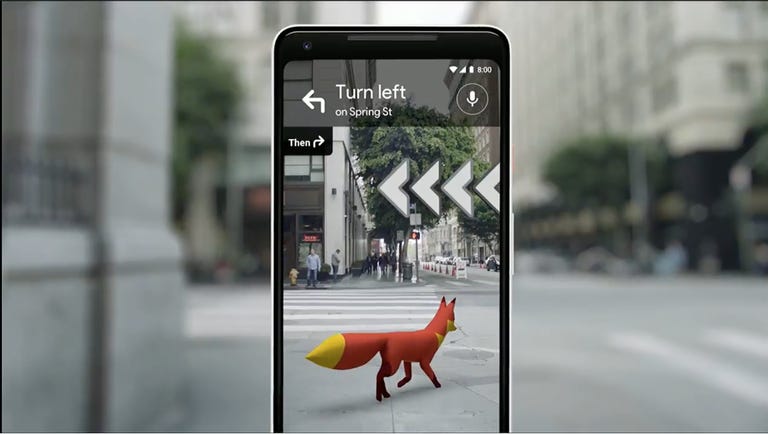
The virtual fox feature isn't being released for testing yet.
The AR directions worked well, though there were some hiccups. At some turns, it took a while for the arrows to pop up on the screen. At one point during a long straightaway, the traditional map at the bottom of the screen was veering left at an angle. As an aside, Kim also noted that the feature sometimes doesn't work as accurately in darkness.
For the feature to work, Google combines GPS data from cell towers and satellites with the information Google already has from its Street View maps.
When Google showed a demo video of the AR directions at the I/O conference in May, the company also showed off a mode where a 3D animated fox guides your way. That feature isn't being released for testing Monday. Kim said one of the reasons for the missing feature was that the cute little fox was maybe too cute, and could be a distraction for people as they hold their phones in front of them.
At the conference, the company also teased that Maps would integrate with Google Lens, the company's visual search tool, to show you information about the businesses around you, again through your phone's camera. But that product is still in prototype stages, Kim said Monday.
First published Feb. 11 at 9:33 a.m. PT.
Update, 12:48 a.m. PT: Adds more information from a live demo.
The Smartest Stuff: Innovators are thinking up new ways to make you, and the things around you, smarter.
Special Reports: CNET's in-depth features in one place.