Google Earth in VR is a beautiful reminder of how small we are (hands-on)
Starting today, it's a free download for the HTC Vive headset.


"I'm like Godzilla!" my wife exclaimed, stomping around the room.
"Ooh, I'm in Italy!" she told me, as Florence's famous cathedral appeared in front of her.
"That's where my mom's from, and that's where my dad's from," she pointed with her wand, as she zoomed across a small portion of the Philippines.
I'd never seen her quite so interested in virtual reality .
Today, Google Earth is coming to VR. It's a free download for the
HTC Vive
headset, and it's a heck of a lot more than just a topographic globe. You can get close enough to fly through cities like Superman, retrace the steps you took during your last vacation, even get an aerial 3D view of your own neighborhood, then grab the sun right out of the sky, spin it around, to see how things look at different times of day or night.
And even though you're flying, you'll probably never feel sick. It's extremely comfortable, which Google engineering lead Dominik Kaeser chalks up to how Google Earth VR makes sure your feet always feel like they're touching the ground.

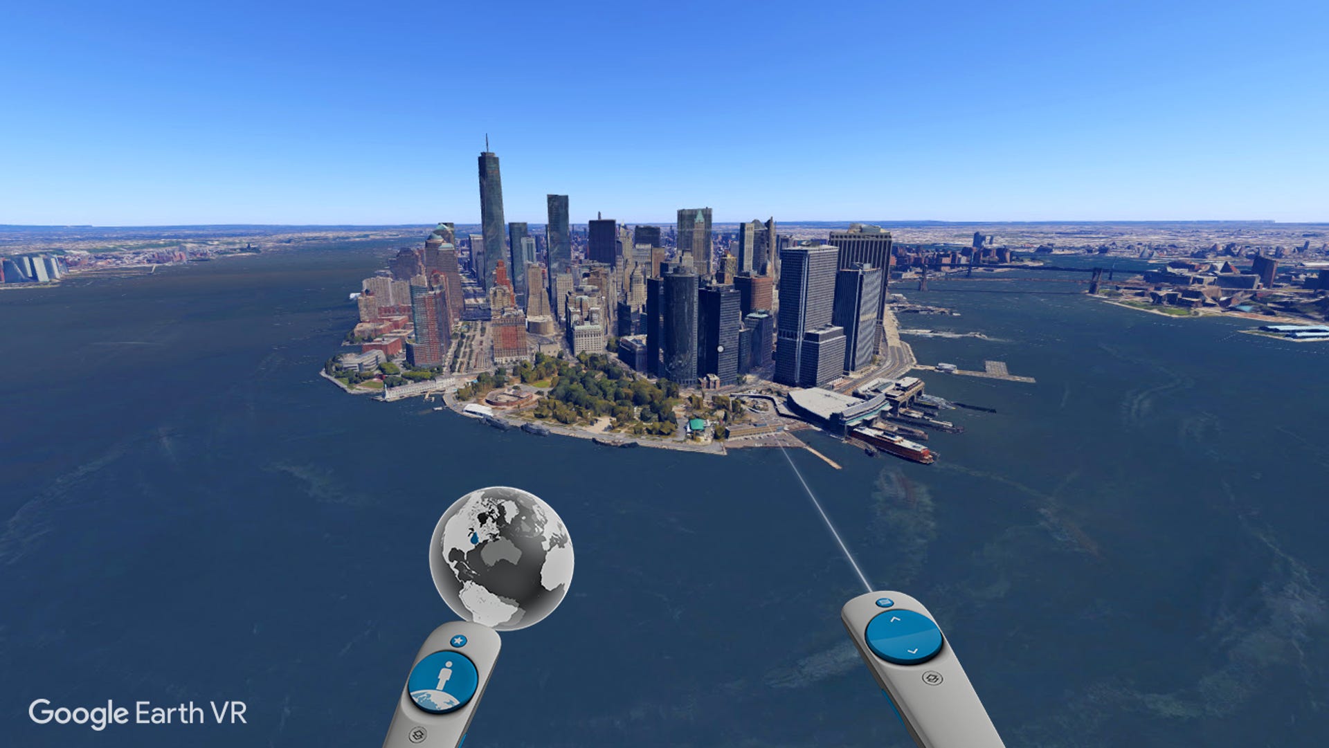
Google Earth VR.
How good it looks depends on how much data Google has collected, though. Google Earth VR hasn't created the world from scratch -- it's using the same blend of satellite, aerial and Street View images as the original Google Earth, just now in a far more immersive experience with way better controls. (Just press the clearly labeled buttons -- you can see the labels in VR! -- and point where you want to go.)
Unfortunately, that means that just like regular Google Earth, there are plenty of places that don't look so hot. Example: London is an architectural 3D marvel in Google Earth, well worth your time, but just 20 miles west, Windsor Castle is just a hill with some rocks painted on top.
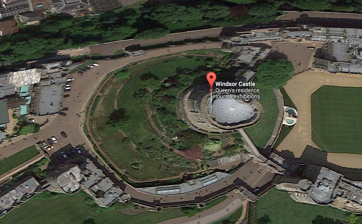
This doesn't look much different in Google Earth VR.
While my hometown of San Jose, CA and my alma mater UC Santa Barbara are recognizable (if rough) 3D, like an old The Sims video game, even the capital of the Philippines is a flat 2D image right now. "It's kind of lame," says my wife. Perhaps because of that, Google includes a number of suggested destinations and premade tours filled with highlights.
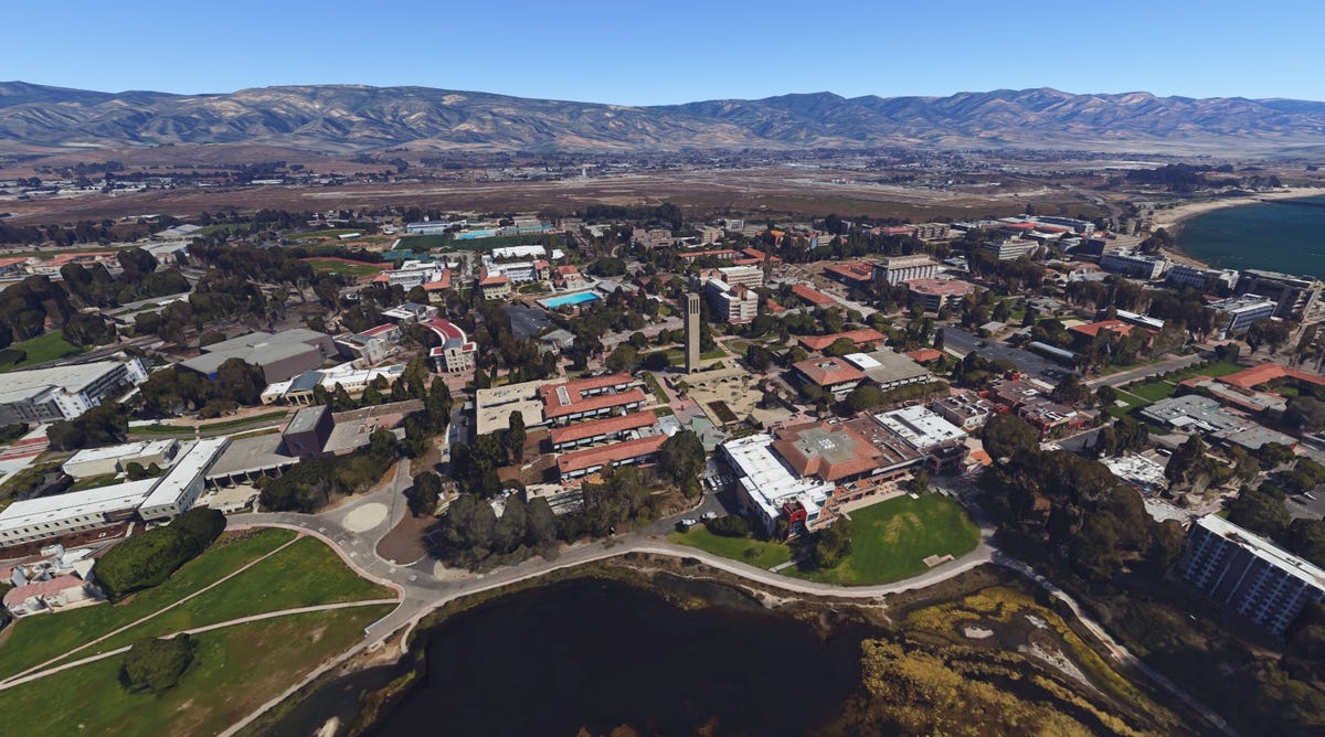

UC Santa Barbara, as seen in Google Earth VR.
There's also no search feature yet -- though I'm almost glad, because one of the most stunning things about zooming through Earth VR is the sheer sense of scale. My wife and I didn't appreciate just how huge Tokyo and Paris are, just how much we must have missed in person, until we struggled to find the places we'd been. When you do find something beautiful outside of a big city, there's a real sense of discovery that comes along with it.
Like many of Google's coolest things, Google Earth VR started as a 20 percent project, and it's been slowly moving forward ever since the first Oculus Rift development kit came out in 2013. Kaeser says it's a Vive-exclusive to start, though they're also looking at other platforms (like Google's Daydream) as well.
Next, says Product Manager Mike Podwal, is more data, more tie-ins to other Google products, more layers on top. He says Google wants this to be "a really rich geospacial way to learn about the world." We spitball about how awesome it would be if you could see, say, the impact of climate change, population density, or even just changes in your own neighborhood using VR.
For now, Google Earth VR is neat, and it's free. You can download it from the Steam Store.