NASA watches wild polar vortex from space
These satellite images will make you shiver.


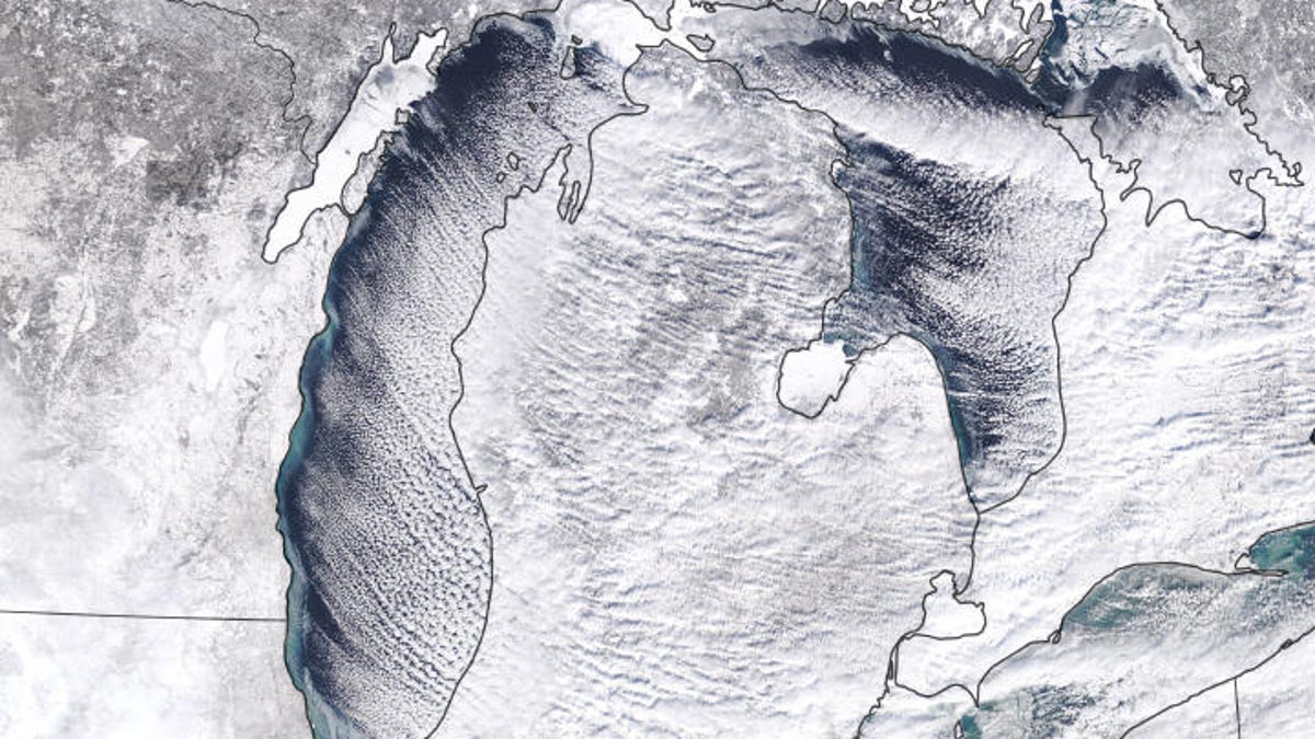
This natural-color view from NASA's Terra satellite shows the Great Lakes region on Sunday.
While people down on Earth are freezing their tushies off as a polar vortex sweeps across parts of the US, NASA's eyes in the sky are looking down from the cold environs of space. The space agency posted a Wednesday update with a view from its Terra satellite.
The Terra image on Sunday showed "cloud streets," long stripes of cumulus clouds, and snow reaching across the Great Lakes.
NASA also shared a look at the cold air mass reaching down into the northern US as envisioned with data run through the GEOS-5 global atmospheric model.
"Measurements of temperature, moisture, wind speeds and directions, and other conditions are compiled from NASA satellites and other sources, and then added to the model to closely simulate observed reality," says NASA.
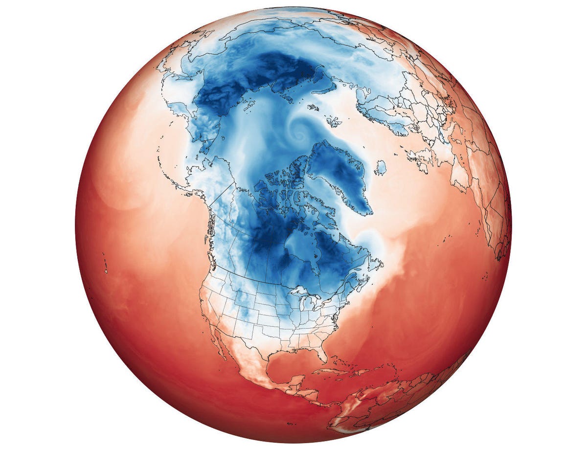
This map shows a modeled view of the polar vortex.
The US National Oceanic and Atmospheric Administration tweeted a dramatic look at the Great Lakes on Wednesday. The time-lapse sequence shows a white veil forming over the area as the cold Arctic air mass surges south.
#GOESEast spotted snow on the ground as the sun rose on what will be a bitterly cold day across much of the U.S. A cold Arctic air mass is surging south into the upper Midwest before spreading across much of the eastern two-thirds of the country. More: https://t.co/vBfvFRrnHF pic.twitter.com/rwoTjV5vX6
— NOAA Satellites (@NOAASatellites) January 30, 2019
The frigid weather is triggering closures, flight cancellations and at least six weather-related deaths so far. "It'll be colder in Chicago that it is in parts of the Arctic Circle. Even the South Pole is expected to be warmer than parts of the US," says CBS News.