OneMap Alliance will create one super HD map to rule them all
The mapping consortium is pushing to have the world mapped in HD by 2020, a lofty goal indeed.


One of the most significant hurdles that self-driving car development needs to clear is the relative lack of ultra-detailed high-definition mapping data for public roads. Right now, the effort to create this data is being undertaken by autonomous car developers themselves as well as by a whole host of mapping companies, but OneMap Alliance wants to change that by banding together, pooling resources and creating global HD maps by 2020.
If 2020 sounds like a crazy-ambitious goal, it is. Especially when you consider how limited the mapping data currently available is, with it mostly being confined to major cities. OneMap Alliance (in addition to sounding like a third-rate Star Trek villain) will use the resources of its multinational constituent mapping companies to adopt one mapping standard and make that data available for purchase by developers.
OneMap Alliance is made up of Here Technologies – a company formerly owned by Nokia but now owned by a consortium led by Audi , BMW, and Daimler – together with NavInfo of China, Increment P/Pioneer of Japan, and SK Telecom of Korea. If most of these companies don't sound familiar, don't feel bad. They're pretty deep cuts.
"By sourcing from the OneMap Alliance partners, automakers get to leverage a map that is fully harmonized across regions, offering the same high quality for their vehicles in the US as it does in Europe and Asia," said Ralf Herrtwich, senior vice president of services at Here Technologies. "This simplified way of sourcing the map will also help reduce automakers' development time and unnecessary costs."
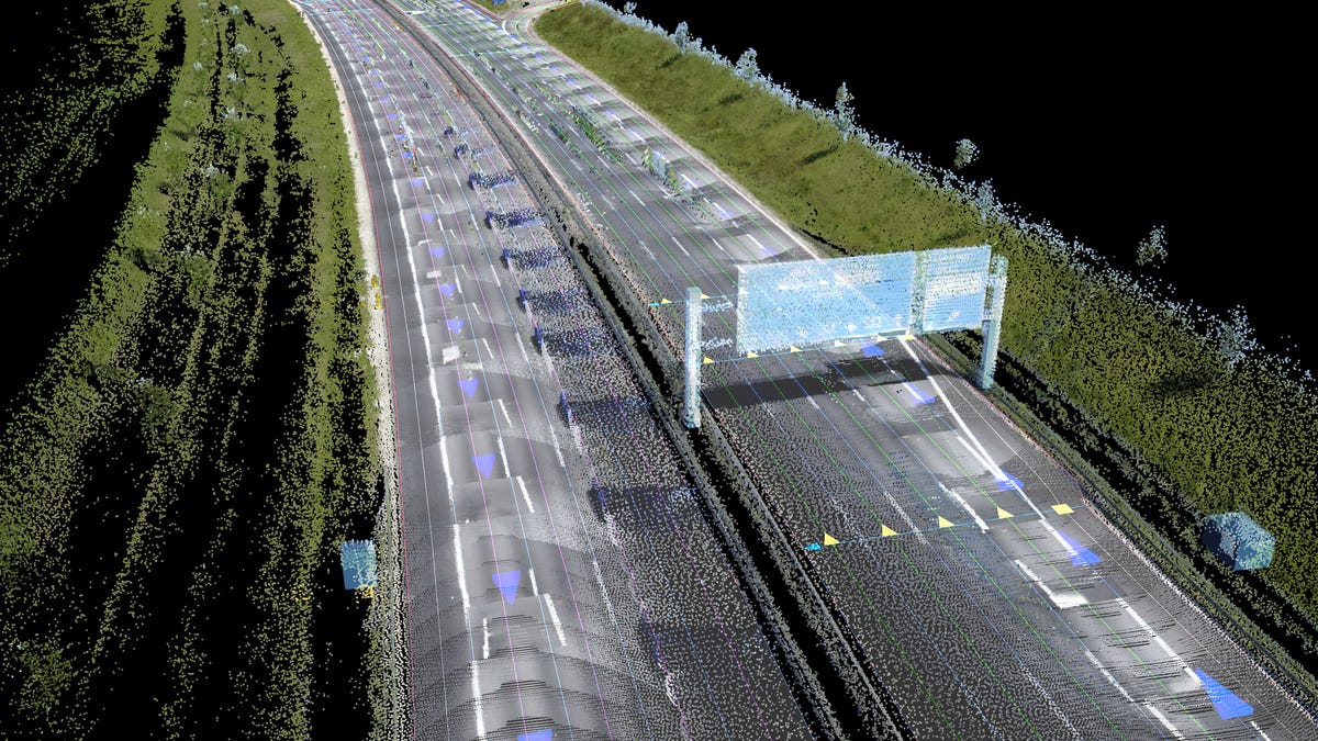
So what exactly does this "HD map" include that your basic Google Maps or Waze doesn't? A lot, actually; specifically they give three-dimensional details on road gradients and hyper-accurate mapping of road markings (turn lanes, bike lanes, bus lanes, etc.). Think of them like those crazy accurate sea-floor maps from The Hunt for Red October that let Sean Connery play fast and loose with his giant, silent submarine.
One of the most challenging aspects of these maps is the fact that the details aren't static and keeping things up-to-date, like road constructions, requires near-constant updates. One bonus of having a single mapping standard like the one that OneMap Alliance proposes is that all of the cars driving using its HD maps could refresh the data continually, the result of which is what OneMap calls a "self-healing map."
Kinda wild, don't you think?