Google redesigns Maps app, adds details on public transit safety, accessibility
The search giant made the announcements to coincide with the app's 15th birthday.


Google Maps is 15 years old and celebrating.
Google on Thursday unveiled a redesigned version of its Maps app, with new features that tell people how cold or warm a train might be, or what local events are going on nearby. The company announced the news to coincide with Google Maps' 15th birthday.
The new feature for "transit attributes" gives people information on the conditions on public transit based on details shared by past riders. For example, people can see if there's a security officer on board or if there's an accessibility entrance or seating. In regions where trains have designated women's cars, the app will let people know whether or not passengers abide by that rule.
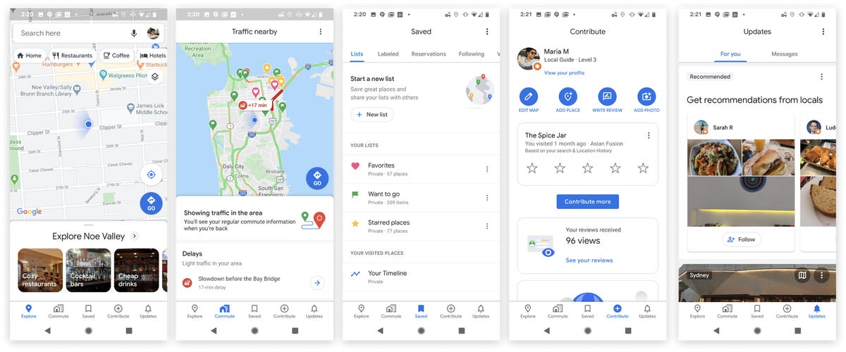
The app redesign will have five tabs at the bottom of the screen.
The updated app will have five tabs along the bottom of the screen: Explore, Commute, Saved, Contribute and Updates. With the Contribute tab, people can give Google local information, like traffic conditions (or details that would help fill in the new "transit attributes" feature). The Update tab is a feed of trending places from local travel guides or publishers like The Infatuation.
The new Google Maps icon.
Along with the redesign, the app is also getting a new logo and icon. It will be a mapping pin in Google's signature colors.
"When we set out to map the world, we knew it would be a challenge," Jen Fitzpatrick, senior vice president of Google Maps, wrote in a blog post. "But 15 years in, I'm still in awe of what a gargantuan task it is."
In the last few years, Google has tried to build out Maps a hub of information, rather than simply a navigation tool. Over the past couple of months, Google has added translation features, food delivery options and information on flight information and hotel bookings.
Google's mapping efforts have come a long way. In December, Google announced that Maps has captured more than 10 million miles of Street View imagery. The distance, Google said, would amount to circling the Earth more than 400 times. The company also said Google Earth, the search giant's aerial mapping service, has a total of 36 million square-miles of satellite imagery for people to browse. With that collection, Google has mapped out the parts of the world where 98% of people live.
Last year, Google began testing a tool called Live View, which uses augmented reality -- overlaying digital graphics on top of real-world images -- to spruce up walking directions on the app. Live View is designed to solve the "blue dot problem," the familiar feeling of getting out of a subway station, looking down at the blue dot on the Maps app and spinning in circles to find your bearings. Live View uses your phone's camera to display arrows that tell you where to go.
Google said Thursday it will expand the rollout of Live View "in coming months" and test new features for the tool. For example, when people search for a place they'll be able to see how far away it is from where they're standing.