Chicago maps its underground maze
The Windy City’s smart city efforts include scanning its vast network of pipes. Mayor Rahm Emanuel sees an opportunity to focus on the future.


This is part of our Road Trip 2017 summer series "The Smartest Stuff," about how innovators are thinking up new ways to make you — and the world around you — smarter.
James Jackson has a problem: He doesn't know what he's getting into.
Every time a construction crew begins digging in Chicago, there's a chance they'll hit something they didn't know was there. It might be an old water line, abandoned long ago and forgotten. Or perhaps a gas pipe, still in use but poorly documented.
Sure, his utility maintenance and construction firm, HBK Engineering, always talks to the city, and gathers blueprints and collects maps of underground pipes wherever they're about to work. But the crews can never be certain.
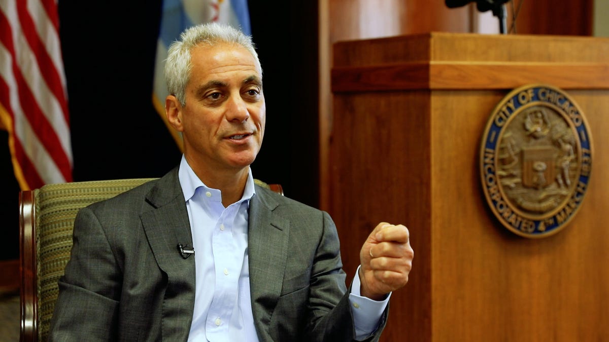
Chicago Mayor Rahm Emanuel on balancing spending: "You have to make some choices. You can't do it all. Where is it that you have the maximum impact?"
In Chicago, incorporated in 1837, the underground network of pipes is so complex, and the records are so outdated and incomplete, the city has created an Office of Underground Coordination. Its job is to pore over dozens of old maps to try to identify what's underneath a construction site before a crew digs.
And when crews do find something unexpected, they have to stop what they're doing and call the city, which brings in a specialist to see if the pipe is being used. The crew then has to get approval to take it out so they can start work again.
"That's just delaying time," says Jackson, a senior vice president at HBK.
Now the solution may rest with the phone in his pocket, and a computer program the city helped develop that creates a digital blueprint of Chicago's underground pipeline network of sewer, water, electricity, gas, broadband and other services from about 30 companies and utilities.
The mapping project is just one of dozens of smart city initiatives happening around the world. Places like Barcelona, Singapore, San Diego and Sicily are exploring projects or coordinating citywide efforts that, for instance, allow their residents to automatically report potholes, find and reserve parking spots, monitor air quality and even answer the all-important question: When will a snowplow clear my street?
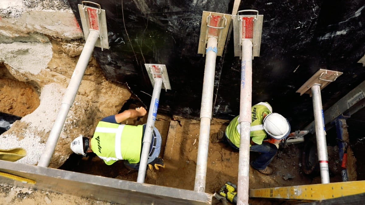
Construction crews in Chicago never really know what they're going to find when they dig under the city's downtown. It could be an abandoned pipe or an important, but poorly documented, power conduit.
In Chicago, many of these efforts are being created through $320 million public-private partnership called UI Labs ("University + Industry"). Based on Goose Island on the north end of the Chicago River, UI Labs aims to "address problems too big for any one organization to solve on its own," according to its website. That includes the 3D map of Chicago's underground infrastructure, launched last October.
Chicago has other projects underway as well. One standout: finding ways to combat rats. The city, which has historically received more complaints about rodents than any other major metro area in the US, saw rat complaints surge 70 percent in the first three months of 2016. Now it's using computer analyses to predict where rats will be, based on reports of overflowing garbage and planned water and sewer pipe repairs, which tend to bring the long-tailed pests into the open.
The city also has a website where people can see the real-time locations of snowplows after a blizzard (a big deal, given the average snowfall in Chicago is 37.6 inches). And starting next month, Chicago will begin replacing its 270,000 street lamps with LEDs, saving electricity costs and, eventually, connecting to a system that will dim the bulbs as the sun comes out.
While the projects are largely disconnected from each other, they all aim to make Chicago a much smarter city to live and work in.
"My whole thing is to allow us not just to use data to be better at what we do, although that's what it is, but also to continue to give people a chance to interact and interface with their government," Chicago Mayor Rahm Emanuel, former chief of staff for President Barack Obama, tells me when we sit down together at Chicago's City Hall.
"You have to think of this in my position, not yours," he adds. "How do you make it — when talking about it —relevant to people? Not threatening, but welcoming?"
Subterranean blues
Take that underground map, for example, a pilot project that involves HBK; an image analysis startup called Reconstruct; and software maker Cityzenith.
The mapping process starts after a construction crew digs into the ground and replaces a pipe, installs a new one or fixes a broken one. That's when a crew member pulls out a phone and — circling the perimeter, first in one direction and then the other — records a video of the visible pipes.
The video is shot at street level because there's always a danger the excavation could collapse. The team uses video instead of a series of photos because it provides enough frames for the next stage of the process handled by Reconstruct, a year-old startup founded by a University of Illinois assistant professor. There, computers use a technique called point clouds to analyze each frame. Think of it as using the computer to scan each pipe from every angle it sees, then converting that information into a digital drawing.
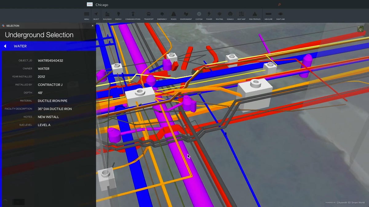
So far it's taken about two weeks to produce a 3D model of the construction site, whose files can be read by a variety of programs used by engineers and architects. That includes a project UI Labs has been testing called 5D Smart World, from Cityzenith, which creates a Google Maps-like model of the city's underground infrastructure.
Chicago has just begun what will likely be a five-year effort to map the underground pipeline network of sewer, water, electricity, gas, broadband and other services in its downtown area.
At a bird's eye view, Smart World displays a gray 3D representation of the city's buildings. But zoom in, beyond the buildings, and a network of pipes appears beneath the streets. Each pipe is color coded as well, showing its route and what it's connected to throughout the city.
UI Labs says being able to see where pipes are, what they do and how they're interconnected in one place could replace Chicago's paper maps. Just as useful, such a digital map can be updated with each new scan of a construction site.
"Ultimately what we want is a three-dimensional understanding of the underground facilities or network of utilities underneath the pavement," says Jackson. "Then they can anticipate or know where the electrical power is so they don't hit or damage it and wind up causing an outage."
Cityzenith's program, still in pilot phase, has also been used in Amsterdam, Barcelona, Dubai and San Francisco. UI Labs expects to have a completed underground map of downtown Chicago within the next five years.
In the meantime, UI Labs believes these new digital maps will help cut the overall time of a construction project by four to 14 months. That includes reducing Chicago's average 30-day wait for building permits, says Katie Olson, program director for the project.
'Da Mayor'
The mapping effort may seem trivial in a city like Chicago, which struggles with alarming homicide rates and budget shortfalls that have led to hikes on everything from property taxes to water and sewer bills, and even phone fees that fund 911.
But the payoff could be big, reducing costly accidents, street closures and construction delays.
"You have to make some choices. You can't do it all," Emanuel says. "Where is it that you have the maximum impact?"
Here's what else Emanuel had to say about governments, tech and smart cities. His comments have been edited for length and clarity.
On making technology investments:
Governments have two gears: first and fifth. We either do too little too late or too much too soon. And we don't have a sense of nuance. We're not really built for dealing with individual residents. We do it en masse.
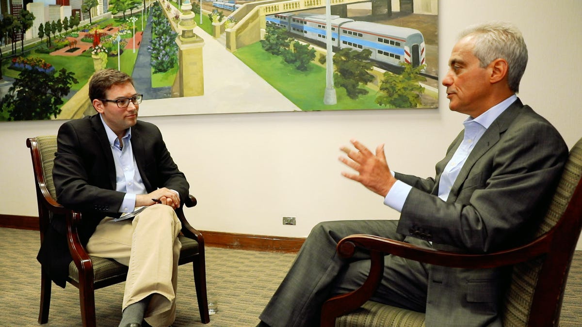
Mayor Emanuel meets with CNET Executive Editor Ian Sherr to talk about his vision for making Chicago a smart city.
You have to think of this in my position, not yours. How do you make it — when talking about it —relevant to people? Not threatening, but welcoming? And that's what we're working on.
On smart city projects:
Governments have a huge amount of data. In the private sector, they are using this data to be much more sophisticated about how they deliver services or sell products.
Government is not in the business of selling. It's in the business of delivering or doing something for its residents as a representative form of government.
On his first smart city success:
My first year here, I put a snowplow tracker on every truck in Chicago. It was a big cultural shift in the department. Like, "Why would we do that?"
I said, "So people could tell where the snowplow is. So we could share [information] with the public."
It was like a mind shift. We're in the business of being public servants.
Then the thing was to not only put it so you could track the truck, but you could track where it was going on the street. Was it headed towards your street? Whose street got plowed first?
Click here to see more Road Trip adventures.
On his vision of what a smart city can do:
I want to see a time when we're communicating to parents early in their child's life. "Have you taken them to the museum? Have you played music?"
All the things that should be done as a reminder — helping parents be good parents and suggesting types of things that they could do that would dramatically improve their child's brain.
In the same way, you could do it as people get older. One of the big challenges is reminding many people to take their medicine.
So using the 311 system in telecommunications in a much more interactive basis, more from a communication and message directly to the end user. And leveraging the technology they have already, of course.
Road Trip 2016: Reporters' dispatches from the field on tech's role in the global refugee crisis.
Road Trip 2015: CNET hunts for innovation outside the Silicon Valley bubble.