Where to go for fried chicken in North Korea
Google Earth interactive site provides detailed look into North Korea.
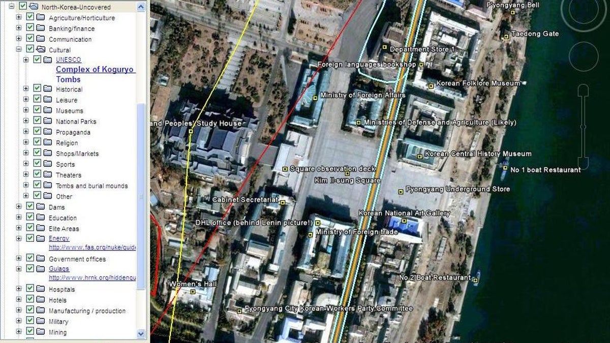
A Google Earth interactive Web site called North Korea Economy Watch not only sheds light on that country's economic, military, and cultural infrastructure, but also maps some of its darkest secrets.
The site is intended as a resource for business, policy makers, academics, journalists and others interested in the North Korean economy, according to founding editor Curtis Melvin. Academic in nature, it shies away from editorializing on hot potatoes issues like the manufacturing of nuclear weapons, and starving peasants.
But it's all there for viewers to form their own conclusions. Palatial mansions and vast compounds for Kim Jong Il and other honchos that include pool complexes and even a waterslide, contrast unfavorable with the austerity of the rest of the country.
Locations of interest run the gamut from anti-aircraft emplacements, military bases, nuclear facilities and prison camps ("The Barn' where the USS Pueblo crew were kept) to restaurants (Pyongyang Fried Chicken Restaurant) and items on dating and courting (defectors claim that prostitution is on the rise).
It also shows what is believed to be the mass graves of some of the estimated two million people who starved in the 1995-98 famine.
The site combines the founding editor's own painstaking research with material from independent contributors to deliver what some are calling one of the "most comprehensive mappings of North Korea that publicly exists today." For example, Melvin told the Wall Steet Journal that he spent hours in front of a computer screen just tracing power lines and looking for telltale shadows of electric towers in order to detail the country's electrical grid.
All posts are attributed to allow peer verification and reference, according to Melvin.