See Record-Breaking Hurricane Agatha Swirl in Intense Space Views
Weather-tracking satellites watched as the first hurricane of the season made landfall in Mexico.


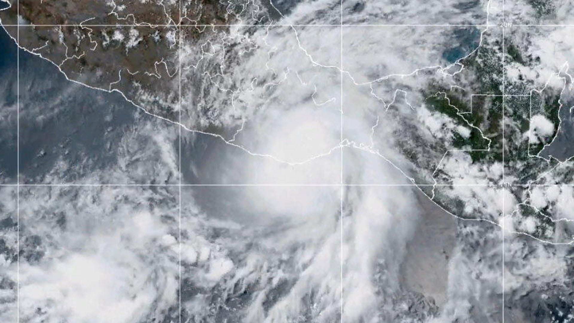
Hurricane season is off to a strong start in the eastern Pacific as Hurricane Agatha made landfall on the southern coast of Mexico on Monday. The storm brought heavy rainfall and the chance for flash floods and mudslides as its remnants moved inland on Tuesday.
Agatha generated 105 mph (169 kph) winds, making it a Category 2 hurricane when it came to ground near the town of Puerto Angel. "Since record keeping began in 1949, this is the strongest hurricane to make landfall in May along the Pacific coast of Mexico," the National Hurricane Center tweeted along with a video of a satellite view of the swirling storm.
4pm CDT 30 May - #Hurricane #Agatha has made landfall just west of Puerto Angel, Mexico, with maximum sustained winds of 105 mph.
— NHC Eastern Pacific (@NHC_Pacific) May 30, 2022
Since record keeping began in 1949, this is the strongest hurricane to make landfall in May along the Pacific coast of Mexico. pic.twitter.com/dUraseRoDe
The NHC cautions that a Category 2 storm can cause extensive damage to homes and trees and can trigger major power outages. Agatha was downgraded to a tropical storm after reaching land.
The National Oceanic and Atmospheric Administration shared another look at Agatha from its GOES-East weather satellite. The closer view highlights the wild cloud patterns in the hurricane.
In this visible imagery, #GOESEast watched #HurricaneAgatha make landfall yesterday near the town of Puerto Angel, Mexico.
— NOAA Satellites (@NOAASatellites) May 31, 2022
The first #hurricane of the season, #Agatha was the strongest May hurricane (winds 105 mph) on record to make landfall on the Pacific coast of Mexico. pic.twitter.com/R3B3o9bLZV
NOAA predicted a below-normal hurricane season for 2022 in the eastern Pacific Ocean. The prediction calls for between four and eight hurricanes. The season runs from May 15 to Nov. 30.
While the Pacific may be a little quieter than usual this year, NOAA expects the Atlantic hurricane season to be more active than normal, a trend that is now entering its seventh year.
Satellites are keeping a close eye on storm developments across the globe amid growing concerns about the connection between climate change and more extreme hurricanes. That makes space views all the more critical when it comes to tracking hurricanes and issuing warnings to communities in the path of destructive storms.