New NOAA Weather Satellite Delivers Its First Stunning Views of Earth
Hello, beautiful.


Storms, volcanic eruptions, wildfires, clouds. The National Oceanic and Atmospheric Administration's new GOES-18 satellite will witness them all, helping us to better forecast and understand weather , climate issues and natural disasters. NASA launched the satellite, which was originally known as GOES-T, on March 1 and it's now sending back eye-opening views of Earth.
NOAA shared the satellite's first imagery on Wednesday. A video tour shows off glorious Earth shots and intense footage of storms, dust and wildfires.
GOES-18 is a geostationary satellite, so it stays in an orbital path 22,236 miles (35,800 kilometers) above the equator that lets it continuously view the Western Hemisphere, tracking the same expanse of Earth at all times. "We're getting 30 times the data down on this satellite as they did on the previous satellites," says GOES-T's deputy program manager, Alreen Knaub. "We're doing space weather, sun weather and Earth weather."
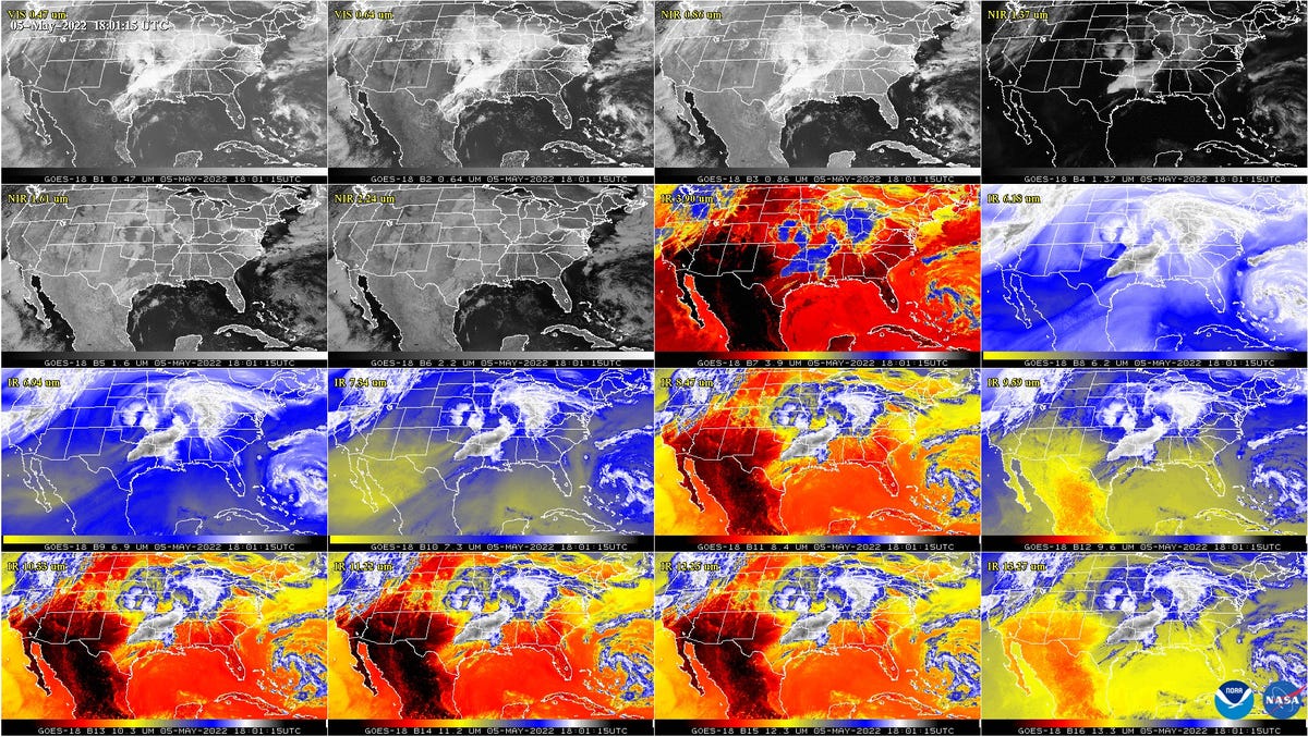

The GOES-18's Advanced Baseline Imager (ABI) instrument delivered these views of the US in different wavelengths.
The new images show the satellite is operating as expected. "GOES-18 is currently undergoing post-launch testing, validation and calibration of its instruments and systems to prepare it for operations," said NOAA in a statement. If all goes well, the satellite will earn a new name, GOES West, in early 2023 as it takes over for the incumbent GOES-17 satellite, which has faced technical challenges.
GOES-18 will become a crucial tool for weather forecasting and the tracking of storms and disasters down below. Its images of our blue marble can also serve as a reminder that we live on an island -- a place both beautiful and fragile -- in space .