NASA spots angry lava fissures from Hawaii volcano
A NASA satellite got a good look as the Kilauea volcano in Hawaii spread its fury through a system of hot fissures.


You've seen the startling images of the ash plume from the recent eruption of the Kilauea Volcano in Hawaii. You may have also seen the close-up views of cracks forming in the ground. Now NASA has given us a compelling look at the volcano's impact as seen from space.
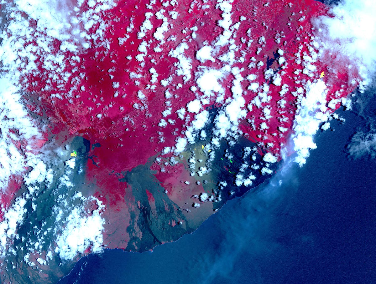
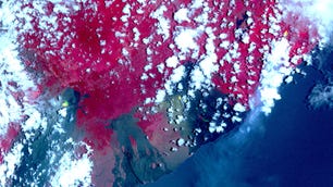
A NASA satellite captured this view of volcanic fissures in Hawaii.
NASA's Terra satellite took a look at the hot fissures on May 6. The satellite's ASTER camera sees in thermal infrared, which is why vegetation appears red in this image. Older lava flows are black and gray and the bright yellow spots superimposed on the satellite view show fresh cracks and flowing lava.
The volcano's eruption on May 3 sparked lava flows, opened fissures, destroyed structures and forced evacuations of people living within the lava zone.
The United States Geological Survey has been posting photos of ground cracks to social media as it tracks the formation of new fissures.
HVO geologists examine ground cracks on/near Highway 130, near Leilani Estates Subdivision. One crack widened about 1.6 inches in 24 hours. https://t.co/ozLPaxQZSm pic.twitter.com/mMb32ewfRN
— USGS Volcanoes🌋 (@USGSVolcanoes) May 9, 2018
Terra is an Earth-observing satellite the size of a small school bus. It launched in 1999 and helps NASA monitor the planet's atmosphere, weather, climate and surface features, including volcanic activity.
Terra previously gave us a sobering look at the destruction caused by a series of severe wildfires in California's wine country in late 2017.