NASA reveals Opportunity rover's final path across Mars
The Mars rover's final traverse map shows a journey worth remembering.


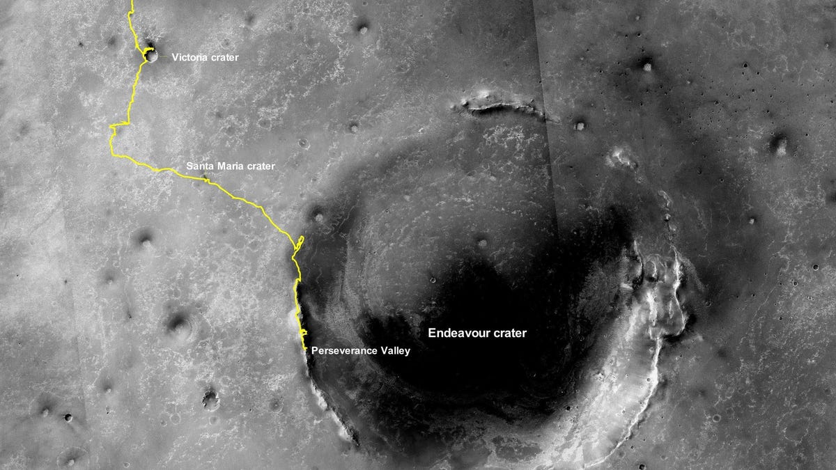
Opportunity's travels on Mars are collected in this traverse map.
It still stings. NASA declared the official death of the beloved Opportunity rover in February, but the postmortem of the mission isn't done yet. The space agency shared the rover's final track across dusty, rocky Mars on Monday.
The traverse map is made up of images from above captured by the Mars Reconnaissance Orbiter. The yellow line traces Opportunity's adventure from where it landed in Eagle Crater in 2004 all the way toward the rim of the imposing Endeavour Crater.
The map labels some of Opportunity's sightseeing stops along the way, including the Victoria and Santa Maria craters. The rover covered 28.06 miles (45.16 kilometers) during its nearly 15-year-long mission. For comparison, NASA's still-functioning Curiosity rover has traveled 12.7 miles (20.4 kilometers) since touching down in 2012.
Opportunity's remains still sit in Perseverance Valley where the rover was engulfed in a massive dust storm that blotted out its solar panels. It last made contact on June 10, 2018.
The yellow line on the traverse map is now set in stone, but it stands as a testament to a remarkable mission.