Hurricane Laura and its 'unsurvivable storm surge' loom in space views
Satellites and NASA astronauts are tracking the monster storm as it flashes lightning and heads for Texas and Louisiana.


Hurricane Laura is dangerous, and it's moving in fast. Satellites and the crew of the International Space Station have been following the monster storm's development and are now tracking its movement toward land.
Widespread flash flooding and catastrophic wind damage will strike parts of Louisiana and Texas this week as the intensifying storm makes landfall. The National Hurricane Center (NHC) expects Laura to become a formidable category 4 hurricane -- with maximum sustained winds of at least 130 mph -- by the time it reaches the US coast.
One of the most eye-opening views of the storm comes from the Cooperative Institute for Research in the Atmosphere (CIRA) at Colorado State University. CIRA tweeted a satellite GIF on Wednesday showing lightning flashing in Laura's outer bands.
Lightning flashes within the outer bands of Hurricane Laura. pic.twitter.com/2dldh4HRPC
— CIRA (@CIRA_CSU) August 26, 2020
CIRA is making real-time Hurricane Laura imagery from the GOES-16 satellite available through its website.
The NHC issued a stark warning on Wednesday, saying "unsurvivable storm surge with large and destructive waves will cause catastrophic damage from Sea Rim State Park, Texas, to Intracoastal City, Louisiana, including Calcasieu and Sabine Lakes."
Unsurvivable storm surge with large and destructive waves will cause catastrophic damage from Sea Rim State Park, Texas, to Intracoastal City, Louisiana, including Calcasieu and Sabine Lakes. This surge could penetrate up to 30 miles inland from the immediate coastline. #Laura pic.twitter.com/bV4jzT3Chd
— National Hurricane Center (@NHC_Atlantic) August 26, 2020
The surge could reach 30 miles (48 kilometers) inland. The NHC said surge-related flooding could be extremely variable depending on timing and tidal cycles.
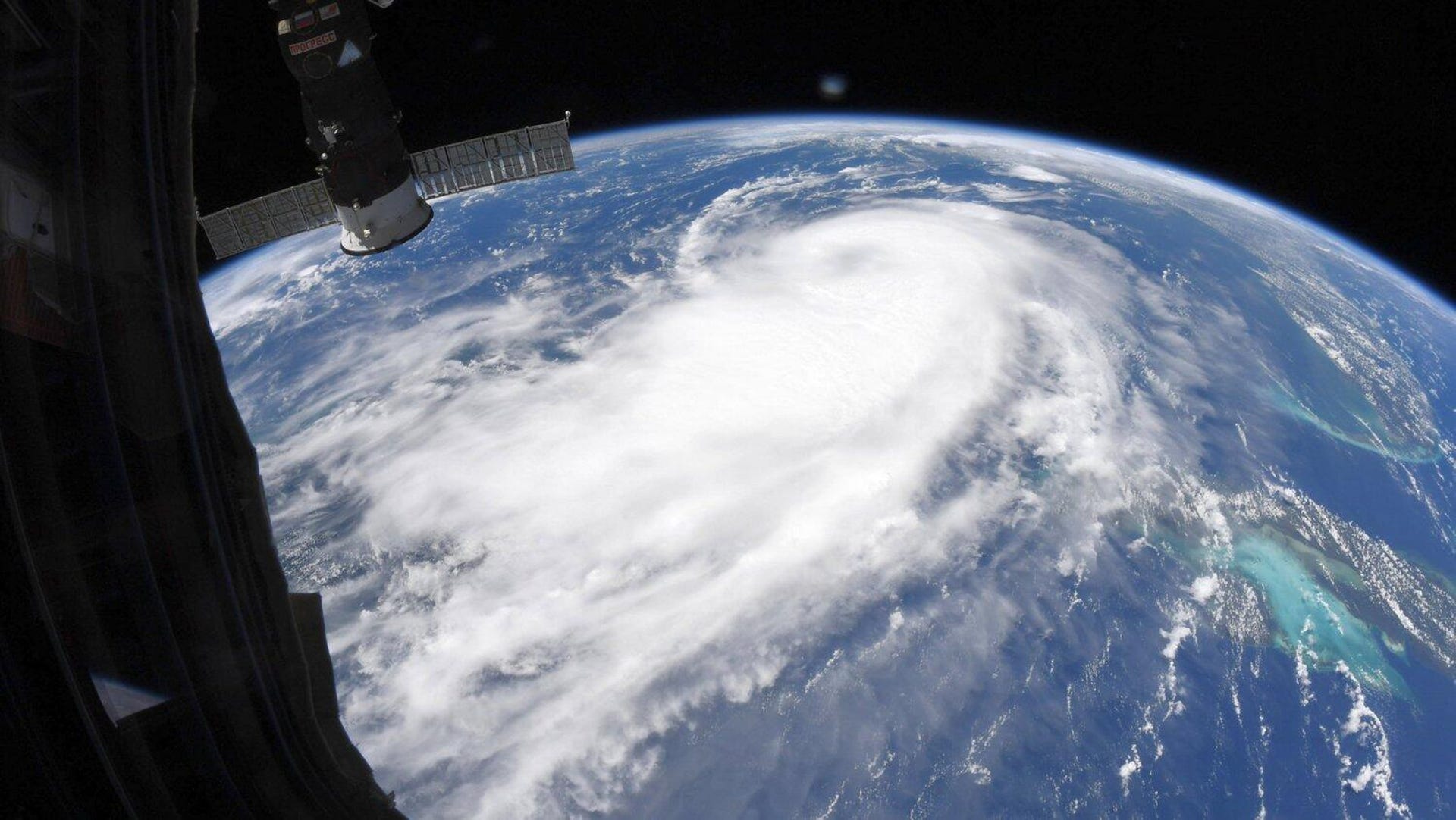
NASA astronaut Chris Cassidy shared photos taken from the International Space Station. They show the large span of the hurricane. As of Wednesday, it was projecting tropical-storm-force winds outward for up to 175 miles (280 kilometers).
Hurricane Laura pic.twitter.com/zVd2HracH7
— Chris Cassidy (@Astro_SEAL) August 25, 2020
NASA released a different sort of view of the storm in the form of a full-disk image of Earth taken by the agency's EPIC Camera on Aug. 25 from the vantage point of NOAA's Dscovr satellite. The hurricane stands out among the cloud patterns crossing the planet.

The EPIC camera delivers full-disk images of the planet. This view shows Hurricane Laura in the Gulf of Mexico on Aug. 25, 2020.
Hundreds of thousands of people in the storm's path have been ordered to evacuate. For the latest on the storm forecasts, visit NOAA's Hurricane Laura information page.
As the NHC said in a Wednesday update: "Actions to protect life and property need to be rushed to completion."