Hurricane Larry seen from the ISS 'looks much larger than Ida'
A NASA astronaut captured a stunning view of the big storm churning in the Atlantic Ocean.


Parts of the US are still recovering from the devastation of Hurricane Ida, which made landfall over a week ago, knocking out power to over a million customers and temporarily reversing the flow of the Mississippi River. Another hurricane is roaming across the Atlantic, and it looks striking from space.
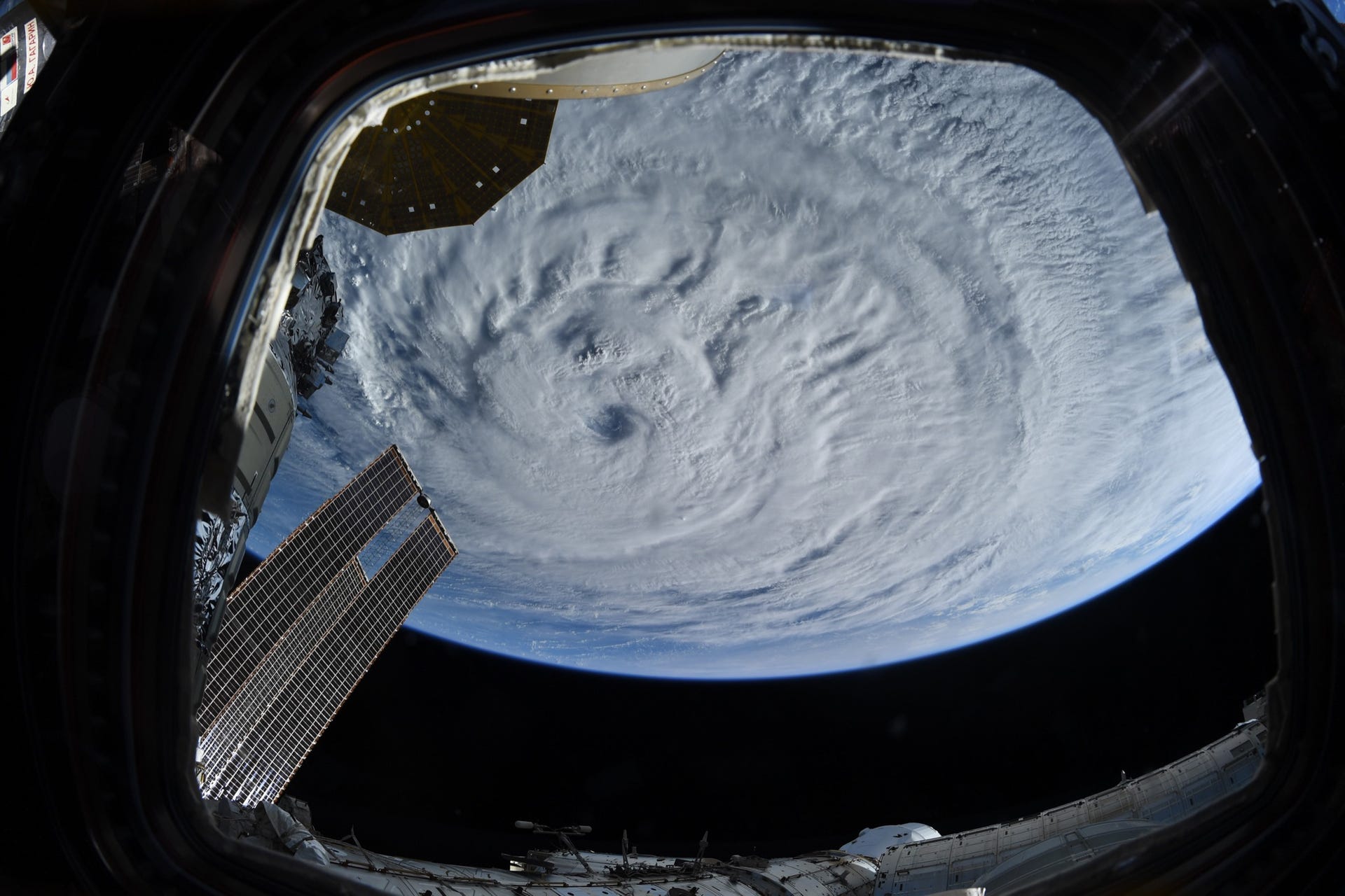
NASA astronaut Meghan McArthur shared a photo on Tuesday of Hurricane Larry as seen from the International Space Station. "From out viewpoint on the space station, it looks much larger than Ida," McArthur tweeted.
Hurricane Larry update from this morning. From our viewpoint on @Space_Station, it looks much larger than Ida. pic.twitter.com/GtGiZK8AEU
— Megan McArthur (@Astro_Megan) September 7, 2021
Parts of the ISS exterior, including solar arrays, can be seen in the image. The large hurricane seems to fill the entire view of Earth below.
The National Hurricane Center is warning that Hurricane Larry is expected send powerful swells toward the Atlantic coast. Swells are expected to peak across the Bahamas on Wednesday and across Florida and the southeastern US through the end of the week.
Powerful swell from #Larry spreading toward the Atlantic coasts today. Buoy observations listed show SWH and swell period. Swell will peak across Bahamas this afternoon and tonight, across Florida and SE U.S. Thu night and Fri, and across the mid Atlantic coasts Fri. #marinewx pic.twitter.com/lgdk5THlwX
— NHC_TAFB (@NHC_TAFB) September 8, 2021
The ocean swells generated by Larry could create what the NHC calls "life-threatening surf and rip current conditions." Current projections of Larry's path show it heading northeast, skirting the US coast and passing near Newfoundland in Canada.
The National Oceanic and Atmospheric Administration gave us another perspective on the huge storm with a satellite time lapse highlighting its large eye and churning movement.
Yesterday, the #GOESEast 🛰️captured this visible imagery of #HurricaneLarry's large eye as the storm churned over the Atlantic. With wind speeds of ~120 mph this morning, #Larry is a major Category-3 #hurricane.
— NOAA Satellites (@NOAASatellites) September 7, 2021
Stay up to date: https://t.co/1L8q1zg4eW pic.twitter.com/BR8fllcwk9
NOAA had already predicted an above-normal hurricane season. The season runs from June 1 to Nov. 30, so more storms are expected to form. Larry won't be the last.