Watch monster storm Hurricane Barbara seethe from space
Barbara ramped up quickly from a tropical storm to a raging hurricane.


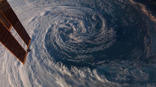
Barbara, on its way to becoming a major hurricane, is seen in a GOES West satellite image from July 1.
Space may be the best place to watch a hurricane. You're far from the danger, but still have an incredible view of the action.
On Tuesday, the National Oceanic and Atmospheric Administration's GOES West satellite delivered a stirring look at the heart of Hurricane Barbara, the first major Eastern Pacific storm of 2019.
Here’s an up-close look at the eye of now Cat. 4 #HurricaneBarbara, as seen by #GOESWest. Barbara is packing maximum sustained winds of nearly 130 mph. More imagery: https://t.co/au0BIQroLJ pic.twitter.com/YbS1ozH8qN
— NOAA Satellites (@NOAASatellites) July 2, 2019
The satellite footage shows the eye of the hurricane, which is packing maximum sustained winds of almost 130 mph (209 km/h). It's now classified as a category 4 storm, one slot below a top-level category 5. NOAA's National Hurricane Center said Barbara could even strengthen a little more.
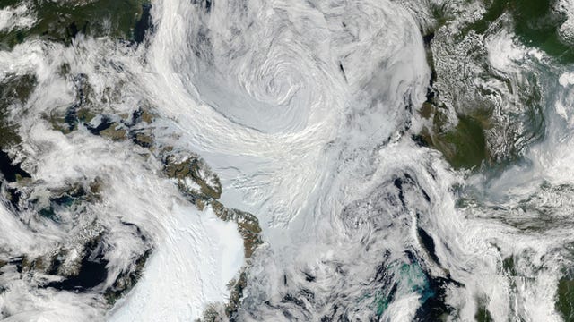
NASA's Aqua and Terra satellites are also tracking the storm. A Terra image from Tuesday shows the hurricane's trademark swirl of clouds.
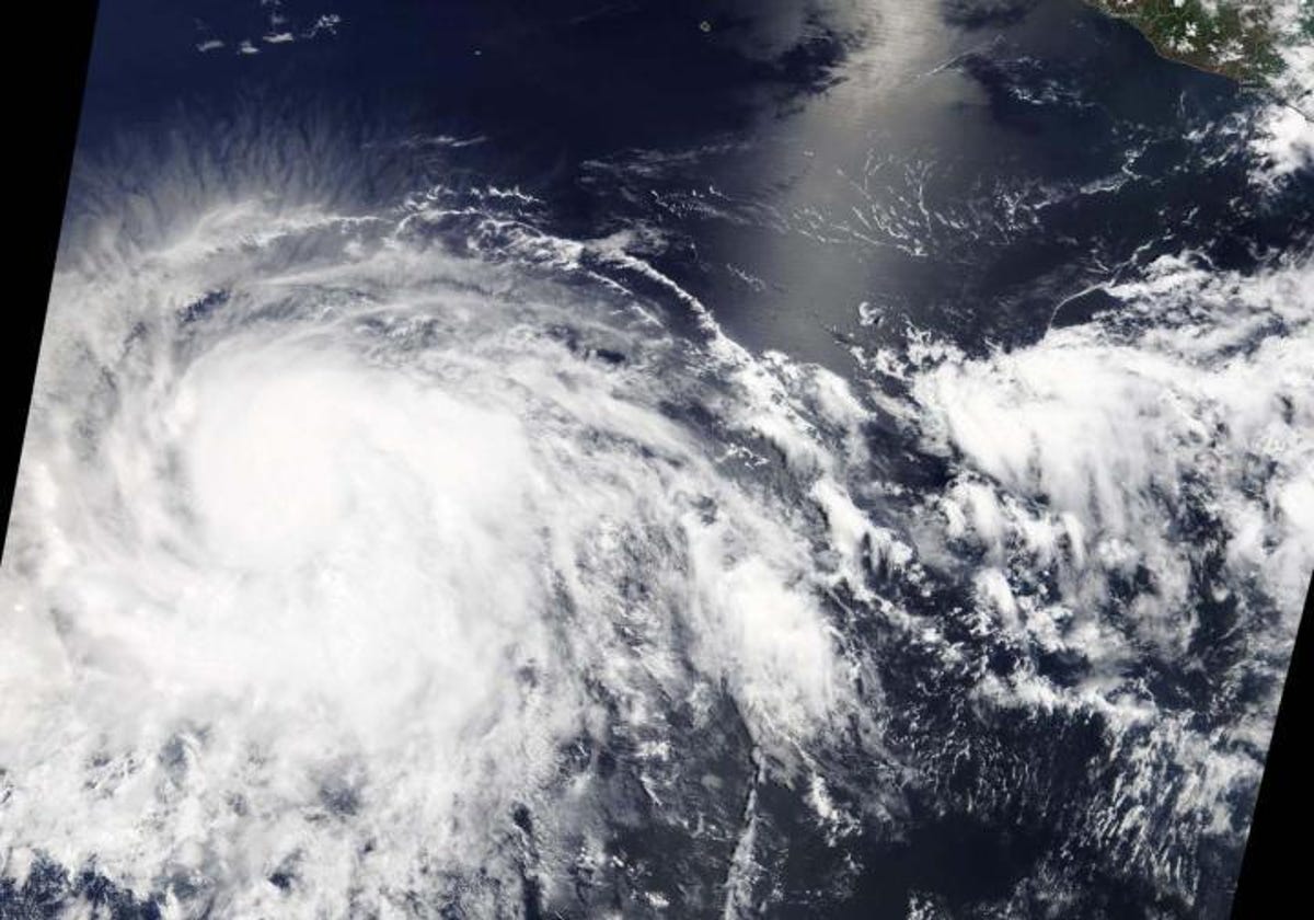
Hurricane Barbara as seen by NASA's Terra satellite.
Hurricane Barbara looks amazing, but it's not threatening land at this time. It is expected to weaken this week, but could potentially bring some stormy weather to Hawaii depending on its path and strength.
Barbara is kicking off what NOAA expects to be an "above-normal" hurricane season in the Eastern Pacific, with a likelihood of four to eight major hurricanes. We can now check the first one of those off the list.