GPS at risk: Those signals are more vulnerable than you realize
That has people worried about how to protect them and what we're doing for backup.


- 30 years experience at tech and consumer publications, print and online. Five years in the US Army as a translator (German and Polish).
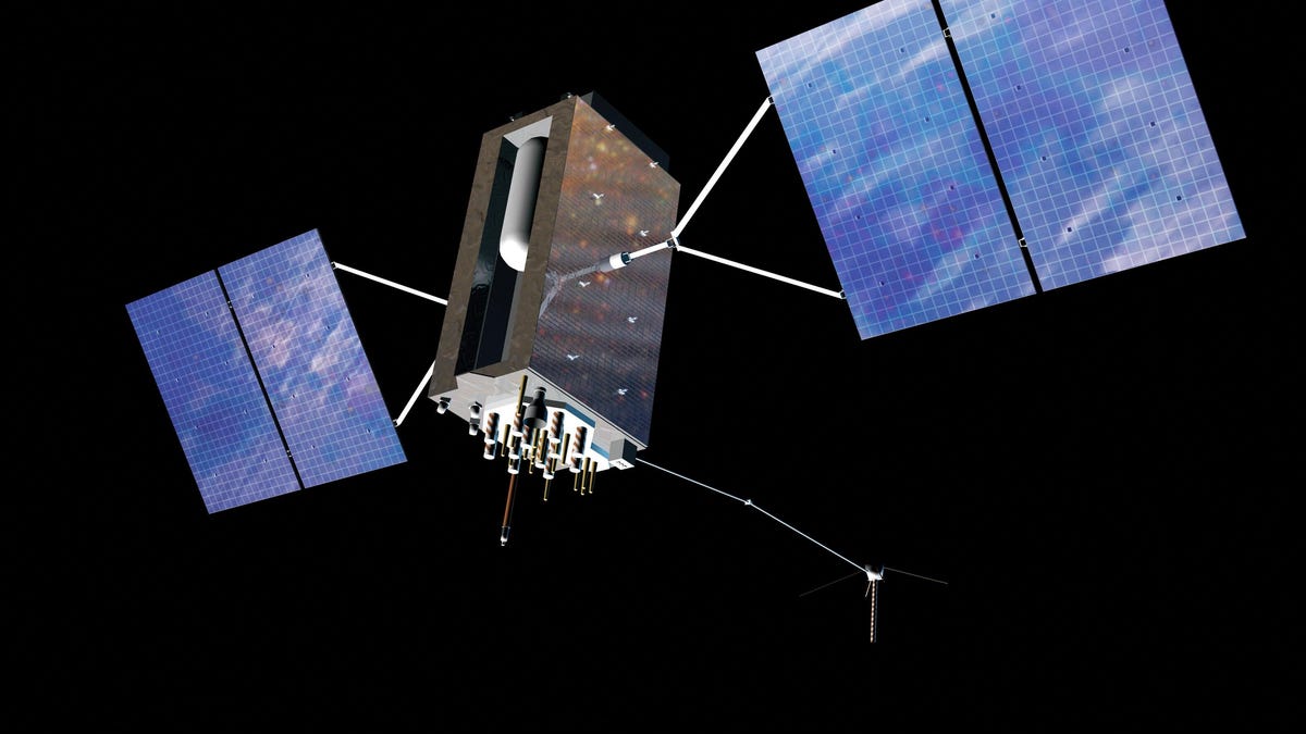
The latest generation of GPS satellite as it probably looks in orbit.
The Cessna Citation Excel was approaching the Sun Valley, Idaho, airport when something seemed off about its flight path. Like a lot of planes, it was tuned to GPS for guidance. Usually, that's a good thing. On this day in August 2018, however, a problem arose. The GPS signals near the airport were unreliable, and smoke in the area made for poor visibility. The midsize business jet was off-course and flying too low in the mountainous terrain.
The likely cause for the wonky GPS readings? Military activity that caused jamming of the signals, according to an account from NASA's Aviation Safety Reporting System, which collates information provided by pilots, air traffic controllers and other aviation professionals. Fortunately, radar on the ground provided a more accurate reading, and controllers got the plane to its destination safely.
It wasn't an isolated event, according to reporting by IEEE Spectrum and others.
GPS is all too susceptible to jamming and its trickster cousin, spoofing. The signals used by aircraft, ships, farm tractors and your smartphone originate from satellites 12,000 miles (19,300 kilometers) out in space. By the time they reach Earth, they're vanishingly weak and easily overwhelmed. A satellite launched in June to the GPS constellation represents a tiny step in making the service more secure. But satellites themselves face dangers.
All those threats have lots of people worried. Just about everything, you see, relies on GPS.
The highly precise signals from the Global Positioning System have worked their way into nearly every fabric of modern life, from recording bank transactions to synchronizing electrical grids to helping you find the nearest Starbucks. Businesses and individuals can use the system's PNT -- positioning, navigation and timing -- capabilities for next to nothing. In the US, GPS has about $1 billion a day in economic impact, according to the National Institute of Standards and Technology. It's also vital to the operations of the US military.
There's so much riding on GPS that a 2018 federal law sought to address one of the biggest underlying issues: the absence of a dedicated backup.
Any substantive damage or disruption to the system would be bad news.
"My hope is we can get ahead of the bang and at least get ... some resilience put in the systems [that depend on GPS] before the bad thing happens," says Dana Goward, president of the Resilient Navigation and Timing Foundation, a Washington, DC-based nonprofit.
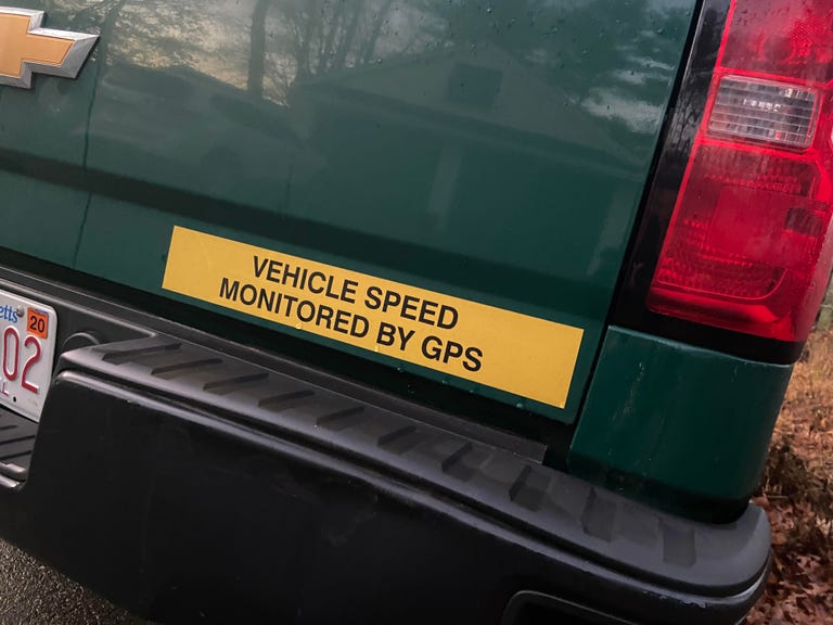
GPS isn't actually watching you. But the data it provides, along with geographic information systems, can help a company keep tabs on its drivers.
A backup would have a lot to prove.
"It's actually hard to create this giant, one-size-fits-all replacement for GPS," says Richard Mason, a senior engineer at Rand Corp. and lead author of a report on national PNT capability commissioned by the Department of Homeland Security in 2019 and released to the public in May of this year. The report is skeptical about how much government intervention is needed, despite GPS' vulnerabilities.
On the plus side, says Mason, "there are lots of little partial backups."
For instance: Your phone could lose GPS, Mason says, and it would still give you some sense of where you are based on cellular signals (what's known as assisted GPS), though not as precisely. Aircraft have alternative navigation systems. Financial firms can get timing services from other sources.
So what's the big deal then? It's that we're addicted to GPS on a grand scale.
Those signals from space have become "the de facto national reference," the National Security Telecommunications Advisory Committee said in a report to President Joe Biden in May. "Such wide adoption means their vulnerabilities pose a near-existential threat."
The group recommended the government develop a strategy for a "National Timing Architecture" and appropriating sufficient funds to create it.
The threats facing GPS
There's precedent for the US government to fund something like GPS because it built GPS in the first place, primarily as a military technology, starting in the 1970s. By the 1990s, satellite navigation was starting to become a noticeable part of civilian life.
Right now, Washington spends about $1.8 billion a year to keep GPS up and running. The US Space Force manages the satellites and the ground stations that track them. (It took over the responsibility from the Air Force after it was spun out into a separate branch in December 2019.) The Transportation Department is the lead civilian agency for PNT efforts.
The GPS constellation consists of 31 satellites located in medium Earth orbit. Those satellites carry atomic clocks, and onboard radios send precise timing signals from them to receivers on the ground, including the GPS chip in your phone. GPS signals reach more than 4 billion military and civilian users worldwide, according to the Space Force.
Those timing signals get translated into location data when a receiver syncs up signals from multiple satellites. The way the satellites are spread out around the globe, you should always be within sight of at least four.
GPS was the first of what's known as a global navigation satellite system, or GNSS. But it isn't the only one: China's Beidou, Russia's Glonass and the EU's Galileo all serve similar purposes. In 2018, the FCC authorized Galileo signals for reception in the US, which means they could serve as a GPS backup, at least to a degree. But GPS itself is the only system under US control.
All satellites are vulnerable to threats out in orbit over which we have little control. For example, space debris could damage individual satellites, or severe solar storms might short circuit the operations of hundreds or more.
They're also vulnerable to anti-satellite weapons and cyber intrusions by potential adversaries who know how much our economy and our military depend on satellites. The more satellites you knock out or confuse, the worse off we are.
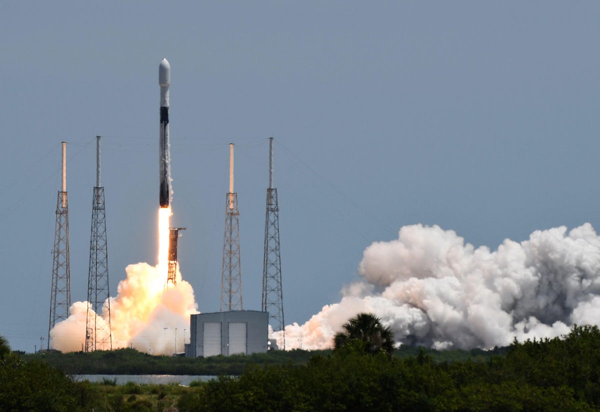
A SpaceX Falcon 9 rocket lifts off June 17, 2021, carrying the fifth GPS III satellite into orbit for the US Space Force.
Gen. John Raymond, head of the US Space Force, told the House Appropriations Committee defense subcommittee in May that we need to be worried.
"Both China and Russia are developing capabilities to deny our access to space," Raymond said. "There's an active threat in the domain."
But the more immediate dangers are more down to Earth: jamming (broadcasting a signal that's stronger than the weak one coming from space) and spoofing (broadcasting a signal that looks like GPS and feeding false information). It's cheap and easy to get away with. The Russians have jammed or spoofed GPS signals in Scandinavia, Ukraine and Syria. North Korea has targeted them in South Korea. And then there are those flight disruptions in the US, which may, ironically, have resulted from the US military's efforts to figure out how to deal with that problem.
"The threat that we're most concerned about with GPS is jamming," Raymond said.
The law seeking a GPS backup
A few years back, the National Timing Resilience and Security Act directed the transportation secretary to establish a land-based timing system that could serve as a backup for GPS within two years. That deadline came and went in late 2020, but in January of this year the Transportation Department reported to Congress on the "roadmap to implementation" it's been following toward that goal.
A companion DOT report detailed a variety of technologies that could provide "complementary service in the event of GPS disruptions." Some commercially available technologies, it said, could go part way toward mimicking GPS' timing services. But the agency said none would be able to serve as a universal backup for the positioning and navigation capabilities.
Of the 11 technologies evaluated by the Transportation Department, one hit the mark in all the use cases: a metropolitan beacon system made by Sunnyvale, California-based NextNav. The beacons -- transmitters that send out the radio signals -- are set up on land, rather than in space, and are clustered in urban areas (hence "metropolitan").
For NextNav, the real-world application is its up-and-coming TerraPoint service, which gives a glimpse of how GPS-like capabilities are possible from something that isn't GPS.
TerraPoint beacons, set up on cell towers and building rooftops, are about the size of a dorm room refrigerator, sporting an omnidirectional antenna and a 110-volt power supply, and they're spaced about eight to 10 kilometers apart (versus that 12,000-mile range for GPS). That makes for a much more robust signal. CEO Ganesh Pattabiraman estimates they're "about 100,000 times stronger than GPS."
The commercial service that NextNav is working toward would be independent of GPS but function just like it, providing full position, navigation and timing data, according to Pattabiraman. Each of its transmitters has an atomic clock and sends a precise, low-frequency timing signal to receivers equipped with chips from companies such as Broadcom and GCT Semiconductor that support GPS, Galileo, Glonass and other GNSS. The service is designed to operate with mass market devices like mobile phones, cars and drones as the network gets built out.
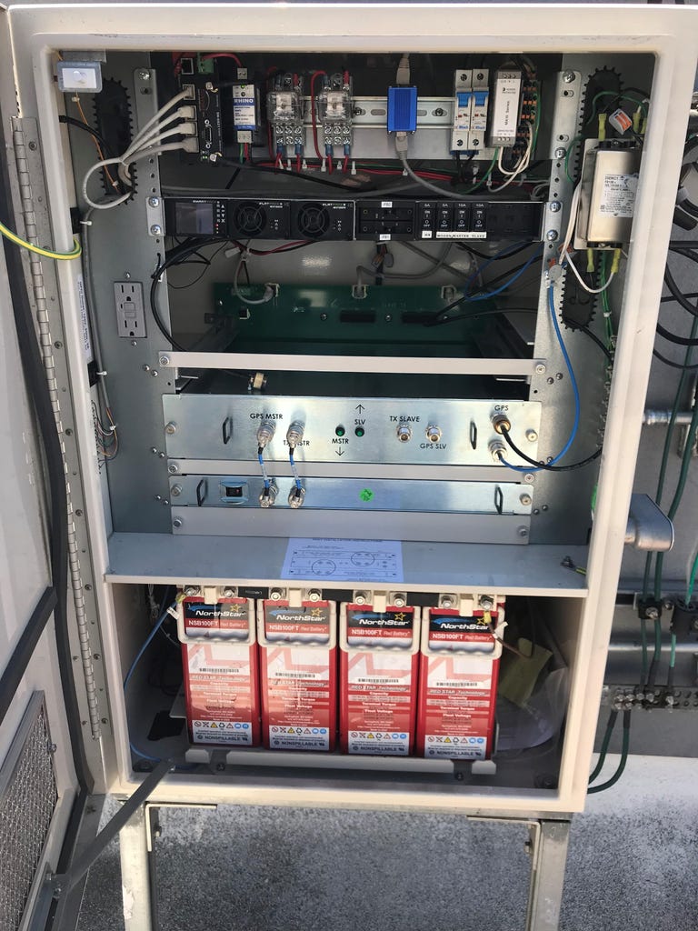
Here's a look at the insides of one of NextNav's TerraPoint transmitters.
"It looks just like another GPS signal," Pattabiraman said. To the receiver, "it's just another constellation, except it happens to be land-based."
TerraPoint is deployed at scale only in the San Francisco Bay Area, where eVTOL companies like Joby Aviation are doing tests with it for urban navigation, takeoff and landing operations. It has a more limited presence in a number of other areas, too. NASA, for instance, has deployed a TerraPoint network at Langley, Virginia, for urban drone operations. NextNav expects that an acquisition announced in June, and done with a public offering in mind, will give it funding to expand.
Key to getting any GPS alternative into widespread use is to make it as easy to use as, well, GPS. Alternatives like the now defunct Loran radio navigation system required separate and bulky receivers, and the US government put an end to it a decade ago. Some companies are working on services using what's known as enhanced Loran, aka eLoran, but it has yet to become more than a niche application in the US.
"The good thing about NextNav, and things like NextNav," said Rand's Mason, "is that [eventually] it would just be in every smartphone, and so you're using it whether you know it or not."
That isn't to say a GPS backup has to be earthbound. Companies like Satelles, which also participated in the Transportation Department demonstrations, use the Iridium constellation of low Earth orbit satellites at an altitude of just 480 miles (780 km). It's already providing timing and location services, deployed as a backup for GPS for customers including financial networks and energy utilities.
A startup called Xona Space Systems is designing its own low-orbit PNT system. In May, the Defense Advanced Research Projects Agency, or DARPA, awarded Northrop Grumman a contract to demonstrate how low-orbit satellites would perform providing PNT signals. Researchers are looking into whether SpaceX's Starlink satellites, built to beam broadband from orbit to Earth, could be pressed into service as a PNT resource.
Some of those options are still just on paper. But even those that are in operation don't have the scale of the long-established GPS.
Meanwhile, GPS itself is getting a boost. The satellite that went up in June is the fifth in a new series known as GPS III, which is designed to be up to three times more accurate and have up to eight times the anti-jamming capability. For the military specifically, it's helping enable the encrypted M-Code signal that's tough on jamming and spoofing.
Eight times a weak signal, however, still isn't a signal that's much of a match for powerful jammers and spoofers operating nearby.
The role of government
What makes GPS so attractive for so many applications is that it already exists. It's essentially universal. It's cheap and easy to use. That also makes it hard to muster enthusiasm for spending time and money to come up with something that does what it does, as widely as it does.
Plus, those partial backups add up to … something.
The big question is how much the US government needs or wants to lean into building a sizable backup for GPS.
Rand recommends restraint, though it acknowledges there are some potential federal initiatives that could be cost-effective, including a timing-only backup or law enforcement efforts focused on GPS jamming.
"There's not a compelling case for government to do a lot more than it's doing or [to do] a big new backup system," Mason said. "There's also the question of, 'Is anybody going to use it?'"
That isn't good enough for Goward, of the Resilient Navigation and Timing Foundation. He sees China as having thoroughly outpaced the US in establishing a sophisticated, comprehensive approach to PNT that includes three types of satellites at different altitudes, plus eLoran and PNT capabilities in the telecom system for independence from space.
He wants lawmakers to take action soon.
One thing Congress will have to consider: the budget proposed in late May for fiscal 2022, which starts in October, includes a line calling for the repeal of the National Timing Resilience and Security Act -- a tacit acknowledgement that we aren't likely to see that GPS backup mandated by the law anytime soon. (It also includes $10 million for research into backup and complementary systems.)
Goward estimates the US might be able to spend just $50 million to $75 million a year for a timing system that everybody in the country could access. He calls it "budget dust" compared with what we're already spending on GPS.
"The next step," he says, "is for Congress to decide what it wants to do."
In the meantime, the jamming goes on, and pilots like those in that Cessna outside Sun Valley will need to cast a wary eye on what their GPS device is telling them.