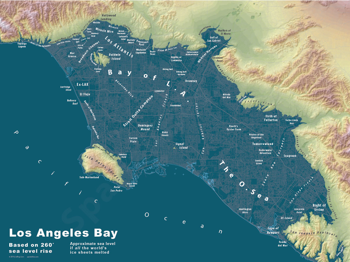
Welcome to Los Atlantis: Whimsical maps imagine a post-flood Earth
Ever been to Central Shark or Greenwich Spillage? Urban planner Jeffrey Linn creates and sells captivating maps that guide you through the world after sea levels rise.


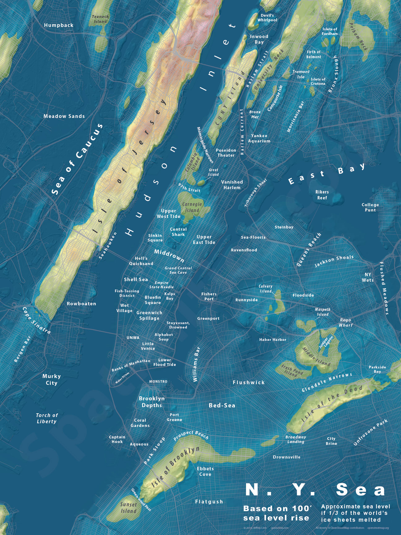
Ever sailed the "Strait Outta Compton" or spent a holiday on the "Isle of Brooklyn"? Me neither, and that's because the only place these destinations exist is on Jeffrey Linn's exquisitely drawn maps that imagine what Earth will look like after sea levels rise dramatically.
Linn is an urban planner and Geographic Information Systems (GIS) developer -- and one way talented mapmaker. On his site called Spatialities, he has 10 different post-sea-level-rise maps that he created using real-world data from organizations including the US Geological Survey and its National Elevation Dataset.
In figuring out just how much water would flood into our coastal cities should sea levels rise, Linn relied on this USGS study. While he says USGS data indicates that the total possible rise in sea levels is 263.5 feet, sometimes he renders his maps at levels slightly below that. "I never render sea levels higher than what is possible from melted ice according to the USGS," he says on his site.
In addition to being factually accurate, Linn's maps also have a touch of humor evident in the names he gives to the cities and neighborhoods that will survive after the deluge -- Los Atlantis, the Isle of Jersey and Park Sloop, for example.
"There are people who don't agree with the way I've dealt with the subject of climate change with these maps -- they think the funny names and extreme sea levels are a distraction from what will actually happen in the lifetimes of the current generations," Linn says. "I believe that what happens to future generations is also important, and that leavening a serious issue with humor will put it into the minds of more people. Plus, I really have a good time making up the names -- it's fun."
Right now Linn says he's between jobs so it's a good time to work on the maps. He's hoping to create enough of them to eventually produce an "Atlas of Drowned Cities," a project for which he's seeking a publisher. For now, his maps can all be seen on his website, or they can be purchased in poster form through Zazzle.
(Via Gizmodo)