Tropical cyclone Cristobal set some wild new weather records
The storm went on a historic journey to the Great Lakes.


You don't usually associate the Great Lakes region of the US with tropical cyclones, but a storm named Cristobal decided it would buck decades of history and march on up to visit Lake Superior.
The National Oceanic and Atmospheric Administration (NOAA) satellite team called out some of Cristobal's historic records in a tweet on Wednesday, saying it was the farthest northwest a tropical system has traveled in North America. It was only the third system of its kind to cross the state of Wisconsin and was the first on record to cross Lake Superior.
On June 9, #GOESEast watched what is now the remnants of tropical depression #Cristobal entering #Wisconsin.
— NOAA Satellites (@NOAASatellites) June 10, 2020
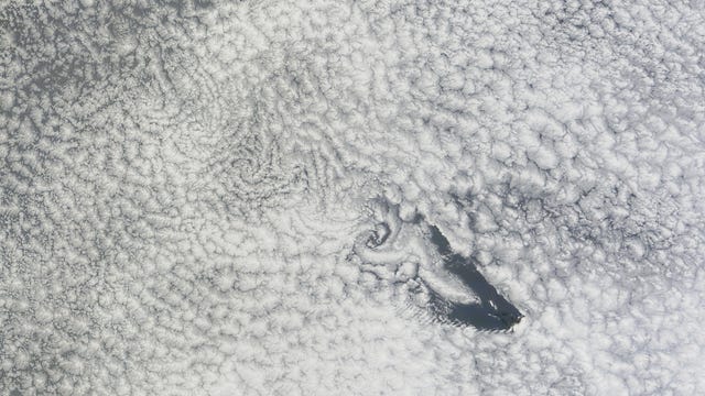
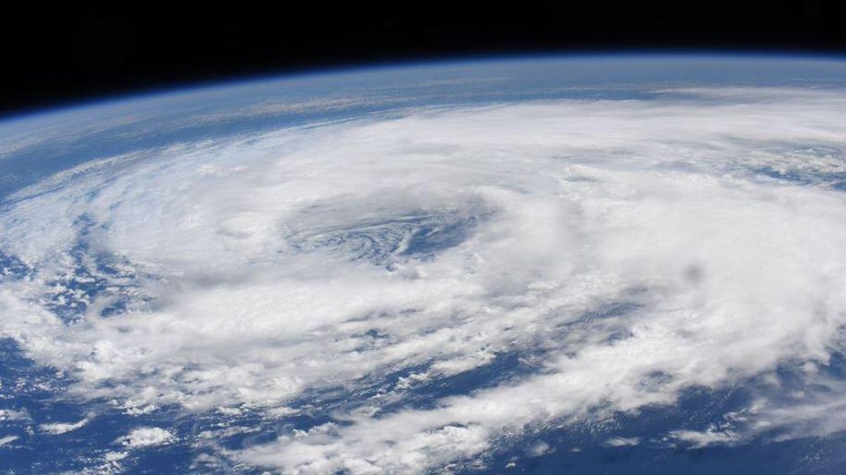
QUICK STATS: This is the farthest NW a tropical system has traveled in North America, the 3rd time one has crossed the state, and the 1st that crossed #LakeSuperior. pic.twitter.com/LDfL8fStmV
The 2020 Atlantic hurricane season officially kicked off on June 1, and Cristobal is already the third named storm of the year. As of Wednesday, it was designated a post-tropical cyclone, but was still buffeting the Great Lakes area with wind and rain. The storm's remnants are forecast to move into Canada later in the day.
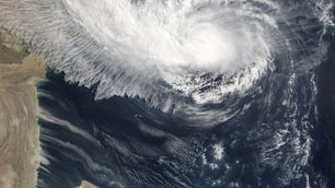
NASA astronaut Chris Cassidy captured some eye-popping views of swirly Cristobal from the International Space Station on June 8.
Best of luck to all of the folks in the gulf coast region who are about to deal with the weather from Tropical Storm #Cristobal. pic.twitter.com/xxNrazh53a
— Chris Cassidy (@Astro_SEAL) June 8, 2020
Cristobal never reached hurricane status, which requires higher winds than the system produced. It was classified as a tropical storm while over the ocean, but was downgraded to a tropical depression as it traveled across land.
Cristobal's unusual route represents a strange start to what NOAA predicts will be a busy Atlantic hurricane season.