Tracking deforestation in real time
Google.org, Google's philanthropic arm, has announced a cloud-based method for analyzing deforestation around the world, in a much more up-to-date manner than was previously possible.
Google.org, Google's philanthropic arm, has announced a cloud-based method for analyzing deforestation around the world, in a much more up-to-date manner than was previously possible.
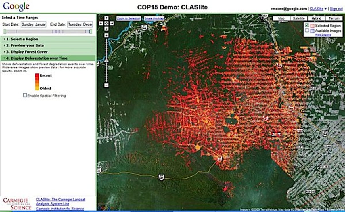
Using Google's terabytes of satellite imagery, it allows scientists to look back over time at any location in the world to see how the forest has changed. Going beyond visual comparisons, it uses the power of cloud computing to do actual measurement of deforestation. Much more rapid analysis of the images than is possible on a single desktop computer pinpoints locations of most recent activity. This allows authorities to locate illegal logging very precisely, within days of the activity.
According to the official Google.org blog:
With this technology, it's now possible for scientists to analyze raw satellite imagery data and extract meaningful information about the world's forests, such as locations and measurements of deforestation or even regeneration of a forest. In developing this prototype, we've collaborated with Greg Asner of Carnegie Institution for Science, and Carlos Souza of Imazon. Greg and Carlos are both at the cutting edge of forest science and have developed software that creates forest cover and deforestation maps from satellite imagery. Organizations across Latin America use Greg's program, Carnegie Landsat Analysis System (CLASlite), and Carlos' program, Sistema de Alerta de Deforestation (SAD), to analyze forest cover change. However, widespread use of this analysis has been hampered by lack of access to satellite imagery data and computational resources for processing.