NASA tracks ominous Siberian wildfires in smoke-filled views from space
More than 250 fires burned across a region of Russia at one time.


It's already been a difficult year for Siberia, which logged a drastic land surface temperature reading of 118 degrees Fahrenheit (48 degrees Celsius) in June. Now parts of the Russian region are on fire.
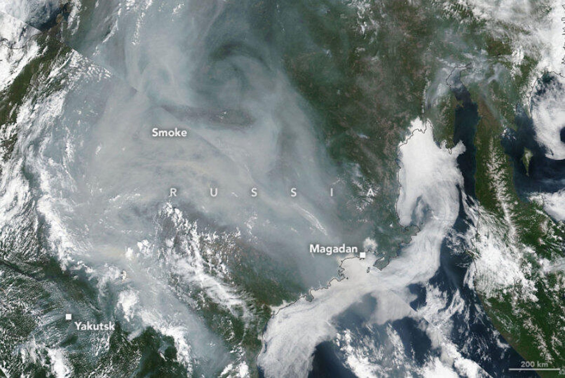
On Wednesday, NASA shared satellite views of the Sakha Republic and huge swathes of wildfires burning through subartic forests. One image from the Suomi NPP satellite shows a blanket of smoke on July 5 near the city of Yakutsk.
"Satellite data indicates that several small fires burned intermittently in the area for weeks, but several exploded in size during the last week of June," NASA said.
NASA cited Sakha's emergency ministries, which said over 250 fires were burning across 2,210 square miles (5,720 square kilometers) of land on July 5. A wider view of the region from NASA's Aqua satellite shows a series of fires across the landscape, each emanating a distinctive smoke plume.
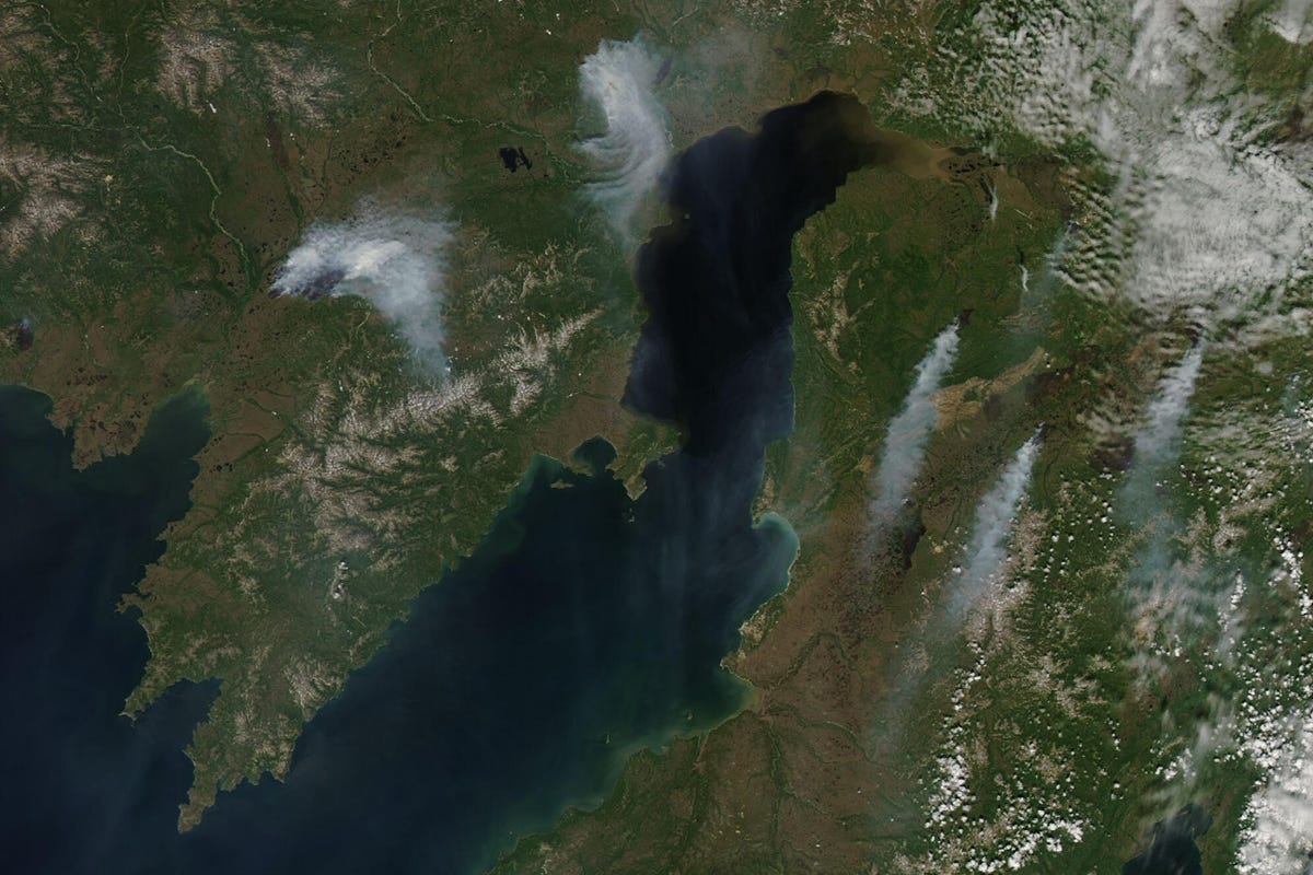

This Aqua satellite view from July 4, 2021 shows a series of fires burning around Penzhina Bay.
A third image zooms in on one particular fire and clearly shows the smoke, the line of advancement and a large dark burn scar.

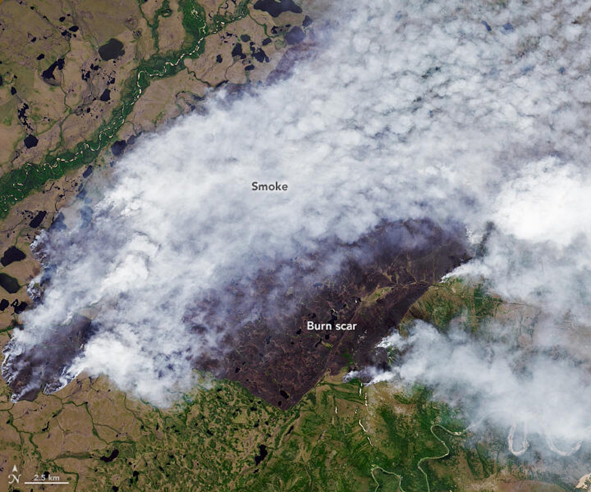
A Landast 8 view shows a close-up of a fire in the Sakha Republic in Russia on July 4, 2021.
The satellite wildfire images bear an eerie resemblance to others from recent years. In 2019, Siberian fires sent smoke spreading far beyond Russia's borders. Intense fires scarred the land last year, as well. Fire-tracking satellites can help firefighters battle blazes and monitor the spread and destruction caused by the fires.
A study released earlier this year pointed to human influence as a culprit in the extreme heat that struck Siberia in 2020. Extreme weather and brutal wildfires are on the rise as humanity stares down a worsening climate crisis.
Follow CNET's 2021 Space Calendar to stay up to date with all the latest space news this year. You can even add it to your own Google Calendar.