NASA satellite sees devastation from California wildfires
NASA's Terra satellite captures a haunting look at the destruction caused by the deadly wine country blazes.


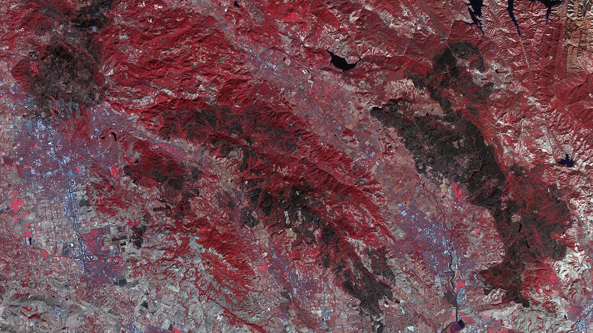
The dark gray areas show where fires swept across the landscape.
October has been a horrifying month in Northern California as a series of deadly wildfires raged through wine-growing regions and towns. Firefighters are still working to fully contain some of the fires.
NASA's Earth-watching Terra satellite turned its eyes to the area and snapped an image that shows just how much damage the fires left behind.
The image comes from Terra's ASTER (Advanced Spaceborne Thermal Emission and Reflection Radiometer) instrument, which is why the colors appear so unnatural. Red stands for vegetation while the dark gray swathes show the places scarred by the fires.
The image covers roughly 40 square miles (104 square kilometers), including the cities of Santa Rosa and Napa.
ASTER is used to monitor conditions on our planet, including volcanic eruptions, movement from glaciers and surface temperatures.
The California wildfires are responsible for killing at least 42 people and destroying thousands of homes and buildings. NASA satellites have followed the fires throughout, monitoring smoke plumes and tracking the spread of the burns.