Google's new Timelapse feature shows impact of climate change over decades
"We can objectively see global warming with our own eyes," says the director of Google Earth.


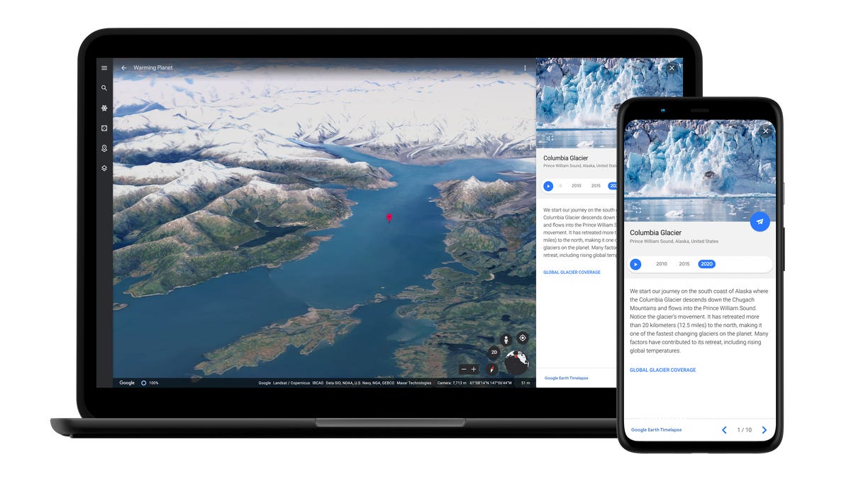
Google announces a new feature called Timelapse for Google Earth.
Google on Thursday unveiled a new feature for its Google Earth service, which shows people 3D models of the planet using satellite images. Now, users will be able to see how landscapes and geography anywhere in the world have changed over decades.
The new feature, called Timelapse, is the biggest change to the product in five years, Google said. With the tool, people can see the effects of both natural and man-made phenomena, like the sands of Cape Cod slowly shifting south, or the expansion of Las Vegas over the deserts of Nevada.
One of the aims of the project is to give people tools to study the impact of climate change, like wildfires in the western US or deforestation in the Amazon, said Rebecca Moore, director of Google Earth.
"We can objectively see global warming with our own eyes," Moore said during a briefing with reporters, adding that she hopes it will "inspire action." "It makes the abstract concrete."
The landscape of Cape Cod's beaches changing over time.
For the feature, Google worked with several government agencies and groups, including NASA, the US Geological Survey and the European Union's Copernicus program. The Timelapse tool is compiled from 24 million satellite images from 1984 to 2020. The company used thousands of machines in the cloud to compile 20 petabytes -- or 20 million gigabytes -- of imagery.
The announcement comes as Google has tried to push its mapping services beyond just getting people from one point to another. In the last few years, the company has launched social features for Google Maps, including restaurant recommendations, as well as tools to connect people with local businesses like plumbers or yoga instructors. In 2019, the tech giant said Google Earth has a total of 36 million square miles of satellite imagery for people to browse. With that collection, Google has mapped out the parts of the world where 98% of people live.
Moore said the satellite imagery is provided by the space agencies and only shows changes at the landscape level. So people won't be able to zoom in and see individual houses and cars, like they can with Google Maps.
But even as Google aims to put the spotlight on global warming with its Timelapse feature, the company has also been criticized for helping to spread climate change denial. Last year, the campaign nonprofit Avaaz released a report accusing YouTube, which is owned by Google, of "actively promoting" videos that contain misinformation about climate change.