DigitalGlobe's new satellite yields first images
Satellite imagery company releases some early views taken Monday of Texas. WorldView-2 images will be used by Microsoft and Google.


- Shankland covered the tech industry for more than 25 years and was a science writer for five years before that. He has deep expertise in microprocessors, digital photography, computer hardware and software, internet standards, web technology, and more.

Twelve days after it launched WorldView-2 into orbit, DigitalGlobe has released its first images from the satellite, which will supply high-resolution photography for Google's and Microsoft's online mapping services.
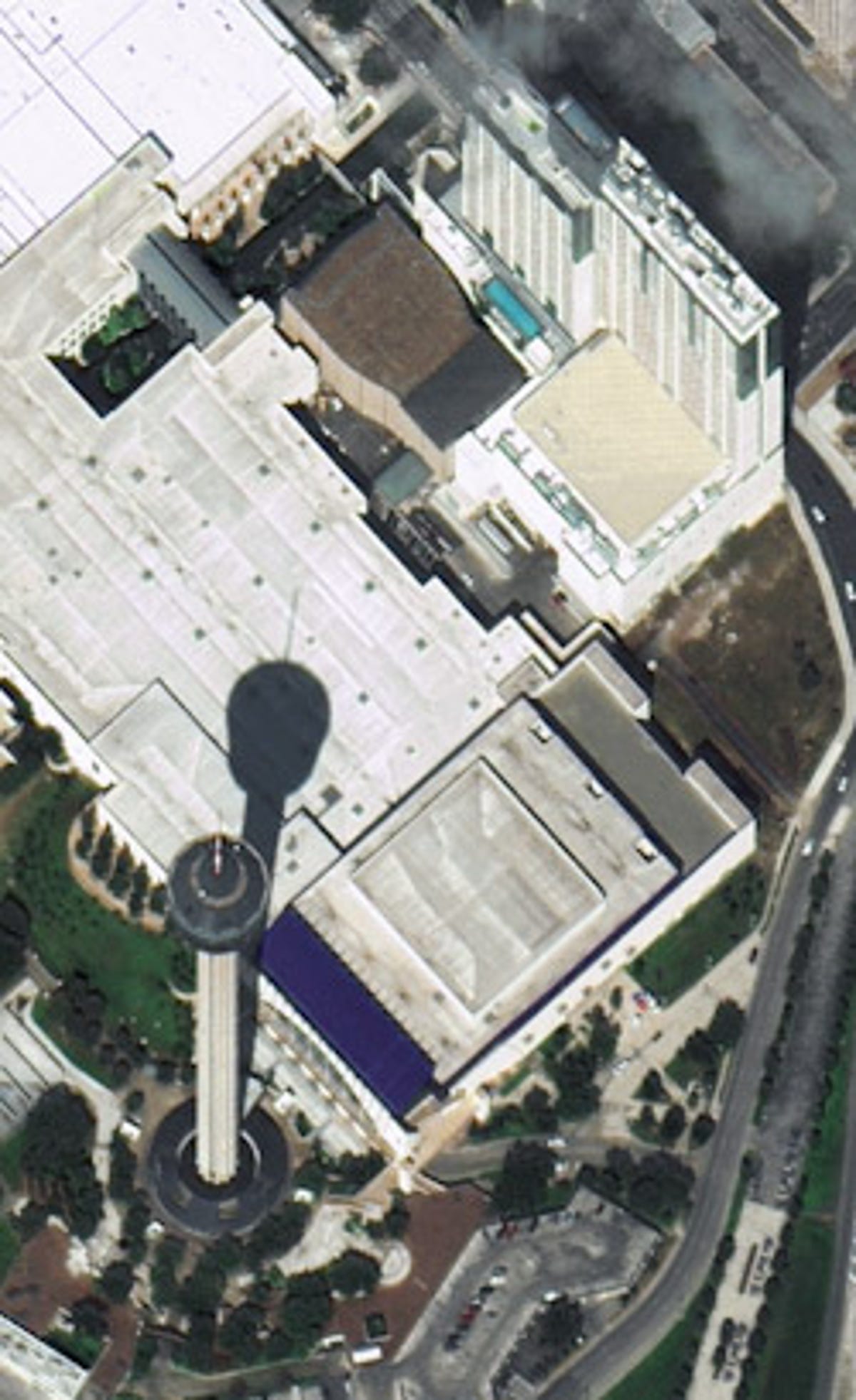
The first images are of two locations in San Antonio, Texas, where the company is showing off its work at the GeoInt 2009 Symposium this week, and of Dallas Love Airport.
The quality of the images should improve over these first shots, taken Monday. "More refinements to early-stage images can be expected as the ongoing check-out and calibration continues," DigitaGlobe said.
Microsoft and Nokia sponsored the WorldView-2 launch, but the former's Bing and the latter's Navteq won't be the only services to get the imagery. They'll share it with Google, which has been the sole online beneficiary of images from GeoEye-1, a satellite launched last year by DigitalGlobe rival GeoEye.
The new satellite is able to capture imagery with a resolution fine enough to detect features as small as 0.46 meters, or 1 1/2 feet, on the ground, though federal regulations permit DigitalGlobe to offer images with only a maximum resolution of 0.5 meters for general commercial use, the Longmont, Colo.-based DigitalGlobe said. Other DigitalGlobe satellites with sub-meter resolution in orbit already are QuickBird and WorldView-1.
"WorldView-2 is expected to improve the speed and rate of imagery delivery to the government and commercial markets with large-scale collection capacity and daily revisit rates," meaning that the satellite can photograph the same site multiple times during the same day, the company said. The satellite can capture multispectral imagery--eight bands of light, or more than what's visible to humans--though at a lower resolution of 1.8 meters.


