NASA captures space view of California wildfires blazing
The Los Angeles-area wildfires can easily be seen from space, both by satellites and astronauts on the space station.


California's year of destructive wildfires continues with a series of new blazes burning around the Los Angeles area this week. LA residents have been sharing eye-opening photos of the fires shooting flames near major roadways. The view from space offers a different, but just as devastating, perspective on the burn areas.
NASA shared a false-color image on Thursday from the European Space Agency's Sentinel-2 satellite. It highlights a brown burn scar north of the city of Ventura. The flames stand out starkly as smoke billows toward the Pacific Ocean. Untouched areas of vegetation appear in bright shades of green.
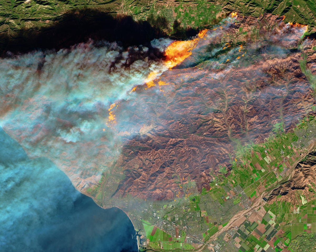

This view from the ESA's Sentinel-2 satellite shows wildfires near Ventura, California on Dec. 5.
The fires are destroying buildings and eating up ground near cultural resources, including The Getty Center. Strong, dry Santa Ana winds are fanning the fires and making it very difficult for firefighters to curb the blazes. Nearly 200,000 residents have been evacuated as the winds and fires rage on.
NASA astronaut Randy Bresnik viewed the fires from his vantage point on board the International Space Station and shared the apocalyptic images on Twitter:
I was asked this evening if we can see the SoCal fires from space. Yes Faith, unfortunately we can. May the Santa Ana’s die down soon. #Californiawildfire pic.twitter.com/qNzjTjWa4t
— Randy Bresnik (@AstroKomrade) December 6, 2017
The smoke plume extends for such a distance, it almost looks like cloud cover:


NASA astronaut Randy Bresnik shared this view of the California fires from space.
NASA's Terra satellite also caught sight of the fires. NASA shared an annotated natural-color image from Tuesday afternoon that points out the landmarks and the difference between smoke and clouds across the ocean.
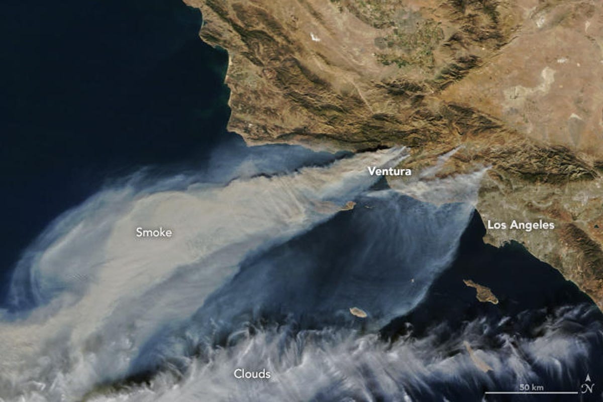
NASA's Terra satellite view shows both smoke and clouds.
The current spate of wildfires comes not long after a series of devastating burns across California's wine-country region in October. NASA's Terra satellite also bore witness to the damage from those fires.
NASA and ESA satellites will continue to monitor the current fires and we can expect to see more views from space as the catastrophe unfolds.