Hurricane hunters plan expanded use of drones
The National Atmospheric and Oceanic Administration hopes to send more unmanned planes where the human-powered storm-chasing vehicles cannot go.
WASHINGTON--For decades, U.S. government scientists have sliced specially equipped planes through hurricanes and other severe weather on a quest for crucial data to fuel weather forecasts. But in the future, drones are expected to do more and more of that work.
In the coming years, the National Oceanic and Atmospheric Administration envisions acquiring and leasing unmanned aerial vehicles (UAVs), a senior official said Friday at a conference here put on by the Association for Unmanned Vehicles International. They'll be tasked with monitoring everything from weather conditions and fires to ice melting in the Arctic and endangered marine mammals near Hawaii.
"We think the time has come," said Scott Ryder, chief of staff for NOAA's unmanned systems division. "We're going to do it with this technology, and we're on our way."
UAVs could prove a boon to NOAA's operations because traditional hurricane-hunting missions using manned WP-3D Orion or Gulfstream-IV jet aircrafts face numerous limitations, Ryder said.
For one thing, they can't descend too low in the storm because high winds can kick salt water up into the engines, causing damage and potentially endangering flight crews, although Ryder said no lives have been lost as a result of such accidents yet. Hurricane hunting aircraft also aren't as adept at predicting storms that are more than 72 hours away, which is a problem, since the Federal Emergency Management Agency would like to be able to make evacuation calls 96 hours in advance, Ryder said.
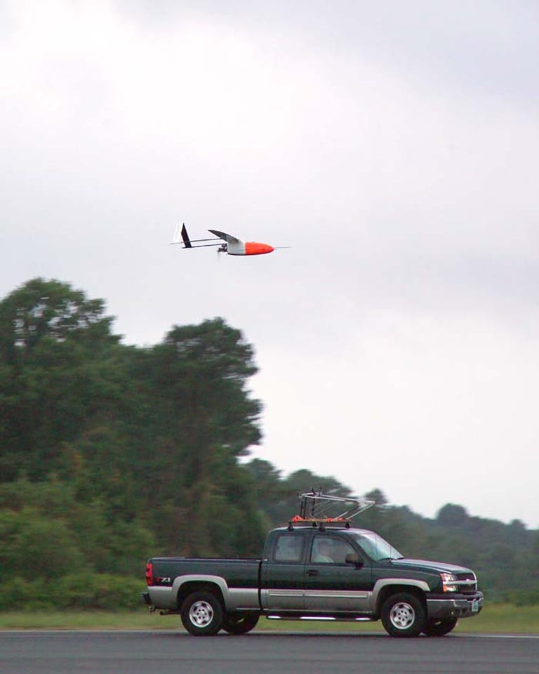
By contrast, a high-endurance UAV can remain in the eye of a storm for several hours and stay at altitudes as low as 80 meters, about 50 percent lower than a traditional hurricane-hunter's minimum altitude range.
Last November, NOAA sent an Aerosonde UAV into Hurricane Noel for 17 hours and 27 minutes, collecting 7.5 hours' worth of data from the storm's core. A handful of other demonstrations have occurred during the past few years. In 2009 and 2010, NOAA plans to work with NASA to study hurricanes using a UAV called the Global Hawk, which the U.S. Air Force has used extensively in combat.
For now, the UAV program is in its infancy, but some other projects have already begun in "testbeds" in the Arctic, Pacific, and Gulf of Mexico regions, Ryder said.
Compared with the Defense Department's $15 billion budget for unmanned systems this year, NOAA's share of the pie is a minuscule $3 million. But the agency has requested double that for next year, and Ryder said he expects spending to swell to $25 million to $30 million two or three years from now. (Ryder, for his part, did concede that as a political appointee, he most likely won't be around at that point.)
Beyond hurricane research, NOAA also plans to use UAVs to fill "critical gaps" in its existing satellite coverage, Ryder said. For example, it's not always possible to get complete climate information over the Pacific Ocean using satellites alone, he said.
Another potential use is monitoring so-called "atmospheric rivers," which can cause flooding rains NOAA found contributed to massive mudslides in Southern California in 2005. It also plans to work with NASA during the next few years to conduct missions in the Arctic and Antarctic to gather data about climate change.