Google Street View goes into the belly of a volcano
Google collects 360-degree images of a lava lake in Vanuatu, a country that's more than a thousand miles from the Australian coast.


Ashlee Clark Thompson Associate Editor
Ashlee spent time as a newspaper reporter, AmeriCorps VISTA and an employee at a healthcare company before she landed at CNET. She loves to eat, write and watch "Golden Girls" (preferably all three at the same time). The first two hobbies help her out as an appliance reviewer. The last one makes her an asset to trivia teams. Ashlee also created the blog, AshleeEats.com, where she writes about casual dining in Louisville, Kentucky.
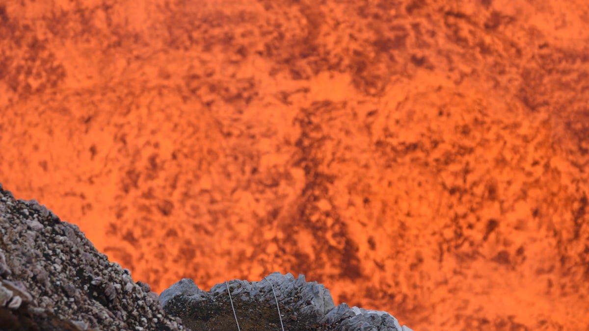
Starting Wednesday, Google Street View includes a deep dive below sidewalks and streets -- specifically, 360-degree pictures of the inside of a volcano, according to a post on Google's blog. This is the first time Google Street View has gone beneath the Earth's surface.
The pictures come from 400 meters (roughly 1,300 feet) down into the Marum crater on the island Ambrym. Ambrym is one of the 80 small islands that make up the country of Vanuatu, which is more than 1,000 miles (about 1,610 kilometers) from the coast of Australia. There are also views of the island's community and coastline.