Sandy: Watch a killer storm develop as seen from space (pictures)
As Tropical Storm Sandy batters North America, NASA satellite imagery offers a detailed look at Sandy's 2,000-mile scope.
James Martin
James Martin is the Managing Editor of Photography at CNET.
His photos capture technology's impact on society - from the widening wealth gap in San Francisco, to the European refugee crisis and Rwanda's efforts to improve health care.
From the technology pioneers of Google and Facebook, photographing Apple's Steve Jobs and Tim Cook, Facebook's Mark Zuckerberg and Google's Sundar Pichai, to the most groundbreaking launches at Apple and NASA, his is a dream job for any documentary photography and journalist with a love for technology.
Exhibited widely, syndicated and reprinted thousands of times over the years, James follows the people and places behind the technology changing our world, bringing their stories and ideas to life.
Bearing down on the U.S. East Coast, Hurricane Sandy is now a Category 1 hurricane, according to the National Hurricane Center.
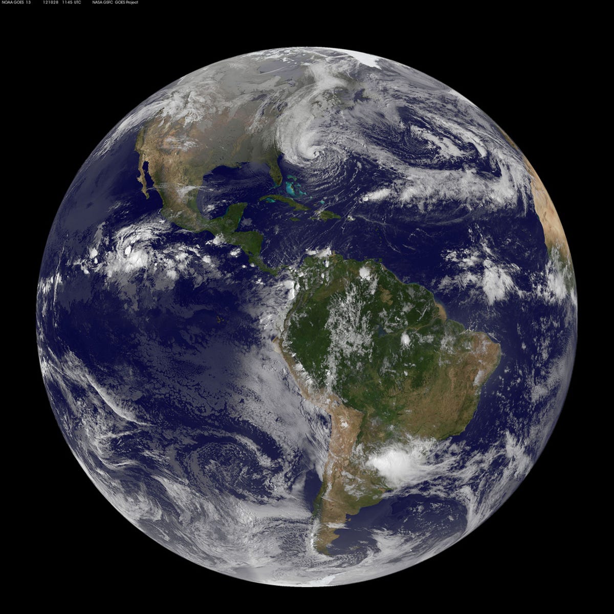
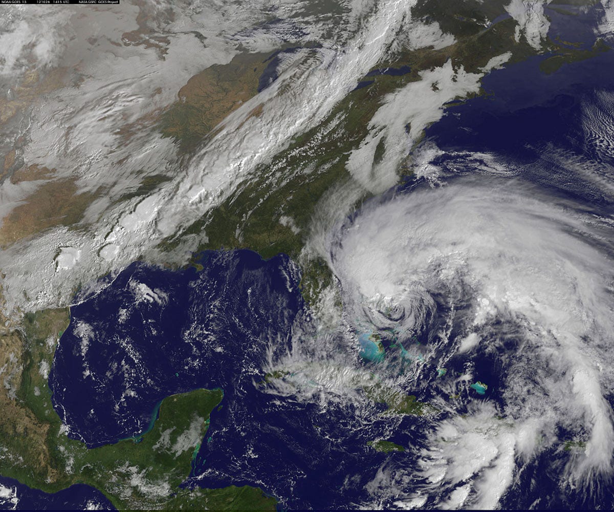
Various NASA satellites are providing a detailed look at look at Sandy's 2,000-mile extent. The National Oceanic and Atmospheric Administration's GOES-13 satellite, which is part of the Geostationary Operational Environmental Satellite system, captured this image of Earth with the massive Sandy covering a large swath of the eastern US.
Taken on Oct. 28 at 9:02 a.m. ET, the line of clouds heading north from the Georgia coast is also running into a cold front slipping down from the north and west.
An atmospheric pressure drop during the morning of October 28 has signified that the storm is gaining remarkable strength.
2 of 10 NASA GOES Project Text: NASA/Rob Gutro
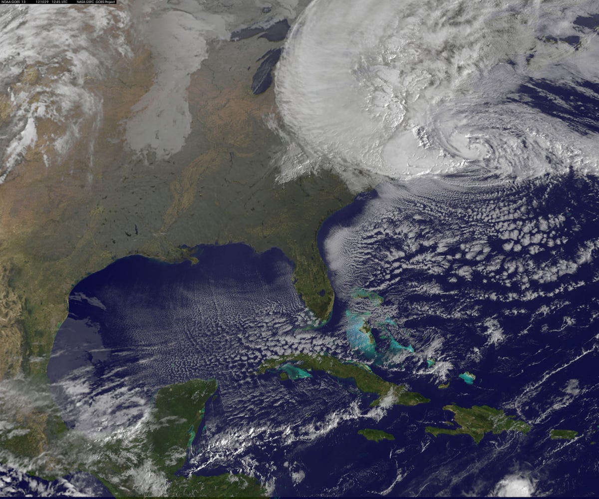
NOAA's GOES-13 satellite view Oct. 29 at 9a.m.
NOAA's GOES-13 satellite captured this image of Hurricane Sandy battering the U.S. East coast this morning, Monday, Oct. 29 at 9:10 a.m. EDT.
At 8 a.m. EDT the National Hurricane Center noted that the center of Hurricane Sandy was located about 310 miles south-southeast of New York City, moving north-northwest at 20 mph.
The maximum sustained winds are now exceeding 85 mph. Tropical Storm force winds extend almost 500 miles from the center, making those winds 1,000 miles in diameter.
3 of 10 SSAI/NASA, Hal Pierce
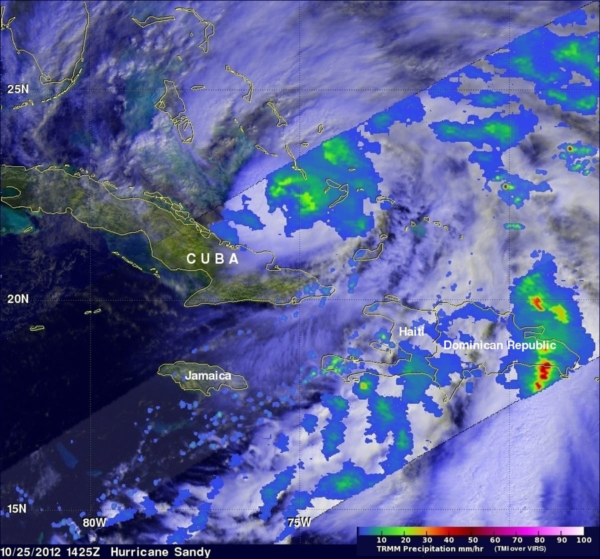
2 inches an hour over the Dominican Republic
A few days earlier, on October 25 at 10:25 a.m. ET, NASA's TRMM satellite saw that rain associated with Hurricane Sandy storm's center, was moderate (in green and blue) and falling at a rate of 20 to 40 millimeters per hour. The heaviest rainfall at the time of this image was falling over the Dominican Republic at more than 2 inches/50 mm per hour, seen in red.
4 of 10 NASA GOES Project
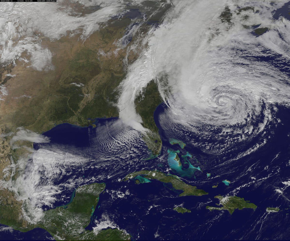
Sandy comes ashore
The GOES-13 satellite captured this image of the massive Hurricane Sandy on October 28 at 12:02 p.m. ET. The line of clouds from the Gulf of Mexico north are associated with the cold front that Sandy is merging with. Sandy's western cloud edge is already over the Mid-Atlantic and northeastern U.S.
NOAA expects the combination of the two weather fronts to bring heavy rainfall and sustained winds to the mid-Atlantic region for a couple of days, causing flooding, downed trees and power outages.
Rainfall amounts of 4 to 8 inches are forecast for portions of the mid-Atlantic states, including the Delmarva Peninsula, with up to 12 inches possible in isolated areas.
5 of 10 NASA GOES Project
A perfect storm
This image, taken by the GOES-13 satellite on October 26, shows Hurricane Sandy as it passes over the Bahamas. The lines of clouds seen on the left, moving east across the United States, represent a cold front. The several weather systems coming together prompted talk of particularly volatile conditions that led to the situation being "Frankenstorm."
The National Hurricane Center warned Sunday that Sandy is expected to bring "life-threatening storm surge flooding" to the Mid-Atlantic coast including Long Island Sound and New York Harbor, with winds expected to be near hurricane force at landfall.
Storm surge in the Long Island sound is expected to be between 6 and 11 feet.
6 of 10 Suomi NPP - VIIRS
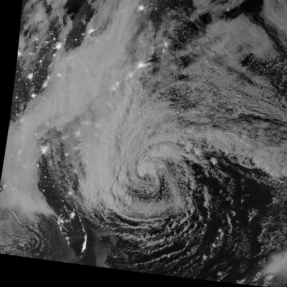
Sandy seen in the dark of night
This nighttime image of Hurricane Sandy was captured by the Visible Infrared Imaging Radiometer Suite (VIIRS) on the Suomi NPP satellite around 2:42 a.m. ET on October 28.
NASA says the storm was captured by a special "day-night band," which detects light in a range of wavelengths from green to near-infrared and uses filtering techniques to observe dim signals such as auroras, airglow, gas flares, city lights, and reflected moonlight. In this case, the cloud tops were lit by the nearly full Moon occurring on October 29th. Some city lights in Florida and Georgia are also visible amid the clouds.
7 of 10 NOAA/NASA/GSFC/SuomiNPP
Suomi NPP satellite imagery
Early in the morning of October 25, the Suomi NPP (National Polar-orbiting Partnership) satellite passed over Hurricane Sandy after it made landfall over Cuba and Jamaica, capturing this highly detailed infrared imagery, showing areas of deep convection around the central eye.
8 of 10 NASA GOES Project
NASA's Terra satellite over Sandy
When NASA's Terra satellite flew over Hurricane Sandy around noon local time on October 25, the MODIS (Moderate Resolution Imaging Spectroradiometer) instrument captured this image of Hurricane Sandy that showed the vast area the storm is covering. NASA says Sandy has grown since the morning hours on October 25 by about 120 miles in diameter, according to satellite data.
9 of 10 NASA GOES Project
2 inches an hour
On October 27 at 3:07 p.m. ET, NASA's Tropical Rainfall Measuring Mission (TRMM) satellite recorded the storm's heaviest rainfall, at the time of this image west of the center, at more than 2 inches per hour, seen in red on the map.
10 of 10 NASA image courtesy LANCE MODIS Rapid Response Team at NASA GSFC
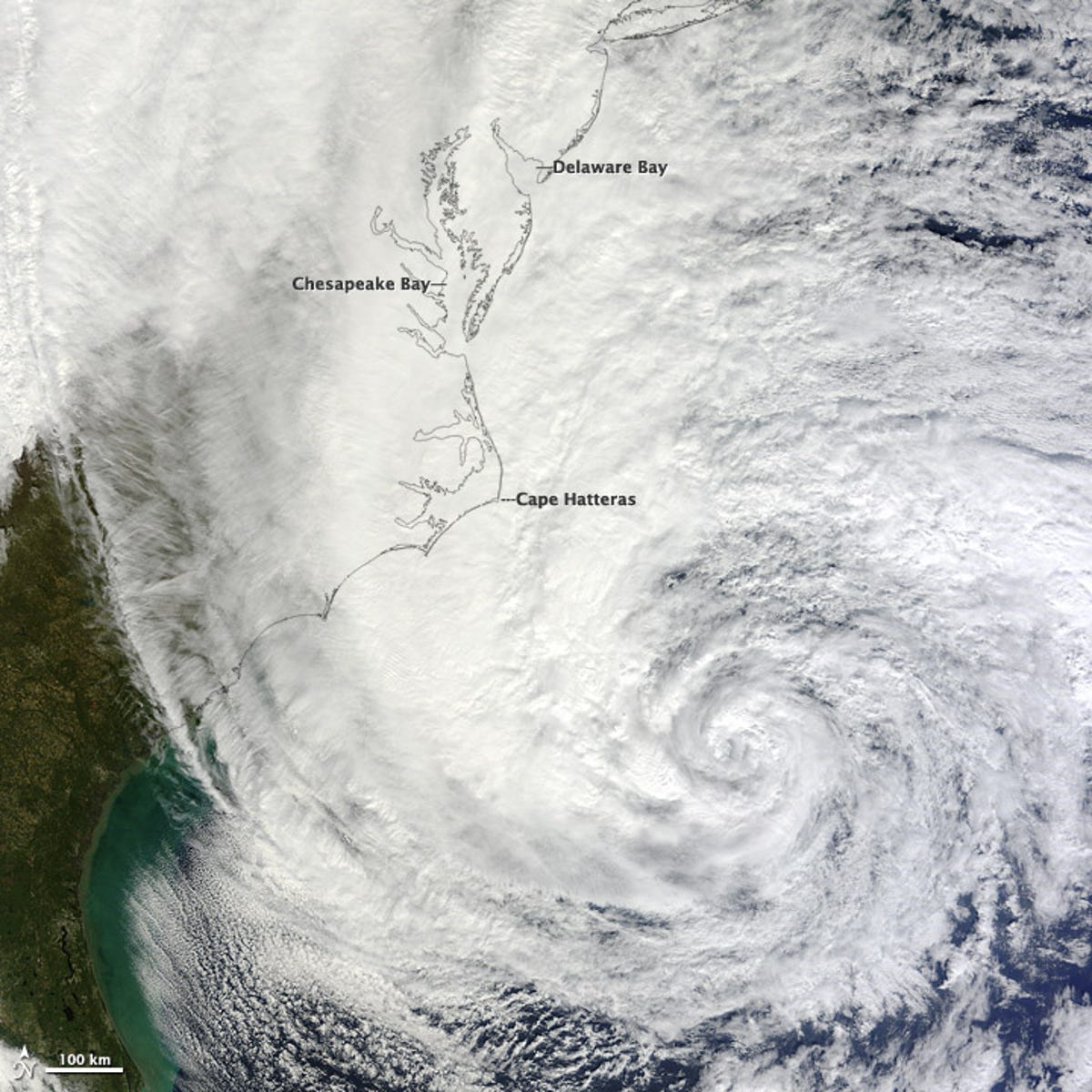
Sandy approaches Cape Hatteras, North Carolina
At noon EST today, on October 28, 2012, the Moderate Resolution Imaging Spectroradiometer (MODIS) on NASA’s Terra satellite acquired this image of Hurricane Sandy off the southeastern United States, where the maximum sustained winds were measured at 75 miles per hour, and the central pressure was 951 millibars.