The Lunar Orbiter Laser Altimeter is helping to create the most precise and complete map to date of the moon's complex, heavily cratered landscape.
James Martin
James Martin is the Managing Editor of Photography at CNET.
His photos capture technology's impact on society - from the widening wealth gap in San Francisco, to the European refugee crisis and Rwanda's efforts to improve health care.
From the technology pioneers of Google and Facebook, photographing Apple's Steve Jobs and Tim Cook, Facebook's Mark Zuckerberg and Google's Sundar Pichai, to the most groundbreaking launches at Apple and NASA, his is a dream job for any documentary photography and journalist with a love for technology.
Exhibited widely, syndicated and reprinted thousands of times over the years, James follows the people and places behind the technology changing our world, bringing their stories and ideas to life.
The Lunar Orbiter Laser Altimeter, one of
seven scientific instruments onboard the Lunar Reconnaissance Orbiter spacecraft, recently completed a project resulting in a new map of the surface of moon with unprecedented detail.
Developed at NASA's Goddard Space Flight Center and launched in June 2009, the Lunar Orbiter Laser Altimeter (LOLA) uses laser ranging to measure the moon's surface
elevation, slope, and roughness in 3D. The primary objective was to produce a global geodetic
grid for the moon to which all other observations could be geodetically referenced, NASA said.
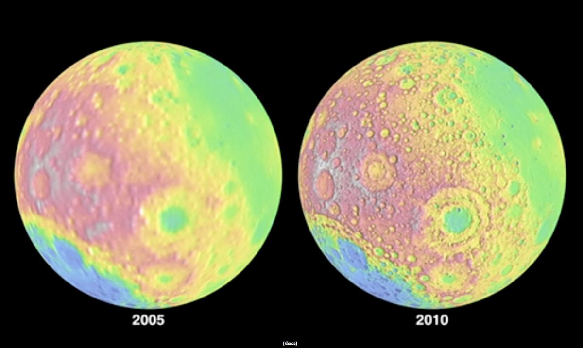
Here, the most recent LOLA digital elevation map, which was compiled in late 2009 (right) is compared to the previous moon mapping achieved by the Unified Lunar Control Network in 2005. Notice the vastly improved detail of the moon measurements.
2 of 9 NASA/GSFC/MIT/SVS
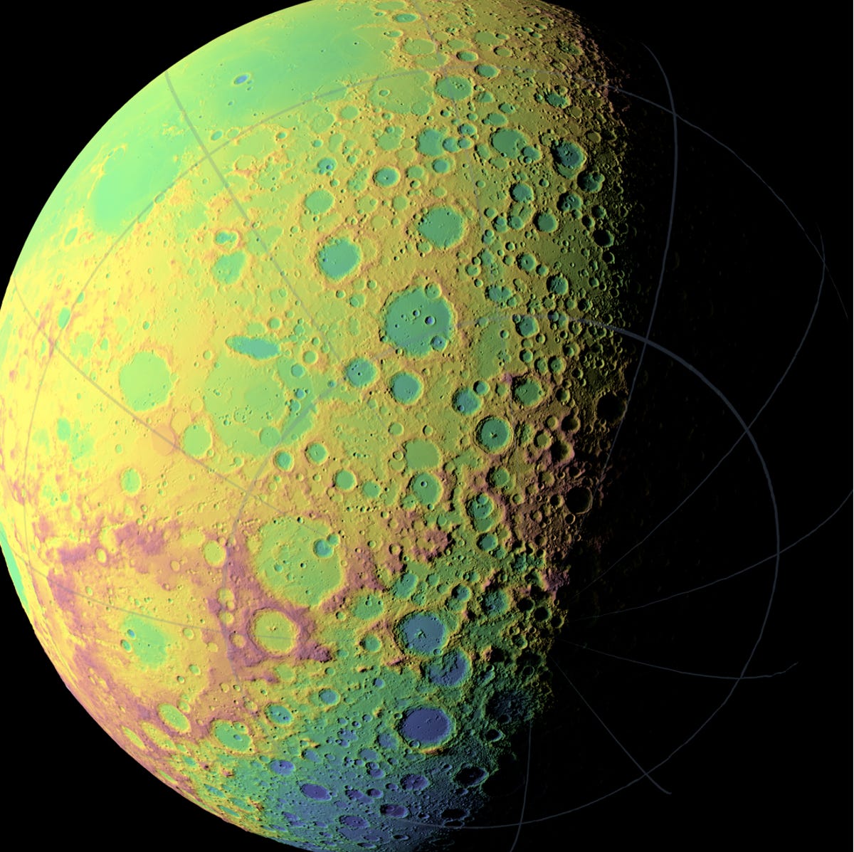
Detailed mapping
LOLA was designed to assist in the
selection of landing sites on the moon for future robotic and human exploration. Previous knowledge of location, direction, and magnitude of surface slopes, and variations in elevation in the region was inadequate, according to NASA.
This is one of LOLA's detailed high-resolution topographic maps of the moon's southern hemisphere.
Though the previous maps of the moon were accurate to around .5 miles to 5 miles, the newest measurements are giving NASA a look at the moon with much more detail.
The newest maps are accurate to the level of 30 meters (.19 miles) or less spatially and 1 meter vertically.
3 of 9 NASA/GSFC
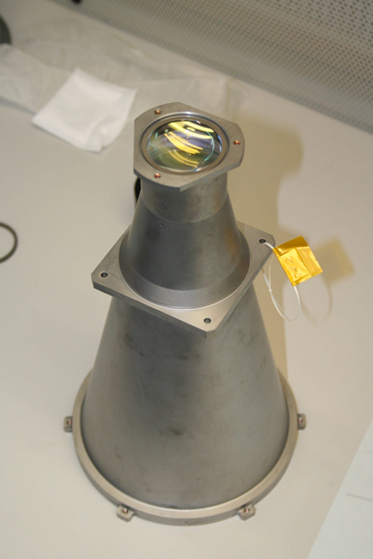
LOLA Receiver
The LOLA instrument is not an imaging device, but a measurement tool. The lens is designed not to maintain a specific image quality, but rather to collect the maximum number of photons with the fewest possible losses, and to minimize the
background radiation, which might interrupt precise measurements.
The 14-centimeter receiver, a 500-milimeter clear aperture refractive telescope, focuses the received photons on to a fiber optic bundle, according to NASA.
4 of 9 NASA/GSFC/MIT/SVS
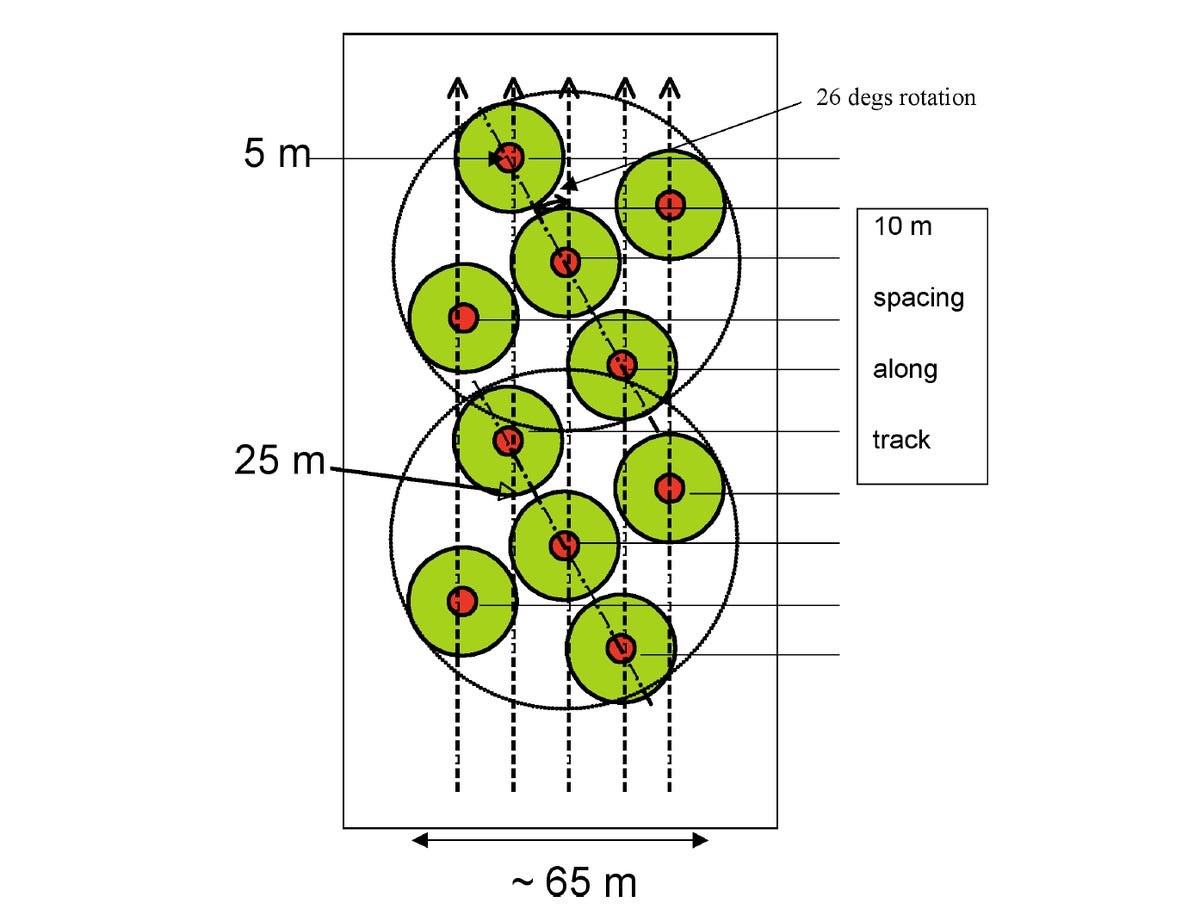
LOLA's 5-spot pattern on the lunar surface
To determine an accurate full surface slope of the moon requires the measurement of slope in two
directions.
LOLA's multibeam 50-point pattern projected onto the lunar surface provides five measurements in an X-pattern from which the slopes can be derived.
This X-shaped five-point pattern also has the advantage that when rotated, it will
provide five near-equidistant parallel profiles, in LOLA's case with approximately 12 meters
between each profile.
5 of 9 NASA/GSFC/MIT/SVS
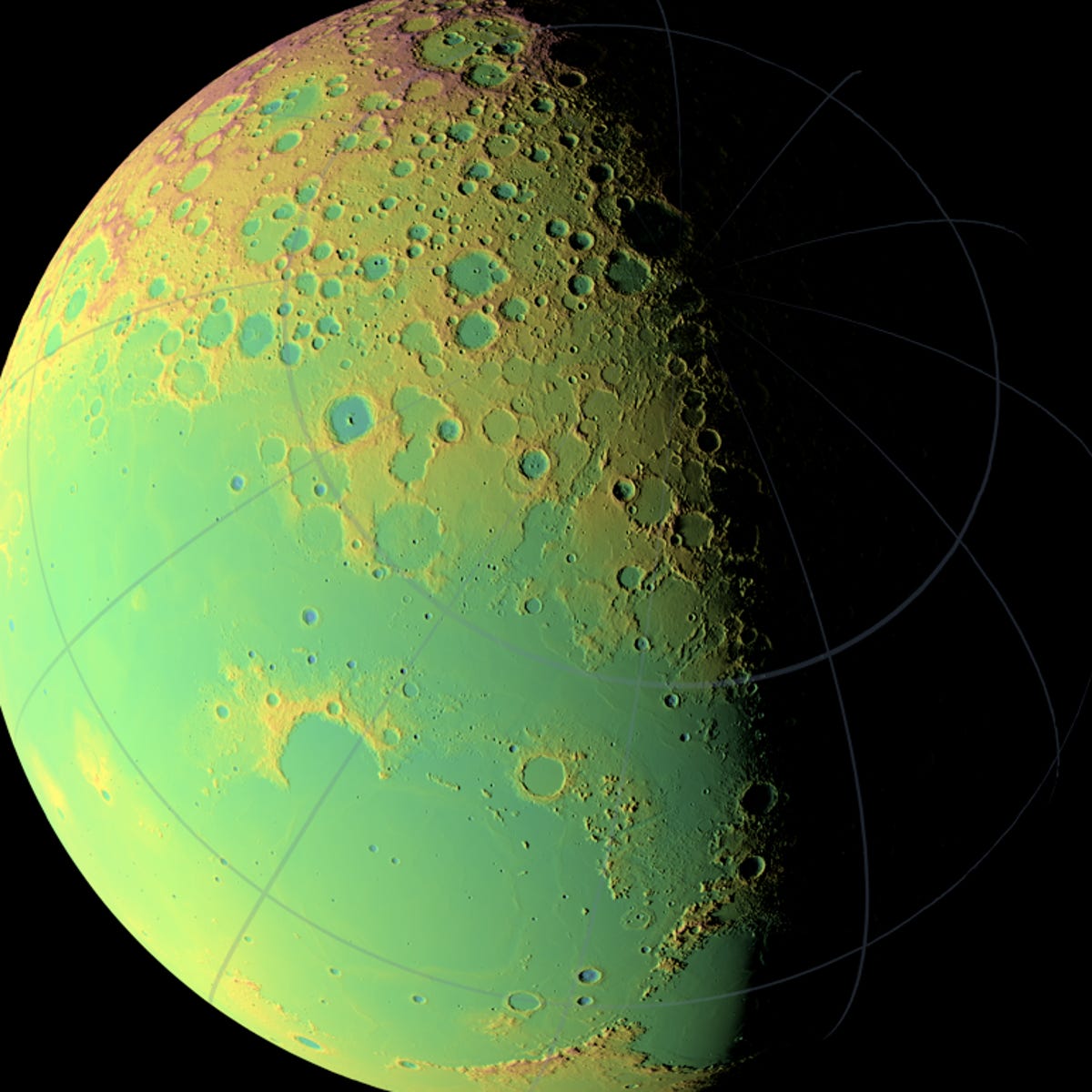
Apollo 15 landing site
Altimetric ranging systems and the ability to determine the position of the LRO spacecraft lead to significantly greater accuracy than that achieved on earlier missions.
This LOLA topographic map, centered on the Apollo 15 landing site, highlights the Apennine and Caucasus ranges and the fairly subtle wrinkling in Serenitatis. The false colors indicate elevation: red areas are highest and blue lowest.
6 of 9 NASA/GSFC
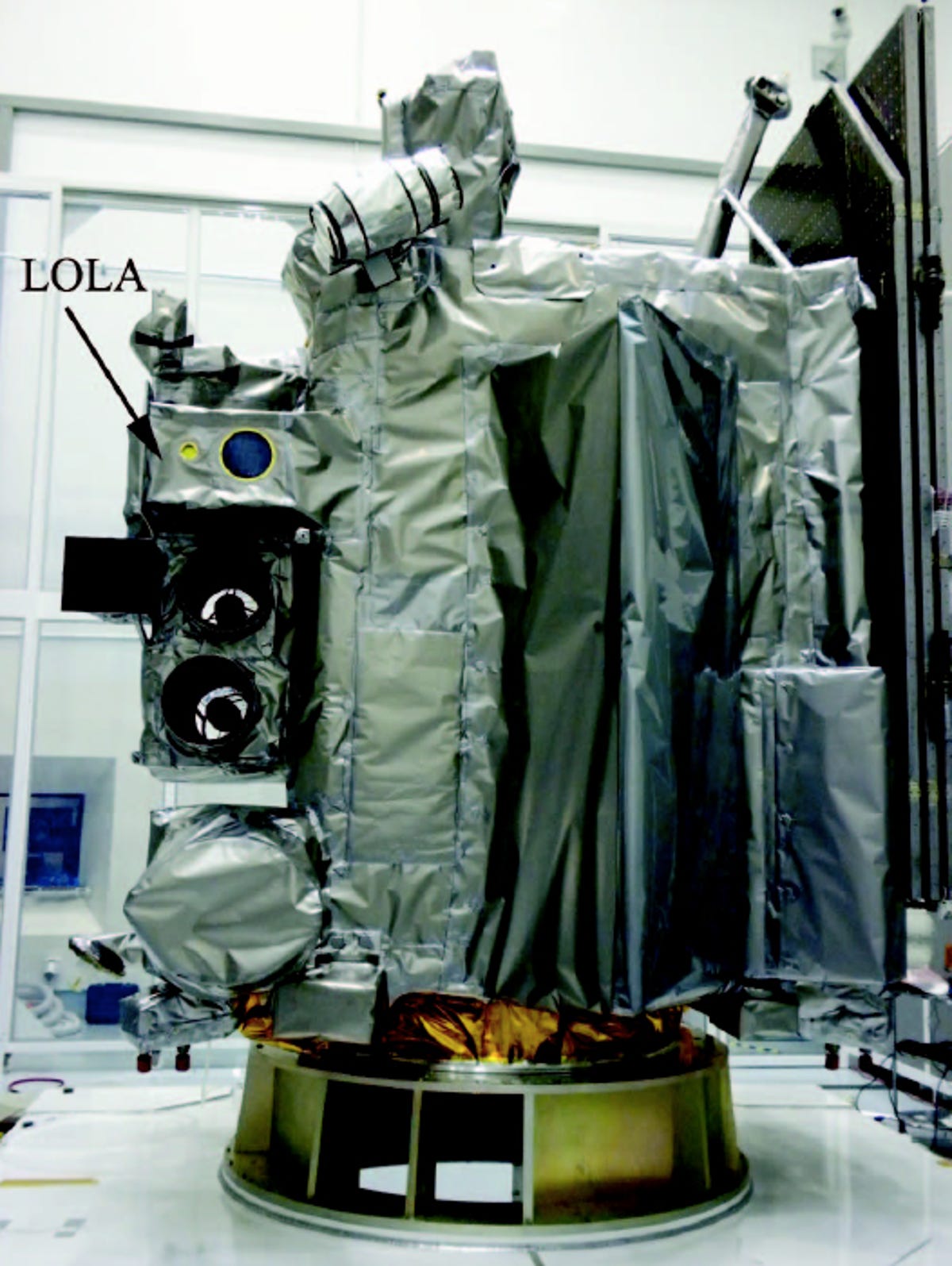
LOLA integrated to the LRO spacecraft.
Environmental tests done on the unit included operational and survival thermal testing, assessing temperature extremes, operation in vacuum, and vibration testing.
Here, LOLA is seen integrated into the LRO spacecraft following final testing.
The engineering model optical assemblies are tested with the same optical components as the actual flight model, but they're built with aluminum instead of titanium or beryllium for the structural components, according to NASA.
Testing assemblies while early in development is critical to correct any design flaws, verify all
interfaces and optical test procedures,
and identify the required optical ground
support equipment, the agency said.
If they're not caught before LOLA heads into space, simple miscalculations can doom an entire project.
7 of 9 NASA/GSFC/MIT/SVS
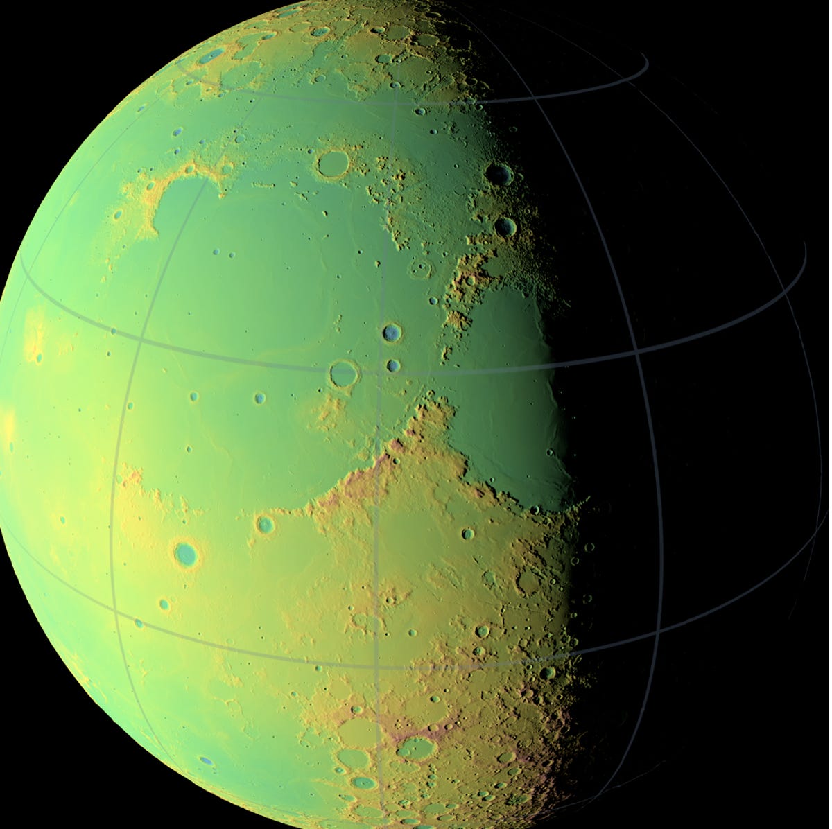
Moon's northern hemisphere
During the one-year mapping period, the measurement laser was fired from the LRO more than 600,000 times, taking more than 3 billion measurements of the moon's surface.
The short pulses from a single laser burst produced a five-beam pattern that achieved the accurate measurements.
With each of the five beams, LOLA measures
the time of flight, pulse spreading (which measures the surface roughness), and the transmit versus return of energy (denoting the reflective qualities of the location).
Here, we see the representation of LOLA's data collected from the moon's northern hemisphere. The false colors indicate elevation: red areas are highest and blue lowest.
8 of 9 NASA/GSFC
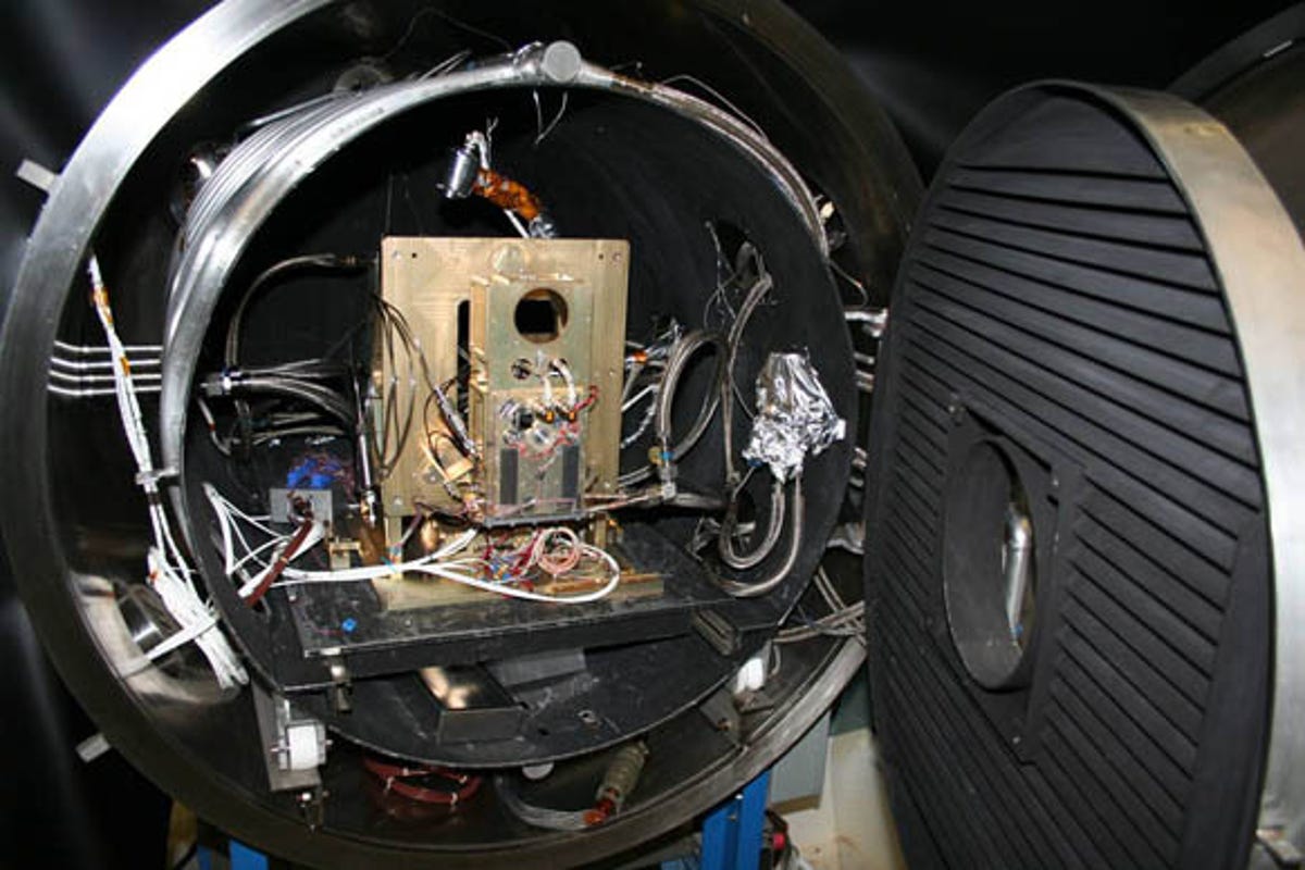
EM Transmitter TVAC Chamber
The engineering model transmitter inside the lab undergoing thermal vacuum testing.
9 of 9 NASA/GSFC
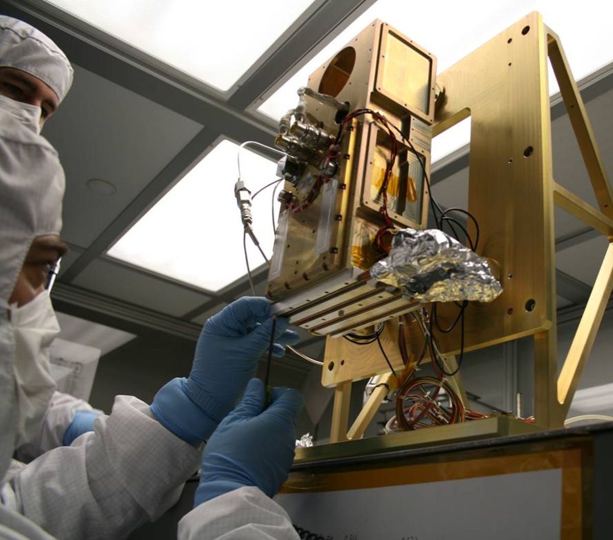
Addition of the TVAC Cold Plate
Inside the lab, engineers prepare to perform an analysis test on LOLA.
Launched on June 18, 2009, the Lunar Reconnaissance Orbiter, carrying LOLA, is the first mission to the moon in more than 10 years.
As the inaugural spacecraft of the United States' "Vision for Space Exploration," the LRO will collect information that will be used in the next generation of NASA's space discoveries.