NASA sees dramatic Earth weather from space (pictures)
Swirling cloud vortexes and billows of dust take on an otherworldly appearance when seen by astronauts and satellites looking down from orbit.


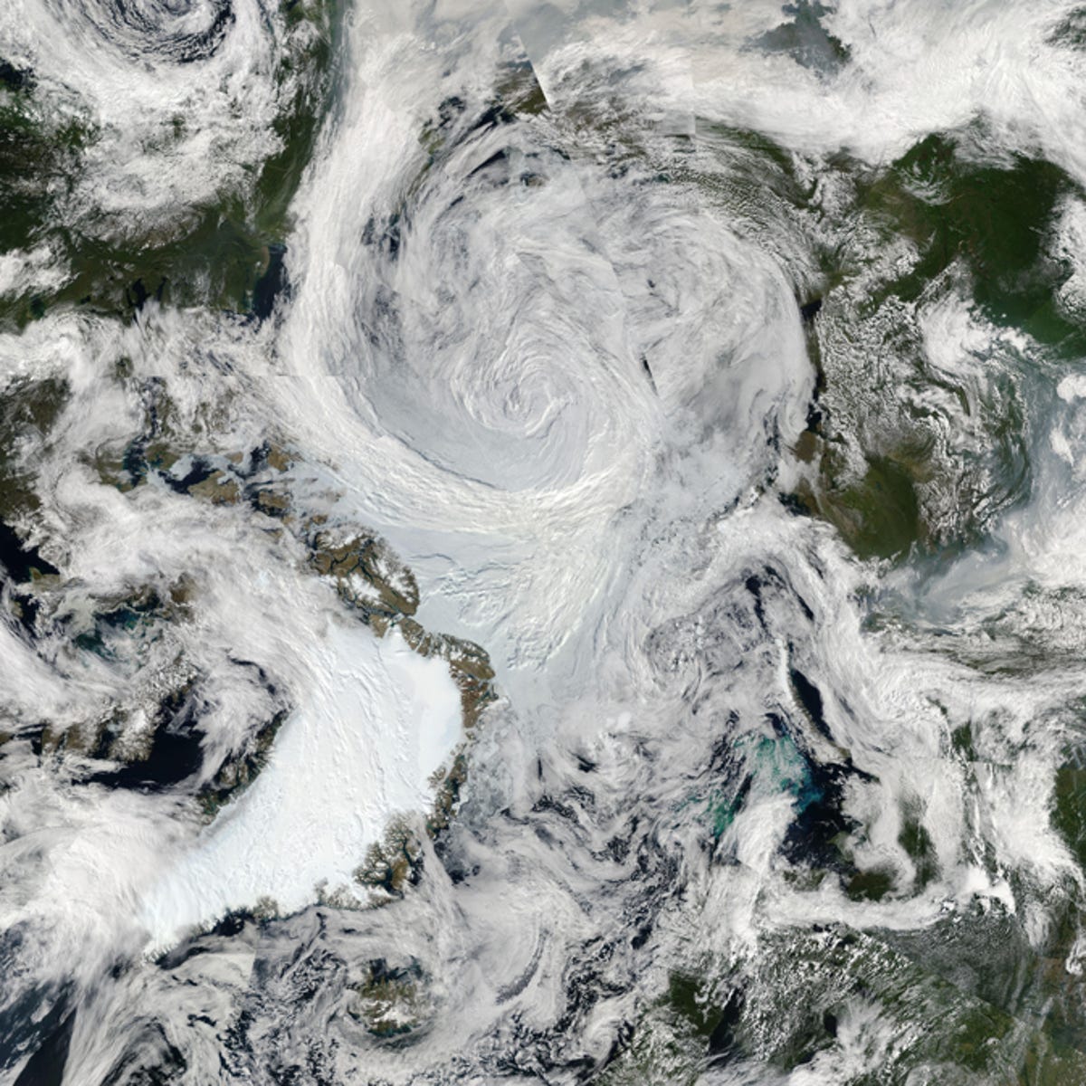
Spinning Arctic storm
NASA's space-dwelling people and machines have a very different perspective on Earth weather than the Blue Marble's gravity-bound denizens below the clouds.
NASA's Aqua satellite caught this image in 2012 while looking down at a storm over the Arctic Ocean. "It's an uncommon event, especially because it's occurring in the summer. Polar lows are more usual in the winter," said Paul A. Newman, chief scientist for Atmospheric Sciences at NASA's Goddard Space Flight Center.
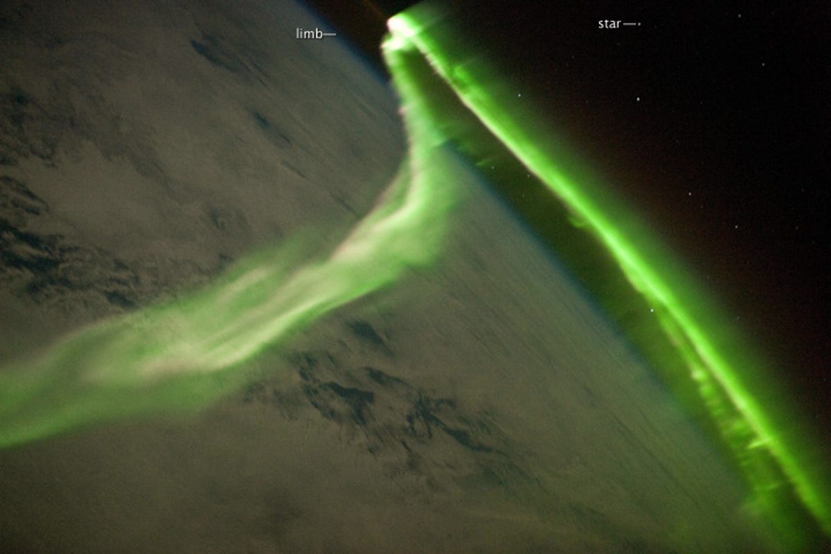
Green aurora ribbon from above
The Northern Lights are much sought-after photography subjects, but they look a bit different when viewed from space. This green aurora appeared in May 2010 and the image was captured from the International Space Station. The aurora takes on a ribbon shape from this distance above the Earth. The space station was 220 miles above the Indian Ocean at the time.

Swirl of storm clouds from the space station
Astronauts on the ISS snap quite a few photographs of what they see happening down below. A crew member from Expedition 29 used a digital still camera to capture this dramatic image of a pre-winter storm off the coast of Australia in March 2014. A solar array panel is visible on the left side.

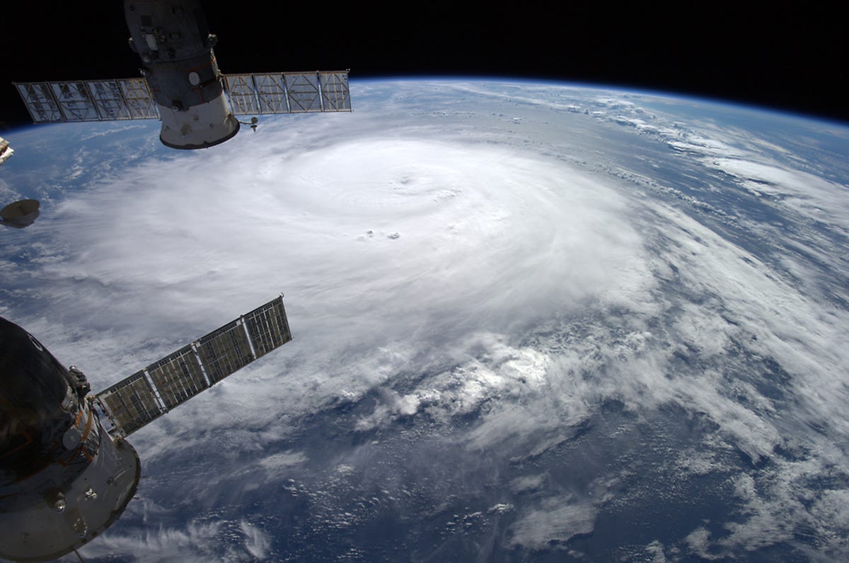
Eye of a typhoon
Typhoon Maysak became a super-typhoon on March 31. European Space Agency astronaut Samantha Cristoforetti took a photo of the storm from the viewpoint of the International Space Station. The image provides a fascinating and frightening perspective on a powerful weather system.
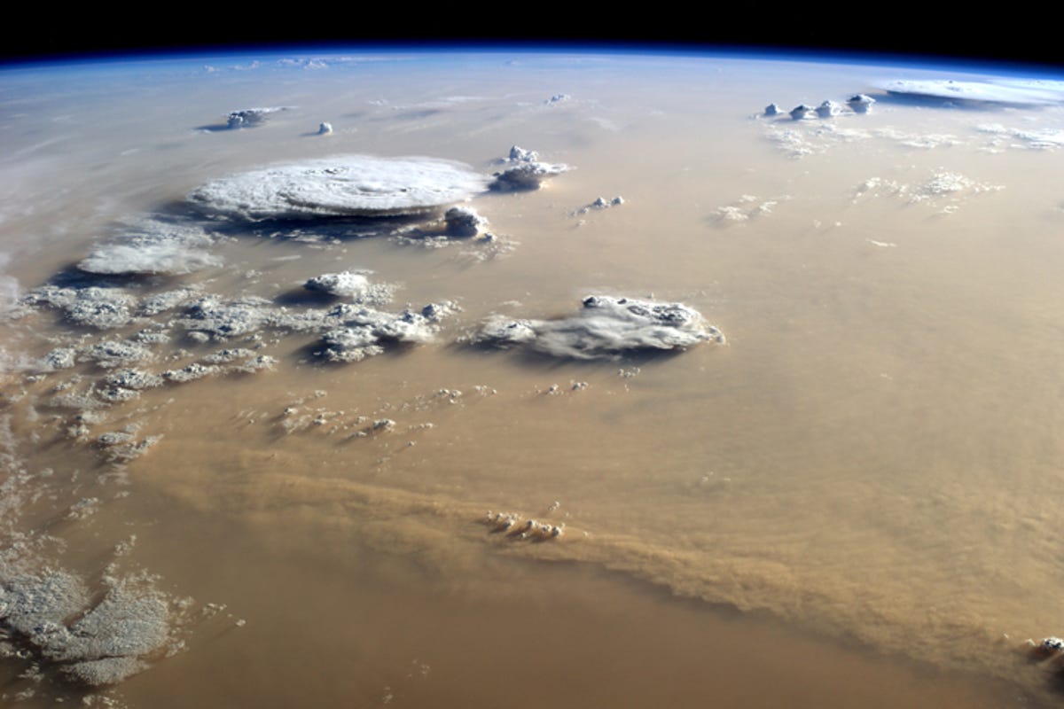
Dust and clouds over the Sahara
Swirling white clouds are a common view of the weather from orbit around Earth. This particular image shows a mixture of dust and clouds over the Sahara Desert, creating an image that is more brown than white. Astronaut Alex Gerst took this photo from the International Space Station in September 2014. The space station was positioned over Libya at the time.
Hurricane from the space station
European Space Agency astronaut Alex Gerst took this photo of Hurricane Gonzalo in October 2014. The major hurricane, classified as a Category 4, was moving toward Bermuda. Parts of the International Space Station are visible in the image, lending perspective to the faraway view from space.
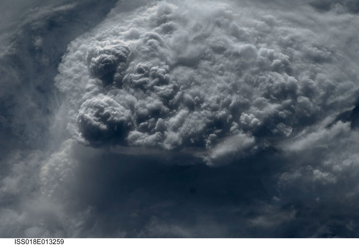
Clouds building upward
It doesn't take a full-on hurricane or typhoon to create a dramatic weather image as seen from space. This photo of mounding clouds is a favorite of ISS Expedition 18 flight engineer Sandra Magnus. Magnus' mission on the space station lasted 133 days in 2008 and 2009.
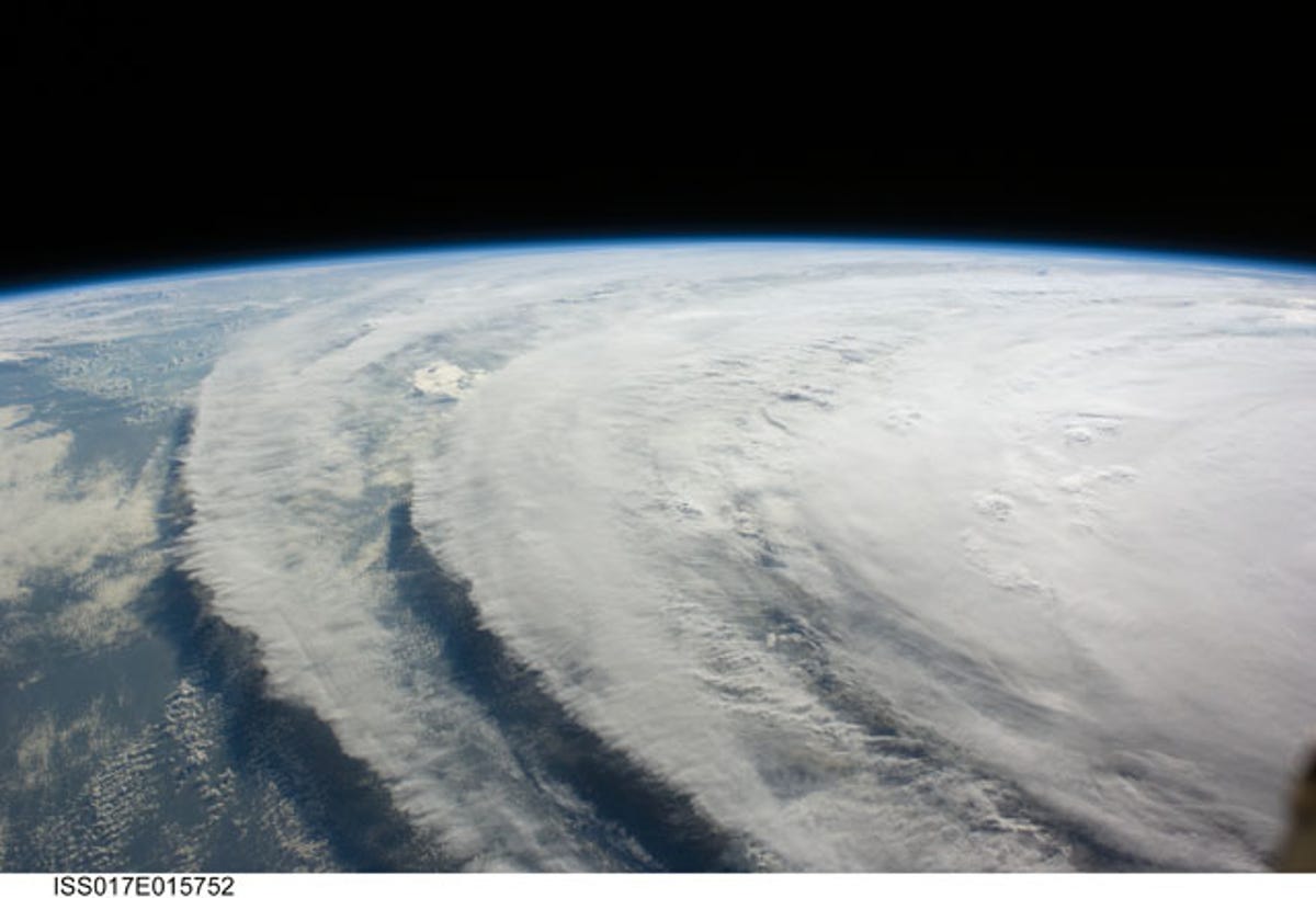
Cloud steps seen from space
Hurricane Ike formed in 2008, giving the crew of the International Space Station an opportunity to photograph it from orbit, 220 miles above Earth. At the time, the hurricane blustered with sustained winds of 80 nautical miles per hour. This image reveals an almost steplike formation of cloud rings.
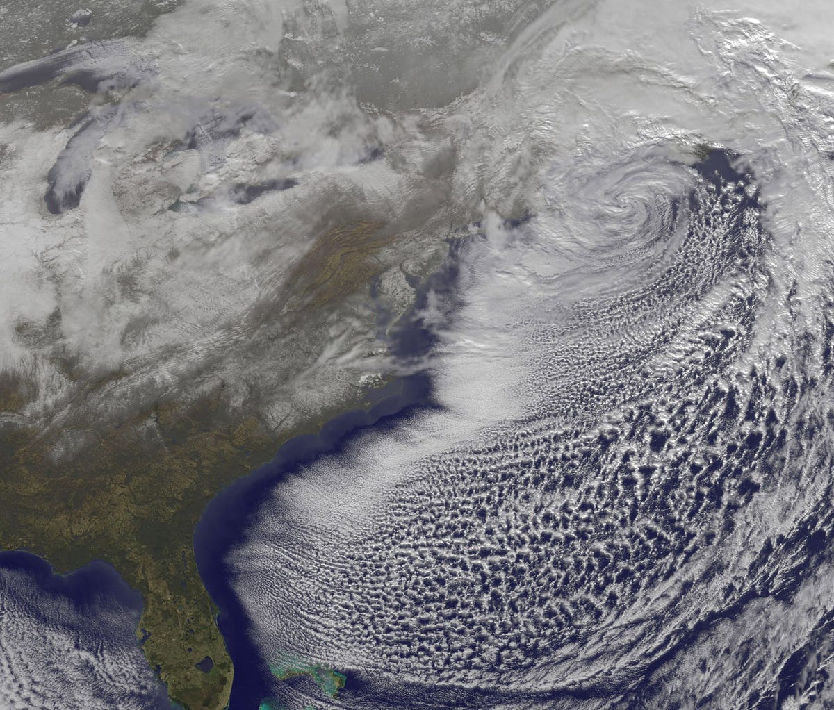
Blizzard from far above
NASA's GOES-13 weather satellite looked down on this blizzard along the east coast of the US in late 2010. The storm was in the process of moving away from New England, leaving a considerable amount of snow in its tracks. Newark, N.J., reported at least 17.7 inches of snow.
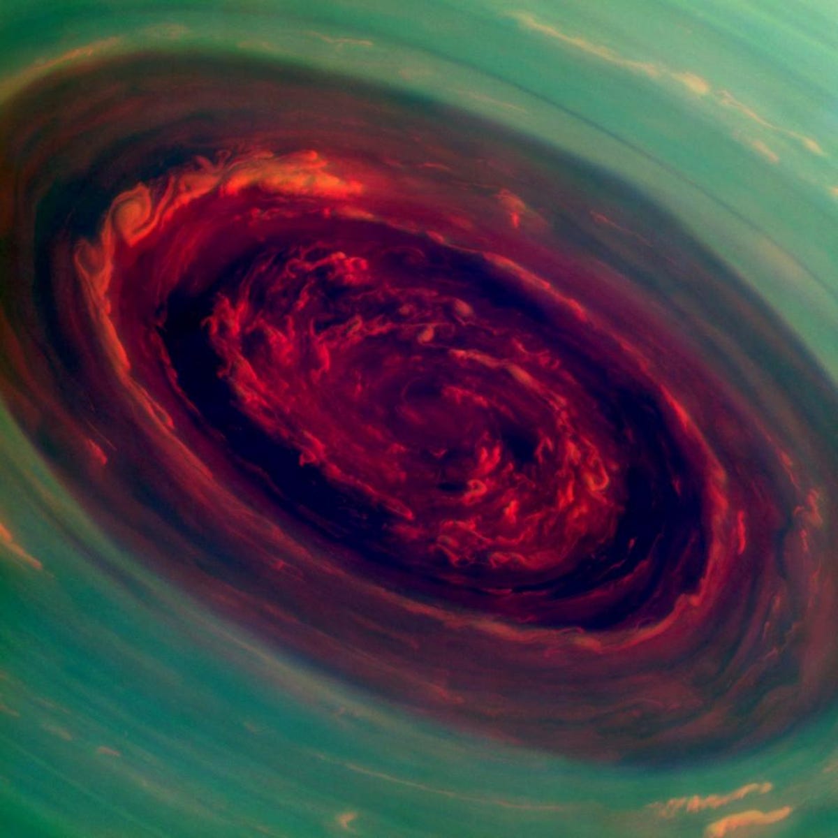
Bonus image: Saturn hurricane
Not all dramatic weather takes place on Earth. NASA's Cassini spacecraft captured this false-color image of a massive hurricane at Saturn's north pole in November 2012. Cassini was 261,000 miles away from Saturn at the time. NASA measured the eye of the storm at 1,250 miles across.
More Galleries

My Favorite Shots From the Galaxy S24 Ultra's Camera
20 Photos
Honor's Magic V2 Foldable Is Lighter Than Samsung's Galaxy S24 Ultra
10 Photos
The Samsung Galaxy S24 and S24 Plus Looks Sweet in Aluminum
23 Photos
Samsung's Galaxy S24 Ultra Now Has a Titanium Design
23 Photos
I Took 600+ Photos With the iPhone 15 Pro and Pro Max. Look at My Favorites
34 Photos
